
Palmyra (Maine)
| Palmyra | |||
|---|---|---|---|
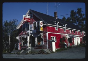 Palmyra General Store |
|||
| Location in Maine | |||
|
|||
| Basic data | |||
| Foundation : | June 20, 1807 | ||
| State : | United States | ||
| State : | Maine | ||
| County : | Somerset County | ||
| Coordinates : | 44 ° 51 ′ N , 69 ° 22 ′ W | ||
| Time zone : | Eastern ( UTC − 5 / −4 ) | ||
| Residents : | 1,986 (as of 2010) | ||
| Population density : | 19.1 inhabitants per km 2 | ||
| Area : | 107.33 km 2 (approx. 41 mi 2 ) of which 104.01 km 2 (approx. 40 mi 2 ) is land |
||
| Height : | 77 m | ||
| Postal code : | 04965 | ||
| Area code : | +1 207 | ||
| FIPS : | 23-56520 | ||
| GNIS ID : | 0582660 | ||
| Website : | www.palmyratown.org/Town_of_Palmyra/Welcome.html | ||

Palmyra is a town in Somerset County in the state of Maine in the United States . In 2010 there were 1986 inhabitants in 943 households in an area of 107.33 km².
geography
According to the United States Census Bureau , Palmyra has a total area of 107.33 km², of which 104.01 km² is land and 3.32 km² is made up of water .
Geographical location
Palmyra is located in the southeast of Somerset County and is bordered by Penobscot County to the east and Penobscot County to the south. The area is bordered by Douglas Pond to the south and Nokomis Pond to the east . Centrally located in the area is Whites Pond . There are other smaller lakes in the town area. The surface is slightly hilly, the 161 m high Furbush Hill is the highest point.
Neighboring communities
All distances are given as straight lines between the official coordinates of the places from the 2010 census.
- North: St. Albans , 9.5 km
- Northeast: Corinna , Penobscot County, 9.2 mi
- East: Newport , Penobscot County, 7.1 mi
- Southeast: Plymouth , Penobscot County, 7.7 mi
- South: Detroit , 5.9 mi
- Southwest: Pittsfield , 6 mi
- Northwest: Hartland , 7.9 mi
City structure
There are several settlement areas in Palmyra: Bog Corner , Dogtown , Goodwin Corner , Hurd Corner , Marsh Corner , Miles Corner , Miller Corner , Palmyra , Sanborn Corner , Thompson and West Palmyra .
climate
The mean mean temperature in Palmyra is between -11.1 ° C (12 ° F ) in January and 20.0 ° C (68 ° F) in July. This means that the place is around 9 degrees cooler than the long-term average in the USA. The snowfalls between October and May are up to two and a half meters, more than twice as high as the average snow depth in the USA; the daily sunshine duration is at the lower end of the range in the USA.
history
After the area was surveyed, it was named Township No. 5, Third Range North of Waldo Patent (T5 R3 NWP) and initially called Sheppardstown. Daniel Gale and his family were the first to settle in 1800 and on June 20, 1807 the area was organized as a town under its current name. The first post office was opened in 1824.
Land was given to Warsaw, now Pittsfield, in 1821 and 1828.
Population development
| Census Results - Town of Palmyra, Maine | ||||||||||
|---|---|---|---|---|---|---|---|---|---|---|
| year | 1800 | 1810 | 1820 | 1830 | 1840 | 1850 | 1860 | 1870 | 1880 | 1890 |
| Residents | 188 | 366 | 902 | 1500 | 1625 | 1597 | 1322 | 1271 | 1004 | |
| year | 1900 | 1910 | 1920 | 1930 | 1940 | 1950 | 1960 | 1970 | 1980 | 1990 |
| Residents | 915 | 960 | 824 | 887 | 934 | 965 | 1009 | 1104 | 1485 | 1867 |
| year | 2000 | 2010 | 2020 | 2030 | 2040 | 2050 | 2060 | 2070 | 2080 | 2090 |
| Residents | 1953 | 1986 | ||||||||
Economy and Infrastructure
traffic
Interstate 95 runs through Palmyra in a west-east direction and US Highway 2 runs parallel to it . The Maine State Route 151 and Maine State Route 152 running from north to south.
Public facilities
There is no medical facility in Palmyra. Medical facilities for the town's residents can be found in St. Albans, Hartland, Dexter and Pittsfield.
Palmyra does not have its own library. The closest are in Hartland, Pittsfield and Newport.
education
Palmyra is part of Regional School Unit 19 with Corinna, Dixmont, Etna, Hartland, Newport, Plymouth and St. Albans .
The following schools are offered in the school district:
- Corinna Elementary School in Corinna, with school classes from pre-kindergarten to 4th grade
- Etna-Dixmont School in Etna, with school classes from pre-kindergarten to 8th grade
- Newport / Plymouth Elementary School in Newport, with school classes from pre-kindergarten through 6th grade
- St. Albans Consolidated in St. Albans, with school classes from pre-kindergarten through 5th grade
- Somerset Valley Middle School in Hartland, with classes from 5th to 8th grade
- Sebasticook Middle School in Newport, with classes from 5th to 8th grade
- Nokomis Regional High in Newport, with school classes from 9th to 12th grade
Personalities
sons and daughters of the town
- James Springer White (1821–1881), co-founder of the Seventh-day Adventist Party
- Frank I. Cowan (1888–1948), politician and Maine Attorney General
Web links
- The community site (English)
- Palmyra on maine.gov (English)
- Palmyra on City-data.com (English)
Individual evidence
- ↑ Palmyra in the Geographic Names Information System of the United States Geological Survey , accessed April 28, 2020
- ↑ Maine 2010 Census Results ; official publication of the Census Authority, (English; PDF; 32.5 MB)
- ↑ Furbush Hill. In: peakery.com. Accessed April 28, 2020 (English).
- ↑ Coordinates of the locations of the Census Authority 2010
- ↑ a b c Palmyra, Somerset County - Maine Genealogy. In: mainegenealogy.net. Retrieved April 28, 2020 .
- ↑ a b Palmyra, Maine (ME 04965) profile: population, maps, real estate, averages, homes, statistics, relocation, travel, jobs, hospitals, schools, crime, moving, houses, news, sex offenders. In: city-data.com. www.city-data.com, accessed on April 28, 2020 .
- ^ History of Palmyra, Maine. In: rays-place.com. history.rays-place.com, accessed April 28, 2020 .
- ↑ Population 1810-2010 according to census results
- ^ Regional School Unit 19. In: rsu19.org. Retrieved April 28, 2020 .
