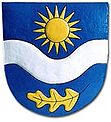
Planá nad Lužnicí
| Planá nad Lužnicí | ||||
|---|---|---|---|---|
|
||||
| Basic data | ||||
| State : |
|
|||
| Region : | Jihočeský kraj | |||
| District : | Tábor | |||
| Area : | 2143 ha | |||
| Geographic location : | 49 ° 21 ' N , 14 ° 42' E | |||
| Height: | 395 m nm | |||
| Residents : | 4,132 (Jan 1, 2019) | |||
| Postal code : | 391 11 | |||
| structure | ||||
| Status: | city | |||
| Districts: | 3 | |||
| administration | ||||
| Mayor : | František Chramosta (as of 2007) | |||
| Address: | Planá nad Lužnicí 74 391 11 Planá nad Lužnicí |
|||
| Municipality number: | 552828 | |||
| Website : | www.plananl.cz | |||
Planá nad Lužnicí (German Plan an der Lainsitz ) is a town with 4028 inhabitants (2017) in the Czech Republic . It is located eight kilometers south of Tábor on the Lainsitz and belongs to the Okres Tábor . The cadastral area is 2143 ha.
geography
The city is located 395 m above sea level. M. on both sides of the Lainsitz at the transition from the Wittingau pan to the Wlaschimer hill country . The railway from Tábor to Soběslav and the European route 55 / state road 3, which also leads to these cities and from which the state road 409 to Chýnov branches off in Planá , runs through Planá nad Lužnicí .
Neighboring towns are Sezimovo Ústí in the north, Turovec in the northeast, Dlouhá Lhota and Borek in the east, Košice in the southeast, Strkov and Doubí in the south, Třebiště in the southwest, Ústrašice , Lhota Samoty and Zhoř u Tábora in the west and Radimovice u Žwestenelče .
history
The first written mention of Planá comes from a letter from Prague bishop Tobias von Bechin from 1288, who mentions the place as the property of the Prague diocese . At the transition from the 13th to the 14th century, the Witigonen on Ústí became the owners of Planá. Jan z Ústí became a follower of the teachings of Jan Hus . When the new town of Tábor was founded by the Hussites in 1420, Jan's brother Oldřich also moved to Tábor and Planá belonged to the Tábor rule until 1547. After the battle of Mühlberg , King Ferdinand I was given a free hand by his brother Emperor Charles V to suppress the Bohemian uprising and his punitive measures against the rebellious city of Tábor included the confiscation of the Tábor rule. Wilhelm von Rosenberg acquired the properties around Planá. In 1553 a wooden bridge was built to the left bank of the Lainsitz near Planá and a customs and toll station was built. In 1565 Wilhelm's brother Peter Wok took over the rule of Planá. However, the over-indebted Peter Wok could not hold it and he sold it to the city of Tábor.
In the Thirty Years War Planá was devastated and the berní rula shows only six farms, one sitter and five cottagers for the place. At the end of the 17th century the Sternberg owners of Planá and they were followed by the Lobkowitz . After the replacement of patrimonial Planá became an independent municipality in 1848, to which the villages Strkov and Lhota Samoty belong since then. With the construction of the railways from Prague to Budweis and Vienna , Planá received a rail connection in 1869. During the German occupation between 1943 and 1945, there was a plan for a labor education camp for men; the prisoners were used to work in agriculture, road construction, in the factory and in peat cutting near Mažice and Borkovice . Up until 1946, Planá was also an important transshipment point for timber rafting on the Lainsitz. In 2002 Planá was flooded by a flood of the Lainsitz.
Attractions
- Church of St. Wenceslas, the originally Gothic building from 1357 was rebuilt in 1666 and 1796. During the last renovation, it also received the church tower.
- Rectory, built in 1784
City structure
The districts Lhota Samoty ( Samot Lhota ) and Strkov ( Sterkow ) belong to Planá nad Lužnicí .
Personalities
- Franz Kafka lived from June 23 to September 19, 1922 in his sister Ottla Kafka's holiday apartment , where he wrote the last nine chapters of his unfinished novel Das Schloss .

