Tamba Province
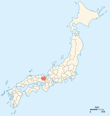
Tamba ( Japanese 丹波 国 , Tamba no kuni ) was one of the historical provinces of Japan . The area is now the central part of Kyōto Prefecture and an area in the eastern part of Hyōgo Prefecture .
Tamba bordered the provinces of Harima , Ōmi , Settsu , Tajima , Tango , Wakasa, and Yamashiro .
Tamba was established in the 7th century. On the 3rd day of the 4th month 713, the northern part with the Kōri Kasa , Yosa , Tamba , Takeno and Kumano was split off as a province of Tango ("Hinter-Tamba"). Both together are also called Tanshū ( 丹 州 ).
The old provincial capital ( kokufu ) was probably in the area of modern Kameoka . The province was ruled by a number of minor daimyo until it was conquered by Oda Nobunaga and given as a fief to his general Akechi Mitsuhide (who later murdered him).
Coordinates: 35 ° 14 ' N , 135 ° 21' E
