Saint-Brandan
|
Saint-Brandan Sant-Vedan |
||
|---|---|---|

|
|
|
| region | Brittany | |
| Department | Cotes-d'Armor | |
| Arrondissement | Saint-Brieuc | |
| Canton | Plélo | |
| Community association | Saint-Brieuc Armor Agglomération | |
| Coordinates | 48 ° 23 ′ N , 2 ° 52 ′ W | |
| height | 122-261 m | |
| surface | 25.16 km 2 | |
| Residents | 2,368 (January 1, 2017) | |
| Population density | 94 inhabitants / km 2 | |
| Post Code | 22800 | |
| INSEE code | 22277 | |
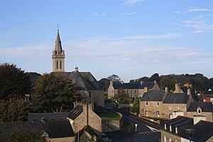
 View of Saint-Brandan |
||
Saint-Brandan ( Breton : Sant-Vedan ; Gallo : Saent-Medan ) is a French municipality with 2,368 inhabitants (as of January 1 2017) in the department of Côtes-d'Armor in the region of Brittany ; it belongs to the arrondissement of Saint-Brieuc and is part of the canton of Plélo . The inhabitants are called Brandanais (es) .
geography
Saint-Brandan is surrounded by the neighboring communities of Le Fœil in the north and north-west, Plaine-Haute in the north, Plaintel in the east, Plœuc-L'Hermitage with L'Hermitage-Lorge in the south, Lanfains in the west and south-west and Quintin in the west and north-west .
The former Route nationale 790 and the Saint-Brieuc – Pontivy railway line pass through the municipality .
Population development
| 1962 | 1968 | 1975 | 1982 | 1990 | 1999 | 2008 | 2016 |
| 1,839 | 1,741 | 1,706 | 2,032 | 2.184 | 2,240 | 2,219 | 2,398 |
literature
- Le Patrimoine des Communes des Côtes-d'Armor. Flohic Editions, Volume 2, Paris 1998, ISBN 2-84234-017-5 , pp. 1134-1138.
Web links
Commons : Saint-Brandan - Collection of images, videos and audio files
