Uzel
| Uzel | ||
|---|---|---|

|
|
|
| region | Brittany | |
| Department | Cotes-d'Armor | |
| Arrondissement | Saint-Brieuc | |
| Canton | Mûr-de-Bretagne | |
| Community association | Loudéac Community - Bretagne Center | |
| Coordinates | 48 ° 17 ′ N , 2 ° 50 ′ W | |
| height | 116-238 m | |
| surface | 6.79 km 2 | |
| Residents | 1,046 (January 1, 2017) | |
| Population density | 154 inhabitants / km 2 | |
| Post Code | 22460 | |
| INSEE code | 22384 | |
Uzel is a French commune with 1,046 inhabitants (at January 1, 2017) in the department of Côtes-d'Armor in the region of Brittany .
geography
Uzel is surrounded by Plœuc-L'Hermitage with L'Hermitage-Lorge in the north, by Plouguenast in the east and by Saint-Hervé and Saint-Thélo in the south.
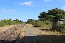
The Route Départementale 700 and the Saint-Brieuc – Pontivy railway line run along the town in a north-south direction , both connecting Saint-Brieuc with Loudéac .
Population development
| 1962 | 1968 | 1975 | 1982 | 1990 | 1999 | 2008 | 2012 |
| 857 | 899 | 926 | 990 | 943 | 897 | 1,056 | 1,113 |
Attractions
See: List of Monuments historiques in Uzel (Côtes-d'Armor)
Personalities
- Fulgence Bienvenüe (* 1852 in Uzel), chief engineer of the Paris Bridge and Road Construction Office and the "father" of Métro Paris
literature
- Le Patrimoine des Communes des Côtes-d'Armor. Flohic Editions, Volume 2, Paris 1998, ISBN 2-84234-017-5 , pp. 1317-1319.
Individual evidence
- ↑ Population statistics Commune de Uzel (22384) , accessed on April 25, 2015 (French)
Web links
Commons : Uzel - collection of images, videos and audio files

