La Malhoure
|
La Malhoure Lanvelor |
||
|---|---|---|

|
|
|
| region | Brittany | |
| Department | Cotes-d'Armor | |
| Arrondissement | Saint-Brieuc | |
| Canton | Lamballe | |
| Community association | Lamballe Terre et Mer | |
| Coordinates | 48 ° 24 ′ N , 2 ° 30 ′ W | |
| height | 77-141 m | |
| surface | 5.02 km 2 | |
| Residents | 594 (January 1, 2017) | |
| Population density | 118 inhabitants / km 2 | |
| Post Code | 22640 | |
| INSEE code | 22140 | |
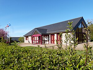
 Mairie La Malhoure |
||
La Malhoure ( Breton : Lanvelor ) is a French municipality with 594 inhabitants (as of January 1 2017) in the department of Côtes-d'Armor in the region of Brittany .
geography
La Malhoure is surrounded by the municipalities of Lamballe-Armor with Lamballe in the north, Tramain in the east, Penguily in the south and Bréhand in the west.
Population development
| 1962 | 1968 | 1975 | 1982 | 1990 | 1999 | 2008 | 2016 |
| 229 | 238 | 229 | 237 | 266 | 348 | 458 | 576 |
literature
- Le Patrimoine des Communes des Côtes-d'Armor. Flohic Editions, Volume 1, Paris 1998, ISBN 2-84234-017-5 , pp. 484-485.
Web links
Commons : La Malhoure - collection of images, videos and audio files
Individual evidence
- ↑ Population statistics Commune de La Malhoure (22140) , accessed on April 24, 2015 (French)

