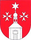
Smetanova Lhota
| Smetanova Lhota | ||||
|---|---|---|---|---|
|
||||
| Basic data | ||||
| State : |
|
|||
| Region : | Jihočeský kraj | |||
| District : | Písek | |||
| Area : | 1305 ha | |||
| Geographic location : | 49 ° 27 ' N , 14 ° 5' E | |||
| Height: | 413 m nm | |||
| Residents : | 283 (Jan. 1, 2019) | |||
| Postal code : | 398 04 | |||
| License plate : | C. | |||
| traffic | ||||
| Railway connection: | Zdice – Protivín | |||
| structure | ||||
| Status: | local community | |||
| Districts: | 3 | |||
| administration | ||||
| Mayor : | Zdenka Šípová (status: 2007) | |||
| Address: | Smetanova Lhota 85 398 04 Čimelice |
|||
| Municipality number: | 549878 | |||
| Website : | www.severnipisecko.cz/smetanova_lhota.htm | |||
Smetanova Lhota (German Smetana Lhota ) is a municipality with 267 inhabitants in the Czech Republic . It is located 16 km east of the town of Blatná in South Bohemia.
The village lies between the Skalice and Lomnice rivers . Smetanova Lhota was first mentioned in a document in 1384, and the place was probably founded in the middle of the 12th century. The districts Vrábsko ( Dietrichstein ) and Karlov ( Karlhof ) belong to the municipality of Smetanova Lhota .
Architecturally noteworthy is the Baroque hunting lodge in Karlov from the 18th century, a one-story building with an oval central structure flanked by two compact side wings. It was built by the Bohemian nobleman Karl Gottlieb von Bissingen . Later it came to the princes of Schwarzenberg at Orlík nad Vltavou Castle , with whom it was restituted to the family in 1992.
Personalities
- Jan Koller (* 1973), Czech national soccer player
Web links
Individual evidence
- ↑ Český statistický úřad - The population of the Czech municipalities as of January 1, 2019 (PDF; 0.8 MiB)


