Waist
| Waist | ||
|---|---|---|
|
|
||
| region | Occitania | |
| Department | Pyrénées-Orientales | |
| Arrondissement | Ceret | |
| Canton | Le Canigou | |
| Community association | Vallespir | |
| Coordinates | 42 ° 32 ' N , 2 ° 40' E | |
| height | 198-681 m | |
| surface | 10.02 km 2 | |
| Residents | 105 (January 1, 2017) | |
| Population density | 10 inhabitants / km 2 | |
| Post Code | 66400 | |
| INSEE code | 66199 | |
| Website | http://www.Taillet.com/ | |
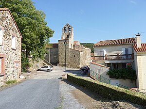
 Main street and church |
||
Taillet is a French commune with 105 inhabitants (as of January 1, 2017) in the Pyrénées-Orientales department in the Occitania region . It belongs to the Arrondissement of Céret and the canton of Le Canigou .
Neighboring communities
Neighboring municipalities of Taillet are Calmeilles in the north, Oms in the east, Reynès in the south, Montbolo in the southwest and Saint-Marsal in the west.
Population development
| year | 1962 | 1968 | 1975 | 1982 | 1990 | 1999 | 2013 |
| Residents | 85 | 56 | 47 | 52 | 74 | 83 | 128 |
Attractions
- Sainte-Valentin church (12th century)
- Notre-Dame del Roure church (12th century)
- Dolmen Caixa del Camp de l'Obra
Web links
Commons : Taillet - collection of images, videos and audio files


