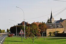
Tendu
| Tendu | ||
|---|---|---|
|
|
||
| region | Center-Val de Loire | |
| Department | Indre | |
| Arrondissement | Chateauroux | |
| Canton | Argenton-sur-Creuse | |
| Community association | Éguzon-Argenton-Vallée de la Creuse | |
| Coordinates | 46 ° 39 ′ N , 1 ° 34 ′ E | |
| height | 107-174 m | |
| surface | 42.17 km 2 | |
| Residents | 648 (January 1, 2017) | |
| Population density | 15 inhabitants / km 2 | |
| Post Code | 36200 | |
| INSEE code | 36219 | |
Tendu is a French municipality with 648 inhabitants (at January 1, 2017) in the department of Indre in the Region Center-Val de Loire ; it belongs to the arrondissement of Châteauroux and the canton of Argenton-sur-Creuse .
Neighboring communities of Tendu are Luant in the north, Velles in the northeast, Mosnay in the southeast, Le Pêchereau in the south, Saint-Marcel in the southwest, Chasseneuil and Le Pont-Chrétien-Chabenet in the west and La Pérouille in the northwest.
Population development
| year | 1962 | 1968 | 1975 | 1982 | 1990 | 1999 | 2007 | 2012 |
| Residents | 504 | 483 | 417 | 465 | 446 | 451 | 550 | 631 |
Attractions
- Prunget Castle (12th / 14th centuries)
- Les Sallerons Castle (19th century)
- Mazières Castle
- La Rocherolle Castle
- Le Broutay Castle (15th / 16th century)
Web links
Commons : Tendu - collection of images, videos and audio files

