Theilheim
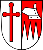
| coat of arms | Germany map | |
|---|---|---|

|
Coordinates: 49 ° 45 ' N , 10 ° 2' E |
|
| Basic data | ||
| State : | Bavaria | |
| Administrative region : | Lower Franconia | |
| County : | Wurzburg | |
| Height : | 231 m above sea level NHN | |
| Area : | 9.69 km 2 | |
| Residents: | 2371 (Dec. 31, 2019) | |
| Population density : | 245 inhabitants per km 2 | |
| Postal code : | 97288 | |
| Area code : | 09303 | |
| License plate : | WÜ , OCH | |
| Community key : | 09 6 79 193 | |
| Community structure: | 1 district | |
| Address of the municipal administration: |
Bachstrasse 13 97288 Theilheim |
|
| Website : | ||
| Mayor : | Thomas Herpich (designing Theilheim together) | |
| Location of the community of Theilheim in the district of Würzburg | ||
Theilheim is a municipality in the Lower Franconian district of Würzburg .
geography
Theilheim is located in the Würzburg region.
There is only the district of Theilheim.
history
Until the church is planted
Theilheim is first mentioned as Daleheim in a document from the Benedictine Abbey of Würzburg on May 13, 1098.
As part of the Eibelstadt, Randersacker and Theilheim winery of the Würzburg monastery, which belonged to the Franconian Empire , Theilheim was secularized in 1803 in favor of Bavaria, then in the Peace of Pressburg in 1805 left to Archduke Ferdinand of Tuscany to form the Grand Duchy of Würzburg, with which it was finally given to Bavaria in 1814 fell. In 1818 the political municipality was established.
Population development
- 1970: 1789 inhabitants
- 1987: 2067 inhabitants
- 1991: 2120 inhabitants
- 1995: 2270 inhabitants
- 2000: 2305 inhabitants
- 2005: 2387 inhabitants
- 2010: 2404 inhabitants
- 2015: 2313 inhabitants
- June 2019: 2,340 inhabitants
politics
Municipal council
The municipal council has 14 seats. In the local elections on March 15, 2020, 1,371 of the 1,893 residents eligible to vote in the municipality of Theilheim exercised their right to vote, bringing the turnout to 72.42%.
mayor
In the local elections on March 15, 2020, Thomas Herpich (Mit Another Theilheim Gestalten) was elected with 59.34% of the vote. His predecessor was Hubert Henig (Independent Voting Association).
Community partnerships
In 2013 the partnership agreement between Theilheim and the northern Italian municipality of Vigolo Vattaro (part of the municipality of Altopiano della Vigolana since 2016 ) was signed. Both municipalities also carry out EU projects.
Architectural monuments
Economy and Infrastructure
Economy including agriculture and forestry
In 1998, according to official statistics, there were no employees at the place of work in the manufacturing sector 111 or in the trade and transport sector. There were a total of 875 employees at the place of residence subject to social security contributions. There were none in the manufacturing sector and two in the construction sector. In addition, in 1999 there were 28 farms with an agricultural area of 383 hectares, of which 362 were arable land and nine were permanent green areas.
education
There are the following institutions (as of 2015):
- 150 day-care places with 137 children
- an elementary school with four teachers and 88 students
Broadband connection
The community of Theilheim has carried out a selection process for the establishment of the broadband connection for the entire community area. The analysis of the current situation and requirements identified an acute undersupply with bandwidths well below 1 MBit. By participating in the funding program for broadband expansion, the municipality was awarded the maximum funding. Deutsche Telekom was awarded the contract to carry out the work. The work has been completed so that copper-based transmission rates between 16 and 250 Mbit downstream and 1 to 30 Mbit upstream (as of November 2019) are available on the local loop.
Others
Theilheim is known nationwide by the name of trousers that end just above the knees as Dalaamer (= Theilheimer) Housn . This designation, the origin of which is unclear, is widespread beyond Main Franconia to Hamburg and Singapore.
Web links
- Entry on the coat of arms of Theilheim in the database of the House of Bavarian History
- Theilheim: Official statistics of the LfStat (PDF; 1.05 MB)
- Theilheim community in the local database of the Bavarian State Library Online . Bavarian State Library
Individual evidence
- ↑ "Data 2" sheet, Statistical Report A1200C 202041 Population of the municipalities, districts and administrative districts 1st quarter 2020 (population based on the 2011 census) ( help ).
- ↑ history. Retrieved November 29, 2019 .
- ↑ City council election 2020
- ↑ City council election 2020
- ↑ Mayoral election 2020
- ^ Municipality of Theilheim 09 679 193. In: Statistics Kommunal 2015. Bavarian State Office for Statistics, accessed on February 4, 2018 .


