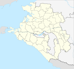
Chernomorsky (Krasnodar, Seversky)
| Urban-type settlement
Chernomorski
Черноморский
|
||||||||||||||||||||||||||||||||||||||||
|
||||||||||||||||||||||||||||||||||||||||
|
||||||||||||||||||||||||||||||||||||||||
Tschernomorski ( Russian Черномо́рский ) is an urban-type settlement in the Krasnodar region in Russia with 8,626 inhabitants (as of October 14, 2010).
geography
The settlement is located on the northwestern edge of the Greater Caucasus a good 40 kilometers southwest of the regional capital Krasnodar . The intensively agriculturally used lowland of the Kuban , which flows about 25 km away, extends north of the village , while the wooded foothills of the Caucasus rise immediately to the south.
Chernomorsky belongs to Seversky Rajon and is located about 15 km west of its administrative center, Stanitsa Severskaya . It is the seat of the municipality of Chernomorskoye gorodskoje posselenije, which also includes the settlements Novopetrowski (6 km north), Oktyabrsky (1.5 km west) and Sputnik (2.5 km north-west) and the hamlet (chutor) Karski (3 km south-east) , Kipyachi (3 km south) and Vessyoly (2 km north) belong.
history
The place was created in connection with the development of an oil deposit known since 1863 , which began shortly after the area was recaptured by the Red Army during the Second World War in February 1943. The first rich oil well was drilled in 1944, and in 1947 the construction of a workers' settlement began, which was initially called Sozgorodok (short for socialist town ). In 1949 the place received the status of an urban-type settlement under its current name, for example "Black Sea Settlement", from Russian Tschornoje more for " Black Sea ", here with reference to the local oil-producing company Tschernomorneft.
Population development
| year | Residents |
|---|---|
| 1959 | 10.110 |
| 1970 | 8,081 |
| 1979 | 8,181 |
| 1989 | 8,398 |
| 2002 | 8,346 |
| 2010 | 8,626 |
Note: census data
traffic
North of the settlement of the leading North Caucasian Railway operated, opened in 1888, on this section in 1994 and throughout the year 2000 electrified railway Tikhoretskaya - Krasnodar - Krymskaja - Novorossiysk over. The Chabl train station (km 720 from Volgograd ) is located on this in the Sputnik part of the municipality , and the Chernomorsky stop a little closer to the settlement (km 718).
On the northern edge of Chernomorsky there is also the A146 trunk road , which connects the M4 Don at Krasnodar with the A290 (formerly M25) and is a shorter alternative route to the Black Sea port of Novorossiysk and is part of the European route 115 .
Web links
Individual evidence
- ↑ a b Itogi Vserossijskoj perepisi naselenija 2010 goda. Tom 1. Čislennostʹ i razmeščenie naselenija (Results of the All-Russian Census 2010. Volume 1. Number and distribution of the population). Tables 5 , pp. 12-209; 11 , pp. 312–979 (download from the website of the Federal Service for State Statistics of the Russian Federation)


