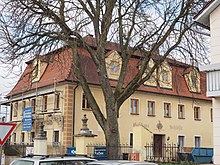
Fünfstetten
| coat of arms | Germany map | |
|---|---|---|

|
Coordinates: 48 ° 50 ' N , 10 ° 46' E |
|
| Basic data | ||
| State : | Bavaria | |
| Administrative region : | Swabia | |
| County : | Danube Ries | |
| Management Community : | Wemding | |
| Height : | 500 m above sea level NHN | |
| Area : | 26.71 km 2 | |
| Residents: | 1304 (Dec. 31, 2019) | |
| Population density : | 49 inhabitants per km 2 | |
| Postal code : | 86681 | |
| Area code : | 09091 | |
| License plate : | DON, Lower Austria | |
| Community key : | 09 7 79 148 | |
| LOCODE : | DE ZUN | |
| Community structure: | 10 parish parts | |
| Address of the municipal administration: |
Schulberg 7 86681 Fünfstetten |
|
| Website : | ||
| Mayor : | Josef Bickelbacher ( CSU / UWG ) | |
| Location of the community of Fünfstetten in the Donau-Ries district | ||
Fünfstetten is a municipality in the Swabian district of Donau-Ries .
geography
location
Fünfstetten is located in the Augsburg region in the hilly landscape between the Swabian Alb and the Franconian Alb on the eastern edge of the Ries crater ( Nördlinger Ries ).
Parish parts
The municipality has 10 officially named parts of the municipality (the type of settlement is given in brackets ):
|
|
history
Until the 19th century
Between 1057 and 1075, Bishop Gundekar II of Eichstätt consecrated a church to St. Church dedicated to Dionysius . In the Middle Ages, Fünfstetten was the seat of the nobility under the Graisbach rule . In 1233 a gentleman from Fünfstetten was mentioned. In the 14th century, the Lords of Wemding bought property here. The place was the seat of a closed Hofmark , which in 1505 came to the newly formed Principality of Pfalz-Neuburg . The introduction of the Reformation in 1554 was ordered by Count Palatine Ottheinrich . Palatine Count Wolfgang Wilhelm ordered the re-catholicization of Fünfstetten in 1618. The Hofmark including the castle belonged to the Barons of Rehlingen from 1762 to 1810 . Since the unification of the Wittelsbach Lands in 1777, Fünfstetten has belonged to the Electoral Palatinate of Bavaria . In 1810, the Hofmark Fünfstetten, together with the nearby Otting, was bought by Carl Friedrich Stephan von Schönfeld , who was elevated to Count of Otting and Fünfstetten in 1817. Carl Friedrich Stephan was an illegitimate son of Friedrich Michael von Pfalz-Birkenfeld and half-brother of King Maximilian I Joseph (Bavaria) ; his son Maximilian Joseph Graf von Otting and Fünfstetten sold his property to the factory owner Oskar Abbreviations.
Religions
Fünfstetten belongs to the Catholic diocese of Eichstätt (parish church of St. Dionysius with a magnificent baroque altar ). The parish is one of the original parishes of the diocese.
On the southern outskirts of Fünfstetten there is a baroque Lady Chapel.
Incorporations
On May 1, 1978, the previously independent municipality of Nussbühl was incorporated with its districts.
Population development
Between 1988 and 2018 the population decreased from 1,351 to 1,321 by 30 inhabitants or 2.2%.
politics
The community is a member of the Wemding administrative community .
Municipal council
- CSU / UWG 8 seats
- PWG - Free voters 4 seats
Status: Local election on March 15, 2020 , term of office May 1, 2020 to April 30, 2026.
mayor
Josef Bickelbacher (CSU / UWG) was elected mayor from May 1, 2020 with 57.7%. He will succeed Werner Siebert, who was mayor from May 2008 to April 2020.
coat of arms
| Blazon : "In red a rising and curled silver tip, inside a black gabled house, on both sides a silver catch iron facing." | |
Architectural monuments
Jobs and agriculture
In 2017 there were 71 jobs subject to social security contributions in the municipality. Of the resident population, 600 people were in an employment relationship subject to compulsory insurance, so that the number of out-commuters was 529 higher than that of in-commuters. 10 residents were unemployed.
In 2016 there were 35 farms. 1729 hectares of the parish area were used for agriculture.
education
In 2018 there were the following institutions:
- Day care center with 62 places and 58 children, 14 of them under three years of age
- Primary school 1st – 4th Class, 99 students and 5 teachers
traffic
Fünfstetten had a train station on the Donauwörth – Treuchtlingen railway line . Between 1906 and 1999 the branch line to Monheim branched off there .
The place is connected to the surrounding villages and the federal highway 2 , which is about 5 km to the east, via the district road DON 20 and community roads .
Web links
- Community of Fünfstetten on the website of the administrative community Wemding
- Brief local history
- Statistical data and maps
- Fünfstetten: Official statistics of the LfStat
Individual evidence
- ↑ "Data 2" sheet, Statistical Report A1200C 202041 Population of the municipalities, districts and administrative districts 1st quarter 2020 (population based on the 2011 census) ( help ).
- ^ Community of Fünfstetten in the local database of the Bavarian State Library Online . Bayerische Staatsbibliothek, accessed on September 3, 2019.
- ^ Federal Statistical Office (ed.): Historical municipality directory for the Federal Republic of Germany. Name, border and key number changes in municipalities, counties and administrative districts from May 27, 1970 to December 31, 1982 . W. Kohlhammer, Stuttgart / Mainz 1983, ISBN 3-17-003263-1 , p. 793 .
- ↑ http://www.wahlen.bayern.de/kommunalwahlen/
- ↑ Greetings. Verwaltungsgemeinschaft Wemding, accessed on July 7, 2020 .
- ^ Entry on the coat of arms of Fünfstetten in the database of the House of Bavarian History


