
Obersontheim
| coat of arms | Germany map | |
|---|---|---|

|
Coordinates: 49 ° 3 ' N , 9 ° 54' E |
|
| Basic data | ||
| State : | Baden-Württemberg | |
| Administrative region : | Stuttgart | |
| County : | Schwäbisch Hall | |
| Height : | 366 m above sea level NHN | |
| Area : | 54.83 km 2 | |
| Residents: | 5079 (December 31, 2018) | |
| Population density : | 93 inhabitants per km 2 | |
| Postal code : | 74423 | |
| Area code : | 07973 | |
| License plate : | SHA, BK , CR | |
| Community key : | 08 1 27 063 | |
| Address of the municipal administration: |
Rathausplatz 1 74423 Obersontheim |
|
| Website : | ||
| Mayor : | Siegfried Trittner | |
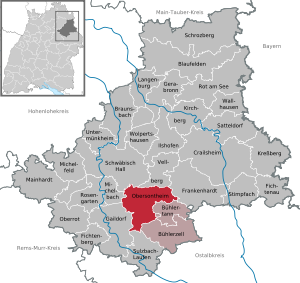
| Location of the municipality Obersontheim in the district of Schwäbisch Hall | ||
  |
||


Obersontheim is a municipality in the Schwäbisch Hall district in the Franconian north-east of Baden-Württemberg .
The municipality is the seat of the municipal administration association of Upper Bühlertal , to which the municipalities of Bühlertann and Bühlerzell also belong.
geography
Geographical location
Obersontheim is located between the district town of Schwäbisch Hall, 15 km away, and Ellwangen, in the neighboring Ostalb district, 24 km away . The community is located in the valley of the Bühler , which flows into the Kocher . Another nearby medium-sized center is Crailsheim (17 km).
Obersontheim has a share in the natural areas of the Swabian-Franconian Forest Mountains and Hohenloher-Haller Ebene .
Landscapes, mountains, rivers
The municipality of Obersontheim extends from the Ellwanger Mountains in the east to the Limpurger Mountains in the west. The Limpurger Berge are divided by the wide Fischach valley ; it is only separated from the Bühlertal by a narrow, wooded ridge of the Limpurger Berge . The main town Obersontheim and Untersontheim are on the Bühler , Oberfischach and Mittelfischach, on the other hand, on the Fischach , which flows south of the municipality into the Bühler.
Bühler and Fischach valleys belong to the most natural valleys in the north of Baden-Württemberg. Because of the once difficult access to the valley and the relatively little human intervention so far, an original nature with high biodiversity has been preserved. Fish and bird species that have become rare can still find suitable habitats in and around the Bühler.
geology
The community is located in the Keuperbergland in the area of the Bühler stepped bay. To the west, its area extends roughly as far as the watershed against the Kocher on the pebble and parlor sandstone plateau of the Limpurger Mountains ( coal road ), while on its east side it just borders on a tectonically similar high location on the edge of the catchment area of the Speltach (Hahnenbergwald). The flatter elevations between the Bühler and Fischach valleys occasionally reach the reed sandstone in the municipality . In the valleys and on the leveled areas of the Fischach valley as well as on the plateau around the valley notch of the Bühlertal valley, gypsum keuper is pending , occasionally gypsum lenses are recognizable morphologically. To the east of the main town of Obersontheim, on the Heerberg, which has now largely been removed, there is an almost exhausted quarrying in the base gypsum, which once opened up a fairly complete profile of the Upper Gipskeuper. Lettenkeuper strokes closer to the Bühlertal . Down in the Bühlertal even the Upper Muschelkalk is reached, as can be seen in abandoned quarries and a large one that is still in operation near Ummenhofen. Following roughly the line Oberfischach – Hausen – Untersontheim – Häffnersteige, the Neckar-Jagst-Furche crosses the municipality, partly morphologically formed as a depression ( Bobach , Riedbach ), partly with a relief reversal (Speckrain east of Untersontheim).
Neighboring communities
The following cities and communities border the community of Obersontheim (clockwise from the north): Schwäbisch Hall , Vellberg , Frankenhardt , Bühlertann , Bühlerzell , Sulzbach-Laufen , Gaildorf and Michelbach an der Bilz .
Community structure
The community of Obersontheim includes 21 villages, hamlets, farms and houses as well as some desert areas . The village of Mittelfischach, the hamlets Engelhofen, Unterfischach and Weiler and the homestead Rothof as well as the abandoned villages of Beringers and Sanweles belong to the former municipality of Mittelfischach. The former municipality of Oberfischach includes the village of Oberfischach, the hamlets of Benzenhof, Herlebach and Rappoltshofen, the Beutenmühle and Rappoltsau farms and the Lotthaus and Mühlhof houses as well as the abandoned villages of Hundshof (or Muselmoor), Vogelhof and Röschbühl (or Fallhaus). The former community of Untersontheim includes the village of Untersontheim, the hamlets of Hausen, Siehdichfür and Ummenhofen and the residential areas Beilsteinmühle, Mettelmühle and Röschbühl (Fallhaus) as well as the abandoned villages of Burg and Beihelstein. The municipality Obersontheim in the territorial status of June 30, 1971 belonged the village Obersontheim, as well as the abandoned villages Bräunlinshausen and Mettelhofen.
Division of space

According to data from the State Statistical Office , as of 2014.
history
Early history
Obersontheim has an interesting past as the former residence of Limpurg's taverns . They directed the fortunes of the village from 1541 to 1713 and built significant parts of the historic town center during this time. Castle , town hall and church are still visible signs of their work today. At that time the market rights and the high court were obtained for the place. They demonstrated a strong and progressive social understanding for their time by building an orphanage and a hospital.
Incorporations
On July 1, 1971 Untersontheim was incorporated, on August 1, 1972 Mittelfischach and Oberfischach.

Mittelfischach

Oberfischach

Untersontheim


Religions
Protestant parishes exist in the main town and in the sub-towns of Mittelfischach, Oberfischach and Untersontheim. In the main town of Obersontheim there is also a Catholic and a New Apostolic church congregation.
mayor
Siegfried Trittner has been the mayor since 1998. He was confirmed for a third term in July 2014 with 98.06% of the vote.
Culture and sights


Buildings
- Three-winged castle Obersontheim of the Limpurg taverns, built 1541–1593 by the taverns Erasmus and Friedrich
- Evangelical parish church Obersontheim , built 1585–1586 by Schenk Friedrich VII. Von Limpurg-Sontheim
- Former limpurgic chancellery building with two corner towers, half-timbered building, today town hall
- Herrenmühle
- Koppenmühle with weir and water wheel
- Old village church in the suburb of Untersontheim with wall ring
- Kilian's Church in the suburb of Oberfischach with Romanesque components in the church tower
- In 1960 the Protestant church in Mittelfischach replaced a dilapidated previous building from the 14th century.
- Old cemetery (Obersontheim)
Sports
The Bühlertal swimming pool is located between Obersontheim and Bühlertann. Tennis courts can be rented on two tennis facilities.
Regular events
Every Friday from 2 p.m. there is a weekly market in Obersontheim.
Economy and Infrastructure
traffic
Two state roads cross in Obersontheim. The state road 1066 Crailsheim – Löwenstein leads from northeast to southwest across the municipality, from northwest to southeast the L 1060 Schwäbisch Hall – Ellwangen. Both of these can be used to reach the A 6 Heilbronn – Nuremberg and A 7 Ulm – Würzburg motorways.
Established businesses
- Alfred Kärcher GmbH & Co. KG
- Company VMS Maschinenbau GmbH
- Concrete Röser
- Friedrich Stark GmbH & Co. KG
- Housing Laukenmann GmbH
education
The Obersontheimer Schenk-Friedrich-Schule is a primary and secondary school with a Werkrealschule . A secondary school is located in neighboring Bühlertann . Gymnasiums, other secondary schools and vocational schools are located in the nearby towns of Schwäbisch Hall , Crailsheim , Ellwangen and Gaildorf .
Personalities
Sons and daughters of the church
- Johann Samuel Welter (1650–1720), composer
- Christian Friedrich Daniel Schubart (1739–1791), poet, composer and journalist
- Otto Pflugfelder (1904–1994), biologist, former rector of the Hohenheim Agricultural University
- Karl Ludwig Gerok (1906–1975), organist, composer and author
- Klaus Gärtner (* 1945), political scientist and politician (FDP)
literature
- Geological map 1: 25,000 sheets Obersontheim, Geological State Office Baden-Württemberg, Stuttgart 1982.
- D. Göhner, MP Gwinner, K. Hinkelbein: Explanations on sheet Obersontheim. Geological State Office Baden-Württemberg, Stuttgart 1982.
Notes and individual references
- ↑ State Statistical Office Baden-Württemberg - Population by nationality and gender on December 31, 2018 (CSV file) ( help on this ).
- ↑ Natural areas of Baden-Württemberg . State Institute for the Environment, Measurements and Nature Conservation Baden-Württemberg, Stuttgart 2009.
- ^ The Fischach was straightened in the 20th century.
- ↑ See the literature list.
- ^ The state of Baden-Württemberg. Official description by district and municipality. Volume IV: Stuttgart district, Franconian and East Württemberg regional associations. Kohlhammer, Stuttgart 1980, ISBN 3-17-005708-1 . Pp. 421-425.
- ↑ State Statistical Office, area since 1988 according to actual use for Obersontheim.
- ^ Federal Statistical Office (ed.): Historical municipality directory for the Federal Republic of Germany. Name, border and key number changes in municipalities, counties and administrative districts from May 27, 1970 to December 31, 1982 . W. Kohlhammer, Stuttgart / Mainz 1983, ISBN 3-17-003263-1 , p. 456 f .
Web links
- ditto from Mittel-Fischach and Ober-Fischach
- Map of the municipality of Obersontheim on: State Agency for the Environment Baden-Württemberg (LUBW) ( information )
- Map of the village of Obersontheim on: Geoportal Baden-Württemberg ( information )

Blaufelden | Braunsbach | Bühlertann | Bühlerzell | Crailsheim | Fichtenau | Fichtenberg | Frankenhardt | Gaildorf | Gerabronn | Ilshofen | Kirchberg an der Jagst | Kreßberg | Langenburg | Mainhardt | Michelbach an der Bilz | Michelfeld | Oberrot | Obersontheim | Rose garden | Red at the lake | Satteldorf | Schrozberg | Schwäbisch Hall | Stimpfach | Sulzbach-Laufen | Untermünkheim | Vellberg | Wallhausen | Wolpertshausen