Waltersdorf (Greiz)
|
Waltersdorf
City of Greiz
Coordinates: 50 ° 38 ′ 25 ″ N , 12 ° 15 ′ 0 ″ E
|
|
|---|---|
| Height : | 395 m above sea level NN |
| Incorporation : | July 1, 1950 |
| Incorporated into: | Reinsdorf |
| Postal code : | 07973 |
| Area code : | 03661 |
|
Location of Waltersdorf in the city of Greiz
|
|
|
In the town
|
|
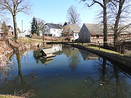
Waltersdorf is a place in the city of Greiz in the district of Greiz in Thuringia and belongs to the district of Reinsdorf .
geography
Waltersdorf is on federal highway 94 , which leads up to the ground floor in the extended Elstertal area, on which the former village is located. Neighboring towns are Schönfeld and Reinsdorf . The district road 205 also connects the district with traffic.
history
The village was first mentioned in a document on November 7, 1358. The community "Waltersdorf near Irchwitz" was incorporated into Reinsdorf on July 1, 1950, which in turn has been part of the city of Greiz since 1994.
Web links
Commons : Waltersdorf - Collection of images, videos and audio files
Individual evidence
- ^ Wolfgang Kahl : First mention of Thuringian towns and villages. A manual. Verlag Rockstuhl, Bad Langensalza, 2010, ISBN 978-3-86777-202-0 , p. 303

