Witten center
|
Witten center
City of Witten
Coordinates: 51 ° 26 ′ 23 " N , 7 ° 20 ′ 14" E
|
|
|---|---|
| Area : | 11.41 km² |
| Residents : | 33,553 (Jun. 30, 2015) |
| Population density : | 2,941 inhabitants / km² |
| Postcodes : | 58452, 58453, 58455 |
| Area code : | 02302 |
|
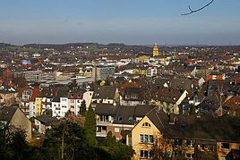
Look at Witten-Mitte from Helenenberg from
|
|
Witten-Mitte is one of the seven districts of the city of Witten an der Ruhr . It consists of the Witten city center districts , Oberdorf-Helenenberg , Industriegürtel West, Krone , Crengeldanz , Main Cemetery , Stadium , Industriegürtel Nord and Hohenstein . Around 33,000 people live in Witten-Mitte.
history
A parish church "in Wittene" was first mentioned in a document in 1214 . Such a parish church presupposes that at this time there must have already been a small village in the area that today includes the inner city of Witten-Mitte. In the document of the Cologne bishop Adolf I , a certain Antonius decanus in Wittene is mentioned, pastor of the Witten parish and at the same time dean of the Wattenscheid dean's office. How many inhabitants Witten had at that time is unknown. Based on the income of the parish church around 1300, it is assumed that there were 25 courtyards around the church.
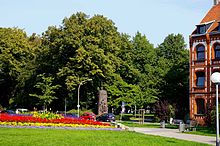
The area that is known today as the center emerged from two “germ cells”: on the one hand, the upper and lower villages , where initially the majority of the farmers settled, and on the other, the Schultenhof . This was the largest farm in the area and was located in what is now the city center district. This farm was only mentioned in a document in 1375, but local research now assumes that there was a farm at its location 200 to 300 years earlier. In the 14th century, other farms were established around this courtyard. Since the entire city center is now built on, only one street name, Schultenhofstrasse, indicates the courtyard. In 1862, the then owner of the Schultenhof sold part of his property to the city of Witten. This property also included a house that the city used as a town hall until 1922/23 . It only lost its importance with the construction of the new town hall between 1922 and 1925. It was largely destroyed in a bombing raid in 1944 and finally demolished in 1949. In its place is now part of the Witten Town Hall Square and thus the point that Witten people call "center" in everyday language.
Market law
The fact that Witten was able to develop into a town at all is due, among other things, to the market rights that it was granted on April 22 or May 2, 1675, the sources are somewhat inaccurate in this regard. In Kleve , Elector Friedrich Wilhelm von Brandenburg presented the representatives of the community with the relevant certificate. Witten thus developed into a magnet for people from all over the surrounding area. When Herbede was granted this right in 1683 , Witten protested and found an ally in the city of Hattingen . Their joint protest was successful, and in 1689 Herbede's market rights were withdrawn again.
Johanniskirche
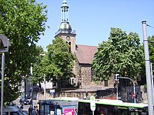
The Johanniskirche is located directly opposite the town hall square and is therefore part of the “Mitte” and the “Innenstadt” district.
It emerged from the parish church, first documented in 1214, and is considered the oldest building in the city. Due to excavations in the vicinity of the church, local history researchers are now certain that a church - probably a small chapel - must have stood in its place as early as the 9th or 10th century .
In its current form it was built in 1752 on the foundations of the original church, and in 1845 it was given its present-day appearance as part of an extension. After destruction in World War II , the reconstruction was completed in 1952.
reformation
With the arrival of the Reformation in Witten, the Johanniskirche became a Protestant church in 1582 .
town hall
In 1862 the city of Witten purchased a private house near the market square to house the administration of the growing city. On October 25, 1911, the magistrate finally announced a competition to build a new town hall. When the First World War broke out , the city council only decided to start construction on July 7, 1921. With the occupation of the Ruhr by French troops in 1923 and the high inflation of the time, construction work repeatedly came to a standstill. The first phase of construction was completed in 1924 so that the town hall could be partially occupied. The administration was required to take possession of the offices quickly in order to forestall an occupation of the premises by the French occupation forces. In July 1924 the main building was finally handed over to its intended use. In the same month, construction work began on the striking tower , which, together with the St. John's Church opposite, has shaped the face of Witten-Mitte and thus Witten's inner city since its completion. Originally, the top of the tower was supposed to be adorned with a bronze statue on a pedestal, which would have cost 10,000 Reichsmarks to make. However, since the city lacked the money for such a production in 1924, the production of the statue was postponed and instead the spire was completed with a pinnacle made of copper sheet in 1926. This temporary arrangement adorns the top of the Witten town hall tower to this day.
Boroughs

Witten-Mitte consists of the city center districts, Oberdorf-Helenenberg , Industriegebiet-West, Krone , Crengeldanz , Hauptfriedhof, Stadion, Industriegebiet-Nord and Hohenstein , based on the maps of the Office for Statistics , Urban Development and Internet Service of the City of Witten . In the public view, these districts are perceived very differently. While a district like Krone is clearly defined as a district in the public perception - with its own district boundaries, its own history, its own identity - designations such as Industriegebiet-West represent above all administrative constructs, so-called "statistical districts".
Downtown
The city center district includes the city's pedestrian zone (Bahnhofstrasse) and Ruhrstrasse, Wittens' business center. The town hall is also located in the district.
Oberdorf-Helenenberg
The merging of the Oberdorf and the Helenenberg is an administrative construct. The area of the upper village is considered to be the nucleus of Witten. The first settlers probably settled here in the 9th century.
Industrial belt west
The industrial belt west covers an area in the west of the city. The largest industrial company in the city, Deutsche Edelstahlwerke, is located in this area . Deutsche Bahn also maintains the Witten points repair shop in this area . The industrial belt has the district number 13. On December 31, 2014, it had a total of 2,169 inhabitants.
Crown
As a district, Krone has only been part of Witten since 1929. Previously, the "Statistical District 14" belonged to the Langendreer office .
Crengeldanz
The Crengeldanz house in particular plays a decisive role in the history of the city of Witten . In the district with the district number 15, among others, the work of today is the British company Pilkington .
Main cemetery
The district main cemetery has the district number 16. On December 31, 2014, it had a total of 1581 inhabitants. In fact, the demarcation of this district is a purely statistical construct. As the name suggests, the Witten main cemetery "Walfischbusch" is located within the boundaries of the district. The cemetery , which was laid out in 1963, covers an area of 20.5 hectares and owes its name to the Wallfisch colliery , which mined hard coal in its place between 1832 and 1880 . The eastern borderline of the statistical district runs right through the so-called sunshine . This is a housing estate that was also built in the 1960s , which due to its relaxed housing style with multi-storey cooperative houses , single-family houses , its own retail structure , the establishment of a primary school in 1967 (from 1971 secondary school , since 2006 secondary school ) and a completely self-sufficient location without any noteworthy connection to other districts, has its own district character. But although a Sonnenschein farm was first mentioned in a document as early as 1664 and this corridor is even historically relevant , the district, which in the public perception exists as a separate district, does not exist as such in the districts of the city of Witten. The delimitation, which can be described as arbitrary, through the middle of the "quasi-district" divides it between the statistical district of the main cemetery and the district of Crengeldanz .
Stadion

The district of Stadion bears the district number 17. On December 31, 2014, it had a total of 2303 inhabitants. The district in the east of Witten-Mitte gained importance due to the settlement of the "Witten Ost" train station on the Rheinischer Esel railway line . Most of the railway site has been fallow since the railway line was shut down in 1982.
The Diakoniewerk Ruhr Witten and the Evangelical Hospital Witten are also located in the district . The so-called sister park is connected to the facilities . The outward appearance of the district is very uneven. In addition to four to five-storey residential buildings, there are many small businesses in the east of Witten , but hardly any retail trade. On the other hand, it offers a number of inner-city green corridors , which not only include the sister park, but also a small wood along the disused railway line . The city's largest Protestant cemetery is also within its limits.
The district owes its name to the Wullenstadion , the largest sports stadium in Witten, which is located in the district directly on the border with Annen .
Industrial belt north
This statistical district has the district number 18. On December 31, 2014, it had a total of 6375 inhabitants.
Hohenstein
The Hohenstein is the central city forest of Witten and a recreational area known beyond the city limits . From the Berger monument it is possible to see the entire Ruhr valley far into the weather . As a statistical district, the city forest bears the district number 19.
economy
retail trade
Thanks to Bahnhofstrasse, the extensive pedestrian zone in the city center of Witten, the city can assert itself as a medium-sized center in the region. In fact, the inner city within Witten is the main location of the local retail trade, it is the main center of the city. Only Annen and Herbede can show the status of a local secondary center with corresponding business settlements within Witten.
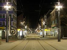
The retail trade within the city center is concentrated on two streets: Ruhrstrasse and Bahnhofstrasse, which was one of the first shopping streets to be turned into a pedestrian zone as early as the 1960s . A curiosity is the fact that although Bahnhofstrasse is officially designated as a pedestrian zone, tram tracks run right through the pedestrian zone and there is also regular tram traffic. Further retail is spread across the entire city center.
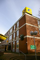
While the "upper" section of Bahnhofstrasse has a number of well-known retailers and a large department store and attracts buyers from all over the region, the business operators in the so-called "Untere Bahnhofstrasse", the western end of the pedestrian zone, are struggling with vacancies and against consumer decline. In the hope of making “Untere Bahnhofstrasse” more attractive, the establishment of a hypermarket of the Kaufland chain near the affected section of the pedestrian zone was approved in 2004. A short time later, the “Novum”, one of the largest, moved to western Bahnhofstrasse Second hand department stores in Germany . The city administration was hoping for positive synergy effects for the “Untere Bahnhofstrasse” from the Kaufland settlement in particular , and the Witten City Council approved the settlement in April 2004 with a large majority. As an expert opinion from 2007 shows, the expectations attached to the settlement for the “Untere Bahnhofstrasse” were not fulfilled.
The main post office and the small City-Center shopping center that was built in the 1970s, but which had never really been accepted by the people of Witten, were demolished in 2008 and the StadtGalerie shopping center was built on the site (opening 2009).
health
The city of Witten is home to two hospitals , both of which are located in this district:
- Marienhospital (Catholic)
- Evangelical Hospital Witten (until the mid-1970s "Diakonissenhaus" , colloquially the name is still used today)
literature
- Rüdiger Jordan: Of capitals, pulpits and baptismal fonts. An exciting guide to 67 churches and monasteries in the Ruhr Valley . 1st edition. Klartext Verlag , Essen 2006, ISBN 3-89861-436-0 .
- Klaus-Dieter Kraus: From chewing gum and school meals to effervescent powder . With contemporary image and text documentation from Witten an der Ruhr, as well as historical notes on this period of life and time. 1st edition. Paragon-Verlag, Bochum 2001, ISBN 3-932872-08-8 .
- Michael Schenk (Ed.): Witten. New pictures from the old days (= The archive pictures series ). Sutton Verlag , Erfurt 2009, ISBN 978-3-86680-409-8 .
- oA: Witten, as it used to be : City hall building in difficult times . In: Ruhr Nachrichten , local edition Witten (No. 229/2006)
Web links
Individual evidence
- ↑ a b Information on the area and the population of the districts ( Memento from April 11, 2015 in the Internet Archive )
- ↑ a b c d Population according to statistical districts. (PDF; 30 kB) (No longer available online.) In: Witten.de . December 31, 2015, archived from the original on July 9, 2016 ; Retrieved July 9, 2016 .
- ↑ From development to opening . CityGalerie Witten. Archived from the original on December 17, 2012. Retrieved December 28, 2015.
