
San Bernardino, California
City of San Bernardino | |
|---|---|
| File:Sb 2003 dt 002a.jpg | |
| Nickname(s): Gate City, City on the Move, the Friendly City | |
 Location in the state of California | |
| Country | United States |
| State | California |
| County | San Bernardino |
| Government | |
| • Mayor | Patrick J. Morris (D) |
| Area | |
| • Total | 78.5 sq mi (202.4 km² km2) |
| • Land | 75.8 sq mi (152.3 km² km2) |
| • Water | 0.4 sq mi (1.1 km² km2) |
| Elevation | 1,049−2,900 ft (321 m) |
| Population (2007) | |
| • Total | 205,010 |
| Time zone | UTC-8 (PST) |
| • Summer (DST) | UTC-7 (PDT) |
| Area code(s) | 909,951 |
| FIPS code | 06-65000 |
| GNIS feature ID | 1661375 |
| Website | http://sbcity.org/ |
San Bernardino is the county seat of San Bernardino County, California, United States. San Bernardino's estimated population, as of 2006, is 205,010.[1] As of 2006, it was the 18th largest city in California, and the 101st largest city in the United States.[2]. San Bernardino is part of the Riverside-San Bernardino-Ontario Metropolitan Area, the 14th largest metro in the nation also part of the Greater San Bernardino Area which is just refered to divid the San Bernardino-Riverside Area counties(San Bernardino Coubty and Riverside County). It is an anchor city of the Inland Empire. San Bernardino has three major events, the annual Route 66 Rendezvous,[3] a multi-day classic automobile event held in downtown San Bernardino each September, the National Orange Show,[4] held each April/May, and the Western Regional Little League Championships each August. The world's largest fast food chain, McDonald's, began in the city in 1940 by brothers Dick and Mac McDonald.
Though the closing of Norton Air Force Base and Kaiser Steel, as well as the relocation of railroad jobs in the 1980s and 1990s had a large impact on the economy and culture of the city, new industrial development is occurring near the San Bernardino International Airport. Though traditional retail and office areas such as downtown and Highland Avenue have suffered, the City is seeing growth along its south-end focused on Hospitality Lane. Though much of the housing stock is, on the average, older than the surrounding region, new homes continue to be built in different parts of the City, with the bulk on the north-end in the Verdemont area.
Downtown
History
San Bernardino, California is one of the oldest communities in the State of California. San Bernardino was named on May 20, 1810, but the present-day location was not largely settled until 1851 after statehood. The first Anglo-American colony was established by Latter-day Saints (Mormons). The City was incorporated in 1854. The Latter-day Saints were recalled in 1857 by Brigham Young. The city later became a trading hub for the region. The California Southern Railroad established a rail link with Los Angeles and the rest of the nation in 1883. In 1905, the City of San Bernardino passed its first Charter. World War II brought what would become Norton Air Force Base. The McDonald Brothers opened the first McDonald's restaurant in San Bernardino 1948. In 1980, the Panorama Fire destroyed 284 homes. In 1994, Norton Air Force Base closed, later becoming San Bernardino International Airport.
- 1810 - Padre Francisco Dumetz, a Spanish priest, names San Bernardino (the valley) on May 20, 1810, feast day of St. Bernardine of Siena[5]
- 1842 - Rancho San Bernardino granted to Antonio Maria Lugo, encompassing the entire San Bernardino Valley.[6]
- 1848 - Treaty of Guadalupe Hidalgo cedes California to the United States[7]
- 1851 - Mormon colony founded[8]
- 1851 - Jews arrive with the Mormon settlers. They establish the oldest Jewish cemetery in continuous use on the West Coast. Congregation Emanu El was later chartered in 1891.

- 1852 - Colonel Henry Washington erects survey monument in San Bernardino Mountains, founds the San Bernardino Base and Meridian. The Base Line is along the street of the same name.[9]
- 1854 - San Bernardino incorporated on April 13, 1854[10]
- 1857 - Brigham Young recalls Mormons to Utah. San Bernardino disincorporated.[11] The first orange trees are brought to the valley.[12] The Fort Tejon earthquake ruptured the San Andreas Fault, the last major earthquake on the San Bernardino portion of the fault to this day.[13]
- 1862 - A flood causes the Santa Ana River to carry three times its usual volume, altering its banks, wiping out nearby Agua Mansa. A smallpox plague from Los Angeles hits San Bernardino.
- 1870 - Regional rival Riverside, California formed by John W. North.
- 1873 - The Southern Pacific Railroad enters into negotiations with the City to build a railroad through town. Talks break down.
- 1874 - The first permanent court house[14] is founded on Court Street near "E" Street.
- 1875 - The Southern Pacific reaches the valley but stops at Slover Mountain Colony. The station is named Colton after Southern Pacific Official David D. Colton, and will become the City of Colton.
- 1882 - Julia and Joseph Meyer arrive in the area today known as Verdemont in Northwestern San Bernardino, and eventually they will own 2,000 acres (8 km²) which they use to grow wine grapes.
- 1883 - California Southern Railroad reaches San Bernardino on September 13th. San Bernardino High School becomes the first high school in the county.
- 1885 - On November 9, 1885, the last spike is driven on the California Southern Railroad, linking San Bernardino to the Atlantic Pacific Railroad.
- 1886 - San Bernardino reincorporated. A passenger rail fare war erupts between Southern Pacific and Santa Fe dropping the price from $125 to $1. All of Southern California booms.
- 1890 - The sanitarium that later becomes Patton State Hospital is founded.
- 1893 - Rival city Riverside secedes from San Bernardino County and forms its own County, with the City of Riverside its county seat.
- 1894 - The Sun Newspaper begins publishing.

- 1901 - San Bernardino's first permanent City Hall is located on a Corner of Third and "D" Street.
- 1902 - San Bernardino Valley Traction Company forms to operate electric trolleys in and between Colton, San Bernardino, Redlands and Highland.
- 1905 - San Bernardino passes its first Charter. Harris Company opens inside a small dry goods store. It becomes a small regional department store until it merges with Gottschalks in the 1990s.
- 1911 - First National Orange Show held.
- 1923 - North San Jacinto Fault Earthquake of magnitude 6.3 centered 7 miles south of San Bernardino damages many buildings, including Patton State Hospital, County Hospital, County Courthouse and Hall of Records. Greatest damage due to sandstone, masonry or otherwise poor construction.[15]
- 1925 - Future President Lyndon B. Johnson works as an elevator operator in the Platt Building in downtown San Bernardino
- 1926 - San Bernardino Valley College built.
- 1927 - The San Bernardino County Court House is built on the site of Fort San Bernardino, as Court Street is extended to Arrowhead.
- 1930 - San Bernardino's population grows to 37,481[16]
- 1938 - A major flood from the mountains damages the City.
- 1940 - San Bernardino's population reaches 43,646[17]
- 1941 - Dorthy Ingrham becomes the first African American Teacher an Bernardino, and later the first African American administrator in the state.
- 1942 - San Bernardino Air Material Command opens (later Norton Air Force Base).
- 1944 - San Bernardino native Leland Francis Norton was killed in action over Amiens, France on May 27, 1944. He was dive-bombing a target in an A-20 attack/bomber.
- 1947 - San Bernardino Air Depot deactivated, Congressman Harry Shepard gets it reactivated and expanded.
- 1948 - On December 12, siblings Richard and Maurice McDonald convert their "barbecue" restaurant on "E" Street into a fast food restaurant, McDonald's, by introducing their Speedee Service System. Glen Bell, inspired by their success opens Bell's Hamburgers on the corner of Oak and Mount Vernon Avenues. Bell would later open Taco Tia at Base Line and Acacia in 1954, El Taco, and in 1962, Taco Bell in Downey, California.
- 1950 - Norton Air Force Base named after Leland Norton. San Bernardino's population reaches 73,827.
- 1952 - Neal Baker, a friend of Glen Bell's and an admirer of the McDonalds', opens the first Bakers' Drive Thru. This local chain now has 35 stores in the Inland Empire.
- 1961 - Dick and Mac McDonald sell Ray Kroc business rights to their restaurants for $2.7 million dollars; they retain the original McDonalds as "The Big M." Kroc opens a McDonalds across the street. Today, the Kroc restaurant remains boarded up, the original McDonalds was demolished, though a McDonalds museum exists at the original site (with a building built in the 1970s), which is run by Albert Okura, founder of the local chicken chain, Juan Pollo.
- 1965 - California State University, San Bernardino founded.
- 1970 - W.R. "Bob" Holcolmb is first elected Mayor. He would serve until 1985, and then again from 1989 to 1993.
- 1973 - A new City Hall is opened on what was once the middle of Third Street between "E" and "F". This modern, eight level, glass and concrete building, designed by Gruen and Associates is the current seat of City government.
- 1976 - Omnitrans is formed, replacing the San Bernardino Transit System.[18]
- 1978 The Roman Catholic Diocese of San Bernardino is founded, covering San Bernardino and Riverside Counties, with its cathedral at Our Lady of the Rosary Cathedral in San Bernardino on Arrowhead Avenue at 25th Street.
- 1980 - Starting on November 24, and raging for six days, the Panorama Fire scorches 24,000 acres (97 km²), left four dead, destroyed 284 homes, and damaged 49 others. Many City firefighters lost their homes to this devastating firestorm. Low interest FEMA loans (at a time with record high mortgage interest rates) allowed most victims to rebuild and even expand their homes. The [Census] counts 118,794 residents.[19]
- 1985 - Norman F. Feldheym Library is dedicated. It is named after Rabbi Norman F. Feldheym, a prominent local leader who sat on the Library Board of Trustees for many years, among other civic accomplishments. Evelyn Wilcox is elected the first female mayor. The County Government Center (nicknamed the "Taj Mahal") opens at Fourth Street and Arrowhead Avenue, just north of the courthouse.
- 1987 - Professional (Single-A) baseball arrives when a team from Ventura California moves to Fiscalini Field in Perris Hill Park and are named the San Bernardino Spirit. James F. Penman is first elected as City Attorney, replacing Ralph Prince, City Attorney since the 1950s.
- 1989 - San Bernardino train disaster: Southern Pacific Railroad freight train derails, killing four on Duffy Street. Days later, the Cal-Nev gasoline pipeline ruptures and ignites at the same location from damage sustained in the derailment cleanup. The Miss USA Pageant is held in San Bernardino on July 25, and televised on CBS. Seeking free airtime, the City invests in an 800 number, which CBS does not show on the air. W.R. "Bob" Holcolmb, after four years out of power, is re-elected mayor.
- 1990 - San Bernardino's population reaches 164,164.[20]
- 1994 - Norton Air Force Base closed.
- 1996 - San Bernardino Stadium (renamed Arrowhead Credit Union Park in 2003) is opened with the San Bernardino Stampede (formerly the San Bernardino Spirit) baseball club as its lead tenant. This stadium on South E Street replaced Fiscalini Field in Perris Hill Park as the home of the minor league baseball team. (They are later renamed the Inland Empire 66ers]).
- 1997 - Mayor Judith Valles (Smith) is elected as Mayor. She is the first Latino elected Mayor in the City's history.
- 1999 - On January 31, the Harris' Department Store on E Street closes. George E. Brown, Jr., (D-Colton) the area's long-time representative in the United States House of Representatives dies in office.
- 2000 - In December 2000, the City closes the Cypress Inn mobile home park off of Mount Vernon Avenue in the City's Westside. The park is closed by the City's Fire Prevention Unit because of life safety issues involving a gas leak and illegal/unsafe electrical hook-ups. The park is largely inhabited by monolingual Spanish speakers. The City, using money set-aside for redevelopment, relocates the park's inhabitants to local motels. One resident, Valente Duran, complains about the treatment by the City. He says "In Mexico, they treat us better than here." San Bernardino City Attorney James F. Penman writes Valente Duran a letter in English and in Spanish that says in part "The people of this City have no desire to deprive you or your family of what you may believe would be better treatment by the government of Mexico. Therefore, in substitution for the housing, food, and other assistance the City of San Bernardino is voluntarily providing, we want to give you the option of continuing to receive this assistance or accepting our offer to arrange and pay for transportation for you and your family, one way, to Mexico." The letter causes a political firestorm.
- 2001 - Mayor Judith Valles is elected for a second term, running unopposed. Local newspapers allege this is a first in City history, but it is probably unlikely that someone ran against Apostle Amasa M. Lyman in 1854.
- 2003 - On October 25, 2003, the Old Fire (also known as the Old Waterman Canyon Fire), started by arson, destroys hundreds of structures in the foothills and in Del Rosa before heading into the San Bernardino Mountains. Many San Bernardino City Fire Department firefighters were battling the Grand Prix fire (which at the time was largely in Fontana and Rancho Cucamonga) at the time, reducing the City's full resource response. Two City firefighters lost their homes to the Old Fire. The hills denuded, floods devastate the KOA campground just outside the city limits on Christmas Day and the manager, Jan Bradley, is killed.
- 2006 Judge Patrick "Pat" J. Morris wins a mayoral run-off against City Attorney James "Jim" Frank Penman. On March 4, 2006, thousands of concertgoers start a riot at the Orange Show after a concert (see San Bernardino punk riot).
Geography
San Bernardino is located at 34°7′46″N 117°17′35″W / 34.12944°N 117.29306°WInvalid arguments have been passed to the {{#coordinates:}} function (34.129510, -117.293150)Template:GR.
According to the United States Census Bureau, the city has a total area of 153.5 km² (59.2 mi²), of which 152.3 km² (58.8 mi²) of it is land and 1.1 km² (0.4 mi²), or 0.74%, is water.
The city lies in the San Bernardino foothills and the eastern portion of the San Bernardino Valley, roughly 60 miles east of Los Angeles. Some major geographical features of the city include the San Bernardino Mountains and the San Bernardino National Forest along the northern border; the Cajon Pass adjacent to the northwest border; City Creek, Lytle Creek, San Timoteo Creek, Twin Creek, Warm Creek (as modified through flood control channels) feed the Santa Ana River, which forms part of the city's southern border south of San Bernardino Airport, but only a small amount of the river flows within the city.
A large part of the city is over the Bunker Hill Groundwater Basin, including downtown. This accounts for historically high groundwater in portions of the city, including the former Urbita Springs, a lake which no longer exists (it is now the site of the Inland Center mall), but which was a popular entertainment area until the 1930s. Seccombe Lake, named after a former mayor, is a man-made lake downtown at Sierra Way and Waterman Avenue. The San Bernardino Valley Municipal Water District ("Muni"), which despite its name has nothing to do with the city, has plans on building a multi-acre reservoir south of Base Line to reduce groundwater and sell it to neighboring agencies.
The city has some notable hills; among them Perris Hill (named after Fred Perris, an early engineer, and the namesake of Perris, California), Kendall Hill (which is near California State University, San Bernardino), and the Shandin Hills, also known as "Little Mountain," (strictly speaking is only the peak with the radio transmitters) which are generally bounded by Sierra Way, 30th Street, Kendall Drive, and Interstate 215. Freeways act as geographical dividers for San Bernardino.
Interstate 215 is the major east-west divider, while State Route 30 (known as the "Martin A. Matich Freeway") is the major north/south divider. Interstate 10 is to the south of the city, though a portion traverses San Bernardino near Waterman. Other major highways include State Route 206 (Kendall Drive and E Street); State Route 66 (which includes the former U.S. 66); State Route 18 (from State Route 30 north on Waterman Avenue to the northern City limits into the mountain communities), and California State Route 259, the freeway connector between Route 30 and I-215.
Climate
San Bernardino has a temperate climate, with mild, chilly to cold wet winters, and hot summers with somewhat low humidity. Snow flurries occur on occasion. San Bernardino gets a total of 16 inches (41 cm) of rain, snow or hail each year in the winter.
The Santa Ana winds blow out of the Cajon Pass during the autumn, which makes fire danger very high.
Neighborhoods
San Bernardino's neighborhoods are not commonly named. Some neighborhoods reflect tract names or geographical regions that existed before annexation. Del Rosa is the area generally between the foothills, Highland Avenue, Mountain and Arden Avenue, and includes unincorporated county islands. Delmann Heights is the area north of Highland Avenue, west of the 215, and east of the unincorporated area of Muscoy, California (which is within the city's sphere of influence for annexation). Some portions of Highland are within the City of San Bernardino, generally consistent with the portions of historical "West Highlands" north of Highland Avenue. The city also contains the post office for Patton, California, the area coexstensive with Patton State Hospital, a medium-security facility for sexually-violent mentally ill patients. Mountain Shadows originally was the development name for the area between Palm Avenue and Highland Avenue to State Route 330; today it generally means the mobile-home park of the same name. The "west side" is used generically to refer to the areas west of the 215 freeway. North Loma Linda is the area west of Mountain View (the border with Redlands), south of the Santa Ana River, North of the 10 freeway, and east of Tippecanoe Avenue. The area north of Northpark Avenue is sometimes referred to as Northpark. The area northwest of University Parkway, and north of Kendall Avenue to the city limits in Devore is called Verdemont. The neighborhood around Hemlock near Del Rosa is sometimes commonly called "Holcolmb Hill" in reference to former Mayor W.R. "Bob" Holcolmb, a long-time resident. The City of San Bernardino briefly (circa 2002) referred to the area immediately north of the Feldheym Library as "Old Towne," but the name is neither historically accurate, nor organic in any way. The "Bench" or "Rialto Bench" refers to the area with Rialto mailing addresses between Foothill Boulevard and Base Line, which is elevated over the wash.
Zip codes
San Bernardino has zip codes 92401 through 92427.[21] Some parts of the San Bernardino include Loma Linda, Rialto and Highland zip codes.
Parks and recreation
San Bernardino has many parks and recreation centers. Perris Hill Park is the largest and most well-known park, with a YMCA, a senior center, a pool, tennis courts, Fiscalani Field, and the Roosevelt Bowl.
Demographics
As of the 2000 census, there are 185,401 people, 56,330 households, and 41,120 families residing in the city. The population density is 1,217.2/km² (3,152.4/mi²). The population today is higher (2006 estimate: 201, 823)[22], and the Census may have had an undercount. Some areas, particularly north of downtown, have a density beyond design capacity, including garage conversions. There are 63,535 housing units at an average density of 417.1/km² (1,080.3/mi²). 47.48% of the population are Hispanic or Latino of any race. 28.23% White, 18.41% African American, 1.40% Native American, 4.19% Asian, 0.37% Pacific Islander, 27.12% from other races, and 5.28% from two or more races.
Large parts of Western & Central San Bernardino are home to mixed ethnic populations of low-income, of which the Mexican American and African American population dominates. Historically, many Latinos, primarily Mexican-Americans and Mexicans lived on Mount Vernon Avenue, while the East Base Line section was mostly black since the 1960s, particularly in an area centering around a public housing project called Waterman Gardens. Third Street near Arrowhead Avenue once boasted a Chinatown, detailed in the history section. The San Manuel Indian Reservation has developed a full-scale Las Vegas-style casino, now one of the area's largest private employers. The Reservation is technically not in the City, just north of its boundaries, and San Manuels use the geographical identifier of "Highland" instead of San Bernardino, particularly in advertising.
There are 56,330 households out of which 44.1% have children under the age of 18 living with them, 44.9% are married couples living together, 21.1% have a female householder with no husband present, and 27.0% are non-families. 21.1% of all households are made up of individuals and 7.5% have someone living alone who is 65 years of age or older. The average household size is 3.19 and the average family size is 3.72. As of 2000, 52.4% of housing is owner-occupied, 47.6% is renter-occupied, while 11.6% of all other housing units were vacant.
In the city the population is spread out with 35.2% under the age of 18, 11.0% from 18 to 24, 29.6% from 25 to 44, 16.0% from 45 to 64, and 8.2% who are 65 years of age or older. The median age is 28 years. For every 100 females there are 96.7 males. For every 100 females age 18 and over, there are 92.2 males.
The median income for a household in the city is $31,140, and the median income for a family is $33,357. Males have a median income of $30,847 versus $25,782 for females. The per capita income for the city is $12,925. 28.6% of the population and 23.5% of families are below the poverty line. Out of the total population, 36.2% of those under the age of 18 and 11.4% of those 65 and older are living below the poverty line.
Government
Form and structure of the City of San Bernardino
The City of San Bernardino is a charter city, a form of government under California that allows limited home-rule, in that it can pass its own laws not in conflict with state law, such as when state law is silent, or expressly allows municipal regulations of areas of local concern. San Bernardino became a charter city in 1905, the most current charter was passed in 2004.
The City of San Bernardino has what may be a unique form of government, with a strong, full-time, elected mayor, a city manager, an elected City Attorney, City Clerk, and City Treasurer, and seven council positions elected in a ward system. The charter also created the San Bernardino Unified School District, a legally separate agency, and the Board of Water Commissioners, a semi-autonomous, but legally indistinct commission, and a Board of Library Trustees.
The City Manager is responsible for all department heads, except for the fire and police chiefs. Previously, the San Bernardino Municipal Code recognized a City Administrator. In March 2006, City Administrator Frederick ("Fred") Wilson became the City's first City Manager.
When the City originally adopted a ward system, there were five wards. In the 1960s, the Council was expanded to seven wards. The boundaries are adjusted with each federal census as required by federal constitutional law. The current council is:
First Ward: Esther Estrada; Second Ward: Dennis Baxter; Third Ward: Tobin Brinker; Fourth Ward: Neiland ("Neil") K. Derry; Fifth Ward: Chas (not Charles) Kelley; Sixth Ward: Rikke Van Johnson; Seventh Ward: Wendy McCammack;
The Mayor is Patrick J. Morris;
The City Clerk is Rachel Clark;
The City Treasurer is David Kennedy;
The City Attorney is James "Jim" Frank Penman;
As per California law, all city positions are non-partisan.
San Bernardino shares certain powers with other agencies to form legally separate entities known as joint-power authorities under California law. These include Omnitrans, which provides transportation throughout the east and west valleys of San Bernardino County; SANBAG, which coordinates transportation projects throughout the County, and the Inland Valley Development Agency, which is responsible for redevelopment of the areas around the San Bernardino International Airport.
Additionally, the Redevelopment Agency of the City of San Bernardino (which goes by the name "Economic Development Agency of the City of San Bernardino," but never legally changed its name, is a separate legal entity, though the City Council of the City of San Bernardino sits as the Agency Board, and the Mayor is its executive.
The Government of Mexico has a consulate in downtown San Bernardino on the southeast corner of Third Street and "D" Street. Citizens of Mexico can obtain a Matrícula Consular which many governments and businesses use in lieu of U.S. photo identification.
Legal system

San Bernardino is the County Seat of San Bernardino County. As such the (main) courthouse is, and by law must remain, in downtown San Bernardino. Currently, the main courthouse is located at 351 North Arrowhead Avenue. It consists of a four-story building of steel and concrete construction built in 1927. A six-story addition was added in the 1950s. Currently, there are plans to seismically retrofit the 1926 structure, which will cause courtrooms and clerks to be temporarily moved to 303 West Third Street, site of the former State Building. The courthouse, after retrofit, will be transferred to the state's authority.
Juvenile Court and Juvenile Hall are located in a county enclave adjacent to the City on Gilbert Street, near the site of the former County Hospital. A new courthouse is tentatively planned to be built at the south east corner of Third and Arrowhead, across from both the planned 303 West Third courtrooms, and the current court. Funding for the future court will likely be conditioned upon a statewide bond initiative. The state courts operate as the San Bernardino Superior Court, San Bernardino District (formerly Central Division prior to the unification of the Superior and Municipal Courts in 1998).
The County's District Attorney and the Public Defender both have their main offices on Mountain View Avenue, directly east of the Courthouse.
The California Court of Appeal Fourth District, Division Two used to be located in San Bernardino, but moved to Riverside in the 1990s. Federal cases (including Bankruptcy) are also heard in Riverside courthouses.

As a charter city, San Bernardino may make and enforce its own laws not in conflict with the State's laws. These rules have been codified as the San Bernardino Municipal Code. Violations of the San Bernardino Municipal Code, punishable as a misdemeanor or infraction (or both) are prosecuted by the City Attorney's Office in the San Bernardino Superior Court. The City also has two administrative processes for violations of the San Bernardino Municipal Code, including adopted codes such as the Uniform Building Code and the California Fire Code. One is an administrative citation system, similar to a parking ticket, with a pay or contest procedure. The other is an administrative hearing process, generally used for multiple code violations by the Code Enforcement Department.
The San Bernardino Police Department has a holding area, but pre-trial in-custodies are transported to the West Valley Detention Center in Rancho Cucamonga. Sentenced criminals are held at the Glen Helen Rehabilitation Center, just outside the City's limits in the Verdemont area. While the Central Detention Center, located at 630 East Rialto Avenue in San Bernardino, served as the main jail from 1971–1992, today it mostly serves federal prisoners under contract.
San Bernardino's legal community has two centers: downtown and Hospitality Lane. Criminal, family, and government lawyers are centered downtown, while local civil firms and outposts of state and national firms, corporate, and insurance defense firms, are located along Hospitality Lane.
Public safety
The 1905 Charter created the San Bernardino Police Department and Chief of Police; before 1905, there was a position of City Marshal. The current Charter places the Chief of Police under the direction of the Mayor.
The San Bernardino City Fire Department was founded in 1878. The Fire Chief is under the direction of the Mayor. It is a completely professional (as opposed to volunteer) fire department.
Charter Section 186 requires that the monthly salaries of police and fire local safety members be the average of like positions at ten comparable cities in California.[23] Thus, if the average goes up in other cities, the compensation of the local safety employees automatically rises.
Over 90 percent of local police officers do not live within the City limits. [24]
Recent police efforts include joint patrols with the San Bernardino County Sheriff's Department and the California Highway Patrol. As of November 2006,[25] Part 1 Crime (Murders, Rape, Robbery, Assault, Burglary and Theft) was down 14.07 percent from 2005. Stricter enforcement caused a rise in both juvenile and adult arrests.[26]
San Bernardino has long dealt with spillover of crime from the Los Angeles region.[27] The San Bernardino Police Department's Multiple Enforcement Team (MET)[28] focuses on controlling gangs. This includes both street gangs and prison gangs.[29] Some efforts include putting GPS tracking devices on parolees.[30] The San Bernardino City Attorney's Office pioneered the use of gang injunctions in San Bernardino County. The City has seven civil gang injunctions covering 400 members.[31] These include permanent injunctions against the Five Time Hometown Crips,[32] Verdugo Flats Gang, [33] Sur Crazy Ones, [34] Delmann Heights Bloods Gang,[35] and the California Gardens Gang.[36] At least one of these injunctions was studied by a UC Irvine professor, which found short-term benefits to the injunctions.[37]
San Bernardino has long battled with crime, blight and poverty. According to the Morgan Quitno Press, a book publisher, it was #16 most dangerous in 2003, and #18 in 2004, and #24 in 2005. According to FBI data of 2005, San Bernardino's murder rate was 31.3 per pop. 100,000.[38] In comparison to Los Angeles' rate, 13.2 per pop. 100,000, its murder rate is relatively high.
Sister cities
San Bernardino has eleven sister cities, as designated by Sister Cities International[39] and the Mayor's office.[40] of the City of San Bernardino:
Tachikawa is the oldest and strongest of the relationships, and predates Sister Cities International, Inc. It was formed because both San Bernardino and Tachikawa had United States Air Force Bases.
Economy
Government, retail, and service industries dominate the economy of the City of San Bernardino. Light manufacturing and warehouses dominate portions of the City, particularly near California State University and San Bernardino International Airport.
Media
San Bernardino is part of the Los Angeles Nielsen area. As such, its residents receive the same television stations as most other Southern Californians. KVCR-TV, a PBS affiliate operated by the San Bernardino Community College District, is the only local San Bernardino television station. KPXN, the Los Angeles "i" network affiliate, is licensed to San Bernardino, but contains no local content. Most of North San Bernardino cannot receive over-the-air television broadcasts from Los Angeles. This is because Mount Baldy and other San Gabriel Mountain peaks block transmissions from Mount Wilson. Since the 1960s, most North San Bernardino residents have required cable television to obtain television. Today, the City has two main cable franchises: Northwest San Bernardino has Charter Communications, the rest of the City is served by Time Warner Cable), and Mountain Shadow Cable is a small local company that provides services to the eponymous mobile home park. DBS satellite is also prevalent.
Historically, San Bernardino has had a number of newspapers. Today, the San Bernardino Sun, founded in 1894 (but was the continuation of an earlier paper) publishes in North San Bernardino, and has a circulation area roughly from Yucaipa to Fontana, including the mountain communities. Its major competitor is the Riverside Press-Enterprise, which has more than triple the circulation of the Sun throughout the Inland Empire, but a relatively weak household penetration in San Bernardino County. Many older residents refer to the Sun as the Sun-Telegram, its name when it merged with the afternoon Telegram in the 1960s.
San Bernardino and the Inland Empire have their own Arbitron area. Therefore, there are a number of radio stations that broadcast in or near San Bernardino. These include rock station KCXX (FM), country music station KFRG (FM) and PBS affiliate KVCR (FM). Other than government or media outlets, no large internet sites are centered around San Bernardino.
King Kong test screening
The first version of this film was test screened to a sample audience in San Bernardino, in late January, 1933, before the official release. Apparently, at that time the film contained a scene following that in which Kong shakes several sailors off a log into a crevice, showing them eaten alive by a giant spider, a giant crab, a giant lizard, and an octopoid. The spider-pit scene caused members of the audience to scream, some fainted and left the theater. After the preview, the film's producer, Merian C. Cooper, cut the scene. However, a memo written by Merian C. Cooper, recently revealed on a King Kong documentary, indicates that the scene was cut because it slowed the pace of the film down, not because it was too horrific. According to "King Kong Cometh" by Paul A. Wood, the scene did not get past censors and that audiences only claim to have seen the sequence. On the 2005 DVD, nothing is mentioned as to the sequence being in the test screening. Stills from the scene exist, but the footage itself remains lost to this day. It is mentioned on the 2005 DVD by Doug Turner, that Merian C. Cooper, the director, usually relegated his outtakes and deleted scenes to the incinerator (a regular practice in all movie productions for decades), so many presume that the Lost Spider Pit Sequence met this fate as well. Models used in the sequence (a tarantula and a spider) can be seen hanging on the walls of a workshop in one scene in the 1946 film Genius at Work, and a spider and tentacled creature from the sequence were used in O'Brien's 1957 film The Black Scorpion. Director Peter Jackson, and his crew of special effects technicians at Weta Workshop, created an imaginative reconstruction for the 2005 DVD release of the film (the scene was not spliced into the film but is intercut with original footage to show where it would have occurred, and is part of the DVD extras). The scene is also recreated in their 2005 remake, with most men surviving the initial fall but having to fight off giant insects to survive.
Education
Colleges and universities
San Bernardino Valley College (south of downtown) is a public community college. California State University, San Bernardino (north of downtown) is a part of the California State University System. There is also ITT Technical Institute, The Art Institute of California -Inland Empire, San Bernardino, and Everest College. Other nearby institutions include the University of California, Riverside, the private University of Redlands, and California State Polytechnic University, Pomona, which is also part of the California State University. San Bernardino also offers a American Sports University in Downtown San Bernardino.
Primary and secondary schools
San Bernardino is almost entirely served by the San Bernardino City Unified School District. The district also serves parts of the Cities of Rialto and Highland. Parts of the City are served by the Redlands Unified School District, Colton Joint Unified School District, and Rialto Unified School District. Despite the District's name, it is no longer a part of the City of San Bernardino. The district, as signified by its name, has elementary, intermediate, and high schools. The comprehensive high schools are Arroyo Valley High School, Cajon High School, San Bernardino High School, Pacific High School, Middle College, and San Gorgonio High School. Intermediate schools are Richardson Prep, Cesar Chavez Middle School, Golden Valley Middle School as well as Shandin Hills Middle School, Arrowview Middle School, Martin Luther King Junior Middle School Academy, and Curtis Middle School.
Culture and contemporary life
Performing arts
The California Theater of Performing Arts, in downtown San Bernardino, holds cultural events, including touring Broadway theatre presented by Theatrical Arts International the Inland Empire's Largest Theatre Company and the San Bernardino Symphony. The Hyundai Pavilion in adjacent Devore, the National Orange Show, and Coussoulis Arena at Cal State San Bernardino host popular music. The historic Fox Theatre of San Bernardino is also located in the downtown area, next to American Sports University. The Fox Theater is being reopen and remodled.
Museums
The Heritage House at 8th and D holds the collection of the San Bernardino Historic and Pioneer Society. The San Bernardino County Museum, in Redlands, California, has exhibits relating to the history of the City of San Bernardino, including a diorama of the Mormon Fort. A museum is located on the site of the first McDonalds at 1398 N. E Street. [41]The Inland Empire Military Museum is located at 1394 N. E Street.[42]
Gang Violence
The Inland Empire is well known for its Chicano gangs. The most well-known gangs are the Onterio Varrio Sur Black Angels gang and the West Side Verdugo gang, as well as the South Side Verdugo Flats gang, in various parts of south San Bernardino, particularly around Mount Vernon Avenue. Fuelled by drug money and the ease of communication brought on by affordable cell phones, the street gangs have flourished and spread across and beyond the Inland Empire in the face of sporadic and ineffective law enforcement efforts and inadequate intervention strategies. Incidents of gang violence in San Bernardino County have increased since the 1960s, while at the same time growing more brutal. There are now an estimated 68,600 gang members in 287 gangs in the Inland Empire. [citation needed]
Sergeant Phil Brown of the San Bernardino County Sheriff's Department said the gangs are growing more violent in the farthest reaches of the county, including the High Desert. Racial tensions among the Chicano gangs and the Afro-American gangs have heightened dramatically in the Inland Empire, causing even the most rural areas to be affected. "It's getting out in more remote areas," Brown said. "They go gang against gang. There's more gang violence to the general public and it's becoming more random.."
Sports
The city hosts the Inland Empire 66ers baseball club of the California League, which as of 2007 is the Los Angeles Dodgers Single A Affiliate in 2007. The 66ers play at Arrowhead Credit Union Park in downtown San Bernardino.
California State University, San Bernardino Coyotes compete at the NCAA Division II level in a variety of sports. In 2007, the Coyotes' men's basketball team competed in the Division II Final Four in Springfield, Massachusetts. However, only San Bernardino Valley College plays football at the collegiate level.
San Bernardino has had other professional and semi-pro teams over the years, including the San Bernardino Jazz professional women's volleyball team, the San Bernardino Pride Senior Baseball team, and the San Bernardino Spirit California League Single A baseball team.
Transportation
Roads and highways
San Bernardino has a system of mostly publicly maintained local streets, including major arterials, some private streets, state highways, and interstate highways.
The major streets are (north south streets, from the west): Meridian Avenue, Mount Vernon Avenue, E Street, Arrowhead Avenue, Sierra Way, Waterman Avenue, Tippecanoe Avenue, Del Rosa Avenue, Sterling Avenue, Arden Avenue, Victoria Avenue, Palm Avenue, and Boulder Street; east west streets, from the north): Northpark Avenue, Kendall Avenue, 40th Street, Marshall Boulevard, 30th Street, Highland Avenue, Base Line (Street), 9th Street, 5th Street, 2nd Street, Rialto Avenue, Mill Street, Orange Show Road, and Hospitality Lane.
The State Highways include: California State Route 206 (Kendall Avenue), California State Route 259 (the connector between Highway 30 and Interstate 215), California State Route 18 (Waterman Avenue) (the gateway to the San Bernardino National Forest), California State Route 330, and California State Route 66.
Freeways include: Interstate 10, Interstate 215, Interstate 210, California State Route 30 [named the Martin A. Matich Freeway between the I-215 and the I-10 in Redlands on October 17, 2006[43] , California State Route 259, and California State Route 330.
Public transportation

San Bernardino is served by Metrolink. Lines include the "Greedy" Metrolink Inland Empire-Orange County Line and the Metrolink San Bernardino Line. Plans are underway by SANBAG to create a light rail link to Redlands, California, with potential stops at Mill Street and Hospitality Lane. Amtrak's Southwest Chief, operating from Los Angeles to Chicago has one daily train in each direction that stops at the San Bernardino station.
The City of San Bernardino is a member of the joint-powers authority Omnitrans. A Bus Rapid Transit project, called SB-X, is planned from Cal State San Bernardino to Loma Linda. A bus transit center is planned in the vicinity of E Street and Rialto Avenue.
Airports
San Bernardino International Airport (the former Norton Air Force Base) is physically located within the City. A large amount of warehouses are being built in its general vicinity; it is within the jurisdiction of the Inland Valley Development Agency, a joint powers authority, and the San Bernardino Airport Authority. Hillwood, a venture run by H. Ross Perot, Jr., is the master developer of the project, which it calls AllianceCalifornia. The airport does not currently offer commercial passenger service. However the airport is being remodled and will be taking international flights in June 2008, confermed by major Pat Morris.. The airport will have entrencss through both the San Bernardino freeways I-10 and I-215 off Mill Street for I-215, and Waterman Avenue (north) for I-10.
Notable San Bernardinians and popular culture references
The Arts
- Jon Foreman - Christian rock musician
- Gene Hackman - actor
- Kirk Harris - actor, writer
- Edith Head - Academy Award-winning costume designer
- Twyla Tharp - modern dancer
- Michael Reaves - screenwriter, mostly on animated series
Politics
- Anna Escobedo Cabral - 42nd and current Treasurer of the United States
- Merritt B. Curtis - Brigadier General in the Marine Corps and candidate for President of the United States in 1960
- Jefferson Hunt - Western Pioneer
- Dirk Kempthorne - present US Secretary of the Interior and former governor of Idaho
- Claude R. Kirk, Jr. - former governor of Florida
- Robert Waterman - Governor of California
- Terry L. Wilson-United States Air Force
Science
- Michael R. Clifford - astronaut
- Howard Georgi - professor of physics at Harvard University
Sports
- Brandie Burton - professional golfer
- Tyson Chandler - professional basketball player, New Orleans Hornets
- Rich Dauer - Professional Baseball Player
- Shawn Estes - Professional Baseball Player
- Charles Johnson - professional football player
- Steve Johnson - professional basketball player
- John Laurinaitis - professional wrestler
- Alberto Madril - professional wrestler
- Ryan Nece - professional football player, Tampa Bay Buccaneers
- Derek Parra - speed skater, gold and silver medalist at 2002 Winter Olympics, competed at the 2006 Winter Olympics.
- Bryon Russell - Professional Basketball Player, Denver Nuggets
- Swede Savage - Indy 500, sports car, and NASCAR driver. Died in 1973 Indy 500.
- Luis Carrera - Handsome player for the San Diego Chargers.
- Jeremy Stevenson - NHL player born in San Bernardino
- Dave Stockton - professional golfer
- Lisa Marie Varon aka Victoria - professional wrestler
Gallery
-
Downtown San Bernardino
-
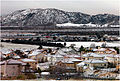 Average January snow fall in San Bernardino
 -
Snowfall in January 12, 2007
-
 San Bernardino, Amtrak station, Santa Fe Depot
 -
San Bernardino I-210 Fwy

Popular Culture References
This article contains a list of miscellaneous information. (October 2007) |
- Site of first McDonald's restaurant
- Famed British disc jockey John Peel worked at local radio station KMEN in the mid-1960s
- Burial place of guitarist Randy Rhoads in Mountain View Cemetery at Waterman and Highland Avenues.
- Site of Mick Jones' last performance with British punk band The Clash
- Mentioned in Bobby Troup's song "(Get Your Kicks On) Route 66"
- Sammy Davis Jr was involved in a car accident where he lost his eye in 1954. He was treated at San Bernardino Community Hospital.
- Will Rogers final public appearance was at the California Theatre in 1935. Two large murals of Rogers appear on the California Theater today.
- The Rolling Stones made their U.S. Concert Debut (though they had other, promotional dates first [25] at the Swing Auditorium on June 5, 1964.
- The first line of the Mark Knopfler song "Boom Like That" is 'I'm going to San Bernardino, ring-a-ding ding,' a reference to Ray Kroc's visit to the first McDonald's.
- Mentioned in a Bugs Bunny cartoon; and in the Simpsons, in the episode titled "Take My Wife, Sleaze" (Can we at least keep her till the orgy at San Berdoo?).
- "San Ber'dino" is the title of a song written by Frank Zappa and appeared on the album "One Size Fits All".
- San Bernardino is also mentioned in the Eagles Of Death Metal song "San Berdoo Sunburn" on their debut album "Peace, Love And Death Metal".
- The first chapter of the HAMC (Hells Angels) was started in San Bernardino (The Berdoo chapter) in 1948.[citation needed]
- Mentioned in the Movie Cars
- According to the B-Movie Cannibal Women in the Avocado Jungle of Death, it is the westernmost outpost of civilization.
- Joan Didion, in her essay Some Dreamers of the Golden Dream, described October in San Bernardino as the "season of suicide, divorce, and prickly dread, wherever the wind blows."
- Twilight Zone episode The Last Flight, and parts of the films [[Ha[] Error: {{Lang}}: no text (help)noi Hilton]], Terminator 3, The Fast and The Furious, Volcano, and Bad Boys were filmed at Norton Air Force Base.
- Referenced in the Creedence Clearwater Revival song Tombstone Shadow "Saw the Gypsy man way down in San Berdoo"
- Industrial punk band Mindless Self Indulgence referenced to San Bernardino in their song, "Planet of the Apes".
- Swing Auditorium in San Bernardino was the site of a "sickter" Grateful Dead performance on February 26, 1977 which featured the debut live performance of two soon-to-be dead classics, "Terrapin Station" and "Estimated Prophet".
Nicknames, pronunciation, and abbreviations
San Bernardino has gone by many nicknames in its history. Of these, San Berdoo[44][45] or Berdoo[46][47] is the most common but is sometimes considered to be derogatory. Others include Gate City[48] (to reflect its proximity to Los Angeles, and the fact that it is at the southern/western end of the Cajon Pass, leading to the High Desert and Las Vegas, Nevada), "The Friendly City"[49]City on the Move[50] (used in the 1970s), and most recently The Heartbeat of Route 66[51]. Latinos played on "Berdoo" by calling the city "Verdugo.[[52]]" [53] The term means "executioner" in Spanish[54], and is also a place name in Los Angeles County, both unrelated to the use. Outsiders often misspell the city as "San Bernadino"[55], without the second "r", based on a common pronunciation of the name. A nickname of more recent vintage is "BurgerTown."[56]. Newspapers, particularly the San Bernardino Sun, will abbreviate San Bernardino (the city but not the county) to "SB." This can cause some confusion in that other places in the state, including the South Bay of Los Angeles County, and Santa Barbara, California are both abbreviated to "SB." The name "San Bernardino" refers both to the incorporated "City of San Bernardino" and other associated, unincorporated parts of the City. Two common abbreviations are "San Bdno" and "San Bdo", in the 60s and 70s local mail was often addressed to "San Bdno, CA"; a Google search today for either abbreviation returns over 700 hits.
Notes
References
- ^ State of California, Department of Finance, E-5 Population and Housing Estimates for Cities, Counties and the State, 2001-2007, with 2000 Benchmark. Sacramento, California, May 2006[1]
- ^ "Table 1: Annual Estimates of the Population for Incorporated Places Over 100,000, Ranked by July 1, 2006 Population: April 1, 2000 to July 1, 2006" (CSV). 2005 Population Estimates. United States Census Bureau, Population Division. 2007-06-28. Retrieved 2007-06-28.
{{cite web}}: Check date values in:|date=(help)See also: List of United States cities by population - ^ [2]
- ^ [3]
- ^ Schuiling, Walter C. San Bernardino County: Land of Contrasts, Windsor Publications, 1984, p. 26
- ^ Schuiling, Walter C. San Bernardino County: Land of Contrasts, Windsor Publications, 1984, p.34
- ^ Schuiling, Walter C. San Bernardino County: Land of Contrasts, Windsor Publications, 1984, p.41
- ^ Schuiling, Walter C. San Bernardino County: Land of Contrasts, Windsor Publications, 1984, 44
- ^ Schuiling, Walter C. San Bernardino County: Land of Contrasts, Windsor Publications, 1984, 47
- ^ Schuiling, Walter C. San Bernardino County: Land of Contrasts, Windsor Publications, 1984, p. 49
- ^ Schuiling, Walter C. San Bernardino County: Land of Contrasts, Windsor Publications, 1984, p. 50
- ^ Schuiling, Walter C. San Bernardino County: Land of Contrasts, Windsor Publications, 1984, p.47
- ^ The Great 1857 "Fort Tejon" Earthquake
- ^ Cataldo, Nick. Images of America: San Bernardino, CaliforniaArcadia Publishing, 2002, p. 39
- ^ Laughlin, H., Arnold, R., and Kew, W.S.W. (1923). Southern California Earthquake of July 22, 1923. Bulletin of the Seismological Society of America, Vol. 13, No. 3, pp. 105-106, Plate 13.
- ^ The World Almanac and Book of Facts, 1943, p. 446
- ^ Heritage Tales, San Bernardino Pioneer and Historical Society 1982, p.1
- ^ [Omnitrans Transportation Milestones 1951-1979|http://www.omnitrans.org/about/fleet_timeline_3.shtml]
- ^ The World Almanac and Book of Facts (1993), p. 401.
- ^ The World Almanac and Book of Facts (1993), p. 401.
- ^ San Bernardino Zip Codes: [4]
- ^ State of California, Department of Finance, E-5 Population and Housing Estimates for Cities, Counties and the State, 2001-2006, with 2000 Benchmark. Sacramento, California, May 2006[5]
- ^ City of San Bernardino, Charter section 186, San Bernardino Municipal Code section 1.28.020
- ^ Brown, Hardy, San Bernardino Black Voice News, "Brinker, Derry, Kelley & McCammack 'Wrapped Up, Tied Up, Tangled Up' . . . Ethics Gone" March 15, 2007 [6]
- ^ November 2006 Part 1 Crime in San Bernardino
- ^ Juvenile and adult arrests in San Bernardino
- ^ del Barco, Mandalit. National Public Radio March 8, 2007 [7]
- ^ Bernardino Police Department's Multiple Enforcement Team (MET)
- ^ [8]
- ^ del Barco, Mandalit. National Public Radio March 8, 2007 [http://www.npr.org/templates/story/story.php?storyId=7779888
- ^ Editorial, "DA Gets a New Anti-Gang Weapon" San Bernardino Sun, February 9, 2007 [9]
- ^ The People of the State of California v. The Five Time Hometown Crips, et al. San Bernardino Superior Court Case SCVSS 80319
- ^ The People of the State of California v. Verdugo Flats Gang, et al., San Bernardino Superior Court Case SCVSS 92975, filed 8/2/2002
- ^ The People of the State of California v. Sur Crazy Ones, et al. San Bernardino Superior Court Case SCVSS 58315, filed 6/23/1999
- ^ The People of the State of California v. the Delmann Heights Bloods Gang et al. San Bernardino Superior Court Case SCVSS 107068, filed 8/25/2003
- ^ The People of the State of California v. The California Gardens Gang, San Bernardino Superior Court Case SCVSS 119636, filed 10/20/2004
- ^ Maxon, Chery L., Hennigan, Karen M., Sloane, David C. "IT'S GETTING CRAZY OUT THERE": CAN A CIVIL GANG INJUNCTION CHANGE A COMMUNITY?* Criminology & Public Policy 4 (3)(2005), 577–605.
- ^ Secondary source: City-Data.com
- ^ Sister Cities International, Inc. (SCI)
- ^ Mayor's Office - Sister Cities
- ^ [10]
- ^ Summons, Trevor, San Bernardino County Sun, March 31, 2006 [11]
- ^ Pitchford, Phil, Riverside Press-Enterprise, October 17, 2006 [12]
- ^ [San Bernardino, San Berdoo, and San Berdino S. T. Farquhar California Folklore Quarterly, Vol. 4, No. 4 (Oct., 1945), p. 410]
- ^ Credence Clearwater Revival "Tomstone Revival" lyrics, Green River (Fantasy Records 1969) http://www.creedence-online.net/lyrics/tombstone_shadow.php
- ^ Used since the 1870s [13]
- ^ Practical Presbyterian, Time Magazine, April 23, 1951 [14]
- ^ See The San Bernardino Daily Sun, July 1918 quoted at Santa Fe Depot and the Railroads[15]
- ^ Interview of Edward Thomann on January 9, 2003 by Professor Joyce Hanson, for the San Bernardino Oral History Project, January 9, 2003 [16][17], [18],
- ^ Interview of Edward Thomann on January 9, 2003 by Professor Joyce Hanson, for the San Bernardino Oral History Project, January 9, 2003 [19]
- ^ The Convention and Visitor's Bureau created this slogan, but no longer uses it
- ^ See," for example, the Verdugo Flats gang [20]
- ^ A History of San Bernardino, California by Manuel Ruben Delgado [21]
- ^ WordReference.com English-Spanish Dictionary [22]
- ^ [23]
- ^ "See" for example [24]
Further reading
- Edward Leo Lyman, San Bernardino: The Rise and Fall of a California Community, Signature Books, 1996.
- Walter C. Schuiling, San Bernardino County: Land of Contrasts, Windsor Publications, 1984
- Nick Cataldo, Images of America: San Bernardino, California, Arcadia Publishing, 2002
See also
External links
- City of San Bernardino
- California State University, San Bernardino
- San Bernardino Valley College
- San Bernardino County Fire Insurance Claims Contractors
