Old Emscher
| Old Emscher | ||
|
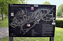
The Alte Emscher in the Duisburg-Nord landscape park |
||
| Data | ||
| Water code | DE : 277132 | |
| location | North Rhine-Westphalia , Germany | |
| River system | Rhine | |
| Drain over | Rhine → North Sea | |
| source | Landscape Park Duisburg-Nord 51 ° 28 ′ 56 ″ N , 6 ° 47 ′ 37 ″ E |
|
| Source height | approx. 26 m above sea level NN | |
| muzzle | In the Rhine (km 788.5) near Duisburg - Hamborn Coordinates: 51 ° 29 '45 " N , 6 ° 43' 5" E 51 ° 29 '45 " N , 6 ° 43' 5" E |
|
| Mouth height | 20 m above sea level NN | |
| Height difference | approx. 6 m | |
| Bottom slope | approx. 0.77 ‰ | |
| length | 7.8 km | |
| Catchment area | 29.245 km² | |
| Big cities | Oberhausen , Duisburg . | |
The Alte Emscher is a 7.8 km long arm of the Emscher in Duisburg with a catchment area of 29.2 km². It represents the original estuary of the Emscher .
Significant subsidence in the Meiderich , Beeck and Bruckhausen area around 1900 meant that the water from the Emscher could no longer drain naturally into the Rhine and could no longer collect. In 1910, the Emschergenossenschaft therefore relocated the estuary further north, into what is now the Kleine Emscher .
In 1914, the cooperative built the Alte Emscher pumping station at the lowest point of the Alte Emscher drainage basin .
For a long time the oxbow lake was an open, canalized, surface sewer for household and industrial sewage. In 1995 the construction of underground, separate sewers began, first in the Duisburg-Nord Landscape Park (LaPaDu), which the Alte Emscher runs through over a length of 3 km. The pipes have a diameter of 1.0 to 4.4 meters and they lead the waste water directly to the Duisburg Alte Emscher sewage treatment plant . At the same time, the river was ecologically improved and the recreational value increased through the Emscher promenade and similar measures. Numerous fish swim in the Alte Emscher today, including catfish and pike. The Emschergenossenschaft has signed a lease agreement with the Rheinischer Fischereiverband and the Alte Emscher has officially been a fishing lake since September 2016.
The renovation was completed in 1999, and since then only rainwater has flowed in the bed of the Alte Emscher, most of which comes from the sealed areas of the landscape park. On the so-called "water path", the rainwater is directed into two water basins connected one behind the other (location of the former cooling towers), then transferred to the fining ponds and then with a delay into the Alte Emscher (rain retention system). With the help of the wind turbine on the Emscher promenade, part of the water is lifted into the tower and then transported to the bunker gardens. If it is not needed there, it flows back to the clear water course via pipes and falls into it openly, which enriches it with oxygen.
The Alte Emscher is cut off from the Emscher river system, only drains its immediate catchment area in the north of Duisburg and the west of Oberhausen and then lifts the water as a right tributary into the Rhine at km 788.5.
Individual evidence
- ↑ a b c Topographical Information Management, Cologne District Government, Department GEObasis NRW ( information )
- ↑ Topographical Information Management, Cologne District Government, Department GEObasis NRW ( Notes )
- ^ Concept ( Memento of March 13, 2010 in the Internet Archive )
Web links
Description of this sight on the route of industrial culture
- Regional Association Ruhr: Landscape Park Duisburg-Nord - industrial nature. In: metropoleruhr.de. July 25, 2018, accessed October 13, 2018 .
- Landscape Park Duisburg-Nord, nature experience, water concept, Alte Emscher


