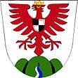
Arnolec
| Arnolec | ||||
|---|---|---|---|---|
|
||||
| Basic data | ||||
| State : |
|
|||
| Region : | Kraj Vysočina | |||
| District : | Jihlava | |||
| Area : | 1136 ha | |||
| Geographic location : | 49 ° 26 ′ N , 15 ° 49 ′ E | |||
| Height: | 540 m nm | |||
| Residents : | 176 (Jan. 1, 2019) | |||
| Postal code : | 588 27 | |||
| License plate : | J | |||
| traffic | ||||
| Street: | Měřín - Záborná | |||
| structure | ||||
| Status: | local community | |||
| Districts: | 1 | |||
| administration | ||||
| Mayor : | Ladislav Fiala (as of 2009) | |||
| Address: | Arnolec 53 588 27 Jamné u Jihlavy |
|||
| Municipality number: | 586854 | |||
| Website : | www.obecarnolec.cz | |||
Arnolec (German Arnoldsdorf , also Arnoletz ) is a municipality in the Czech Republic . It is located ten kilometers southeast of Polná and belongs to the Okres Jihlava .
geography
Arnolec is located in the Arnolecké hory at the confluence of the Arnolecký creek in the Balinka , which rises north of the place. To the north rises the Sádek (698 m), in the northeast the Havlina (706 m) and in the northwest Na Vrchu (617 m).
Neighboring towns are Rudolec in the north, Chroustov in the north-east, Černá in the east, Jersín in the south, Nadějov in the south-west, Zhoř in the west and Stáj in the north-west.
history
The first written mention comes from 1407.
After the abolition of patrimonial Arnolec formed a political municipality in the Iglau district from 1850 . From 1949 the community belonged to the Okres Jihlava-okolí and since 1961 again to the Okres Jihlava.
Attractions
- Chapel of St. Wendelin, on the village square
- Atonement Cross Baba , on the road to Záborná
- Chapel, in the fields between Arnolec and Jersín
Sons and daughters of the church
- Josef Toufar (1902–1950), Catholic priest

