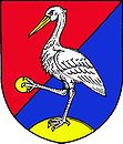
Luka nad Jihlavou
| Luka nad Jihlavou | ||||
|---|---|---|---|---|
|
||||
| Basic data | ||||
| State : |
|
|||
| Region : | Kraj Vysočina | |||
| District : | Jihlava | |||
| Area : | 1569 ha | |||
| Geographic location : | 49 ° 23 ' N , 15 ° 42' E | |||
| Height: | 442 m nm | |||
| Residents : | 2,901 (Jan 1, 2019) | |||
| Postal code : | 588 22 | |||
| License plate : | J | |||
| traffic | ||||
| Railway connection: | Znojmo – Kolín | |||
| structure | ||||
| Status: | stains | |||
| Districts: | 4th | |||
| administration | ||||
| Mayor : | Wiktor Wölfl | |||
| Address: | 1. máje 76 58822 Luka nad Jihlavou |
|||
| Municipality number: | 587478 | |||
| Website : | www.lukanadjihlavou.cz | |||
Luka nad Jihlavou (German meadow at the hedgehog ) is a stain in the Czech Republic .
The baroque palace of the Widmann-Sedlnitzky is a sight and is open to the public.
Districts
- Otín ( Ottendorf ) (117 inhabitants)
- Svatoslav ( Swatoslau ) (45 inhabitants)
- Předboř ( Pschedborsch ) (16 inhabitants)

