
Waltenschwil
| Waltenschwil | |
|---|---|
 |
|
| State : |
|
| Canton : |
|
| District : | Muri |
| BFS no. : | 4240 |
| Postal code : | 5622 |
| UN / LOCODE : | CH WAL |
| Coordinates : | 665 234 / 243035 |
| Height : | 426 m above sea level M. |
| Height range : | 420-541 m above sea level M. |
| Area : | 4.54 km² |
| Residents: | 2959 (December 31, 2019) |
| Population density : | 652 inhabitants per km² |
|
Proportion of foreigners : (residents without citizenship ) |
15.4% (December 31, 2019) |
| Website: | www.waltenschwil.ch |
 View of Waltenschwil, Büelisacher in the foreground |
|
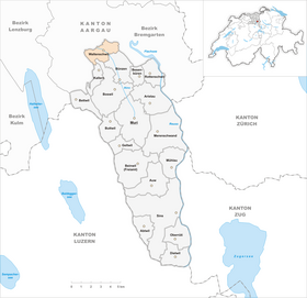
| Location of the municipality | |
  |
|
Waltenschwil ( Swiss German : ˌʋɑltiʃˈʋiːl ) is a municipality in the Swiss canton of Aargau . It belongs to the Muri district and is located in the central Bünztal .
geography
The village of Waltenschwil is located on the eastern side of the Bünztal at the foot of the Buneggli. This moraine hill towers up to 25 meters above the otherwise completely flat plain and merges towards the east into the Wagenrain , a range of hills that forms the natural border with the Reuss valley . After the end of the Würm Ice Age, the moraine hill dammed a shallow lake that silted up into a moor over the course of millennia ; the moor was drained at the beginning of the 20th century. The Bünz is canalised along its entire length and flows towards the northwest. About one and a half kilometers west of Waltenschwil is the significantly smaller street village Büelisacher ( 433 m above sea level ). There, on the western edge of the plain, the terrain rises steeply to the foothills of the Lindenberg .
The area of the municipality is 454 hectares , of which 90 hectares are forested and 105 hectares are built over. The highest point is at 554 m above sea level. M. on the slope near Büelisacher, the deepest at 422 m above sea level. M. at the Bünz. Neighboring communities are Wohlen in the north, Bremgarten in the northeast, Bünzen in the southeast, Boswil and Kallern in the south and Büttikon in the west.
history
Traces of the Celts' settlement date from prehistoric times . From approx. 70 to 330 AD there was a Roman manor near Büelisacher , the bathing wing of which was discovered and excavated in 1862. An Alemannic settlement emerged in the 7th or 8th century . The Lords of Waltenschwil, a ministerial family of the Habsburgs , built a residential tower at the foot of the Lindenberg around the year 1000 . They died out before the founding of the Old Confederation ; Nothing remains of the tower.
The village of Waltiswil was first mentioned in a document in 1085. The place name comes from the Old High German Waltineswilari and means "Hofsiedlung des Waltin". After the conquest of Aargau by the Confederates in 1415, the village in the Hermetschwil office was under the common rule of the free offices , whereas Büelisacher was in the Boswil office . Most of the property and the associated rights came into the possession of the Muri monastery in 1471 . In 1601 a fire destroyed over 30 houses.
In March 1798 the French took Switzerland and proclaimed the Helvetic Republic . Waltenschwil and Büelisacher were united against the will of their residents. The new community was in the Sarmenstorf district of the short-lived Canton of Baden . Together with forest houses she formed an agency; since 1803 it has belonged to the canton of Aargau. It took some time, however, for the residents of both villages to get along. Büelisacher carried out a tax strike in 1825.
On June 1, 1875 Waltenschwil received a station on the southern railway . However, this was closed again at the end of May 1997, as it was a bit out of the way and had too few frequencies. The agriculture lost early one its dominant position, as many residents in the industries of the neighboring municipality of Wohlen found work. The population stagnated at just under 700 until the mid-1960s. This was followed by striking growth, which was only briefly interrupted during the economic crisis of the 1970s. In 40 years the population more than tripled.
Attractions


For centuries Waltenschwil belonged to the parish of Boswil and was only raised to an independent parish in 1800. Initially, the Nikolauskapelle, built in 1516 and expanded in 1788/89, served as a parish church. The new parish church of St. Nicholas was built between 1837 and 1839 . The community had preferred a baroque building , but the cantonal building commission pushed through a hall church in the classical style. On the road to Büelisacher is the Mariahilfkapelle, a chapel built in 1860 in the neo-Gothic style.
coat of arms
The blazon of the municipal coat of arms reads: "A yellow crescent moon rising in blue, accompanied on the right by one, on the left by three five-pointed white stars placed on a pole." The coat of arms is derived from that of the Lords of Waltenschwil, which was first depicted in 1548; the chronicler of the time, however, simply adopted the Boswil coat of arms . On the community seal of 1811, the crescent was given a face, a three-mountain and four stars. Because the coat of arms was still too similar to that of Boswil, the face and the three-mountain were omitted in 1969.
population
The population developed as follows:
| year | 1850 | 1900 | 1930 | 1950 | 1960 | 1970 | 1980 | 1990 | 2000 | 2010 |
| Residents | 684 | 586 | 740 | 683 | 677 | 1,107 | 1,163 | 1,693 | 2,029 | 2,524 |
On December 31, 2019, 2959 people lived in Waltenschwil, the proportion of foreigners was 15.4%. In the 2015 census, 51.0% described themselves as Roman Catholic and 17.7% as Reformed ; 31.3% were non-denominational or of other faiths. In the 2000 census, 95.7% stated German as their main language, 0.9% Italian , 0.7% each Albanian and English .
Politics and law
The assembly of those entitled to vote, the municipal assembly , exercises legislative power. The executing authority is the five-member municipal council . He is elected by the people in the majority procedure, his term of office is four years. The parish council leads and represents the parish. To this end, it implements the resolutions of the municipal assembly and the tasks assigned to it by the canton. The District Court of Muri is primarily responsible for legal disputes . Waltenschwil belongs to the Friedensrichterkreis XIII (Muri).
economy
According to the corporate structure statistics (STATENT) collected in 2015, there are around 670 jobs in Waltenschwil, 9% of them in agriculture, 19% in industry and 72% in the service sector. The majority of the working population are commuters and work mainly in Wohlen and Villmergen . The Dubler Mohrenköpf company, founded in 1953, is the third generation to manufacture “ Mohrenköpf ”. Waltenschwil is also known for its go- kart track next to the railway line (even if it is named after Wohlen) and for the zoo.
traffic
The busy Hauptstrasse 25 ( Lenzburg - Zug ) runs between Waltenschwil and Büelisacher . The Postbus line runs through the village from Wohlen station to Muri , in Rottenschwil there is a connection to Zurich-Wiedikon .
education
In Waltenschwil there is a kindergarten as well as a primary school . All upper levels of the compulsory elementary school ( Realschule , Secondary School , District School ) are in neighboring Wohlen . The closest grammar school is the Cantonal School in Wohlen .
literature
- Raoul Richner: Waltenschwil. In: Historical Lexicon of Switzerland .
- Georg Germann : The art monuments of the canton Aargau . Ed .: Society for Swiss Art History . Volume V: The Muri District. Birkhäuser Verlag, Basel 1967, DNB 457321970 .
Web links
Individual evidence
- ↑ Cantonal population statistics 2019. Department of Finance and Resources, Statistics Aargau, March 30, 2020, accessed on April 2, 2019 .
- ↑ Cantonal population statistics 2019. Department of Finance and Resources, Statistics Aargau, March 30, 2020, accessed on April 2, 2019 .
- ↑ a b Beat Zehnder: The community names of the canton of Aargau . In: Historical Society of the Canton of Aargau (Ed.): Argovia . tape 100 . Verlag Sauerländer, Aarau 1991, ISBN 3-7941-3122-3 , p. 456-457 .
- ^ National map of Switzerland, sheet 1090, Swisstopo.
- ↑ Standard area statistics - municipalities according to 4 main areas. Federal Statistical Office , November 26, 2018, accessed on May 10, 2019 .
- ^ Martin Hartmann, Hans Weber: The Romans in Aargau . Verlag Sauerländer, Aarau 1985, ISBN 3-7941-2539-8 , p. 206 .
- ^ Germann: The art monuments of the Canton of Aargau, Volume V: District of Muri.
- ^ Joseph Galliker, Marcel Giger: Municipal coat of arms of the Canton of Aargau . Lehrmittelverlag des Kantons Aargau, book 2004, ISBN 3-906738-07-8 , p. 310 .
- ↑ Population development in the municipalities of the Canton of Aargau since 1850. (Excel) In: Eidg. Volkszählung 2000. Statistics Aargau, 2001, archived from the original on October 8, 2018 ; accessed on May 8, 2019 .
- ↑ Resident population by religious affiliation, 2015. (Excel) In: Population and Households, Community Tables 2015. Statistics Aargau, accessed on May 10, 2019 .
- ↑ Swiss Federal Census 2000: Economic resident population by main language as well as by districts and municipalities. (Excel) Statistics Aargau, archived from the original on August 10, 2018 ; accessed on May 8, 2019 .
- ↑ circles of justice of the peace. Canton of Aargau, accessed on June 20, 2019 .
- ↑ Statistics of the corporate structure (STATENT). (Excel, 157 kB) Statistics Aargau, 2016, accessed on May 8, 2019 .
Abtwil | Aristau | Auw | Beinwil (Freiamt) | Besenbüren | Bettwil | Boswil | Coins | Buttwil | Dietwil | Geltwil | Kallern | Merenschwand | Mühlau | Muri | Oberrüti | Rottenschwil | Sins | Waltenschwil
Former municipality: Benzenschwil | Forest houses | Will
Canton of Aargau | Districts of the Canton of Aargau | Municipalities in the Canton of Aargau