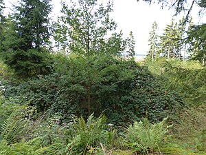
Burgstall Blankeneck
| Burgstall Blankeneck | ||
|---|---|---|
|
Central hill with moat |
||
| Alternative name (s): | Old moat | |
| Creation time : | Medieval | |
| Castle type : | Höhenburg, spur location | |
| Conservation status: | Worn, horseshoe-shaped moat and another moat preserved | |
| Place: | Issigau - Kemlas - "Blankeneck" | |
| Geographical location | 50 ° 23 '48.4 " N , 11 ° 43' 28.5" E | |
| Height: | 545 m above sea level NN | |
|
|
||
The Burgstall Blankeneck , also called Alter Wallgraben , is an abandoned medieval castle complex near Kemlas on the Bavarian-Thuringian border on a mountain spur jutting from the Blankneck mountain into the Saale valley .
Geographical location
The Burgstall is located in the Upper Franconian community of Issigau in the Kemlas district . It is located around 2,300 meters north of the Evangelical Lutheran Parish Church of St. Simon and Jude . The former Spornburg lies at 545 m above sea level. NN on the northern part of a ridge about 120 meters above the Saale valley, which extends from its highest point at 579 m above sea level. NN height extends from south to north-northeast. The mountain called Blankeneck drops very steeply to the north and northeast to the Saale, and to the west to a side valley of the Kemlasbach. On the south and south-east side, the difference in altitude of the terrain is less great and steeply sloping. The place of the former castle in the northeast is set apart from the rest of the mountain by a saddle a few meters lower .
description
The possibly heaped up oval core area of the castle extended from north to south and measures around 35 by 24 meters. Around the surface of this core mound there is a wall, which today is, however, severely disturbed, and in places it is still up to one meter high and about two meters wide. On the west, south and east sides of the core hill is surrounded by a horseshoe-shaped rampart, on its inside a ditch was sunk. This wall is around 1.2 meters high from the outside and drops three meters down to the ditch, which is still ten meters wide. To the north of the castle hill, an additional section wall with a shallow inner ditch was created between it and the steep drop to the valley, its ends bend slightly to the south, and ends in the horseshoe-shaped main ditch. This wall is still one meter high and two meters wide. Today there are no more foundations or other building remains. Today the site is protected as a ground monument number D-4-5636-0005: Medieval castle stables and prehistoric hilltop settlement .
history
No historical or archaeological information is known about this castle , and there are currently no findings that could date the complex. It is roughly dated to the medieval period. Traces and slag finds halfway up the mountain indicate mining activity; the Saale was probably used to transport materials or goods. There is a theory that there was actually a medieval port here. In the Bavarian premiere , a corresponding canal can be seen parallel to the river. As a border fortification, the castle may have acted as a counterweight to Blankenberg Castle .
literature
- Klaus Schwarz: The prehistoric and early historical monuments in Upper Franconia . (Material booklets on Bavarian prehistory, series B, volume 5). Verlag Michael Lassleben, Kallmünz 1955, p. 129.
Web links
Individual evidence
- ^ Location of the Burgstall in the Bavaria Atlas
- ^ Source description: Klaus Schwarz: The prehistoric and early historical terrain monuments of Upper Franconia , p. 129
- ↑ List of monuments for Issigau (PDF) at the Bavarian State Office for Monument Preservation (PDF; 126 kB)
- ↑ Klaus Schwarz: The prehistoric and early historical land monuments of Upper Franconia , p. 129
- ^ Bavarian State Office for Monument Preservation
- ↑ View of the first recording with the BayernAtlas


