
Magpie basin

The Elsterbecken is an artificially created river basin in Leipzig .
location and size
The 2,650 m long Elster basin extends west of Leipzig's old town from the Palmengarten weir (also: Upper Elster Weir) to the Lower Elster Weir in the floodplain forest . It is 155 m wide, the water level is between 104.4 m above sea level on the Palmengarten weir and 104.3 m above sea level on the Lower Elster weir.
At its southern end, the basin is fed from the water of the Weißer Elster and Elsterflutbett via the palm garden weir . At the northern end of the basin there are three drains: the Nahle begins on the left at the Nahle weir , the Neue Elster branches off to the right via the Untere Elster weir , while the normally largest amount of water flows off in the middle via the Luppewehr as Neue Luppe . Together with the White Elster, the Elster basin is a first-order stream.
history
Historical terrain situation

Until the construction of the Elster Basin, wide meadows stretched across the site, which were also called the Frankfurter Wiesen , based on the Frankfurter Tor to be passed on the arterial road to the west . The meadow area was interspersed with numerous small ponds and pools and overgrown with groups of trees and bushes. However, there was no continuous watercourse on the site. At that time, the river course of the White Elster, known in this section of the Alte Elster , was still on the immediate western outer border of today's Waldstrasse district and thus a few hundred meters east of the later Elster basin. Alte Elster and the Kuhburger Wasser , located further to the west, often transformed the entire area of the Frankfurter Wiesen into a closed water surface during floods. The site was therefore not built on. The only exception was the Ratsziegelei, the building of which was erected north of today's Jahnallee and which maintained several clay pits there. In addition, the meadow area served as pasture for cattle. From the 1890s onwards, part of the site was increasingly used for sports and leisure facilities (see also: Sportforum Leipzig ). In addition to the facilities of a gymnastics and sports club, the palm garden was designed and the area of the small fair opened up.
Planning and construction of the Elster Basin from 1850 to 1925
Plans had been in place since the 1850s to contain the floods that occurred year after year. With regard to the concrete design of the flood protection in the area of the Frankfurt meadows, however, there was a dispute for decades. In some cases, based on the Hamburg Alster Lake, there was support for the construction of several artificial lakes, in some cases a long water basin was advocated. Only after the flood of the century in February 1909 did the Leipzig city council reach an agreement in 1911 on the redesign of the Frankfurt Meadows and the construction of the Elster basin, which began in June 1913.
In addition to the excavation of a water basin, the construction of representative communal buildings and buildings for the Leipzig trade fair , which were to become the new city center, were planned. The costs of the project should be refinanced through the sale of the building land gained by the regulatory measures.
Due to the war , the Elster basin was not completed as originally planned in 1918, but only in 1925. Alte Elster and Kuhburger water were then backfilled. The Elster basin has been spanned by two bridges since then: the Zeppelin Bridge (built 1913–1915 by Hugo Licht ) in the south along the Jahnallee and the Landauerbrücke (until 1945: Hindenburgbrücke ) in the north along the Leutzscher Allee.
In 1925, sludge was extracted from the Elster basin, which was used to fill up the surrounding area and to create the festival meadow . After the Luppewehr was damaged in World War II , the Elster basin increasingly silted up. After the end of the war, this mud was used to build the nearby central stadium .
Current situation and plans
Large parts of the Elster basin have only a shallow water depth. The tributaries of the Weißer Elster and Pleiße carry a large proportion of sediments as far as Leipzig at a relatively high flow velocity, which settle in the Elster basin with its significantly lower flow velocity. The water depth of over 1.50 meters planned for the construction of the basin has therefore been significantly reduced in large parts of the basin. After major floods, there is occasional silting up and island formation in the Elster basin, most recently very markedly after the floods in August 2002. In the following years, lush vegetation grew on these islands. In 2005/2006 the basin was dredged again to such an extent that it is again completely covered with water between the Elster weir and the Zeppelin bridge, and further downstream to a large extent (with the exception of the bank areas). It was not until the flood of 2013 that 80,000 tons of sediment were deposited again, and the dredging took until the beginning of 2019.
The Elster basin can hardly fulfill its original function of ensuring a large flow rate through Leipzig in the event of a flood. Therefore it is planned to re-create the filled old Elster with a slightly different course as the main bed of the Elster and to open the partially piped Elstermühlgraben again . At low and medium water levels, the incoming sediment-rich water should be directed past the Elster basin in this way. The higher flow velocity is intended to prevent or reduce the settling of the sediments in this way.
The Elster basin should then become a standing body of water. For this purpose, the Luppewehr was modified so that it can close the pool to the New Luppe . In the event of a flood, the Elster basin would be flooded, in this case the Luppewehr should be tilted down so that the flood can drain away quickly, combined with the hope that part of the sediments deposited in the Elster basin will also be transported away with the flood.
There is criticism of the plans from the BUND. The Alte Elster is not needed for the flood discharge. The sole completion of the Elstermühlgraben and the transformation of the Elster basin into a river landscape would have a positive effect on biodiversity and would also be more economical. The city of Leipzig would have to bear the costs of maintaining a standing Elster basin.
Recreation
The Elsterbecken is part of the corridor that connects the southern and northern parts of the Leipzig floodplain forest . Both banks are frequently visited by Leipzigers and their guests. The Richard-Wagner-Hain extends south of the Zeppelin Bridge on both sides .
On the right bank there is a well-used footpath and bike path, which is paved in the part north of the Zeppelin Bridge; to the south there is a snack bar on this bank in the summer and since 2013 a small pagoda as part of an art project.

Elsterbecken bird sanctuary
The entire Elster basin is a water bird sanctuary . As a wintering place for it has little grebe , red-throated divers , long-tailed duck , Sabine's Gull , Black Scoter and Singschwan national importance.
Beaver in the magpie basin
Since 2015, more feeding traces have been found on the trees, especially on the western side of the Elster Basin between the Zeppelin Bridge and Landau Bridge, and beavers have occasionally been seen. It is believed that at least 2 families of beavers have settled in the area. In the course of time, the beavers have already felled a large part of the trees near the banks with a trunk diameter of up to 60 cm in the area.
photos
Art object pagoda with ohana balls, in the background the palm garden weir

Elster basin with Zeppelin bridge, view from the Palmengarten weir

View from the Zeppelin Bridge over the Elster Basin. Today's central stadium is on the right edge of the picture

Landauerbrücke over the Elster basin, in the background today's central stadium

Branch of the Nahle (left) from the Elster basin, in the background the Luppewehr and the railway bridge over the Neue Luppe

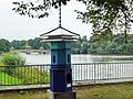
Weir between the Elsterbecken and the Neue Luppe


See also
literature
- Horst Riedel: Stadtlexikon Leipzig from A to Z. Pro Leipzig, Leipzig 2005, ISBN 3-936508-03-8 , keywords "Frankfurter Wiesen" and "Elsterbecken".
Web links
Individual evidence
- ↑ Cf. No. 101b of Annex 1 to Section 24 Paragraph 1 of the Saxon Water Act of October 18, 2004 ( page no longer available , search in web archives ) Info: The link was automatically marked as defective. Please check the link according to the instructions and then remove this notice.
- ^ Artmann / Bobbe, flood protection in Leipzig. In: Leipziger Blätter 47 (2005), pp. 86–88
- ↑ Archived copy ( Memento of the original from January 12, 2016 in the Internet Archive ) Info: The archive link was inserted automatically and has not yet been checked. Please check the original and archive link according to the instructions and then remove this notice.
- ↑ Leipzig Elster Basin: sediments are cleared. State dam administration of the Free State of Saxony, October 25, 2018, accessed on February 15, 2019 .
- ↑ Horlacher / Bobbe / Möricke, Expert Opinion Stabilization of the Sediment Budget in the Leipzig Water Exchange from April 19, 2002
- ↑ Leipzig zoning plan, Leipzig Mitte space pass, p. 4–6 ( page no longer available , search in web archives ) Info: The link was automatically marked as defective. Please check the link according to the instructions and then remove this notice. (PDF; 535 kB)
- ↑ Integrated water concept Leipzig 2004 in accordance with the resolution of the Leipzig City Council of February 18, 2004
- ↑ Study on the design and control of the Leipzig water junction with the disclosure of the Elstermühlgraben in the city of Leipzig, taking into account the requirements of the EU Water Framework Directive and the sediment balance of flowing waters, p. 8f. ( Page no longer available , search in web archives ) Info: The link was automatically marked as defective. Please check the link according to the instructions and then remove this notice.
- ↑ Ralf Julke: BUND Leipzig advertises in the city council for the creation of a real river in the Elster basin. Leipziger Internet Zeitung, February 5, 2019, accessed on February 15, 2019 .
- ^ Article in the Leipziger Internet-Zeitung from April 16, 2013
- ↑ Newcomer is honored. Accessed April 7, 2020 (German).
- ↑ Beavers are living in the middle of Leipzig again - and are leaving their mark. Retrieved April 7, 2020 .
Coordinates: 51 ° 20 ′ 48 ″ N , 12 ° 20 ′ 35 ″ E