
Fritztal Mountains
| Fritztal Mountains | |
|---|---|
| Highest peak | Hochgründeck ( 1827 m above sea level ) |
| location | St. Johann im Pongau district , Salzburg / Liezen district , Styria |
| part of | Salzburg Slate Alps |
| Classification according to | Trimmel 1430 |
| Coordinates | 47 ° 24 ' N , 13 ° 24' E |
| Type | Inner alpine low mountain range (forested) |
| rock | Grauwackenzone / Werfener layers ( Slate Alps ) |
| Age of the rock | Ordovician - Lower Triassic (approx. 450–250 mill. A) |
The Fritztal Mountains are the eastern part of the Salzburg Slate Alps . They are located in the Pongau (St. Johann district) of the state of Salzburg , the eastern part in the Styrian Ennstal ( Liezen district ) of the state of Styria .
For naming
The name of the mountain group is mainly used in Austrian hydrography and geology, less in mountain literature, as it hardly offers any alpine goals. The name refers to the Fritztal, which runs across the group . The Gründecker Berge is also outdated , after the highest peak.
Location and landscape

The Fritztal Mountains extend from the Salzach Valley , the Pongau Basin near Bischofshofen and St. Johann ( Salzachpongau ) to the upper reaches of the Enns ( Ennspongau and Schladming ). They are located between the Niedere Tauern in the south and the Tennengebirge in the north to the southern foot of the Dachstein massif in the east. There the group runs to a point between the northern limestone Alps and the central Alps .
Like the whole of the Slate Alps, they are of low mountain range , hilly with extensive ridges, with heights below 2000 m, but in contrast to the grass mountains of the western Pongau, Pinzgau and Tyrolean Oberland, they are forested right up to the summit . Otherwise they show the typical characteristics of the northern intermediate Alps in terms of climate and vegetation .
Boundary and neighboring mountain groups
According to the mountain group structure according to Trimmel , the group bears the number 1430 (in 1400 North Tyrolean-Salzburg Slate Alps ) and delimits as follows
- in the west St. Johann im Pongau - Salzach to Bischofshofen to the Dientener Mountains (1420, namely Schneeberg - Hochglockner Group 1422)
- in the northwest of Fritztal upwards - St. Martinbach near Hüttau upwards via St. Martin am Tennengebirge - Lungötz in Lammertal to Tennengebirge (1511)
- in the northeast Lungötz - Neubach upwards - Arzbergalm - Marcheggsattel - Hofalm - Warm Mandling downwards via Filzmoos to the confluence of the Kalte Mandling - this and the Schildlehenbach upwards - Ramsau - Ramsaubach downwards to Weißenbach (municipality of Haus) in the Ennstal to the Dachstein (1540), namely Gosaukamm 1541 to Hofalm, Hoher Dachstein and southern templates 1543 to Ramsau, then Miesberge
- in the south-east of Enns from Weißenbach up via Schladming to Gleiming (municipality of Pichl-Preunegg , confluence of Forstaubach ) to the Schladminger Tauern (2620), to Schladming to the Hochwildstelle group ( Sölktal / Untertal 2625), then Kalkspitzen ( Obertal / Forstau 2622)
- in the south-west of Enns via Mandlingpass (Styrian-Salzburg border) - Radstadt - Altenmarkt - Litzlingbach near Reitdorf (municipality of Flachau ) - Wagrainer Höhe - Schwaighofbach - Wagrain - Wagrainer Bach - St. Johann to the Radstädter Tauern (2610), to Radstadt Seekarspitze group ( Forstau / Taurachtal 2621), to Reitdorf Steinfeldspitze group ( Taurach- / Ennsquelltal 2615), to Wagrain Mosermandl group ( Ennsquell- / Kleinarltal 2614), from Wagrain Draugsteingruppe ( Kleinarl- / Grossarltal 2613)
Outline and summit
The group is divided into four subgroups, four mountain-like massifs each , separated by less prominent valley passes :
- Hochgründeck ( 1827 m above sea level , Trimmel 1431), Bergstock in the west, between Sankt Johann, Wagrain and Flachau, the highest peak of the group, one of the highest wooded mountains in Europe, with some ridge peaks
- Rossbrand ( 1770 m above sea level , Trimmel 1432), central, west − east ridge between Altenmarkt / Eben, Radstadt and Filzmoos, panoramic mountain (cable car from Filzmoos) with a striking transmitter
- Gerzkopf ( 1728 m above sea level , Trimmel 1433), Stock in the north, between Filzmoos and Lungötz in the Lammertal, already the foot of the Dachstein massif on the Bischofsmütze , wooded, gently-scaled limestone massif up to the summit, but the landscape is similar to the other mountains in the group, Natura 2000 and nature reserve ( Gerzkopf European Protected Area)
- Ramsauleiten ( Rittisberg 1565 m above sea level , Trimmel 1434), high plateau-like, small, partially populated train in the east between Schladming and Ramsau
geology
The main part of the Slate Alps are geologically included in the Grauwackenzone , in the Fritztaler Mountains the core area is exclusively the Schattberg Formation / Löhnersbach Formation / Jausern Formation ( Ordovician - Devonian ). The entire Gerzkopf, however, is made up of Werfener strata ( Lower Triassic ), so its basement is already counted as part of the limestone Alps, clods of this system can be found on the Hochgründeck. There are also the typical west-east trending veins of the silicate rocks of the Silurian and Upper Devonian , which build the Goldegger Plateau in the west on the other side of the Salzach valley. In between, and also at Altenmarkter Feuersang that greywacke reaches south from the orographic limits to the south close to the Salzach Ennsstörung the complex Schladming-Seckau - and Radstädter ceiling systems (eastern edge of the Tauern window ) to.
The entire Ramsauleiten lies south of the fault line that cuts the southern foot of the Dachsteinstock and is built up on the surface from sediments of the Würm , in the underground from the Ramsaudolomit , which stretches eastwards to the Sonnwendkogel . Halserberg ( 1398 m above sea level ) and Saumerberg ( 1229 m above sea level ) on the Mandling Pass are open dolomite. In this respect, this part can also be seen as a template for the Dachstein. The Eibenberg (Eibenbergkopf 1405 m above sea level ) south to Forstau, which also belongs to the Ramsau Dolomite range, could be geographically included in this group, orographically it is significantly separated by the Enns, and is usually assigned to the Schladminger Tauern.
tourism
The Fritztaler Mountains are extensively developed as an easy hiking area, the west belongs to the Salzburger Sportwelt tourist region , the east to Schladming-Dachstein , the north to the Lammertal . The former two are also members of the Ski amadé ski association , and there are also some smaller ski areas here ( Monte Populo in Eben am Roßbrand, Filzmoos on Roßbrand and Gerzkopf, Hahnbaum lifts St. Johann am Hochgründeckfuß). The mountain huts are all private and mostly accessible by car.
Two long-distance hiking trails lead through the group, the Arnoweg (stages 50 Radstadt - Roßbrand - Filzmoos, 51 Filzmoos - Hofpürglhütte - to Annaberg), here also the Salzburger Almenweg (stages 27 & 28), and the St. Rupert Pilgerweg (stages Hüttau - Hochgründeck - Bischofshofen).
literature
Cards:
- Austrian map (ÖK) 1: 50,000 sheets 125 Bischofshofen , 126 Radstadt and geological map of the Republic of Austria (GÖK) Area maps Dachstein region 1: 50,000 and the area around Wagrain 1: 25,000; GÖK 1: 200,000 Salzburg (publ. Each with an explanation, GÖK 1: 50,000 125/126 not yet published)
- Freytag - & - Berndt hiking map 201 Schladminger Tauern · Radstadt · Dachstein 1: 50,000 (Fritztaler Mountains complete Bischofshofen to Gröbming)
Individual evidence
-
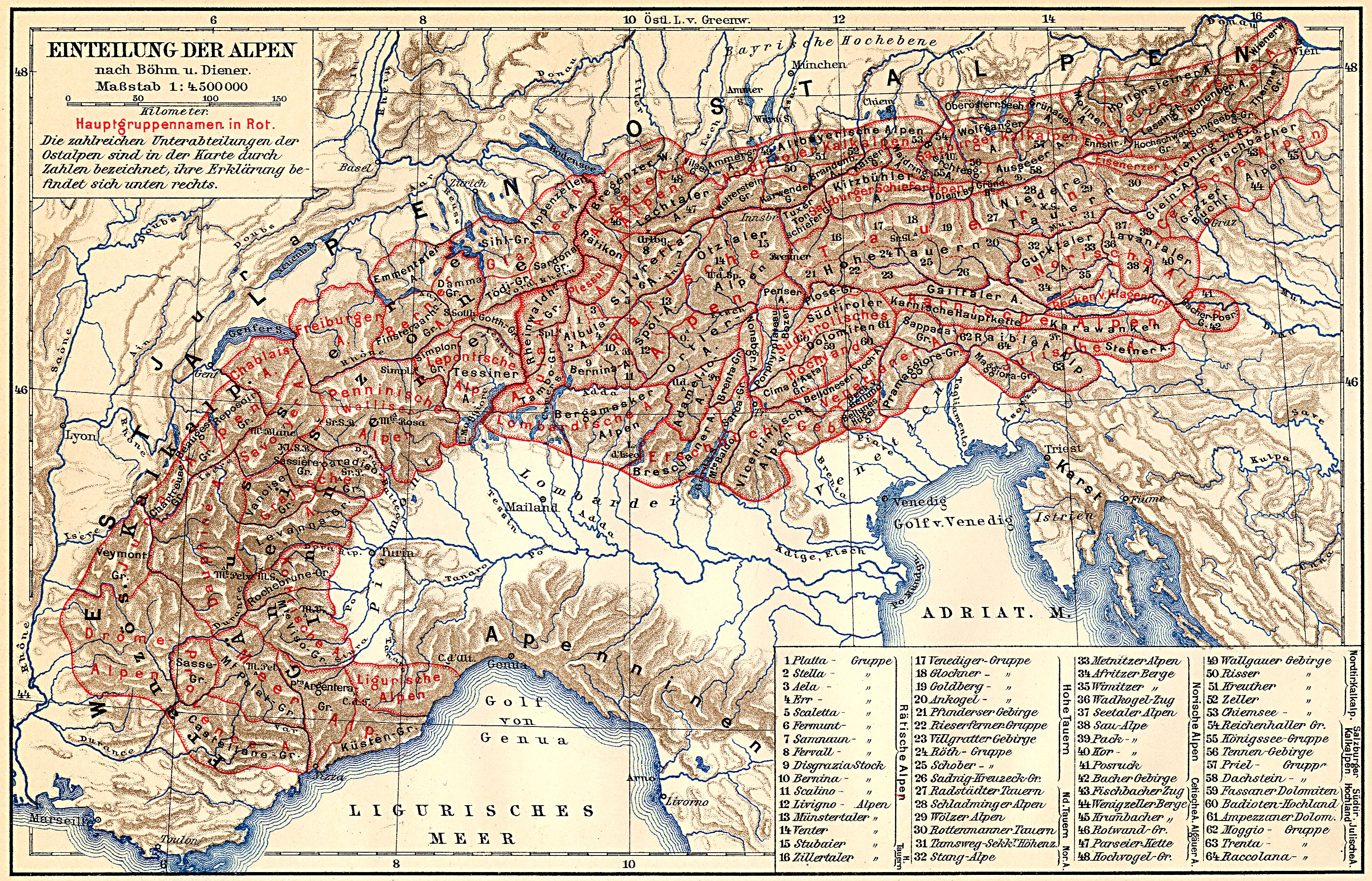
↑ Alps . In: Meyers Großes Konversations-Lexikon . 6th edition. tape 1 . Leipzig 1905, [2]. Geographical division of the Alps. ([Eastern Alps.] 11) The Salzburg Limestone Alps. , S. 361–369 [365] ( zeno.org - classification according to Böhm and Diener, map 1: 4,500,000 ). Salzburg . ibid. volume 17 , 1909, [1]., Pp. 499-500 [499] ( zeno.org ).
According to Böhm 1887 August von Böhm : Classification of the Eastern Alps . In: A. Penck (Ed.): Geographische Abhandlungen . tape
1 . Eduard Hölzel, Vienna 1887 (1 multicolored map 1: 1,000,000). Revised Carl Diener : The Mountain Construction of the Western Alps . Tempsky / Freytag, Prague 1891. - ^ W. Kilian, F. Müller, F. Starlinger: The forestry growth areas of Austria. A natural area structure according to forest ecological aspects. In: Forstliche Bundesversuchsanstalt FBVA (Ed.): Reports of the Forstliche Bundesversuchsanstalt Wien . No. 82 , 1994, ISSN 0374-9037 , p. 1-60 . Online: Franz Starlinger: Growth Area 2.2: Northern Intermediate Alps - Eastern Part . (No longer available online.) Federal Office for Forests , Federal Research and Training Center for Forests, Natural Hazards and Landscape , March 15, 2005, archived from the original on October 25, 2012 ; accessed in 2010 .
- ^ A b Hubert Trimmel : Mountain group structure for the Austrian cave directory . Ed .: Association of Austrian Speleologists. Vienna 1962.
- ↑ at Trimmel part of the eastern Salzkammergut Alps 1510, otherwise in general Salzburger Kalkhochalpen
- ↑ in Trimmel part of Am Stein and Miesberge 1544
- ↑ Alexander Tollmann : Tectonic map of the Northern Limestone Alps . Part 2: The middle section . In: Geological Society in Vienna (ed.): Releases the Geol.Ges.iW . 61st volume. Vienna 1968 ( PDF , uibk.ac.at). PDF ( Memento of the original from March 6, 2014 in the Internet Archive ) Info: The archive link was inserted automatically and has not yet been checked. Please check the original and archive link according to the instructions and then remove this notice.
- ↑ Clemens Hutter : Arnoweg. The Salzburg circular hiking trail . Bergverlag Rother ( Section 6 - Kalkberge Ost , arnoweg.com).
- ↑ Salzburger Almenweg: Stage 27: Radstadt - Filzmoos and next stage
- ↑ St. Rupert pilgrimage route . pilgerwege.at. St. Rupert Pilgrimage Brochure ( Memento of the original from March 4, 2016 in the Internet Archive ) Info: The archive link was inserted automatically and has not yet been checked. Please check the original and archive link according to the instructions and then remove this notice. , Archdiocese of Salzburg (PDF; 969 kB).