Guatemala Department
| Department of Guatemala | |
|---|---|
| Location of Departamento de Guatemala in Guatemala | |
| Data | |
| Capital | Guatemala City |
| population | 3,400,300 (calculation 2016) |
| surface | 2,253 km² |
| Population density | 1,599 inhabitants / km² |
| structure | 17th |
| Big cities | 3 |
| Highest elevation | 2,552 ( Pacaya ) |
| ISO 3166-2 | GT-GU |
| Coat of arms of the department | |
| Guatemala City with the volcanoes Agua, Fuego and Acatenango | |
The Department of Guatemala is one of 22 departments in the Republic of Guatemala . It is located in the southern highlands and extends over 2,253 km². The capital of the department and the entire republic is Guatemala City . The department officially has around 3.4 million inhabitants and, due to its economic and demographic weight, also forms the Región Metropolitana , one of the eight regions of the country established for the purposes of spatial and economic planning .
The department of Guatemala borders in the north with Baja Verapaz , in the northeast with the department El Progreso , in the east with Jalapa , in the southeast with Santa Rosa , in the southwest with Escuintla and in the west with Sacatepéquez and Chimaltenango .
National nature
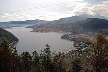
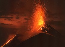
The department is located at an average altitude of around 1,500 meters in the cordillera of the Central American Sierra Madre . In the middle of the department, in the high valley of Valle de La Ermita (also Valle de La Virgen or Valle de las Vacas ) bordered by gorges and mountains, Guatemala City is located. The surrounding cities and communities are also partly on plateaus, which are interrupted by deep valleys. The almost 4,000 m high volcanoes Agua , Fuego and Acatenango , which significantly shape the landscape of the department, are located in neighboring Sacatepéquez. In the southwest, on the border with Escuintla, lies the Pacaya , one of the most active volcanoes in America , and at its foot Lake Amatitlán . The south slopes slightly towards the Pacific coast and is drained by the Rio Maria Linda and its tributaries. In the north, the rivers Pixcayá, Las Vacas, Las Cañas and their tributaries flow into the Río Motagua , which in turn forms the border with Baja Verapaz and finally flows into the Caribbean. The climate on the plateaus is generally temperate with daytime temperatures between 18 and 28 ° C, it gets colder on the mountain ranges and warmer in the lower areas in the north and south of the department. The rainy season usually lasts from May to October, but exceptions to this rule are becoming more common. Large parts of the mountain forest had to give way to new settlement and industrial areas, roads and agriculture.
population
In the 19th century the department had about 100,000 inhabitants. In addition to Spanish-speaking Ladinos (mestizos) , it was mainly populated by Cakchiquel and Pocomam . In 1950 there were 250,000 people in Guatemala City. The severe earthquake of 1976 destroyed many other cities and villages in Guatemala in addition to the capital. Numerous homeless people from other parts of the country soon came to the department and settled in the previously rural municipalities around Guatemala City. As a result of this catastrophe and in the wake of the general population explosion, the Guatemala City agglomeration developed . According to official information, it has around 2.5 million inhabitants today and consists of Guatemala City, the largest city in Central America with over one million inhabitants , the cities Mixco and Villa Nueva as well as some other surrounding places such as Chinautla and Santa Catarina Pinula . Nowhere else in the country are the contrasts between rich and poor as strong as in the metropolitan area of the capital: While individual districts and settlements hardly differ from larger cities in North America and Europe, numerous people live in unstable dwellings on the slopes of the gorges, the Barrancos , which run through the area and are often affected by landslides in the rainy season. The agglomeration is increasingly eating its way into the surrounding area, as a small, up-and-coming middle class can afford to buy or rent a row house in the closed settlements that the construction industry is systematically building on the grounds of former fincas . At the same time, poorer families are also settling in desolate satellite towns in the surrounding area because rents in the inner city are too expensive. In addition to the increasing deforestation of the remaining forest, this also leads to a further deterioration in the traffic situation during rush hour.
There is a great deal of speculation about population figures, often based on incorrect definitions, in particular on the erroneous equation of Guatemala City with the agglomeration. The fact is that countless people live in the metropolitan area who are not officially recorded or registered in other departments. The INE national statistical institute usually takes this into account in its projections . On working days, around 5 million people can be in the metropolitan area, including day and weekend commuters . The department today has at least 3 million inhabitants in a total of 17 municipalities ( large municipalities or districts ):
The Municipios are independent regional authorities with elected mayors and representatives of the people . Urban Municipios are usually subdivided into Zonas and Colonias (districts and settlements), rural Municipios in Aldeas and Pueblos (rural communities) and Caseríos, Parajes, Fincas, Rancherías ( hamlets and farms ). As a state administrative district , the department is headed by a governor sent by the central government .
economy
The Department of Guatemala is the most dynamic economic region in Central America. Authorities , associations , guilds , media companies , banks , insurance companies , transport companies , branches of foreign corporations and various other service providers are concentrated in the capital . Since the state only offers basic services in the field of education, a flourishing education industry has developed with innumerable private schools and numerous private universities of different quality. In the area, in Mixco and especially in Villa Nueva, there is a wide range of industries , including food , textile and construction industries . San Juan Sacatepéquez is known for its furniture construction . The pharmaceutical and automotive industries are of secondary importance . Often production takes place in maquilas , which usually bring foreign entrepreneurs good profits and jobs for the local population. In the absence of functioning unions , the workers in the maquilas are being exploited unrestrainedly. In the rest of the department, agriculture and livestock still play a role. Are grown, among other beans , corn , coffee , sugarcane , ornamental plants and various fruits and vegetables. Tourism is limited to through traffic and to a few attractions in and around Guatemala City, including the Pacaya and Lake Amatitlán.
traffic
Since Guatemala City is the country's transport hub , the department is also relatively well developed. Here the Interamericana (CA 1) running through the highlands meets the Interoceanica (CA 9), which connects Puerto San José on the Pacific with Puerto Barrios on the Caribbean coast . All other parts of the country can ultimately be reached via these two highways, which have been converted into motorways in the department . A ring road around the capital ( Anillo Metropolitano , new name: Anillo Departamental or Regional ) is to be built from 2011. The first section, which runs relatively far to the north (Chuarrancho), will connect CA 1 with CA 9 between Santo Domingo Xenacoj ( Sacatepéquez ) and Sanarate ( Departamento El Progreso ). In Guatemala City there is a multi-lane ring road ( Anillo Periferico ), but only in name, as it only has a continuous route in the north, west and south and at the same time takes up almost all heavy traffic from the Pacific to the Caribbean and vice versa. The railway line from Puerto San José via Guatemala City to Puerto Barrios, which could at least partially transfer this heavy traffic from the road to the rail, was shut down several years ago. A reactivation with the help of foreign capital has failed several times due to conflicts of interest. In contrast to Mexico City or Caracas , Guatemala City also has no subway and no S-Bahn or light rail . All public transport in the agglomeration, apart from taxis , is ensured by a dense network of bus routes. Attacks on long-distance buses and especially city buses as well as the generally critical security situation have in turn increased individual traffic, with corresponding overloading of the most important traffic axes at peak times. In Guatemala City, individual lanes have been separated by structural measures in recent years and provided with numerous bus stops similar to S-Bahn stations. In contrast to the other buses, the green buses that run there only stop at the official, police-secured stations. This very successful and comparatively inexpensive busway system is officially referred to as transmetro and unofficially also as metro de superficie ("surface metro "). The other city bus routes (red buses) have been gradually replaced by the new local public transport system transurbano (white-blue buses) since 2010 .
Guatemala City International Airport has been considered Central America's most modern airport since its renovation.
history
The Maya moved the great trade center of Kaminaljuyú to the great trade center of Kaminaljuyú , which is protected by deep gorges and has a pleasant climate, at the crossroads of important trade routes between the Pacific, the highlands and the Caribbean to build. The city was once five square kilometers and at times had more than 50,000 inhabitants. In the 4th century AD, Kaminaljuyú, at that time the largest city in the Guatemalan highlands, allied itself with Tikal ( Peten ) and Teotihuacán ( Mexico ) and thereby achieved considerable political influence in addition to its economic importance. The decline of the allies in the 7th and 8th centuries contributed to the decline and abandonment of Kaminaljuyús. The area was subsequently populated by only a few Cakchiquel and Pocomam for several centuries . After Pedro de Alvarado had destroyed their fortresses Iximché and Chinautla Viejo ("Mixco Viejo") in 1524 and 1525 and subjugated the population, he set up the capital of his colonial area first in what is now Ciudad Vieja , and then from 1543 in Antigua Guatemala , whose administrative districts include the The area of today's department belonged for the most part during the colonial period. The severe earthquake of July 26, 1773 destroyed Antigua and led to the relocation of the capital of the General Capitanate of Guatemala . After lengthy disputes, the area around the village of La Ermita, near the ruins of Kaminaljuyú, where Guatemala City was founded in 1776, was selected. After independence from Spain , the government divided the national territory into seven departments on November 4, 1825, including the department of Guatemala. In 1935 it was expanded to include the area of the dissolved Amatitlán Department in the south.
Web links
Coordinates: 14 ° 38 ′ N , 90 ° 31 ′ W


