
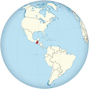
Guatemala
| Republic of Guatemala | |||||
| Republic of Guatemala | |||||
|
|||||
|
Motto : El país de la eterna primavera (Spanish for The Land of Eternal Spring ) |
|||||
| Official language | Spanish | ||||
| capital city | Guatemala City | ||||
| State and form of government | presidential republic | ||||
| Head of state , also head of government | President Alejandro Giammattei | ||||
| area | 109,021 km² | ||||
| population | 16.9 million ( 67th ) (2020; estimate) | ||||
| Population density | 153 inhabitants per km² | ||||
| Population development | + 1.5% (estimate for 2020) | ||||
gross domestic product
|
2019 | ||||
| Human Development Index | 0.663 ( 127th ) (2019) | ||||
| currency | Quetzal (GTQ) | ||||
| independence | September 15, 1821 (from Spain ) |
||||
| National anthem | Guatemala Feliz | ||||
| National holiday | September 15th (Independence Day) | ||||
| Time zone | UTC − 6 | ||||
| License Plate | GCA | ||||
| ISO 3166 | GT , GTM, 320 | ||||
| Internet TLD | .gt | ||||
| Phone code | +502 | ||||
 .svg) |
|||||


Guatemala ([ gu̯ateˈmaːla ], officially the Republic of Guatemala , Spanish República de Guatemala ) is the most populous state in Central America in the south of the Yucatán Peninsula . Guatemala is bordered by Honduras to the southeast, El Salvador to the south, Mexico to the north and Belize to the east . The country is bordered by two oceans: to the east by the Atlantic Ocean ( Gulf of Honduras ), part of the Caribbean Sea , and to the southwest by the Pacific Ocean .
etymology
The name (previously written in Romansh as “Goathemala”) is derived from the Toltec ( Nahuatl ) word Cuauhtēmallān , which means “land of trees”. But there are at least 16 other theories about the origin of the name Guatemala. For example, Guatemala could have originated from the porridge apple tree , the so-called Kuautemalli in the Nahuátl language. Another theory is that Guatemala was derived from Coctemalan , the milkweed plant. This yerba mala (milkweed family) was found in increasing numbers around Iximché , a pre- Hispanic Mayan city . Another possibility is that the name comes from Guhate-zmal-ha, the mountain of steaming water .
geography
physical geography
Guatemala is located in Central America at 15 ° 30 'North, 90 ° 15' West. This means that the geographical center of the American double continent is also in Guatemala, more precisely in the city of Cuilapa . The area of the state roughly corresponds to the area of the new federal states .
It borders Mexico to the north (962 km common border), Belize to the east (266 km), Honduras to the southeast (256 km) and El Salvador (203 km) to the south . The total length of the border is thus 1,687 kilometers.
geomorphology
The region on the Pacific coast is known as Costa Sur (south coast). It is a 40 to 50 kilometer wide, approximately 240 kilometer long strip of flat land, the natural vegetation of which is characterized by dry forest . The coastline is hardly structured and has only very few spits . The beach consists essentially of black sand. The coastal landscape consists essentially of alluvial land that has formed from the deposits of the rivers.
The narrow, higher-lying Boca Costa connects to the north of the coastal region . There, too, the soils are sandy. The terrain sometimes has extreme differences in altitude over a short distance and is covered by cloud forest.
The central highlands, the Altiplano de Guatemala , makes up around a quarter of the country's area, is 100 to 150 kilometers wide and is characterized by several mountain ranges running from northwest to southeast, including the Sierra Madre de Chiapas in the south and the Sierra de los Cuchumatanes in the north of the highlands. Part of the Sierra Madre de Chiapas is a chain of volcanoes. To the west is one of the highest volcanoes in Central America, the Tajumulco . With its 4220 meters, it towers over the highlands of Guatemala . The height of the volcanoes decreases towards the east. The majority are comparatively young stratovolcanoes , which arise when the coconut plate , the Caribbean and the North American plate meet . See also list of volcanoes in Guatemala . The rest of the highlands are mostly at 1,500 to 3,000 meters above sea level. The subsoil is mainly composed of granite , slate and geologically old limestone and sandstone from the Paleozoic Era and their weathering products. The highlands are covered by Páramo grass and mountain rainforest . The Altiplano is the most populous region of Guatemala; Among other things, there is the capital as well as the next largest cities, which are mostly laid out in climatically favorable valleys.
The area east and northeast of the capital to Lake Izabal and the border with Honduras and El Salvador is known as Oriente . It is a predominantly dry area. The Páramo goes partially into thorn bush savannah . Only the Motagua River is a fertile arable region.
In the northeast of the country around Lake Izabal and on the Caribbean coast , on the other hand, there is abundant rainfall and tropical rainforest.
The regions north of the central highlands have a moderate climate, high amounts of precipitation and transitions between tropical rainforest, cloud forest and mountain rainforest. In many places the landscape is characterized by strongly karstified limestone.
The northernmost part of the country, Petén , is lowland with almost continuous tropical rainforest. Only on the border with Belize is there a larger pine savannah. The geology is characterized by the partially karstified limestone table of the Yucatán peninsula . The region makes up most of the country's area, but is only sparsely populated.
climate
The flat and fertile coastal strip on the Pacific has a continuously humid tropical climate, but the greatest amounts of rain with up to 5000 millimeters per year fall on the Caribbean coast and over the Peten in the north. The north-east trade wind is the dominant air flow and the most important source of rain .
The highlands are characterized by very different climatic zones. Due to its location between 1,300 and 1,800 meters above sea level, there is a mild climate almost all year round with daytime temperatures between 18 and 28 degrees Celsius. At higher altitudes, the air temperature can drop sharply, especially in January and February. In addition, a pronounced rainy season begins in the mountains every year at the beginning of May with daily, intensive rainfall. The rainy season ends in October. Since the trade winds mainly rain down in the northern damming of the highlands, only 600 to 1500 millimeters of rain per year are recorded in the higher regions of the Altiplano.
On both coasts and in Petén, the mean annual temperature reaches its maximum value of 26 degrees Celsius. In the western Altiplano, the lowest average temperatures are reached at just under 15 degrees.
In October 2005 , Hurricane Stan caused floods and mudslides in many places.
Human geography
General
The highlands are the cultural and most populous center of Guatemala. Today's capital Guatemala City is located in a lower part of this highland region .
Metropolitan areas
The most important cities have the following population figures (as of October 1, 2013): Guatemala City Guatemala 1,125,000, Villa Nueva 720,000, Mixco 700,000, Quetzaltenango 165,000, Chinautla 155,000, Huehuetenango 150,000, Escuintla 150,000, Chimaltenango 145,000, Petapa 132,000, San Juan Sacatepéquez 113,000, Villa Canales 104,000, Amatitlán 102,000, Santa Lucía Cotzumalguapa 101,000, Puerto Barrios 78,000, Cobán 68,000, Chichicastenango 67,000, San Pedro Sacatepéquez 65,000, Jalapa 63,000, Santa Catarina Pinula 62,000, Momostenango 62,000, Antigua Guatemala 60,000.
Flora and fauna
Around 35 percent of the country's area is covered by forest, 45.4 percent of which is cultivated (as of 2006). The rest of the forest area is under nature protection. The largest protected area is the Maya Biosphere Reserve in the north of the country. However, nature conservation is chronically disregarded in all parts of the country, so that increasing forest loss can be recorded.
Most of the northern part of the country is covered by tropical rainforest . The central part of the country, on the other hand, consists of pine savannah due to the severe drought and altitude, while the mountain sides mainly have tropical mountain and cloud forests. The inland highlands are drier and have typical savanna vegetation with grass corridors and individual trees as well as mixed forests of pines and oaks in certain places. The lowlands on the coast of the Pacific are covered with dry forest in the east and tropical wet forest in the west, while the lowlands on the Caribbean Sea also have tropical wet forest. There are also small mangrove forests on the coasts .
Especially in the wooded lowlands there is a rich biodiversity. Although it has become rarer, monkeys and tapirs can be found as well as ocelots , jaguars and umbilical pigs . Among the reptiles of the rainforest, numerous species of snakes as well as crocodiles and iguanas are particularly noteworthy. There are also numerous species of birds in the rainforests. The approximately 35 cm high quetzal - the heraldic animal of Guatemala - for example, with its green iridescent feathers that can be up to a meter long, is one of the most colorful birds in the tropical rainforest.
population

56.01% of Guatemalans are of European or European indigenous descent. In contrast to the other countries of Central America, the European-Indian population group bears the name Ladinos . The population of European descent is predominantly of Spanish origin or is composed of descendants of German immigrants of the 19th century. Another 41.66 percent of the total population are indigenous people , mostly members of the Mayan ethnic group . According to other surveys, the indigenous peoples even make up 60% of the total population. More than 20 indigenous peoples are counted in the country. The rest of the population is of Asian descent or belongs to the Garifuna , descendants of the indigenous peoples of the Caribs and Arawak living on the Caribbean coast, as well as escaped black African slaves from the island of St. Vincent .
Guatemala is a country of emigration and many people have left the country. For 2015, the emigrant quota is estimated at 5% of the population. The country itself receives only a few migrants and is one of the countries with one of the lowest proportions of foreigners in the world. In 2017, 0.5% of the population was born abroad.
Life expectancy in Guatemala between 2010 and 2015 was 72.4 years (men: 69.2 years, women 75.6 years).
According to a survey by the polling institute Gallup in December 2012, the people of the country are among the happiest people on earth.
Population development

| year | population | year | population |
|---|---|---|---|
| 1950 | 3,115,000 | 1985 | 8,240,000 |
| 1955 | 3,625,000 | 1990 | 9,264,000 |
| 1960 | 4,211,000 | 1995 | 10,408,000 |
| 1965 | 4,870,000 | 2000 | 11,651,000 |
| 1970 | 5,622,000 | 2005 | 13,096,000 |
| 1975 | 6,434,000 | 2010 | 14,630,000 |
| 1980 | 7,283,000 | 2015 | 16,252,000 |
Source: UN World Population Prospects
Languages and dialects
The only official language in Guatemala is Spanish . It is the language of the mestizos and the population of European descent and is the mother tongue of around 65% of Guatemalans. A further seven languages are also recognized. In addition to some Mayan languages (including the Quiché language or K'iche 'with over 2 million speakers), for example, the Arawak language of the Garifuna, the Igñeri . Among the Garifuna, who have close ties with Belize, English with a Caribbean influence is also very widespread. The Xinca language is only spoken by a few elderly people. There are also other Maya languages, some of which have strong regional differences. A total of 53 different indigenous languages and idioms are spoken in Guatemala, including 22 Mayan languages:
| language | Proper name | Language family | Speaker (Tzian 1994) |
Speaker (Census 2002) |
Ethnic group (2002 Census) |
Language area |
|---|---|---|---|---|---|---|
| Acateco | Maya: Kanjobal-Chuj | 39,826 | 35,763 | 39,370 | around San Miguel Acatán | |
| Achí | Maya: Quiché-Mam | 82,640 | 105.992 | Baja Verapaz | ||
| Aguacateco | Awakateko | Maya: Quiché-Mam | 34,476 | 9,613 | 11,068 | West Huehuetenango |
| Cakchiquel | Kaqchikel | Maya: Quiché-Mam | 1,002,790 | 444,954 | 832,968 | at Lago de Atitlán and Sololá |
| Chortí | Ch'orti ' | Maya: Chol-Tzeltal | 74,600 | 11,734 | 46,833 | in the southern lowlands of Guatemala (around Copán) |
| Chuj | Chuj | Maya: Kanjobal-Chuj | 85.002 | 59,048 | 64,438 | Huehuetenango |
| Itzá | Itzá | Maya: Yucatan | 1,783 | 1,094 | 1,983 | on Lake Petén |
| Ixil | Ixil | Maya: Quiché-Mam | 130,773 | 83,574 | 95,315 | El Quiché |
| Jacalteco | Popti '(Abxubal) | Maya: Kanjobal-Chuj | 83,814 | 34,038 | 47,024 | to Jacaltenango |
| Kanjobal | Q'anjob'al | Maya: Kanjobal-Chuj | 205,670 | 139,830 | 159.030 | Huehuetenango |
| Kekchí | Q'eqchi ' | Maya: Quiché-Mam | 711,523 | 716.101 | 852.012 | Alta Verapaz to Lago Izabal |
| Mam | Mam (Qyool) | Maya: Quiché-Mam | 1,094,926 | 477.717 | 617.171 | Huehuetenango |
| Mopan | Mopan | Maya: Yucatan | 13,077 | 2,455 | 2,891 | South Peten |
| Pocomam | Poqomam | Maya: Quiché-Mam | 127.206 | 11,273 | 42.009 | around Guatemala City and Jalapa |
| Pocomchí | Poqomchi ' | Maya: Quiché-Mam | 259.168 | 92,941 | 114.423 | around Guatemala City and Jalapa |
| Quiche | K'iche ' | Maya: Quiché-Mam | 1,842,115 | 890.596 | 1,270,953 | El Quiché, Totonicapán, Sololá and Quetzaltenango |
| Sacapulteco | Maya: Quiché-Mam | 42.204 | 6,973 | 9,763 | El Quiché | |
| Sipacapense | Maya: Quiché-Mam | 5,944 | 5,687 | 10,652 | San Marcos | |
| Tacaneco | Maya: Quiché-Mam | 20,000 | around Tacaná (San Marcos) | |||
| Tectiteco | Maya: Quiché-Mam | 4,755 | 1,144 | 2,077 | about Tectitán | |
| Tzutuhil | Tz'utujil | Maya: Quiché-Mam | 156.333 | 63,237 | 78,498 | around Santiago Atitlán |
| Uspanteco | Maya: Quiché-Mam | 21,399 | 3,971 | 7,494 | El Quiché | |
| Garífuna | Arawak | 6,539 | 3,564 | 5,040 | Izabal | |
| Xinca | Xinca | 297 | 1,283 | 16,214 | Jutiapa | |
| Quinco | Quinco | 123 | Izabal | |||
| Spanish / Ladino | Español | 7,080,909 | 6,750,170 | nationwide |
Guatemala has a very high illiteracy rate of 21%. For this reason, various aid programs such as Probigua are organized, the majority of which are dependent on private donations.
religion
About 47 percent of the population are Roman Catholics , about 35 percent belong to Protestant churches (mostly independent evangelical churches ). Many Mayan rituals have flowed into the Christian folklore of the country ( syncretism ). Thus we find, for example, often offerings to Christian saints on the church steps as early Maya deities were offered (see also Ethnic religions of Mesoamerica ) . A well-known example of the strong cultural influence of the former colonial power Spain are the large parades during Holy Week ( Semana Santa ) in Antigua, which are similar to those in Seville, Spain.
The number of Muslims in Guatemala is estimated at 1200 and that of Jews at around 2000.
The country’s Catholic Church is organized into two ecclesiastical provinces, which are subordinate to the Archbishops of Guatemala and Los Altos , and two Apostolic Vicariates . Until the middle of the 20th century, the country's Catholic Church was oriented towards a strictly anti-communist course and, among other things, played a key role in the overthrow of the government and the establishment of the military dictatorship in 1954. The 1950s saw a significant influx of missionaries from Europe and the United States, so that priests with foreign citizenship soon made up the majority of the clergy. Church support for social reforms came from the foreign missionaries. At the end of the 1960s, criticism of the military government by the clergy increased considerably. At the end of 1976, a series of murders of clergy and church service workers began by the military and paramilitary death squads .
story
Testimony to pre-Columbian history are countless Mayan ruins , most of which have not yet been recorded , including Tikal (at least 50,000 inhabitants during the heyday), Calakmul (probably 50,000 inhabitants) and Cival (up to 10,000 inhabitants) as the most important. A myriad of remains of ancient Mayan cultures are still hidden, only the most important ruined cities have been uncovered and explored, especially with financial help from abroad. See also the list of Mayan ruins .
After the conquest (Conquista), the country remained a Spanish colony until September 15, 1821. From 1823 to 1839 Guatemala was part of the Central American Confederation . It was not until 1840 that the independent state of Guatemala came into being.
The first period of the young republic from 1841 to 1871 was characterized by conservative regimes in power whose main goals were careful economic modernization while maintaining the hierarchical social order of the colonial era.
The period from 1871 to 1944 is known as the liberal nation-state. The country's economic modernization was accelerated. Large-scale coffee and banana cultivation began, the latter in particular through the United Fruit Company .
With the October Revolution of 1944 and the overthrow of the then dictator Jorge Ubico (1931–1944), a democratic decade began in Guatemala. President Arévalo (1944–1949) democratized the country, introduced freedom of the press and implemented the first workers' code in the history of Guatemala. Extensive land reforms were carried out under his successor Jacobo Arbenz (1950–1954). At that time around 2% of all large landowners owned around 70% of the agriculturally usable land.
The US State Department launched a campaign against Guatemala. The CIA then intervened in June 1954 in cooperation with opposition Guatemalan military ( Operation PBSUCCESS ). For many years it was believed that this campaign was based on the intervention of the United Fruit Company (UFC). The UFC had its largest plantations in Guatemala and was also the owner of the International Railways of Central America and the then only Caribbean port in the country, Puerto Barrios. The recently released CIA files on the operation, however, make the United Fruit Company's influence appear rather small. According to this information, the intervention should rather be viewed as part of the Truman Doctrine to prevent a suspected communist threat from Central America.
In 1954, at the instigation of the USA, Arbenz was overthrown and replaced by the dictator Carlos Castillo Armas . Within a very short time he reversed all social reforms, including the agricultural reform that had begun. He was murdered in 1957. Ydígoras , also from the ranks of the Guatemalan military, responsible for numerous massacres and the brutal suppression of various uprisings in Guatemala under the rule of Ubico , became his successor.
Active and passive women's suffrage developed in several stages between 1945 and 1985: The constitution of 1879 established direct active suffrage. It applied to all male alphabets over the age of 21 or to those men who had an office, a pension or other income. […] With the constitution of 1945 and the electoral law of 1946, women's suffrage was introduced; However, a distinction was made between different levels of the right to vote: Male alphabets over the age of 18 were required to vote, whereas the secret right to vote for female alphabets was optional; for illiterate males the election was secret but public. In 1956, secret voting was introduced with compulsory voting for men and women who were able to read and write; there was no compulsory voting for illiterate males; illiterate women were not allowed to vote. The passive right to vote for women was only achieved to the same extent as the right to vote for men after decades: a restricted passive right to vote for women, which excluded women who could not read and write, was introduced in 1946. Even after the legal changes in 1956, illiterate women were not allowed to be elected. The 1965 constitution extended the right to stand for election to all citizens, but voting was still not compulsory for women who could not read or write. It was not until the 1985 constitution established full equality between women and men in terms of the right to vote.
A civil war raged in Guatemala from 1960 onwards , which was not formally declared over until 1996 when a peace treaty was signed. By then, the war had cost the lives of more than 200,000 people and created over a million refugees . Especially through General Efraín Ríos Montt , the fight against the indigenous population through the dictatorship took on the form of genocide . Whole areas were bombed across the board.
Since the 1960s at the latest, there has also been a conflict over neighboring Belize, whose territory is wholly or partially claimed by Guatemala (→ territorial conflict between Belize and Guatemala ). When Belize applied for membership in the United Nations after independence in 1981, Guatemala was the only one of 145 member states present to vote against it in the UN General Assembly.
Guatemala was badly hit by the tail of Hurricane Stan in October 2005 ; Over 1000 people were killed by floods, landslides and mudslides.
The violence of earlier ideological clashes was continued in gang crime by maras and the drug mafia .
Since 2007 and according to the mandate until 2019, the International Commission against Impunity in Guatemala (Cicig) has been investigating corruption and organized crime. Head of State Jimmy Morales declared the UN's chief investigator, the Colombian prosecutor Iván Velásquez, to be an undesirable person at the end of August 2017 after he began investigating the president. The constitutional court overturned the deportation order. Three former presidents were in jail on corruption charges at the beginning of 2018, and the investigation into Jimmy Morales had to be closed because parliament did not lift his immunity. The investigation came at a critical time, as the prosecutor general's term of office expired in spring 2018. For the second time since 2017, in September 2018 the Constitutional Court overturned an expulsion order issued against Iván Velásquez because of “security concerns”.
politics
Political system

Guatemala is a presidential democratic republic . The constitution of January 15, 1986 establishes the separation between the legislature ( Congreso de la República , Parliament), the executive (President and Vice-President) and the judiciary (Supreme Court). The parliament and the president are elected every four years, and all citizens over the age of eighteen are entitled to vote, with the exception of active members of the military. The Supreme Court is appointed by Parliament for four years.
In the elections on November 9, 2003, Óscar Berger Perdomo was elected GANA's candidate for president. The party was also the strongest party in the parliamentary elections, with a turnout of 54.5%.
In the presidential elections on September 9, 2007, Álvaro Colom Caballeros ( UNE , 28.23%) and Otto Pérez Molina ( PP , 23.51%) received the most votes. They faced a runoff election on November 4th, which the Social Democrat Álvaro Colom Caballeros won with 52.8%. The indigenous Nobel Peace Prize laureate Rigoberta Menchú received only 3% of the vote. Parliamentary elections were also held on September 9th. Here the UNE emerged as the strongest party with 22.81%, followed by the GANA (16.51%) and the PP (15.91%).
In the presidential elections on September 11, 2011, Otto Pérez Molina (PP, 36.10%) and Manuel Baldizón ( LIDER , 22.68%) received the most votes. They faced a runoff election on November 6th, which ex-General Molina won with 53.74%.
After Otto Pérez Molina resigned on September 2, 2015 on charges of leading the corruption network “La Línea” of over 100 people, Vice President Alejandro Maldonado Aguirre took over the presidency. On January 14, 2016 joined Jimmy Morales as the 50th president in the history of Guatemala his presidential office to after the elections "neither corrupt nor crooks" of 6 September 2015, the campaign had decided for themselves (FCN, 23.85%) . The turnout was 70.38%.
Like most Latin American countries, Guatemala does not have a historically grown democratic, political tradition. The party landscape is not very stable, many parties dissolve after a legislative period or disappear into insignificance. This is indicative of the strong influence of social groups outside the party system, in particular the military and businesspeople.
In parts of the country, trust in the state legal system, especially among the indigenous population, is so low that there have been cases of vigilante justice. Due to the tense situation, the police and judiciary in metropolitan areas are supported by the military.
In terms of foreign policy, Guatemala was isolated for years during the civil war. Since the beginning of democratization and the conclusion of the peace treaty with the rebels, Guatemala has tried to play an appropriate role on the international stage. A trade agreement has existed between Mexico, Guatemala, Honduras and El Salvador since 2001, and a customs union with El Salvador since March 10, 2004 . Guatemala has been a member of Petrocaribe since July 2008 and a member of CELAC since 2010 .
Guatemala is one of the few American countries that still practice the death penalty . The last execution took place in 2000. Since then, efforts have been made to abolish the death penalty in law, but this failed in parliament due to a large majority of supporters of the death penalty. In October 2017, it was abolished in civil criminal law by a judgment of the Constitutional Court, while it remains, at least nominally, in military criminal law.
In 2006 the UN Commission against Impunity CICIG was set up by the United Nations at the request of the country. The agency is tasked with prosecuting serious crimes in Guatemala, and the commission conducts numerous investigations into the country's political elite and their involvement in corruption and organized crime. The institution is regularly criticized, there have even been attempts to end the mandate of the commission, most recently in August 2017, when the current Guatemalan President Morales, with an urgent decision, declared Iván Velásquez Gómez, current chairman of the CICIG, persona non grata and one Decree of deportation raised against the chairman. The CICIG had previously opened an investigation into Morales for illegal campaign funding in 2015 and asked Congress to lift Morales' immunity in order to prosecute him. The Constitutional Court declared the order to expel Velásquez to be invalid.
In the runoff election for the 2019 presidential election on August 11, 2019, around eight million citizens entitled to vote will elect a successor to President Jimmy Morales between Sandra Torres and Alejandro Giammattei . Giammattei won the election with around 58% of the vote and was sworn in as President on January 14, 2020.
Political indices
| Name of the index | Index value | Worldwide rank | Interpretation aid | year |
|---|---|---|---|---|
| Fragile States Index | 79.2 out of 120 | 58 of 178 | Stability of the country: increased warning 0 = very sustainable / 120 = very alarming |
2020 |
| Democracy index | 4.97 out of 10 | 97 of 167 | Hybrid regime 0 = authoritarian regime / 10 = complete democracy |
2020 |
| Freedom in the World Index | 52 of 100 | --- | Freedom status: partially free 0 = not free / 100 = free |
2020 |
| Freedom of the press ranking | 38.45 out of 100 | 116 of 180 | Difficult situation for freedom of the press 0 = good situation / 100 = very serious situation |
2021 |
| Corruption Perceptions Index (CPI) | 25 out of 100 | 149 of 180 | 0 = very corrupt / 100 = very clean | 2020 |
military
By the time the peace agreement was signed in 1996, Guatemala's armed forces had a total of 44,200 men. In the years that followed, they were gradually sharply reduced and in 2019 comprised around 21,500 men and women. Today they mainly support the Policía Nacional Civil in the fight against crime.
In 2017, Guatemala spent just under 0.4 percent of its economic output or US $ 284 million on its armed forces.
Administrative structure

Guatemala is divided into 22 departments. The respective administrative headquarters bear the title "Cabecera". A department can comprise up to 30 “Municipios” as the next smaller administrative divisions.
| # | Department | capital city | Area (km²) | Population 2016 |
Inhabitants per km² |
|---|---|---|---|---|---|
| 1 | Alta Verapaz | Coban | 8,686 | 1,294,000 | 149 |
| 2 | Baja Verapaz | Salamá | 3.124 | 307.200 | 98 |
| 3 | Chimaltenango | Chimaltenango | 1,979 | 704,400 | 356 |
| 4th | Chiquimula | Chiquimula | 2,376 | 415,900 | 175 |
| 5 | El Peten | Flores | 35,854 | 760,400 | 21 |
| 6th | El Progreso | Guastatoya | 1.922 | 172.200 | 90 |
| 7th | El Quiché | Santa Cruz del Quiché | 8,378 | 1,125,000 | 134 |
| 8th | Escuintla | Escuintla | 4,384 | 775,700 | 177 |
| 9 | Guatemala | Guatemala City | 2.126 | 3,400,300 | 1,599 |
| 10 | Huehuetenango | Huehuetenango | 7,403 | 1,294,100 | 175 |
| 11 | Izabal | Puerto Barrios | 9,038 | 467,000 | 52 |
| 12th | Jalapa | Jalapa | 2,063 | 365,400 | 177 |
| 13 | Jutiapa | Jutiapa | 3,219 | 482.200 | 150 |
| 14th | Quetzaltenango | Quetzaltenango | 1,951 | 882,600 | 452 |
| 15th | Retalhuleu | Retalhuleu | 1,858 | 340,100 | 183 |
| 16 | Sacatepéquez | Antigua | 465 | 349,900 | 753 |
| 17th | San Marcos | San Marcos | 3,791 | 1,147,400 | 303 |
| 18th | Santa Rosa | Cuilapa | 2,955 | 382,700 | 130 |
| 19th | Sololá | Sololá | 1,061 | 505,500 | 476 |
| 20th | Suchitepéquez | Mazatenango | 2,510 | 582.200 | 232 |
| 21 | Totonicapán | Totonicapán | 1,061 | 553,400 | 522 |
| 22nd | Zacapa | Zacapa | 2,690 | 240,600 | 89 |
business

Guatemala is the largest economy in Central America , but also one of the poorest. The gross domestic product (GDP) for 2017 is estimated at 75.7 billion US dollars. In purchasing power parity , the GDP is 137.8 billion US dollars or 8100 US dollars per inhabitant. Real growth was 2.8%. However, income is very unevenly distributed. Around 54 percent of the population lived in poverty, 13 percent in extreme poverty. In the ten years from 2006 to 2016, the poverty rate rose from 51 to 59 percent and half of the children are chronically malnourished .
Guatemala's economy is characterized by the close involvement of large companies with politics and the military. Leading entrepreneurs as well as politicians and high-ranking officers come from the same social circles of the upper class, which are largely isolated from social advancement. In addition, the business association CACIF has considerable influence on politics. One of the most important industry associations is Anacafé, which represents the coffee producers.
In the course of the slow democratization and the subsidence of the civil war since the 1990s, there has been significant economic growth. However, corruption, legal uncertainty, hardly any social policy, environmental damage and resistance of the population to major projects remain problems for the Guatemalan economy. For some years now, the security situation has been worsening again due to the fighting between state power and drug cartels, which is a deterrent to investors. Nonetheless, in 2013 a peak value for direct investment from abroad was reached at around 1.3 billion euros.
The maquiladora economy, which is characterized by legwork to foreign companies, is exposed to sharp criticism from labor and human rights organizations. The long-term economic benefit is also regularly called into question due to the low level of technology and knowledge transfer and the low level of government income generation. In 2012, Guatemala had the lowest level in the world, with tax revenues of ten percent of GDP. Attempts at tax reform have repeatedly failed for 20 years and tax evasion is widespread.
In addition, this form of economy in Guatemala contributes to the increasing proletarianization of the rural population, whose possibilities to support themselves through traditional agriculture are steadily decreasing. A leap in this development from agricultural to industrial production took place during the civil war years and especially from 1982 to 1983. During this time, many rural structures were destroyed, making a large number of new and cheaper workers available on the labor market.
The rate of price increase in September 2014 was 3.45 percent. The unemployment rate for 2011 was estimated at 4.11 percent, but a study from the same year assumes that 68 percent of the employed work in the “informal sector”, i.e. in casual jobs without contractual or social security.
Remittances from Guatemalans who have emigrated to their families are of great importance. In the USA alone, 1.6 million Guatemalans are believed to be illegal immigrants. In 2013, Guatemalans abroad sent an estimated US $ 5.1 billion home.
In the Global Competitiveness Index , which measures a country's competitiveness, Guatemala ranks 84th out of 137 countries (as of 2017-2018). In 2017, the country ranks 74th out of 180 countries in the index for economic freedom .
Key figures
All GDP values are given in US dollars ( purchasing power parity ).
| year | GDP (purchasing power parity) |
GDP per capita (purchasing power parity) |
GDP growth (real) |
Inflation rate (in percent) |
Public debt (as a percentage of GDP) |
|---|---|---|---|---|---|
| 1980 | 19.43 billion | 2,693 | 3.7% | 10.7% | n. v. |
| 1985 | 23.69 billion | 2,896 | −0.6% | 19.2% | n. v. |
| 1990 | 31.90 billion | 3,443 | 3.1% | 38.0% | n. v. |
| 1995 | 43.31 billion | 4.161 | 4.4% | 8.4% | n. v. |
| 2000 | 56.02 billion | 4,809 | 2.5% | 6.0% | 19% |
| 2005 | 73.10 billion | 5,582 | 3.3% | 9.1% | 21% |
| 2006 | 79.40 billion | 5,927 | 5.4% | 6.6% | 22% |
| 2007 | 86.65 billion | 6.325 | 6.3% | 6.8% | 21% |
| 2008 | 91.25 billion | 6,515 | 3.3% | 11.4% | 20% |
| 2009 | 92.43 billion | 6,456 | 0.5% | 1.9% | 23% |
| 2010 | 96.24 billion | 6,578 | 2.9% | 3.9% | 24% |
| 2011 | 102.32 billion | 6,844 | 4.2% | 6.2% | 24% |
| 2012 | 107.30 billion | 7,026 | 3.0% | 3.8% | 24% |
| 2013 | 113.06 billion | 7,249 | 3.7% | 4.3% | 25% |
| 2014 | 119.90 billion | 7,529 | 4.2% | 3.4% | 24% |
| 2015 | 126.21 billion | 7,766 | 4.1% | 2.4% | 24% |
| 2016 | 131.74 billion | 7,945 | 3.1% | 4.4% | 25% |
| 2017 | 137.80 billion | 8,145 | 2.8% | 4.4% | 24% |
export
The Guatemalan economy is clearly oriented towards export. In 2013 it amounted to 10.1 billion euros.
The country's main export good is coffee . In the 2012/13 season, 3.7 million bags of 60 kilograms were exported. This makes Guatemala the seventh largest coffee exporter in the world. Other important export goods are textiles, sugar, bananas (1.5 million tons of production in 2008) and cardamom . Despite the smaller volume compared to agricultural products, textiles make up the largest single item under export income at 13 percent (2013). In addition, precious stones and metals, chemicals, cotton , palm oil , nuts, tobacco , rubber , essential oils , bicycles and rum are exported. From a very small level, vegetables, fruits and ornamental plants become more and more important.
Textile production takes place mainly in maquilas . These are located in Export Processing Zones ( EPZs ), are very little regulated and have very low taxes.
The most important trading partners in 2013 were the USA (38 percent of the export value), Central America (27 percent), Mexico (5 percent) and the EU (6 percent).
From a German perspective, the trade balance between Germany and Guatemala was positive in 2013 at 103 million euros.
import
In 2013, Guatemala imported goods and services valued at around 17.5 billion US dollars. The most important import goods are petroleum products, chemicals, electronics, textiles, cars and machines. The most important countries of origin of the imports are the USA (37 percent of the import value), Mexico (10.6 percent), China (8.5 percent), the EU (5 percent) and the surrounding countries of Central America.
Agriculture
Around a third of the population is employed in agriculture, which, however, only generates 13.5 percent of the gross domestic product (2013). Most farms operate subsistence farming with only a small excess production.
Most of the agricultural export products are produced on the south coast with its fertile alluvial soil, high temperatures and sufficient rainfall. However, coffee cultivation is concentrated in the higher-lying regions adjacent to it on the south-western slope of the highlands and in the central departments of Baja and Alta Verapaz. Cardamom has been cultivated specifically since the 1970s in order to be less dependent on the price trend for coffee and sugar. In the north of the country, cattle breeding has a certain importance.
The export-oriented agriculture is mainly operated by large farms with dependent farmers. These large companies have mostly been run by upper-class families since the end of the 19th century. In the densely populated Altiplano, low-yield agriculture is concentrated, characterized by small family businesses with often less than one hectare of usable land. In the sparsely populated, large-scale Petén in the north of the country, efforts are being made to expand the country so that parts of the population from the densely populated Altiplano can be relocated there.
tourism

Tourism has become an important industry since the end of the civil war in 1996. The country's tourist attractions are Lake Atitlán , the old capital Antigua Guatemala , the ancient Mayan city of Tikal in Petén, Lago Izabal with the Rio Dulce and Livingston on the Caribbean coast, as well as some other cities worth seeing such as Quetzaltenango and Chichicastenango in the highlands. Guatemala also makes interesting that the country has numerous climates and diverse landscapes that have produced a rich flora and fauna. In the highlands, the climate is pleasant for Central Europeans and North Americans.
Industry and Services
In 2013, industry generated 28.8 percent of the gross domestic product and the service sector 48 percent. Industrial production on a significant scale has only taken place since the mid-1940s.
The industry shows a low level of production because of the inadequate and deficient infrastructure and the low availability of investment capital. For example, despite the existence of our own oil reserves, fuel has to be imported on a large scale, since the two refineries that have been under construction for years have not yet been completed.
Mining
In Guatemala, nickel, gold and crude oil (production 2009: 3.9 million barrels ) are primarily extracted. Since environmental standards are hardly observed, this is associated with considerable ecological damage.
Energy industry
Up until 1990, 92 percent of electricity in Guatemala was generated by hydropower plants and only 8 percent from fossil fuels . In the 1990s, however, mainly thermal power stations were built, so that in 1996 only 55% of the electricity was generated from renewable energy sources . By 2013 this value had fallen further to 40 percent. In the case of renewable energies, besides hydropower, cogeneration through the burning of bagasse in sugar cane factories and the use of geothermal energy also played a role. Cogeneration in the sugar industry in Guatemala has been practiced since 1992. For this purpose, existing steam boilers were replaced by modern high-pressure boilers and the consumption of process steam was reduced.
Photovoltaics is used to a limited extent. The energy industry in Guatemala is largely a private sector . In order to promote the use of renewable energies, a law on the promotion of renewable energies was passed in 2003, which provides, among other things, a ten-year tax exemption for corresponding investments.
Due to the rural structure of Guatemala, the share of wood and charcoal in the energy consumption of private households is 90%.
In 2008, Guatemala joined the Petrocaribe regional energy agreement .
State budget
At 13 percent, Guatemala has the lowest tax rate in all of Latin America. The state budget in 2016 comprised expenditure of the equivalent of 8.18 billion US dollars , which was offset by income of the equivalent of 7.39 billion US dollars. This results in a budget deficit of 1.1% of GDP .
The national debt was 25.3% of GDP in 2016.
In 2006 the share of government expenditure (as a percentage of GDP) was in the following areas:
Infrastructure
Road network
Two international roads connect Guatemala with El Salvador and Mexico . The legendary Panamericana crosses the country over a length of 511 km from San Cristóbal Frontera via Guatemala City , Flores , Huehuetenango to Malacatán . It follows the Centroamericana CA-1. The second, the Carretera del Pacifico, leads via Escuintla , Mazatenango , Coatepeque to Tecún Umán . The Carretera Interoceánica connects Puerto San José on the Pacific with Puerto Barrios on the Atlantic . It also runs through Guatemala City . From this road branches off a connection to Honduras , another opens up Alta Verapaz and shortly before Puerto Barrios a new road leads to Flores in Petén . All major departmental cities are connected by paved roads. Overall, however, of the 17,621 km (2016) long road network, only 43 percent are paved.
98,000 buses are in use in the public transport sector.
Rail network
Since October 2007, all transports have been carried out via the road system by trucks or buses, as the last train ran between Puerto Barrios on the Caribbean Sea ( Gulf of Honduras ) and Guatemala City (Northern Railway) this month .
Guatemala once had a railway network with the gauge of 914 mm in its largest extension of 896 km. In addition to the route already mentioned, the main lines Guatemala City - Escuintla - Puerto San José , the central railway Santa Maria (near Escuintla) - Mazatenango - Retalhuleu - Coatépeque - Ayutla (today Tecún Umán) and Zacapa - Anguiatu (on the border with El Salvador ). Other branch lines were Ocós - Ayutla, Champerico - Caballo Blanco (near Retalhuleu), San Antonio - Palo Gordo (near Mazatenango) and Mulua (near Retalhuleu) - San Felipe . The banana railways Bananera - Quirigua on the Northern Railway and Rio Bravo - Tiquisate - Izabal on the Central Railway were connected to this railway network .
(Map)
The railway age began in Guatemala in 1877 with the construction of the railway from Puerto San José to Escuintla . In 1904 the Guatemala Railroad was founded, a foundation initiated by the United Fruit Company . This promoted the construction of the above-mentioned railways in order to develop the land acquired from the United Fruit Company in Guatemala. The company went on in 1912 in the International Railways of Central America . The railway company has been part of an excellently managed railway system for decades. Due to wrong political decisions (one-sided preference for the road), however, the decline began in the 1960s. In 1968 the state took over the railway, which was almost bankrupt at the time. The state-owned Ferrocarriles Guatemaltecos ( FEGUA ) took over the operation. The first secondary lines were discontinued for consolidation. Nevertheless, the downward trend continued and in March 1996 the remaining traffic was stopped. The US Railroad Development Corporation was able to acquire a concession that was to run for 50 years. The company succeeded in putting the northern railway line from Puerto Barrios to Guatemala City back into operation. However, efforts to reopen additional routes included in the concession failed. After disputes between the Railroad Development Corporation and the government, the aforementioned cessation of operations followed in 2007.
There were two other railways in Guatemala, the 95 km long Ferrocarril de Los Altos , built in standard gauge, between San Felipe and Quetzaltenango and the 45 km long Ferrocarril de Verapaz , built in Kapspur , between Panzós and Panacajche. The Ferrocarril de Los Altos was destroyed by storms in 1934, the Ferrocarril de Verapaz stopped after the road was expanded in the 1960s.
Air traffic
Guatemala has three international airports in Guatemala City ( La Aurora ), Flores ( Mundo Maya ) and Quetzaltenango . These three airports were comprehensively modernized between 2005 and 2007 as part of a national infrastructure program. In Puerto Barrios and Puerto San José there are airports of regional importance. There are also a number of smaller airfields for general aviation .
The plan to build a new international airport for the capital in the southern lowlands near Escuintla has meanwhile been abandoned for financial reasons. Instead, at the end of 2007, the first section of the new passenger terminal went into operation at Guatemala City Airport. The capital's airport can only be used to a limited extent for long-haul aircraft, as the relatively short runway cannot be extended for urban and topographical reasons.
Guatemala has a stake in the Central American airline TACA .
Ports
Guatemala has two major ports through which most of its exports are handled, Puerto Santo Tomás, located on the Atlantic near Puerto Barrios , and Puerto Quetzal , which is part of Puerto San José , on the Pacific. In addition, there is the small Pacific port of Champerico , which is / was important for the coffee-growing areas around Retalhuleu and San Felipe .
telecommunications
In 2017, 41 percent of Guatemala's residents used the internet .
Culture
painting
From European impressionism and expressionism, among others. The work of Carlos Valenti is also influenced by Pablo Picasso , who was only granted a creative period of five to six years. Wall painting ( muralismo ) has been widespread since the 1930s , partly traditionally "naive" as in San Juan La Laguna , partly in the style of the Mexican school ( Rina Lazo and Carlos Mérida ), but also illusionistic or abstract ( Luis Díaz ).
literature
music
Promotion of the Mayan languages
literature
in order of appearance
- Juan Maestre Alfonso: Guatemala. Underdevelopment and violence . Suhrkamp, Frankfurt am Main 1971.
- Stephen Schlesinger, Stephen Kinzer : Bitter Fruit. The Story of the American Coup in Guatemala . Doubleday, Garden City 1982.
- German edition: Banana War. CIA coup in Guatemala . Rotpunktverlag, Zurich, 3rd edition 1992, ISBN 3-85869-079-1 .
- Updated edition: David Rockefeller Center for Latin American Studies, Cambridge 2005, ISBN 0-674-01930-X .
- Jim Jandy: Gift of the Devil. A History of Guatemala . South End Press, Boston 1984; New edition 1998: ISBN 0-89608-247-4 .
- Erich Hackl , Willy Puchner : The heart of heaven. From the suffering of the Indians in Guatemala . Herder, Vienna 1985, ISBN 3-210-24813-3 .
- Rigoberta Menchú : The Lament of the Earth. The struggle of the campesinos in Guatemala . Translated from the Spanish by Gabriele Schwab. Lamuv, Göttingen 1993, ISBN 3-88977-339-7 .
- Raimund Allebrand: The heirs of the Maya. Indian departure in Guatemala . Horlemann Verlag, Bad Honnef 1997, ISBN 3-89502-063-X .
- Sabine Kurtenbach: Guatemala . CH Beck, Munich, 1998, ISBN 3-406-39874-X .
- Jennifer Schirmer: The Guatemalan Military Project. A Violence Called Democracy . University of Pennsylvania Press, Philadelphia 2000, ISBN 0-8122-1730-6 (interviews with the military reveal the perpetrators' thought structures).
- Mary Kreutzer, Thomas Schmidinger: Defeats of Peace. Talks and encounters in Guatemala and El Salvador . edition Wahler, Grafenau 2002. ISBN 3-9808498-0-5 .
- Richard Adams, Santiago Bastos (ed.): Las Relaciones étnicas en Guatemala, 1944-2000 . Cirma, Guatemala City 2003 (Colección “Por qué estamos como estamos?”).
- Markus Stumpf and others (ed.): Guatemala - A country in search of peace . Brandes & Apsel, Frankfurt am Main 2003, ISBN 3-86099-755-6 .
- Anika Oettler: Remembrance work and politics of the past in Guatemala . Vervuert Verlag, Frankfurt am Main 2004, ISBN 3-86527-110-3 ( review ).
- Andreas Boueke: Guatemala. Journalistic forays . Horlemann Verlag, Bad Honnef 2006, ISBN 3-89502-225-X .
- Dirk Bornschein: In the tentacles of power. Politics of the Past in the Process of Democratization of Guatemala (1990–2007) . Mensch-und-Buch-Verlag (MBV), Berlin 2010, ISBN 978-3-86664-747-3 .
- Wulf Köpke, Bernd Schmelz (ed.): Heart of the Maya. Guatemala . Museum of Ethnology, Hamburg 2010, ISBN 978-3-9812566-2-8 .
- Francisco Goldman : The Art of Political Murder . Rowohlt, Reinbek near Hamburg 2011, ISBN 978-3-498-02507-6 .
- Andreas Böhm: Devilish shadows. Two women against the Mara Salvatrucha . Horlemann Verlag, Bad Honnef 2011, ISBN 978-3-89502-317-0 .
- Marianne Reyersbach: A room in the tropics. Letters from exile in Guatemala (1937–1940) . Edited by Susanne Bennewitz. Hentrich & Hentrich Verlag, Berlin 2013, ISBN 978-3-942271-79-0 .
- Mario Vargas Llosa: Tiempos recios . Published by Alfaguara, Barcelona 2019. German edition Harte Jahre translated from Spanish by Thomas Brovot, Suhrkamp Verlag Berlin, 2020, ISBN 978-3-518-42930-3 .
Documentaries
- The short life of José Antonio Gutierrez
- Evolution of violence , documentary, Austria 2011, 77 min., Script / director: Fritz Ofner
Web links
- Database of indexed literature on the social, political and economic situation in Guatemala
- Johannes Mayr: Guatemala. In: LIPortal (country information)
- Guatemala. In: Länder-Lexikon.de (information on geography, climate, flora and fauna and population)
- Jürgen Duenbostel: Guatemala - a society in ruins. In: The overview . No. 4, 2001, p. 81.
Remarks
- ↑ population, total. In: World Economic Outlook Database. World Bank , 2021, accessed July 24, 2021 .
- ↑ Population growth (annual%). In: World Economic Outlook Database. World Bank , 2021, accessed July 24, 2021 .
- ^ World Economic Outlook Database October 2020. In: World Economic Outlook Database. International Monetary Fund , 2020, accessed January 30, 2021 .
- ↑ Table: Human Development Index and its components . In: United Nations Development Program (ed.): Human Development Report 2020 . United Nations Development Program, New York 2020, ISBN 978-92-1126442-5 , pp. 345 (English, undp.org [PDF]).
- ↑ Revista D - PrensaLibre.com ( Memento from June 17, 2008 in the Internet Archive )
- ↑ Etymologie, Etimología, Etymologie, Etimologia, Etymology - GT Guatemala, Guatemala, Guatemala, Guatemala, Guatemala - Allgemein, general, en général, generale, in general
- ↑ Guatemala Census, 2018, INE.
- ↑ Migration Report 2017. (PDF) UN, accessed on September 30, 2018 (English).
- ↑ Origins and Destinations of the World's Migrants, 1990-2017 . In: Pew Research Center's Global Attitudes Project . February 28, 2018 ( pewglobal.org [accessed September 30, 2018]).
- ↑ a b c World Population Prospects - Population Division - United Nations. (No longer available online.) Archived from the original on October 19, 2017 ; accessed on November 23, 2018 . Info: The archive link was inserted automatically and has not yet been checked. Please check the original and archive link according to the instructions and then remove this notice.
- ↑ http://www.gallup.com/poll/159254/latin-americans-positive-world.aspx
- ↑ http://bazonline.ch/leben/gesellschaft/Das-Glueck-wohnt-in-Latein Amerika/story/ 22273447
- ↑ Article 143 of the Constitution [1]
- ↑ Leopoldo Tzian (1994): Mayas y en cifras ladinos. El caso de Guatemala
- ↑ a b XI Censo Nacional de Población y VI de Habitación (Censo 2002) - Idioma o lengua en que aprendió a hablar ( Memento from September 28, 2011 in the Internet Archive ). Instituto Nacional de Estadística, 2002 (Spanish).
- ^ The World Factbook - Central Intelligence Agency. Retrieved July 15, 2017 .
- ↑ [2]
- ^ A b Petra Bendel, Michael Krennerich: Guatemala. In: Dieter Nohlen (Ed.): Handbook of the election data of Latin America and the Caribbean (= political organization and representation in America. Volume 1). Leske + Budrich, Opladen 1993, ISBN 3-8100-1028-6 , pp. 359-388, pp. 363-364.
- ↑ a b c - New Parline: the IPU's Open Data Platform (beta). In: data.ipu.org. March 1, 1956, accessed October 2, 2018 .
- ^ Mart Martin: The Almanac of Women and Minorities in World Politics. Westview Press Boulder, Colorado, 2000, p. 157.
- ↑ - New Parline: the IPU's Open Data Platform (beta). In: data.ipu.org. March 1, 1956, accessed October 2, 2018 .
- ↑ United Nations General assembly Thirty-Sixth Session: 13th Plenary Meeting: Agenda Item 20: Admission of New Members to the United Nations. September 25, 1981, accessed May 11, 2019 .
- ↑ The International Commission against Impunity in Guatemala ( Memento from August 31, 2017 in the Internet Archive )
- ↑ NZZ, August 28, 2017, page 2
- ↑ https://www.nzz.ch/international/aktuelle-themen/korruption-in-guatemala-praesident-morales-kann-korruptionsermittler-nicht-ausweise-ld.1312992
- ↑ Fighting corruption - “Other Latin American states look jealously at Guatemala” , SRF, February 18, 2018
- ^ The Constitutional Court of Guatemala duped President Morales , NZZ, September 17, 2018
- ↑ FAZ: Guatemala moves to the left ( Memento from November 7, 2007 in the Internet Archive )
- ↑ TSE - Resultados Elecciones Generales y al Parlamento Centroamericano 2015. Accessed February 12, 2018 (Spanish).
- ↑ Participación de votantes en elecciones supera los 5.3 millones . In: Prensa Libre . ( prensalibre.com [accessed February 12, 2018]).
- ↑ Archive link ( Memento from October 28, 2017 in the Internet Archive )
- ^ CICIG - Comisión Internacional contra la Impunidad en Guatemala - Mandato. Accessed February 12, 2018 .
- ^ Guatemala: runoff between Alejandro Giammattei and Sandra Torres. In: Spiegel Online . August 10, 2019, accessed August 11, 2019 .
- ↑ Conservative Giammattei becomes the next president. Retrieved August 13, 2019 .
- ^ Giammattei sworn in as President of Guatemala. In: ORF.at . January 15, 2020, accessed January 15, 2020 .
- ^ Fragile States Index: Global Data. Fund for Peace , 2020, accessed January 30, 2021 .
- ^ The Economist Intelligence Unit's Democracy Index. The Economist Intelligence Unit, accessed February 6, 2021 .
- ^ Countries and Territories. Freedom House , 2020, accessed January 30, 2021 .
- ↑ 2021 World Press Freedom Index. Reporters Without Borders , 2021, accessed July 24, 2021 .
- ^ Transparency International (Ed.): Corruption Perceptions Index . Transparency International, Berlin 2021, ISBN 978-3-96076-157-0 (English, transparencycdn.org [PDF]).
- ↑ Home | SIPRI. Retrieved July 10, 2017 .
- ↑ Guatemala: Departments & Cities - Population Statistics in Maps and Tables. Retrieved March 18, 2018 .
- ↑ NZZ, January 5, 2016, page 2
- ↑ Thomas Kruchem: Malnutrition in Guatemala - The fateful tradition of the Maya. In: Deutschlandfunk Kultur. August 4, 2016, accessed on January 23, 2021 (German).
- ↑ At a Glance: Global Competitiveness Index 2017–2018 Rankings . In: Global Competitiveness Index 2017–2018 . ( weforum.org [accessed December 6, 2017]).
- ↑ [3]
- ^ Report for Selected Countries and Subjects. Retrieved August 27, 2018 (American English).
- ↑ US Aid, Document No. 20523, PDF ( Memento June 6, 2011 in the Internet Archive ).
- ↑ Page no longer available , search in web archives: Improvements in Guatemala cogeneration to increase electrical output
- ↑ Target group analysis Guatemala 2009, solar energy, hydropower and wind power, German-Guatemalan Chamber of Commerce, November 2009
- ↑ Marta Rivera, REEEP Mexico City 2005 (PDF; 4.1 MB)
- ↑ Torsten Eßer: There is no sustainability without development. Renewable energies in Central America. In: matices-magazin.de. Retrieved April 6, 2020 .
- ↑ a b c d The World Factbook
- ^ The Fischer World Almanac 2010: Figures Data Facts, Fischer, Frankfurt, September 8, 2009, ISBN 978-3-596-72910-4
- ↑ Relation: FC Mexicano (2906766) . openstreetmap.org. Retrieved April 25, 2019.
- ↑ Relation: 3786259 . openstreetmap.org. Retrieved April 25, 2019.
- ^ Individuals using the Internet (% of population). World Bank , accessed July 24, 2021 .

Member States of the United Nations
Antigua and Barbuda |
Bahamas |
Barbados |
Belize |
Costa Rica |
Dominica |
Dominican Republic |
El Salvador |
Grenada |
Guatemala |
Haiti |
Honduras |
Jamaica |
Canada |
Cuba |
Mexico |
Nicaragua |
Panama |
St. Kitts and Nevis |
St. Lucia |
St. Vincent and the Grenadines |
Trinidad and Tobago 1 |
United States
Dependent Territories
US Virgin Islands |
Anguilla |
Aruba 1 |
Bermuda |
Bonaire 1 , Saba and Sint Eustatius |
British Virgin Islands |
Curacao 1 |
Greenland |
Guadeloupe |
Cayman Islands |
Martinique |
Montserrat |
Navassa |
Puerto Rico |
San Andrés and Providencia |
Saint Barthélemy |
Saint-Martin |
Saint-Pierre and Miquelon |
Sint Maarten |
Turks and Caicos Islands
1 is on the South American continental shelf, but is politically part of North America.
Member States:
Antigua and Barbuda |
Argentina |
Bahamas |
Barbados |
Belize |
Bolivia |
Brazil |
Chile |
Costa Rica |
Dominica |
Dominican Republic |
Ecuador |
El Salvador |
Grenada |
Guatemala |
Guyana |
Haiti |
Jamaica |
Canada |
Colombia |
Mexico |
Nicaragua |
Panama |
Paraguay |
Peru |
St. Kitts and Nevis |
St. Lucia |
St. Vincent and the Grenadines |
Suriname |
Trinidad and Tobago |
Uruguay |
Venezuela |
United States
Coordinates: 15 ° 30 ′ N , 90 ° 15 ′ W