
Guderhandviertel
| coat of arms | Germany map | |
|---|---|---|

|
Coordinates: 53 ° 33 ' N , 9 ° 37' E |
|
| Basic data | ||
| State : | Lower Saxony | |
| County : | Stade | |
| Joint municipality : | Lühe | |
| Height : | 2 m above sea level NHN | |
| Area : | 8.93 km 2 | |
| Residents: | 1094 (Dec. 31, 2019) | |
| Population density : | 123 inhabitants per km 2 | |
| Postal code : | 21720 | |
| Primaries : | 04142, 04163 | |
| License plate : | HOURS | |
| Community key : | 03 3 59 021 | |
| LOCODE : | DE GDV | |
| Address of the municipal administration: |
Huttfleth 18 21720 Steinkirchen |
|
| Website : | ||
| Mayor : | Marco Hartlef ( CDU ) | |
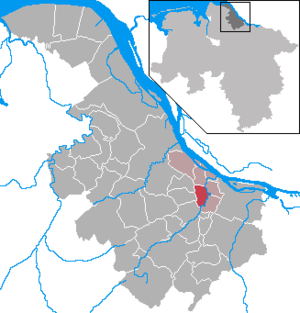
| Location of the community of Guderhandviertel in the district of Stade | ||
  |
||

Guderhandviertel ( Low German Goderhandveerdel ) is a municipality in the Stade district in Lower Saxony . The community belongs to the joint community Lühe , which has its administrative seat in the community of Steinkirchen .
Geographical location
The community is located west of Hamburg in the center of the Altes Land , one of the largest fruit-growing areas in Europe. The Lühe limits the community area to the neighboring communities of Neuenkirchen and Mittelkirchen to the east .
Origin of name
The name Guderhandviertel was first mentioned in 1524: Im Ghuderhandeverndeil . The division of the large settlement community Lu (also to der Lu and bi der Lu ) into four quarters was handed down from the late Middle Ages . There were three church districts ( Im Kerckverndeil ): Steinkirchen , Mittelkirchen and Neuenkirchen as well as a district without a church, the Guderhandviertel. The origin of the name remains unclear. Here are two theories:
- The Guderhandviertel is - viewed from Steinkirchen - on the right hand or
- the settlement is - without a church with a pastor - entrusted to the good hand of God
politics
Municipal council
The municipal council is composed as follows:
(Status: local election on September 11, 2016 )
coat of arms
In a blue shield, one above the other, three silver knives with gold handles; the blades are each covered with a golden cross.
Web links
- Homepage of the community of Guderhandviertel
- Entry by Stefan Eismann on Guderhandviertel in the scientific database " EBIDAT " of the European Castle Institute
Individual evidence
- ↑ State Office for Statistics Lower Saxony, LSN-Online regional database, Table 12411: Update of the population, as of December 31, 2019 ( help ).
- ↑ Main statute of the municipality of Guderhandviertel in the version of July 10, 1990
Agathenburg | Ahlerstedt | Apenses | Balje | Bargstedt | Beckdorf | Bliedersdorf | Brest | Burweg | Buxtehude | Yours | Dollern | Drochtersen | Düdenbüttel | Engelschoff | Estorf | Fredenbeck | Freiburg / Elbe | Grossenwörden | Grünendeich | Guderhandviertel | Hammah | Harsefeld | Heinbockel | Himmelpforten | Hollern-Twielenfleth | Horneburg | Jork | Kranenburg | Crooked dike | Kutenholz | Mittelkirchen | Neuenkirchen | Nottensdorf | Oederquart | Oldendorf | Sauensiek | Stade | Stone churches | Wischhafen