
Ahlerstedt
| coat of arms | Germany map | |
|---|---|---|

|
Coordinates: 53 ° 24 ' N , 9 ° 27' E |
|
| Basic data | ||
| State : | Lower Saxony | |
| County : | Stade | |
| Joint municipality : | Harsefeld | |
| Height : | 37 m above sea level NHN | |
| Area : | 62.46 km 2 | |
| Residents: | 5451 (Dec. 31, 2019) | |
| Population density : | 87 inhabitants per km 2 | |
| Postal code : | 21702 | |
| Area code : | 04166 | |
| License plate : | HOURS | |
| Community key : | 03 3 59 002 | |
| LOCODE : | DE AH6 | |
| Community structure: | 8 districts | |
| Address of the municipal administration: |
Kakerbecker Strasse 1 21702 Ahlerstedt |
|
| Website : | ||
| Mayor : | Uwe Arndt (FWG) | |
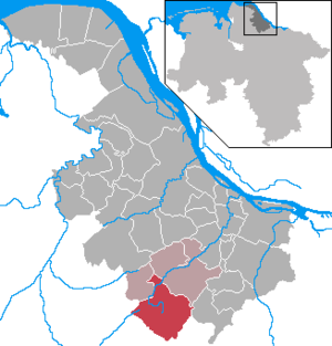
| Location of the municipality of Ahlerstedt in the district of Stade | ||
  |
||


Ahlerstedt ( Low German Ohlers ) is a municipality in the district Stade in Lower Saxony ( Germany ).
geography
Geographical location
Ahlerstedt is located in a poorly forested and slightly hilly landscape on the Stader Geest , southwest of Hamburg and east of Bremen on the border with the Rotenburg (Wümme) district in the eastern Elbe-Weser triangle . The Braken and Harselah nature reserve extends north-east of Ahlerstedt . The floodplain rises in the municipality on the edge of a high moor between Ahrensmoor and Klethen. The closest cities are Buxtehude , Stade and Zeven . Bremervörde and Rotenburg (Wümme) are a little further away.
Ahlerstedt is conveniently located between the major cities of Hamburg (70 km away, 40 km as the crow flies) and Bremen (77 km away, 56 km as the crow flies). Both can be easily reached via the A1 .
Neighboring communities
| Brest | Bargstedt | Harsefeld |
| Non-creatures |
.svg)
|
Sauensiek |
| Heeslingen | Vierden | Resident |
Neighboring cities
|
Bremerhaven 69 km |
Stade 24 km |
Buxtehude 19 km |
|
Bremervörde 27 km |
|
Buchholz in the north heath 47 km |
|
Zeven 18 km |
Rotenburg (Wümme) 50 km |
Tostedt 30 km |
Community structure
There are eight districts in the municipality of Ahlerstedt:
- Ahlerstedt
- Ahrensmoor (divided into Ahrensmoor-North , -East and -West )
- Ahrenswohlde
- Bokel
- Kakerbeck with Kakerbeck-Doosthof and Bockholt
- Oersdorf with Kohlenhausen
- Ottendorf with Klethen
- Wangersen with Klein Wangersen and Hohenhausen
climate
The climate in Ahlerstedt is warm and temperate . Even the driest month still has more rainfall than average in Ahlerstedt . The average annual rainfall is 754 mm. The annual average temperature is 8.4 ° C. The coldest month is January, the warmest month July. The least precipitation falls in February and the most in August.
|
Climate table Ahlerstedt
Source:
|
|||||||||||||||||||||||||||||||||||||||||||||||||||||||||||||||||||||||||||||||||||||||||||||||||||||||||||||||||||||||||||||||||||||||||||||||||||||||||||||||||||||
history
Parish name
Former place names of Ahlerstedt were Alerstede in 1102, Alerstede around 1230 and Alerstede in 1420. The basic word of this place name is undoubtedly –stedt . The defining word could either go back to the Middle Low German alre, elre for alder , which could lead to a basic form Alre-stets (d) ti . German Erle , Low German also Eller , Middle High German alder , Old High German erila, elira , Middle Low German elre , but also Middle Low German alre for everyone . It may also be based on an old first name, maybe Alaher .
prehistory
In the Middle Ages, Ahlerstedt and the other districts belonged to the Archbishopric of Bremen and, after the Thirty Years War, from 1648 to the Duchy of Bremen-Verden .
In the French era , Ahlerstedt , Ahrenswohle , Bokel and Ahrensmoor belonged to Mairie Ahlerstedt in the canton of Harsefeld in the Kingdom of Westphalia until 1811 . From 1811 to 1814 they and the towns of Wiegersen , Bockhorst, Oersdorf , Klethen , Kohlenhausen, Ottendorf , Kutenholz , Bullenholz and Wedel belonged to the Mairie Ahlerstedt in the newly founded canton of Horneburg. From 1823, after the Congress of Vienna , the villages were part of the Landdrostei Stade in the Kingdom of Hanover .
Before 1885, all of today's districts, with the exception of Kakerbeck and Oersdorf , belonged to the Börde Ahlerstedt in the Harsefeld district , after 1885 to the Stade district and since 1932 to the Stade district today .
founding
From 1964 to 1972 Ahlerstedt was the main town of the joint municipality of Ahlerstedt , which from 1971 was congruent with the current municipality.
On July 1, 1972, today's Ahlerstedt community was founded from the communities of Ahlerstedt , Ahrensmoor , Ahrenswohlde , Bokel , Kakerbeck , Oersdorf , Ottendorf-Klethen and Wangersen . Ahlerstedt is part of the Harsefeld municipality .
religion
The community of Ahlerstedt is evangelical-Lutheran and belongs to the parish of the church Ahlerstedt , only Oersdorf and Kakerbeck belong to the parish of the church Bargstedt . There are also two New Apostolic congregations with churches in the districts of Wangersen and Kakerbeck- Doosthof .
The church of St. Michael in Harsefeld is responsible for the few Catholics , which has been part of the parish of the Assumption of Mary in Buxtehude since September 1, 2010 .
politics
Municipal council
The municipal council (including the mayor) has 17 members:
(Status: local election on September 11, 2016 )
mayor
- 1992–1996: Peter Bredehöft (FWG)
- 1996-2001: Hinrich Steffens (CDU)
- 2001–2006: Peter Bredehöft (FWG)
- 2006-: Uwe Arndt (FWG)
Mayor is Uwe Arndt from the Free Voting Association. He comes from the district of Ottendorf and currently lives in the district of Oersdorf .
Community directors
- 1996–2011: Rainer Schlichtmann
coat of arms

Blazon : The coat of arms of the municipality of Ahlerstedt shows a shield divided diagonally from bottom left to top rightby a silver wavy bar . In the blue field at the top left there is a silver prehistoric earth house and in the red field at the bottom right there is a silver earth oven with eight silver flames in its opening. Significance: The prehistoric earth house shown on the coat of arms wasexcavatedin the district of Kakerbeck and the earth oven typical for the region in the district of Ahlerstedt. The silver flames in the oven opening are supposed to symbolize the eight districts of the community.
Partnerships
There is a partnership with the Budzyń Municipality in Poland .
Population development
| date | Residents |
|---|---|
| December 31, 1977 | 4137 |
| December 31, 1982 | 4269 |
| December 31, 1987 | 4279 |
| December 31, 1992 | 4477 |
| December 31, 1997 | 4731 |
| December 31, 2002 | 4985 |
| December 31, 2007 | 5136 |
| December 31, 2012 | 5104 |
Residents in the individual districts
| District | Residents | was standing | |
|---|---|---|---|
| 1 | Ahlerstedt | 1740 | 2011 |
| 2 | Ahrensmoor | 452 | 2003 |
| 3 | Ahrenswohlde | 446 | 1999 |
| 4th | Bokel | ||
| 5 | Kakerbeck | ||
| Kakerbeck-Doosthof | 80 | ~ 2017 | |
| Bockholt | |||
| 6th | Oersdorf | 302 | 2011 |
| 7th | Ottendorf | 575 | ~ 2010 |
| Klethen | |||
| 8th | Wangersen | ||
| Klein Wangersen | |||
| Hohenhausen |
Culture and sights
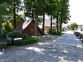
Buildings
Ahlerstedt district
- Today's neo-Gothic , single-nave , four-bay church with choir and west tower made of brick was built from 1863 to 1856 according to plans by the Jewish architect Edwin Oppler . It is Oppler's only non-Jewish sacred building.
- Bakery of the village renewal association
District of Ottendorf
- Via Romea ( Napoleon's path ) with memorial stones

Evangelical Lutheran Church , 1865 by Edwin Oppler

Napoleon stone in the district of Ottendorf

Reconstructed megalithic grave in the Ottendorf district, next to the memorial stone for Willi Wegewitz
Bakehouse


Economy and Infrastructure
traffic
The state road 124 leads through the municipality of Ahlerstedt , via which you can reach Stade , Harsefeld and Zeven as well as the federal roads 71 and 73 .
Four bus routes operate in the municipality of Ahlerstedt, all of which are operated by KVG Stade and are connected to the Hamburg transport association:
- 2029 | Stade - Hagen - Helmste - Harsefeld - Ahlerstedt - Wangersen - Zeven and back
- 2035 | Buxtehude - Apensen - Nindorf - Beckdorf - Sauensiek - Ahlerstedt and back
- 2703 | Zeven - Ahlerstedt - Harsefeld - Hedendorf - Finkenwerder and back
- 2066 | Wangersen - Ahlerstedt and back
The nearest train stations are in Harsefeld , Bargstedt , Aspe and Kutenholz ( Bremerhaven-Buxtehude line ). There is a connection to Hamburg in Buxtehude .
The next motorway connection is in nearby Sittensen to the federal motorway 1 (Hamburg-Bremen).
education

- Ahlerstedt primary school
- School at the Auetal (secondary school)
Companies
The Kreissparkasse Stade and the Volksbank Ahlerstedt have a branch in Ahlerstedt.
There are two industrial areas: Kleine Kamp and Klethener Weg .
Sons and daughters of the church
- Heinrich Behnken (1880–1960), German teacher and author
- Willi Wegewitz (1898–1996), archaeologist and local history researcher
- Peter Tobaben (1905–1972), German politician (DP, later CDU)
- Heinrich Kröger (* 1932), German pastor and author
- Elke Lütjen-Drecoll (* 1944), anatomist and university professor
- Lydia Fischer (* 1949), German politician (CDU)
- Birgit Lemmermann (* 1962), high school teacher, author (Low German) and translator

Plaque on the memorial stone for
Heinrich Behnken
Memorial stone for
Willi Wegewitz


Web links
Individual evidence
- ↑ State Office for Statistics Lower Saxony, LSN-Online regional database, Table 12411: Update of the population, as of December 31, 2019 ( help ).
- ↑ Climate: Ahlerstedt , climate-data.org, accessed on December 8, 2018
- ^ Jürgen Udolph (research): The "place name researcher". In: website NDR 1 Lower Saxony . Archived from the original on December 7, 2015 ; accessed on August 2, 2019 .
- ^ Federal Statistical Office (ed.): Historical municipality directory for the Federal Republic of Germany. Name, border and key number changes for municipalities, counties and administrative districts from May 27, 1970 to December 31, 1982 . W. Kohlhammer GmbH, Stuttgart / Mainz 1983, ISBN 3-17-003263-1 , p. 246 .
- ↑ http://samtgemeinde-harsefeld.de/?page_id=6769
- ↑ a b c d e f g h Home. Retrieved December 16, 2018 .
- ↑ Ahlerstedt primary school
- ^ School at the Auetal
Agathenburg | Ahlerstedt | Apenses | Balje | Bargstedt | Beckdorf | Bliedersdorf | Brest | Burweg | Buxtehude | Yours | Dollern | Drochtersen | Düdenbüttel | Engelschoff | Estorf | Fredenbeck | Freiburg / Elbe | Grossenwörden | Grünendeich | Guderhandviertel | Hammah | Harsefeld | Heinbockel | Himmelpforten | Hollern-Twielenfleth | Horneburg | Jork | Kranenburg | Crooked dike | Kutenholz | Mittelkirchen | Neuenkirchen | Nottensdorf | Oederquart | Oldendorf | Sauensiek | Stade | Stone churches | Wischhafen
Ahlerstedt (core town) | Ahrensmoor | Ahrenswohlde | Bokel | Kakerbeck with Kakerbeck-Doosthof and Bockholt | Oersdorf with Kohlenhausen | Ottendorf with Klethen | Wangersen with Klein Wangersen and Hohenhausen