
Ahrenswohlde
|
Ahrenswohlde
municipality Ahlerstedt
|
||
|---|---|---|
 |
||
| Height : | 41 m | |
| Residents : | 446 (1999) | |
| Incorporation : | July 1, 1972 | |
| Postal code : | 21702 | |
| Area code : | 04166 | |
Location of Ahrenswohlde in Lower Saxony |
||
 Place view
|
||

Ahrenswohlde ( Low German Ohrenswohl ) is the southernmost town in the Lower Saxony district of Stade . It has been part of the municipality of Ahlerstedt , integrated municipality of Harsefeld since July 1, 1972 and is located on the Aue .
geography
Geographical location
Ahrenswohlde is located on a Geest island in the middle of the Ahrenswohlder Moor at an altitude of 30-40 m on the Stader Geest in the southernmost point of the Stade district on the border with the Rotenburg district (Wümme) . Nothing has been preserved from the original forest, apart from small remnants such as the 15 hectare large Meßburen on the southern edge of the village. In Ahrenswohlde the L 127 ( Buxtehude - Zeven ) and the K 54 intersect in the center of the village. In earlier times, the current K 54 was part of an important military and trade route ( Via Romea ). The floodplain flows north of Ahrenswohlde and cuts the K 54 shortly after a curve called the Aue curve .
Neighboring places
| Klethen , Ahlerstedt | Ahrensmoor | |
| Bokel |
.svg)
|
|
| Wangersen | Klein Wangersen , Hohenhausen | Resident |
geology
The place is also very interesting from a geological point of view. Since the Stade salt dome ends here, there were / are large oil deposits here , but they are too deep to be extracted. In the 1980s, a natural gas deposit was also suspected, which is why the Harsefeld Z 1 natural gas well was carried out on the Appel in 1982/83 ; however, it turned out to be an expensive failure, no gas could be found.
history
Naming
From the name Arndeswolde around 1500, the village name developed via Ahrentwohlde , at the beginning of the 18th century, to today's Ahrenswohlde . The ending '-wohlde' indicates a settlement near a forest. The term 'Ahrens' at the beginning of the proper name has not been clarified with any certainty, so there are several theses, here the two best known:
- According to the church chronicle of Ahlerstedt , this name is derived from the eagles living in the forests at that time, hence 'Adlerswald'.
- The name may also come from a proper name, such as Ahrens, or Arndt, which can be deduced from the previous forms of writing.
Age of the place
The first official mention of the place Arndeswolde appears in the ' Voerder Register ' ( Bremervörde ) at the beginning of the 16th century. From 1524 on, farms from Ahrenswohlde appeared for the first time in various regional agricultural registers. From urn finds in 1921 and 1924, however, one can conclude that people settled in this area as early as the time of Christ, or as early as 400 AD. Emperor Charlemagne set the boundaries of his districts around 788 AD . The field name Wimarcha was mentioned as a border point , from which today's 'Wiemark' results, the road that leads towards Sittensen . From these data it can be concluded that the area has been inhabited for at least 2000 years, at least to a small extent. A real foundation date is not yet known, as these different events all took place at very different times. Therefore, no anniversary celebrations have taken place so far, from which a stranger could have deduced the age of the place.
Route importance
Ahrenswohlde is an important location in terms of borders and connecting routes.
- In a north-south direction, a pilgrimage route led along, which even became a military road , and is today's motorway feeder to Sittensen.
- In an east-west direction, the place connected the two present-day metropolises Hamburg and Bremen .
- The previously mentioned boundary of Carolingian possessions, which Charlemagne established, was also important. The Diocese of Bremen led from Bremen over the 'Sneidbach' near Hohenhausen, which leads to the Oste , then over the Wiemark to Harselah to Harsefeld , from where the border continued to Lühe .
Because of the crossing of these important roads, a settlement was built here.
Middle Ages and Early Modern Times
The first settled settlers cleared forests and drained moors
According to the plow treasure register, there were four farms in Ahrenswohlde around 1524, and around 1652 there were five farms subject to payment, as well as a plow kitten and a brink kitten . Donations went to the Harsefeld Monastery .
From 1750 onwards, the Buxtehude - Bremen coach route ran through the town. Those passing through stopped at the Alpers farm, today Bredehöft. There are several travel reports about this.
19th century
The first teaching position was established in 1835. The cemetery on Brümmerweg was built between 1844 and 1848.
The Wiemark was built from 1850 onwards, and some Ahrenswohl people emigrated to the United States at the same time . A major fire destroyed the entire street in the direction of Ahlerstedt in 1887.
The first schoolhouse was built in 1852, before lessons took place in the shepherd's house. A new building took place in 1888.
From 1890 the Brümmerweg , the Kampshorn and the Green Ried were built on.
20th century
In 1902 the first compulsory fire brigade was founded. At the beginning of the century, several craftsmen opened their workshops in the village.
In 1919 Ahrenswohlde founded the Ahrenswohlde / Bokel electricity cooperative with Bokel , where electricity was generated in the local mill . The connection to the regional power grid took place in 1924.
The war memorial for the fallen of the First World War was built in 1921.
The volunteer fire brigade was founded in 1935. From 1937 she formed a fire fighting association with Bokel and Ahrensmoor.
The population rose to 450 in 1945 by displaced persons and bombed out (in 1939 there were 305). A barracks settlement was built for the displaced from 1950 onwards. After 1960 these were demolished. The land was sold as building land; the new housing estate Appelweg was created. A little later, Ohfeldtweg was also designated as a new development area.
After the Second World War , other craft businesses settled here. In 1951 the first street lamps were put up in the village.
In 1956 the fire brigade received a syringe house with a cistern. A hairdresser was also housed there. The connection to the drinking water supply took place in 1964.
After the village school closed in 1974, a play group moved into the old school building.
After a cemetery chapel was built in 1973, the fire brigade received a new fire station in 1976 after the air raid shelter was demolished. The sports field on the outskirts was created in the 1980s.
In 1988 a type RF-4E Phantom from reconnaissance wing 52 of the Bundeswehr crashed near Ahrenswohlde. The pilots were able to save themselves with an ejector seat .
In 1992, electricity and gas lines were earthed, and the connection to the sewer system was made. Footpaths and bike paths were created. In 1994 the village square was redesigned and the wind farm was designated in 1995
Regional affiliation
In the Middle Ages Ahrenswohlde belonged to the Archbishopric of Bremen and from 1648 to the Duchy of Bremen-Verden after the Thirty Years' War . Administratively, Ahrenswohlde belonged to the Buxtehude office , later to the Harsefeld office .
In the French era , Ahrenswohle, Ahlerstedt , Bokel and Ahrensmoor belonged to Mairie Ahlerstedt in the canton of Harsefeld in the Kingdom of Westphalia until 1811 . From 1811 to 1814 they and the towns of Wiegersen , Bockhorst, Oersdorf , Klethen , Kohlenhausen, Ottendorf , Kutenholz , Bullenholz and Wedel belonged to the Mairie Ahlerstedt in the newly founded canton of Horneburg. From 1823, after the Congress of Vienna , the villages were part of the Landdrostei Stade in the Kingdom of Hanover .
When a new district order came into effect in 1885, the Harsefeld office was dissolved, and Ahrenswohlde was now part of the Stade district , which in 1932 became the current district of Stade .
Incorporation
In 1955 5 houses and 30 hectares of Feldmark were incorporated into Ahrenswohlde.
Until 1972, Ahrenswohlde was an independent municipality with its own mayor and council. The parish office was in the mayor's house. After the population increased sharply, an office worker was hired and the office was given fixed working hours.
As part of the community reform, Ahrenswohlde was incorporated into the community of Ahlerstedt on July 1, 1971 , and then in 1972 into the joint community of Harsefeld . Until then, Ahrenswohlde had been the southernmost community in the Stade district.
mayor
| Surname | Term of office |
|---|---|
| Johann Hauschild Sr. | 1888-1918 |
| Joachim Alpers | 1918-1933 |
| Hinrich Müller | 1933-1945 |
| Johann Christian Hauschild | 1945–1957 |
| Hinrich Tipke | 1957-1970 |
Population development
| year | Residents |
|---|---|
| 1524 | 4 fire places |
| 1770 | 8 fire places |
| 1777 | 9 fire places |
| 1824 | 12 fire places |
| 1848 | 145 inhabitants, 12 houses |
| 1910 | 259 |
| 1939 | 305 |
| 1945 | 450 |
| 1960 | 434 |
| 1972 | 444 inhabitants, 91 houses |
| 1999 | 446 |
religion
The place belonged to Heilangau von Heeslingen , where probably the first baptistery of the surrounding places was founded. After the church was founded in Bargstedt , Ahrenswohlde belonged to this church, then to the current Evangelical Lutheran Church of Ahlerstedt , which at that time was still a branch church of Bargstedt.
Culture and sights
Buildings
War memorial

The war memorial was erected in October 1921; it is dedicated to the ten fallen of the First World War . In 1954, two more stones were erected to commemorate the 44 dead in World War II and those who fell from the homeland.
Village community center
The village community center was attached to the fire station in 1980 by the village community . It was consecrated on September 27, 1980. The community bore the material costs. The costs for maintenance and care are organized by the volunteer fire brigade. The village community center is used as a training room, club room for the ASV village community, as a tower room, as a practice room for the choir, as a party room and as a polling station. In 1988 an extension took place.
Association
Volunteer firefighter
On February 17, 1902, a compulsory fire brigade was founded in Ahrenswohlde with 26 men . She had a hand-operated syringe . On May 26, 1935, the compulsory fire brigade became the volunteer fire brigade (FF). From 1937 she formed a fire fighting association with the fire departments in Ahrensmoor and Bokel . During the Second World War, civilians and women were made compulsory. In 1956 a new fire station was inaugurated. 1,962 firefighters their first vehicle, a received TSF brand VW with a hose reels . After the air raid shelter on the village square was demolished in 1976, a new fire station was built there, which received a hose tower in 1977 . In 1985 the FF Ahrenswohlde celebrated its 50th anniversary. In 2000 the fire brigade had a total of 49 members. She is responsible for the organization of the harvest festival, the Easter fire and the fire brigade festival.
Mixed Choir "Evening Peace"
In 1925 some men from the towns of Ahrenswohlde, Klein Wangersen, Hohenhausen and Bokel founded a male choir under the direction of the teacher Anton Alpers, which shortly afterwards became a mixed choir. They gave themselves the name "Abendfrieden" and the flag consecration took place in 1935. They practiced once a week in the evening at school, today in the village community center. The song festival, the Ahrenswohlder village festival, was held once a year. The celebrations took place in the Brunkhorst inn or in the festival tent. The choir performs at celebrations, church services, other song festivals and at the harvest festival.
ASV Ahrenswohlde
The village community Ahrenswohlde, short ASV, was founded in 1972. She organizes the egg scrounging, hikes, football games, trips and village festivals. In 1985, the ASV built a sports field on Ohfeldtweg with a high level of personal contribution, which SV Ahlerstedt / Ottendorf uses for training several times a week.
Gymnastics group
The women's gymnastics group has existed since 1980.
Economy and Infrastructure
economy
Originally, Ahrenswohlde was a pure farming village with few craftsmen. The first settlers cleared forests and drained moors. In addition to the cultivation, they ran some cattle breeding, especially sheep that grazed on the heather around Ahrenswohlde. Another line of business was peat cutting . In the 18th century, Ahrenswohlde was the only village in the Buxtehude district that produced peat coal .
A comprehensive structural change took place after 1945 : Smaller farmers formed working groups. More and more smaller farms were downsized, other farms bought up land and expanded. Large companies specialize e.g. B. on pig fattening , dairy farming or potato cultivation.
The first craftsmen in the village were house residents . From 1750 there was a first restaurant in the village. The Brunckhorst inn existed from 1815 to the early 2000s. Another pub opened in 1998.
From 1816 to 1872 there was a first grocer in town. From 1912 there was a grocery store , which is now a bakery. After 1900 more and more handicraft businesses were founded in the village. The village forge closed in 1974/75. At the end of the 1990s there was a special item market in the village .
Today Ahrenswohlde is still shaped by agriculture. There are also medium-sized handicraft businesses (carpentry, joinery, etc.). The car repair shop founded in 1946, which was later expanded to include a petrol station with a car wash, is now a used car dealership. There is also an organic shop and a bakery. The basic center is Ahlerstedt.
Wind farm
At the municipal council meeting on May 11, 1995 it was decided that wind farms should be built in Oersdorf and Ahrenswohlde. Both plants are on the border with the Rotenburg (Wümme) district. The Ahrenswohlde wind farm is located at the southernmost point of the Stade district and borders the Wohnster Feldmark in the south. The forest areas of Messburen and Wohnster Wald are close by. 25 systems were planned with an output of 600 kW each, but only 20 were built. Commissioning took place on November 28, 1999, and the construction costs amounted to 22 million marks. The inauguration took place on June 9, 2000. Over 21.5 million kilowatt hours of electricity are generated here every year. In the 2000s, more wind turbines were built.
Infrastructure
traffic
In Ahrenswohlde, the state road 127, which leads via Apensen to Buxtehude , and the district road 54, which leads to Ahlerstedt on the L 124, cross in the center of the village .
The next motorway junction is in nearby Sittensen ( federal motorway 1 ).
The nearest train stations are in Bargstedt and Harsefeld ( Bremerhaven – Buxtehude line ).
education
Before a secondary school was set up in Ahrenswohlde in 1835 , lessons were held in the parish of Ahlerstedt. A Kätner from Ahlerstedt held the lesson; Teaching was in the empty shepherd's house of the former community shepherd. The schoolmaster now used the stables there.
In 1842/44 around 30-40 children attended school, and the room in the shepherd's house became too small. In 1852 a school building was built at the intersection in the center of the village. The first school house was destroyed in a fire in 1887. Until the reconstruction in 1888, lessons took place in Bokel .
The new school was a classic Lower Saxony hall building , but with a fixed roof. From 1908 Ahrenswohlde formed a school association with the neighboring municipality of Bokel , but the Bokelers still attended the school in Wangersen , so that Ahrenswohlde had to pay guest school fees to Wangersen. In 1909 the schoolhouse was lengthened by 2.50 and the old half-timbered gable was torn down. Due to a lack of space, the schoolhouse was completely rebuilt in 1928: There were now two classrooms and two teacher's apartments. The second teaching position was canceled in 1938 due to a lack of pupil numbers, but was re-established after the Second World War . From 1948 the third teaching post was established. From 1950 to 1957 renovation work took place again, the outer walls were replaced by solid walls, the half-timbered gables were expanded, new windows were installed and the floors were renewed. The classrooms were given sinks and closets. Bathrooms have been installed.
From 1955 on, children from Klein Wangersen started school in Ahrenswohlde. An extension was planned, but was not carried out because a center school was set up in Ahlerstedt in 1964 , as the students were already in the 9th grade in Ahlerstedt . The villages of Ahlerstedt, Bokel, Wangersen, Klethen , Ottendorf and Oersdorf had set up an association for this purpose .
After initially only the upper classes were taught in Ahlerstedt, only elementary school students remained in the village schools in 1968.
After the last teacher was transferred to Celle, the Ahrenswohlder attended the school in Ahrensmoor . The school in Ahrenswohlde was officially closed on August 1, 1972.
Today the Ahrenswohlder pupils attend the primary school in Ahlerstedt. Secondary and vocational schools are located in Ahlerstedt (secondary school), Harsefeld ( grammar school ), Buxtehude (BBS Buxtehude) and Stade (BBS Stade).
post Office
In the past, mail was delivered from Harsefeld until a post agency was opened in Ahlerstedt in 1889, which also served the surrounding towns.
In 1930 a post office opened in Ahrenswohlde . Post buses were used to deliver to the post from Harsefeld and later from Stade. The post office distributors were only responsible for their locality. After the Posthilfstelle was dissolved in 1976, the Posthilfstelle distributors were taken over as country deliverers .
Mail has been sorted and delivered from Harsefeld since 1996. Swiss Post still has a branch in Ahlerstedt.
graveyard

The cemetery was laid out between 1844 and 1848, but a cemetery on Brümmerweg was already noted on a map drawn in 1840. Before that, funerals took place in the churchyard in Ahlerstedt. As the communities grew, however, their own cemeteries were created. In 1952 the cemetery was expanded and in 1973 the chapel was built. Funeral services used to take place on the floorboards of the local hall houses. However, the newer houses no longer had floorboards, so the chapel was necessary.
Personalities
- Heinrich Kröger (* 1932), pastor and author, born and raised in Ahrenswohlde
gallery
Kampshorn

Exit towards Ahrensmoor

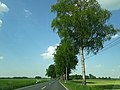
Aue, near Ahrenswohlde on the K 54


literature
- Dorothea Rummelies: At home in Ahrenswohlde . Ahrenswohlde 2001.
- Dorothea Rummelies: Ahlerstedt - yesterday and today . Ahlerstedt 1996.
- Günter Kachmann and Hinnrich Pape: Samtgemeinde Harsefeld - then and now . Harsefeld.
- Association for monastery and local history Harsefeld eV: history and present . Harsefeld.
Individual evidence
- ↑ a b c Dorothea Rummlies: At home in Ahrenswohlde . 2001, p. 204 .
- ↑ CHCF Jansen: Statistical Handbook of the Kingdom of Hanover . In Commission of the Helwings̓chen Hofbuchhandlung, 1824 ( limited preview in the Google book search).
- ↑ FW Harseim: Statistical Manual for the Kingdom of Hanover . Schlueter, 1848 ( limited preview in Google book search).
- ↑ Welcome to Gemeindeververzeichnis.de. Retrieved October 26, 2018 .
- ↑ a b Dorothea Rummelies: At home in Ahrenswohlde . 2001, p. 207 .
- ↑ Dorothea Rummelies: At home in Ahrenswohlde . 2001, p. 209 .
- ↑ Dorothea Rummlies: At home in Ahrenswohlde . 2001, p. 211 .
- ↑ Dorothea Rummelies: At home in Ahrenswohlde . 2001, p. 219 .
- ↑ Dorothea Rummelies: At home in Ahrenswohlde . 2001, p. 172 .
- ↑ Dorothea Rummelies: At home in Ahrenswohlde . 2001, p. 180 f .
- ↑ Dorothea Rummelies: At home in Ahrenswohlde . 2001, p. 178 ff .
- ↑ Dorothea Rummelies: At home in Ahrenswohlde . 2001, p. 182 f .
- ↑ Dorothea Rummelies: At home in Ahrenswohlde . 2001, p. 184 f .
- ↑ Dorothea Rummlies: At home in Ahrenswohlde . 2001, p. 193 ff .
- ↑ Dorothea Rummlies: At home in Ahrenswohlde . 2001, p. 137 ff .
- ↑ Dorothea Rummlies: At home in Ahrenswohlde . 2001, p. 170 ff .
- ↑ Dorothea Rummlies: At home in Ahrenswohlde . 2001, p. 197 ff .
- ↑ Dorothea Rummelies: Ahlerstedt - Gestern und heute , population figures: p. 32–41, historical report: p. 171/172

Ahlerstedt (core town) | Ahrensmoor | Ahrenswohlde | Bokel | Kakerbeck with Kakerbeck-Doosthof and Bockholt | Oersdorf with Kohlenhausen | Ottendorf with Klethen | Wangersen with Klein Wangersen and Hohenhausen