
Hünselburg
| Hünselburg | ||
|---|---|---|
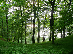
 View from the south of the Urwaldsteig Edersee hiking trail |
||
| Creation time : | Late Latene period | |
| Castle type : | Höhenburg, Spornlage, Wallburg | |
| Conservation status: | Wall and moat remains | |
| Standing position : | rural refuge | |
| Place: | Nieder-Werbe and Asel | |
| Geographical location | 51 ° 10 '52 " N , 8 ° 58' 10" E | |
| Height: | 376 m above sea level NHN | |
|
||

The Hünselburg near Nieder-Werbe in the north Hessian district of Waldeck-Frankenberg ( Germany ) is the castle stables of a hilltop castle , of which wall and moat remains are still present and which is designated as a cultural monument .
Geographical location
The former Hünselburg is located in the basement forest counting natural space "Edersee trough" in the northern part of the nature park basement Edersee , 4.3 km southwest of the Waldecker neighborhood Nieder-Werbe and 2.4 km southeast of the Vöhler community part Asel , in which both districts partially located , and 2.8 km (as the crow flies ) south-south-west of the Vöhler district of Basdorf . It is located on and around the summit of the Lindenberg ( 376 m above sea level ; also indicated as 368 m height), a narrow, cliff-rich mountain spur , steeply sloping to the west and east , which when the water level is high enough to the west, south and east of the Edersee is washed around. With full back this summit situation arises between the Eder - river kilometers 62.5 in the west and 60.0 in the east about 131 meters above the water surface ( 244.97 m ).
History and layout
The multi-part complex, of which only the remains of walls and ditches remain, was a Celtic refuge from the early La Tène period , as found in broken glass and broken glass testify. Two strong walls, noticeably far apart, about 500 m apart, sealed off the mountain spur to the north.
About 6.2 km (as the crow flies) to the west-northwest near Herzhausen are the remains of the Höckelsburg , probably also a Celtic complex, the formation of which is, however, partly dated to the Iron Age .
Hünselburg nature reserve
The southern parts of the project into the Edersee headland of Lindesbergs are since 1977 as 40 or 41.7 hectares large nature reserve Hünselburg ( CDDA reported -No. 81962). The original reason for the expulsion was a (now abandoned) gray heron colony. Today the focus is on the nationally significant near-natural forest and process protection.
hike
A section of the Urwaldsteig Edersee circular hiking trail (length 68 km) leads around the spur of the Lindenberg along the north bank of the Edersee , from which the branch paths rise to the castle site.
gallery

Ascent to the Hünselburg from the south

On the ascent to the Hünselburg from the south with the Edersee in the background
At the Hünselburg


Individual evidence
- ↑ a b c d Map services of the Federal Agency for Nature Conservation ( information )
- ↑ a b Hünselburg, Waldeck-Frankenberg district. Historical local dictionary for Hesse (as of December 14, 2012). In: Landesgeschichtliches Informationssystem Hessen (LAGIS). Hessian State Office for Historical Cultural Studies (HLGL), accessed on December 14, 2012 .
- ^ Ordinance on the nature reserve "Am Rauhensee bei Steinheim" of August 29, 1977 . In: Higher nature conservation authority (ed.): State gazette for the state of Hesse. 1977 No. 38 , p. 1862 , point 1239 ( online at the information system of the Hessian state parliament [PDF; 4.5 MB ]).
- ↑ Hünselburg nature reserve at NABU
literature
- Georg Wilhelm Sante (Hrsg.): Handbook of the historical sites of Germany . Volume 4: Hessen (= Kröner's pocket edition . Volume 274). 3rd, revised edition. Kröner, Stuttgart 1976, ISBN 3-520-27403-5 .
Web links
- Photo: Ringwall of the Hünselburg , on myheimat.de
- Photo: Lindenberg headland as the location of the former Hünselburg seen from the south across the Edersee


Adorf Castle |
Arolsen Castle |
Arolsen New Castle |
Aulesburg |
Castle at the oven |
Old Battenberg Castle |
Neuburg Battenberg |
Bergheim Castle |
Braunsen Castle |
Castle Bring |
Brobeck Castle |
Buhlen Castle |
Christiansburg Castle |
Deisfeld Castle |
Ehrenburg |
Eifa Castle | → Eilhausen Castle |
Eisenberg castle ruins |
Wasserburg Ellershausen |
Esbeck Castle |
Eschenbeck Castle |
Fetzgesburg |
Freienhagen Castle |
Friedrichstein Castle |
Friedrichsthal Hunting Lodge |
Confidence of Friends Castle |
Fürstenberg Castle |
Fürstenstein Castle |
Geppenhagen Castle |
Gershausen moated castle |
Goddelsheim Castle |
Burgring Goddelsheim |
Big House (Thalitter) |
Grimmenstein Castle |
Hartenstein Castle |
Hatzfeld Castle |
Helmighausen Castle |
Hessenstein Castle |
Höckelsburg |
Höhnscheid Castle |
Höringhausen moated castle |
Ringwall Hünenkeller |
Hünselburg |
Huxhohl moated castle |
Itterburg |
Jägersburg |
House fight |
Cellar castle |
Keseburg |
Kleudelburg |
Kugelsburg |
Landau Castle |
Lauterbach farm |
Lengefeld Castle |
Lichtenfels Castle |
Burgstall Linne |
Lusthaus Rhoden | → Manor Malberg |
Burgstall Mederike |
Meineringhausen Castle |
Mengeringhausen Castle |
Mückenburg |
Neu-Jägersdorf |
Nieder-Waroldern Castle |
Nordenbeck Castle |
Nuhn Castle |
Upper castle |
Ober-Ense Castle |
Burgstall Panzenberg |
Reckenberg Castle |
Reckeringhausen Castle |
Older castle Rhena |
Rhena moated castle |
Rhoden Castle |
Schiffelbach castle ruins |
Schwalenburg |
Sehlen Castle (Donisse) | → Selbach moated castle |
Steffenburg |
Tax Castle |
Twiste Castle |
Vöhl Castle |
Waldeck Castle |
Wetterburg |
Wolkersdorf Castle |
Jagdschloss Wolkersdorf
(Objects marked with "→" do not have their own article.)