List of cultural monuments in Königstein (Saxon Switzerland)
The list of cultural monuments in Königstein (Saxon Switzerland) contains the cultural monuments in the town of Königstein (Saxon Switzerland) and its districts in the Saxon district of Saxon Switzerland-Eastern Ore Mountains . The notes are to be observed.
This list is a partial list of the list of cultural monuments in the district of Saxon Switzerland-Eastern Ore Mountains .
This list is a partial list of the list of cultural monuments in Saxony .
Legend
- Image: shows a picture of the cultural monument and, if applicable, a link to further photos of the cultural monument in the Wikimedia Commons media archive
- Designation: Name, designation or the type of cultural monument
-
Location: If available, street name and house number of the cultural monument; The list is basically sorted according to this address. The map link leads to various map displays and gives the coordinates of the cultural monument.
- Map view to set coordinates. In this map view, cultural monuments are shown without coordinates with a red marker and can be placed on the map. Cultural monuments without a picture are marked with a blue marker, cultural monuments with a picture are marked with a green marker.
- Dating: indicates the year of completion or the date of the first mention or the period of construction
- Description: structural and historical details of the cultural monument, preferably the monument properties
-
ID: is awarded by the State Office for the Preservation of Monuments in Saxony. It clearly identifies the cultural monument. The link leads to a PDF document from the State Office for the Preservation of Monuments in Saxony, which summarizes the information on the monument, contains a map sketch and often a detailed description. For former cultural monuments sometimes no ID is given, if one is given, this is the former ID. The corresponding link leads to an empty document at the state office. The following icon can also be found in the ID column
 ; this leads to information on this cultural monument at Wikidata .
Königstein (Saxon Switzerland)
| image | designation | location | Dating | description | ID |
|---|---|---|---|---|---|
 |
Königstein monument protection area | (Map) |
09300017
|
||
 |
Sandstone path up to the whorl | (Map) | re. 1778 (on the rock at the top of the path) | of military historical importance. Hewn sandstone cubes of different sizes, with water drainage steps and initials URB, at the upper end of the path on the right in the rock Initiale HT and 1896, 2–2.50 m wide, approx. 200 m long, probably laid out for military reasons and called "Kanonenweg" . |
09228385
|
 |
Viaduct and dam with retaining walls of the Dresden-Schöna railway line | (Map) | 1850 commissioning | Structural history, railway history, shaping the townscape and technological history of importance. |
09223017
|
 |
Water trough | (Map) | around 1800 | of cultural and historical importance. Trough, approx. 1.10 m high, one corner beveled, pentagonal, hewn, vessel walls approx. 15 cm thick, vessel depth approx. 50 cm, presumably for watering the horses. |
09228384
|
| Waystone | (Map) | probably before 1850 | Significant in terms of traffic history, 180 cm high, 31 cm wide, head 14 cm, sandstone. |
08951454
|
|
| Arch bridge over an inlet of the Waldbach on Vogelstein | (Map) | re. 1828 | of importance in terms of traffic and technology. Single-arch road bridge made of sandstone ashlars, wing walls designed accordingly, sandstone pillars of the bridge railing partially preserved, cracking in the arch of the bridge due to lack of care and overloading by forest vehicles, in addition the northeast side wall breaking away as well as damage to the base wall. |
09304527
|
|
| Memorial stone | (Map) | re. 1840 | in memory of the killing of a stag by Mayor Baer, of local history. |
09302463
|
|
| Historic towpath | (Map) | 18th century | Probably the last corresponding testimony to the technical history of the Saxon Elbe area in the district, of importance in terms of technology and traffic history. Historic towpath on the Elbe , approx. 900 m long, paved with sandstone, width 2.30 m to 2.50 m, in the eastern section three anchored iron rings every 100 m, towpath is in the middle part on the Prossen district , Porschdorf municipality , Flst. 7th |
09301678
|
|
 More pictures |
Unity of the fortress Königstein with rayon with individual monuments, u. a. Torhaus, Kommandantenhaus, Georgenburg, Neues Zeughaus and Caponnierengang, Brunnenhaus, Magdalenenburg, St. George's Chapel, Old Barracks, Treasury, Hauptwache as well as gardens (garden monuments) and the fortress cemetery as a whole | Old Fortress Road - (map) |
1207-1898 | Consolidation of Königstein Fortress with rayon with the following individual monuments: gatehouse, commandant's house, Georgenburg, new armory and caponier's passage , fountain house, Magdalenenburg, St. George's chapel, old barracks, treasure house, main guard, commandant's horse stable, team barracks, war barracks I-IV, bakery barracks, Old arsenal, peace hospital, artillery shed, plague casemate, war powder magazine, treasure casemate, Friedrichsburg, bullet magazine / war powder magazine II, park cistern, war hospital, barracks B / married building, hunger tower / steed, associated works, tombs, horns and rothe bridge with Medusentor, wall weir, fortress to defend the entrance, ammunition loading system for battery VII / VIII, Horn and Seiger tower, round observation and flanking towers, battery positions I-VI, as well as the paving of the old fortress road and the access path from Horn to Hornravelin as well as the King Johann monument near Friedrichsburg and on the fortress cemetery remains of the enclosure and ruins of a chapel (individual monument list ID no. 09223141), gardens laid out on the fortress (garden monuments) and the fortress cemetery (end of the 17th century, as a whole): the complex was devastated after 1945, its outlines can only be guessed at. |
09301198
|
 More pictures |
Königstein Fortress - Torhaus, Commandant's House, Georgenburg, New Armory and Caponniere's Walk, Brunnenhaus, Magdalenenburg, St. Georgs Chapel, including the fortification facilities (individual monuments to ID No. 09301198) | Old Fortress Road - (map) |
13th century, documented mention in 1241 | Individual monuments of the entity Königstein Fortress with Rayon: Gatehouse, Commandant's House, Georgenburg, New Armory and Caponnier's Walk, Brunnenhaus, Magdalenenburg, St. George's Chapel, Old Barracks, Treasure House, Main Guard, Commandant's Horse Stable, Team Barracks, War Barracks I-IV, Bakery Barracks, Altesierkasino Armory, peace hospital, artillery shed, plague casemate, war powder magazine, treasure casemate, Friedrichsburg, bullet magazine / war powder magazine II, parking cistern, war hospital, barracks B / married building, starvation tower / steed, associated with the fortification systems (including the outer Rothe bridge), grave scissors Medusentor, Streichwehr, fortress to defend the entrance, ammunition loading system for battery VII / VIII, Horn and Seiger tower, round observation and flanking towers, battery positions I-VI, as well as the paving of the old fortress road and the access path from Horn to Hornravelin and the König -Johann monument near Friedrichsburg and on the fortress cemetery remains of the enclosure and ruins of a chapel - fortress as a strongly fortified building ensemble on the rock plateau of the table mountain of the same name, the rayon (here: fortress frontage) can be clearly seen as a designed open landscape from the adjacent wooded area delimit, of historical, artistic, scientific and landscape design importance. |
09223141
|
| Waystone | Am Königstein - (map) |
2nd half of the 19th century | of importance in terms of traffic history |
09304757
|
|
| Guest house (today residential building) in open development | Am Königstein 3 (map) |
End of the 19th century | Fortress context, of local importance |
09222968
|
|
| Palmschänke - country inn in open development | Am Latz 2 (map) |
around 1900 | Palm tavern - historically and locally of importance, angular construction, partly half-timbered , conversions and extensions. |
09223097
|
|
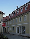 |
Residential house with basket arch door | Amtsgasse 2 (map) |
Early 19th century | Significant in terms of building history and urban development, mansard roof . |
09222925
|
 |
Residential building (No. 4), next to it residential building with clinker brick extension on the back (No. 6) | Amtsgasse 4; 6 (card) |
1st half of the 19th century | Of importance in terms of building history and urban planning |
09222924
|
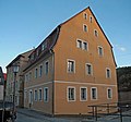 |
Residential house with basket arch door | Amtsgasse 10 (map) |
around 1800 | Significant in terms of building history and urban development, mansard roof. |
09222923
|
 |
House in a corner with plaster structure | Amtsgasse 12 (map) |
Mid 19th century | Significant in terms of building history and the appearance of the street |
09222922
|
 |
Corner house with a basket arch door | Amtsgasse 14 (map) |
Core probably 18th century | historically important |
09222921
|
 |
Residential house in semi-open development | Amtsgasse 16 (map) |
Core probably 18th century | with a more recent shop fitting, of importance in terms of building history and shaping the street scene, mansard roof. |
09222920
|
 |
Side building | Amtsgasse 16a (map) |
after 1800 | with classicistic influences, of architectural significance |
08951448
|
 |
Wall hook for catenary wire suspension of the Bielatal Motorbahn | Bahnhofstrasse - (map) |
1901 | Trackless Bielathal motor railway with electric overhead line (trolleybus) - of importance in terms of traffic history, cf. also Bielatalstrasse and Schandauer Strasse. |
09223062
|
 |
Tenement house | Bahnhofstrasse 1 (map) |
around 1900 | with younger shop fitting, head building, of importance in terms of building history and urban planning. |
09222932
|
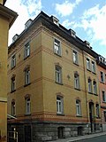 |
Apartment building in half-open development | Bahnhofstrasse 5 (map) |
around 1900 | Clinker brick construction , of importance in terms of building history and urban development |
09222933
|
 |
Apartment building in closed development | Bahnhofstrasse 7 (map) |
re. 1891 | Significant in terms of architectural history and urban development, inscription plaque above portal: "18 HH 91". |
09222934
|
 |
Apartment building in closed development | Bahnhofstrasse 9 (map) |
1890s | Of importance in terms of building history and urban planning |
09222935
|
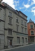 |
Apartment building in half-open development | Bahnhofstrasse 11 (map) |
1890s | with shop fitting, of importance in terms of building history and urban planning |
09222936
|
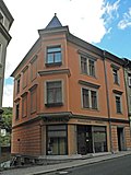 |
Apartment building in half-open development | Bahnhofstrasse 13 (map) |
1890s | with corner bay window and shop fitting, of importance in terms of building history and urban planning |
09222937
|
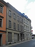 |
Apartment building in closed development | Bahnhofstrasse 15 (map) |
1890s | with the original shop front, important in terms of building history and urban planning |
09222938
|
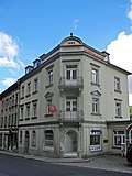 |
Apartment house in a corner | Bahnhofstrasse 17 (map) |
re. 1892 | with the original shop front, important in terms of building history and urban planning |
09222939
|
 |
Königstein train station - reception building and platform roofing | Bahnhofstrasse 19 (map) |
1870s (reception building) | Reception building as well as platform roofing, underpass (tiled floor) and roofing of the entrances and exits to the platforms - of significance in terms of railway history and technology |
09222940
|
 |
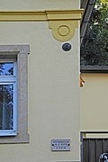
Post office | Bahnhofstrasse 32 (map) |
1890/1899 | Post office building in open development - of architectural and local significance. Richly structured sandstone block construction, beautiful facade structure (with brackets and window canopies), on the facade catenary wire suspension of the trackless electric Bielatal motor train (1901). |
09222947
|
 |
Wall hook for catenary wire suspension of the Bielatal Motorbahn | Bielatalstrasse - (map) |
1901 | Bielatal Motorbahn (trolleybus) - of importance in terms of traffic history (see also ID No. 09222871, Bielatalstrasse 17) as well as Bahnhofstrasse and Schandauer Strasse. |
09223064
|
 |
Road bridge over the Biela , on the railing barometer and thermometer | Bielatalstrasse - (map) |
2nd half of the 19th century | Significant in terms of traffic history and technology history, two sandstone arches, on the railing barometer and thermometer . |
09222862
|
 |
Road bridge over the Biela | Bielatalstrasse - (map) |
19th century | Significant in terms of traffic and technology history, three sandstone arches with parapets, marked with the royal crown. |
09222965
|
 |
Old post office | Bielatalstrasse 2 (map) |
Mid 19th century | of importance in terms of building history and local history. Elongated, three-storey plastered building (head building), coat of arms of Electoral Saxony over the portal. |
09223002
|
 |
Savings bank | Bielatalstrasse 4 (map) |
1920s | Sparkasse building - in the local style, of importance in terms of building history and the appearance of the street, with a round bay window and passage. |
09222865
|
 |
Apartment building in closed development | Bielatalstrasse 5 (map) |
3rd quarter of the 19th century | with shop fitting, of importance in terms of building history and urban planning |
09222874
|
 |
Residential house in open development | Bielatalstrasse 6 (map) |
End of the 19th century | Head building with original shop fronts, important in terms of building history and urban planning |
09223003
|
 |
Apartment building in closed development | Bielatalstrasse 7 (map) |
3rd quarter of the 19th century | with shop fitting, of importance in terms of building history and urban planning |
09222873
|
 |
Apartment building in closed development | Bielatalstrasse 9 (map) |
3rd quarter of the 19th century | with shop fitting, of importance in terms of building history and urban planning |
09222872
|
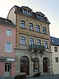 |
Apartment building in closed development | Bielatalstrasse 17 (map) |
1890s | with shop installation, of architectural and urban significance, on the facade wall hooks for the contact wire suspension of the Bielatal motor railway (catenary bus) (see also ID No. 09223064). |
09222871
|
 |
Residential house in open development with fencing | Bielatalstrasse 18 (map) |
3rd quarter of the 19th century | Structurally important, pilaster structure in the middle section. |
09222867
|
 |
Former Hotel "Sachsenhof" | Bielatalstrasse 21; 23 (card) |
1683 Dendro (core building) | Hotel building in semi-open development - with porch and seating niche portal, of architectural, house and local history, right part of the building with bricked-up sandstone window frames (16th / 17th century). |
09222870
|
 |
Old Town Hall; now residential building | Bielatalstrasse 27 (map) |
re. 1689 (portal) | Residential house in semi-open development - with shop fitting, of importance in terms of building history, local history and the street scene. In the backyard arched portal in the rock as a basement access, marked in the keystone. |
09222869
|
| Residential house in semi-open development, high water mark and sandstone stairs at the house | Bielatalstrasse 33 (map) |
re. 1786 | historically important. Building on a high base, basket arch door marked twice, cellar vault. |
09222868
|
|
 |
Catholic parish of Koenigstein | Bielatalstrasse 36 (map) |
End of the 19th century | Rectory in open development - of architectural and local significance, large residential building with wooden winter garden and balcony. |
09222967
|
 |
Catholic Parish Church of St. Maria Immaculata | Bielatalstrasse 38 (map) |
1910-1911 | of importance in terms of building history and local history. Hall church , sandstone block construction with polygonal covered apse and west tower. |
09222966
|
 |
Swivel house; Swivel yard | Bielatalstrasse 58; 58a (card) |
1737 Dendro | Residential building with outbuildings and paving in the courtyard - residential building on the upper floor half-timbered, important in terms of building history and the appearance of the street, steep hipped roof with three rows of bat dormers , without rear building and extension. |
09222973
|
| Residential building | Bielatalstrasse 59 (map) |
around 1800 | Upper floor half-timbered, boarded gable, of architectural significance |
09223001
|
|
 |
House and back building | Bielatalstrasse 67; 69 (card) |
Mid 19th century | historically important. Two-storey plastered building with a crooked roof. |
09222969
|
 |
Residential building | Bielatalstrasse 71 (map) |
around 1800, e.g. T. changed | Upper floor half-timbered, boarded up, historically important |
09222970
|
 |
Residential house in open development, with two rear buildings, retaining wall and enclosure | Bielatalstrasse 72 (map) |
re. 1852 | of local importance. Plastered building with a gable roof, door frames inscribed: "God be and stay with us. Built in 1852. Friedrich Traugott Hencke". Birthplace of Fritz von Bose (1865–1945) here or Dresdner Str. 11 (with plaque). |
09222974
|
 |
Reicheltmühle; Maukischmühle; Breydingmühle | Bielatalstrasse 73a (map) |
re. 1786 | Grain mill with mill building (marked in the keystone), so-called servants' house, the miller's house, connecting passage between servants' house and miller's house as well as old paving in the courtyard - servants' house on the upper floor half-timbered, boarded up, of architectural and local significance. Capstone with Müller crest, designated in 1786 at the north-eastern mill building. |
09222972
|
 |
Syringe house | Bielatalstrasse 74 (map) |
1871 | of local importance. Small free-standing sandstone block building, in the keystone Hüttener coat of arms and inscription: "Auxilio Dei" (With God's help) and palm tree, built into the slope, plastered, with a gable roof . |
09222975
|
 |
Road bridge over the Biela | Bielatalstraße 75 (near) (map) |
19th century | Significant traffic history, sandstone arch |
09222982
|
 |
Hamischmühle; Zeibigmühle | Bielatalstrasse 75; 75a (card) |
in the core of the 18th century (information) | Grain mill with mill building made of two components, attached single-storey gatehouse, residential and office building, e.g. Some with original equipment and a boiler house with forge at the rear, remains of the mill technology still present in the mill building (see also Villa Zeibig, Bielatalstraße 92) - of importance in terms of building history, local history and technology history. Mill building: east wing: four-storey plastered building with plaster bands on the two lower floors, small coupled windows above, mill building, western wing: five-storey plastered building with coupled arched windows and triplet windows on the top floor. Gatehouse: single-storey porch with gabled arched portal and hipped roof, residential and office building (or miller's house): two-storey plastered building with saddle roof and original staircase with stucco mirrors, pilasters with inlaid marble and beautiful fine capitals , the remise opposite the mill was used as a warehouse, in part Technology still preserved: drive motor (approx. 30 kW), around 1930, main transmission from the boiler house to the mill, remains of the transmissions, locomotives from the former boiler house already scrapped. |
09222979
|
 |
Former Gasthof "Zum Hirsch" | Bielatalstrasse 81 (map) |
2nd half of the 19th century | of local importance. Angular construction, with a balcony on the gable and economical plaster ornamentation. |
09222986
|
 |
Residential building | Bielatalstrasse 83 (map) |
Early 19th century | Upper floor timber-framed boarded up, of structural and social significance. |
09222987
|
 |
House and side building of a farm | Bielatalstrasse 88 (map) |
18th century | Residential building upper floor half-timbered boarded up, side building sandstone block construction, of architectural and socio-historical importance. |
09222977
|
 |
Former Restaurant to the Bielatal | Bielatalstrasse 90 (map) |
3rd quarter of the 19th century | Longitudinal building with projected central section and richly structured facade, important for the history of the town and the street scene, projected central section (with gable and arched windows): ballroom, saddle roof. |
09222978
|
 More pictures |
Paper mill with production building and former paper room, residential administration building, entrance complex as well as transformer house and weir | Bielatalstrasse 91; 93 (card) |
4th quarter of the 19th century (factory building) | Paper factory with production building on Bielatalstrasse and the former paper room to the north (both No. 93), the residential and administrative building with rich furnishings (No. 91), the entrance complex (including a former carpentry) and the transformer house (other side of the street) and the one south of the The weir ensemble located in the complex is of local, technical and urban significance. |
09223018
|
 |
Villa Zeibig with staircase | Bielatalstrasse 92 (map) |
3rd quarter of the 19th century | Factory owner's villa at Zeibigmühle with staircase, coach house (see also ID No. 09222979 - Zeibigmühle, Bielatalstrasse 75, 75a) and garden (garden monument) with retaining wall in the north and enclosure wall in the south - of architectural and gardening significance. |
09222981
|
 |
Ham mill | Bielatalstrasse 96 (map) |
1920s | Residential house, two outbuildings of the former sawmill, two gate pillars and courtyard pavement - of local and economic importance. Residential house: two-storey, partly boarded up upper storey, gable roof with bat dormers, two outbuildings: clinker brick building with segmented arched openings and gable roof, the other with boarded upper storey and z. T. illegible inscription. |
09222984
|
 |
Villa Austria, now residential building | Bielatalstrasse 99 (map) |
4th quarter of the 19th century | Residential house in open development - of importance in terms of building history and the appearance of the street, with elaborate facade design (stucco ornamentation, window roofing). |
09222991
|
 |
Residential building (belonging to the Schinke-Mühle) | Bielatalstrasse 100 (map) |
End of 18th century | of importance in terms of building history and social history. Sliding roof , boarded gable. |
09222985
|
 |
Hösch villa | Bielatalstrasse 112 (map) |
around 1900 | Factory owner's residence of the paper mill owner Hösch - with decorative framework and turrets on the roof with decorative framework and turrets on the roof. |
09222988
|
 |
Bad Königsbrunn - former cold water healing facility | Bielatalstrasse 116; 116a-d (card) |
1847 | Cold water sanatorium, with terrace, double staircase and terrace retaining wall - elevated, important in terms of local history and the appearance of the street. Elongated three-story plastered building, four-story corner pavilion, inscription: "Ineuntibus. Pes Salus exeuntibus!" (Go in - come out with healthy feet!), Without modern extensions. |
09222989
|
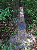 |
Memorial stone Dr. Julius Putzar | Bielatalstraße 118 (near) (map) |
re. 1863 | Memorial stone for Julius Putzar, founder of the cold water sanatorium, with a bronze portrait medallion - of local significance. Dr. Julius Putzar, founder of the cold water sanatorium. |
09223080
|
| Residential stable house | Camillo-Schumann-Strasse 4 (map) |
re. 1773 | Upper floor half-timbered, boarded gable side, of architectural significance. Half-timbered, inscribed in the keystone of the basket arch door. |
09222950
|
|
 |
Residential house with retaining wall | Cunnersdorfer Strasse 4 (map) |
around 1700 | Upper floor half-timbered, plastered on a hillside, historically important |
09222999
|
 |
Residential building | Cunnersdorfer Strasse 5 (map) |
around 1700 | Upper floor half-timbered, of architectural significance |
09300149
|
 |
Apostolic Church | Cunnersdorfer Strasse 11 (map) |
probably 1950s | elevated lying, of importance in terms of building history and local history. Elongated plastered building with gallery and west building, with gable roof. |
09222997
|
 |
Residential house in semi-open development | Dresdner Strasse 1 (map) |
re. 1850 | Significant in terms of building history and the setting of the square, marked above the door, with balcony and shop. |
09222860
|
 |
Residential house in half-open development with rear building | Dresdner Strasse 3 (map) |
1st half of the 19th century | Significant in terms of building history and the appearance of the square, with a balcony and shop. |
09222861
|
 |
Residential house in open development | Dresdner Strasse 4 (map) |
re. 1844 (above the door) | Historically important, late classicist structure with a hipped roof. |
09222908
|
 |
Residential house in open development | Dresdner Strasse 8 (map) |
Mid 19th century | With rich stucco ornamentation, of importance in terms of building history and the street scene. Late classical structure, hipped roof, fine ornamentation. |
09222905
|
 |
Former District Court (now residential building) | Dresdner Strasse 9 (map) |
re. 1892-1893 | Former District court with enclosure and small lime tree avenue (garden monument), next to it memorial stele OdF, memorial for fallen soldiers of the First and Second World War - representative, free-standing courthouse, of architectural and local significance. OdF memorial stele : four sandstone blocks with stairs, fencing: to the west of the building, fence with cast-iron ornamental grille and base as well as fence posts made of sandstone (ancillary system), access: straight path towards the main entrance, water-bound ceiling, sandstone channels on both sides, cut linden avenue, opposite , Terrain falls slightly from south to north, view to the other side of the Elbe. |
09222910
|
 More pictures |
War memorial for the fallen soldiers of the First World War | Dresdner Straße 9, 9 (in front) (map) |
1920s | Sandstone block with an iron cross , with the inscription "Gedenket Unser" and a list of names, of local significance. Relocated from Hainstrasse to Dresdner Strasse 9. |
09223085
|
 |
Old prison | Dresdner Strasse 9a (map) |
1892 | Residential house in open development with fencing and gate pillars - former prison, clinker brick building, of architectural and local significance, |
09222909
|
 |
Elbe villa | Dresdner Strasse 10 (map) |
1902 according to information | Residential house, outbuildings, retaining walls, villa garden and fence - villa-like residential building on a hillside, of architectural and artistic importance. Residential house: with bay window and decorative framework. |
09222904
|
 |
Residential house (with memorial plaque) in open development and on a hillside | Dresdner Strasse 11 (map) |
around 1860; later overmolded | Birthplace of the musician Fritz von Bose, of local history. Inscription: "Birthplace of the composer, pianist and music teacher Fritz von Bose 1865-1945". |
09222907
|
 |
Residential house in open development and on a hillside | Dresdner Strasse 13 (map) |
around 1905 | Significant in terms of building history and the appearance of the street, rich roof landscape, with ornamental framework, wooden balconies, etc. a. |
09222906
|
 |
Fountain with figurative gargoyles | Dresdner Strasse 13 (near) (map) |
around 1900 | of cultural and historical importance. Flat, rectangular bowl with a semicircular attachment (all sandstone), with a metal head (bronze?) As a gargoyle. |
09223081
|
| Residential stable house and barn of a farm | Flatness 3 (card) |
re. 1747 | Stable house upper floor half-timbered, boarded up barn, of architectural and economic significance, with baroque arched door, marked in the keystone. |
09223022
|
|
| Main building of the country inn | Flatness 7a (card) |
End of the 19th century | Upper floor half-timbered, of architectural and local significance |
09223024
|
|
| Residential stable house | Flatness 8 (card) |
inside re. 1686 | Upper floor timber-framed, important in terms of building history and house history |
09223026
|
|
| Farm (Dreiseithof) with residential stable house and angled outbuilding | Flatness 9 (card) |
re. 1824 | Farm (three-sided courtyard) with residential stable house and angular outbuildings (including a barn) as well as old paving in the courtyard - historically and economically important. Stable house (upper floor half-timbered, with three basket arch doors, one marked in the keystone). |
09223025
|
|
| Residential building | Flatness 9 (to) (card) |
End of 18th century | Upper floor half-timbered, of architectural significance |
09223027
|
|
| Johanneshof | Flatness 10 (card) |
re. 1855 | Residential stable house and two side buildings of a four-sided courtyard - residential stable house upper floor half-timbered, marked over the lintel, of architectural and local importance. |
09223028
|
|
| Residential stable house | Flatness 11 (card) |
around 1800 | Upper floor half-timbered, of architectural and socio-historical importance |
09223031
|
|
| Farm with stable house and side building | Flatness 12 (card) |
around 1800 | Stable house upper floor half-timbered, boarded up, of architectural and economic importance. |
09223030
|
|
| Farm with stable house, barn and side building | Flatness 13; 14 (card) |
around 1800 | Farm with residential building (No. 13), barn, side building (boarded up) and former pigsty (now residential building, No. 14) - residential building, upper floor half-timbered, boarded up, of architectural and economic significance. |
09223029
|
|
 |
Residential house in open development and on a hillside | Elbhäuserweg 1 (map) |
around 1900 | historically important. Facade with plaster structure, old windows. |
09222903
|
 |
Residential building with outside staircase | Elbhäuserweg 2 (map) |
re. 1847 | Upper floor half-timbered, of architectural significance |
09222902
|
 |
Residential building | Elbhäuserweg 3 (map) |
Mid 19th century | on a hillside, historically important, plastered building with a crooked hip roof . |
09222901
|
 |
Residential building on a hillside | Elbhäuserweg 4 (map) |
1st half of the 19th century | Upper floor half-timbered structure, historically important, hipped roof with bat dormers. |
09222900
|
| House and outbuildings | Elbhäuserweg 20 (map) |
Mid 19th century | Upper floor half-timbered house, of architectural significance. Former Farm with country inn (information), outbuildings without rear building (marked above the door) with barrel vaulted cellar. |
09223004
|
|
| Residential house in open development | Elbhäuserweg 22 (map) |
1900/1905 | with ornamental framework and wooden extensions, of architectural significance |
09223005
|
|
| Former Brick barn | Elbhäuserweg 25 (map) |
End of 18th century | Residential house in open development - connection with the former brick property, with high mansard roof and basket arch door, of architectural and economic importance. Two-story plastered building with a mansard roof and dormers. |
09223077
|
|
| Sandstone bench | Goethestrasse - (map) |
1932 | inscription plaque in the backrest: “To the memory of Albert Hörig Geb. Vfd Sächs. Switzerland Ortsgruppe Königstein «, of local history. |
09223098
|
|
 More pictures |
Totality of Königstein cemetery with the individual monuments: cemetery chapel, mortuary, crypt house of the Schumann family on the wall on the mountain side, two tombs, retaining walls within the cemetery and enclosure wall as well as cemetery design (garden monument) | Goethestrasse - (map) |
19th century | Totality of Königstein cemetery, consisting of the following individual monuments: cemetery chapel, cemetery, crypt house of the Schumann family on the wall on the mountain side, two tombs, retaining walls within the cemetery and enclosure wall (individual monuments ID No. 09222858) and cemetery design (garden monument) with two cemetery walls running parallel to the enclosure wall Rows of linden trees - important in terms of local history and landscape design. Note: the western part of the cemetery between the upper row of linden trees and the retaining wall in the west has been abandoned and overgrown, only the Schumann family crypt is freely accessible. |
09301197
|
 More pictures |
Königstein cemetery: cemetery chapel, cemetery, crypt house of the Schumann family on the wall on the mountain side, two tombs, retaining walls and enclosure wall (individual monuments to ID no. 09301197) | Goethestrasse - (map) |
1880 (chapel) | Individual features of the totality of the Königstein cemetery: cemetery chapel, burial hall, crypt house of the Schumann family on the wall on the mountain side, two tombs, retaining walls within the cemetery and enclosure wall - of architectural and local significance. Cemetery chapel as a small neo-Romanesque-neo-Gothic hall church (sandstone block construction with gable facade and three-sided choir closure). Tomb Pauline Hilma and H. Otto Adler (1849–1913, 1847–1918), two pairs of columns with architraves, a female figure in the middle with a bowl in the right, tomb Friedrich August Kayser (1823–1879), sandstone tomb with angel relief, family tomb house Schumann (family of musicians). |
09222858
|
 |
Residential house in half-open development and enclosure | Goethestrasse 1 (map) |
1st half of the 19th century | Significant building history and urban planning, three-storey massive extension to Kirchgasse (with basket arch door). |
09222829
|
 |
Residential house in half-open development and staircase | Goethestrasse 4 (map) |
Early 19th century | with shop fitting (or workshop), of importance in terms of building history and urban planning. |
09223076
|
 More pictures |
Ev. City Church St. Marien Koenigstein | Goethestrasse 5 (map) |
1720-1724 | City church Königstein - historically and locally of importance. Evangelical town church, formerly St. Marien. A church near the banks of the Elbe was given to the Teutonic Order by King Wenceslaus II of Bohemia (1271–1305) and is mentioned in 1321. Moved to the current location after 1428, new building 1597–1599. |
09222834
|
 |
Well in the arch of a retaining wall | Goethestraße 6 (near) (map) |
1st half of the 19th century | of cultural and historical importance. Small fountain in wall niche: angular bowl, above metal plate with fish head, sandstone / bronze. |
09222833
|
 |
town hall | Goethestrasse 7 (map) |
1st third of the 19th century | Town hall with a walled-in stove top - of architectural and local importance. Elongated head building, furnace plate iron art casting, inscribed, with the coat of arms of the foundry manager Christian Friedrich Münch (Oberhütte in Rosenthal). |
09222851
|
 |
Former Library | Goethestrasse 8 (map) |
re. 1811 | Residential house in semi-open development - important in terms of building history and the appearance of the street, marked 1811 in the basket arch door. |
09222847
|
 |
Residential house in semi-open development | Goethestrasse 9 (map) |
around 1800, core probably older | Significant in terms of architectural history and the appearance of the street, with a basket arch door. |
09222852
|
 |
Residential house in almost closed development | Goethestrasse 10 (map) |
around 1860 | Birthplace of the composer Georg Schumann , of architectural and local significance. Inscription: "Birthplace of the composer, conductor, pianist and composition teacher Georg Schumann 1866–1952." |
09222848
|
 |
Residential house in open development and rear part of the building (older, partly with half-timbering) | Goethestrasse 11 (map) |
18th century | historically important. Front house: half-timbered construction in the gable, with basket arched door, marked 1876 in the keystone. |
09222853
|
 |
Residential house in almost closed development | Goethestrasse 12 (map) |
18th century | with shop fitting, of architectural and urban significance, stairs and mansard roof. |
09222849
|
 |
Residential house in open development | Goethestrasse 13 (map) |
re. 1847, later changed | historically important |
09222855
|
 |
Semi-open residential building with stairs | Goethestrasse 14 (map) |
1st third of the 19th century | Significant in terms of building history and the appearance of the street. Mansard roof, with basket arch door. |
09222850
|
 |
Residential building | Goethestrasse 19 (map) |
around 1800, possibly older | Upper floor timber-framed boarded, historically important |
09222856
|
 |
Diaconate | Goethestrasse 22 (map) |
1899 (information) | representative, free-standing building with a richly structured facade, of importance in terms of architectural history, the history of the town and the appearance of the street, plastered ashlar. |
09222854
|
 |
Hotel Lindenhof Koenigstein | Gohrischer Strasse 2 (map) |
re. 1849 (beginning) | Hotel construction on a sandstone terrace - representative, free-standing building, of architectural and local significance, with arched windows. |
09222953
|
| Residential house in open development | Gohrischer Strasse 10 (map) |
1924 (information) | in the country house style, historically important. Boarded gable, original windows with shutters, sandstone plinth. |
09222952
|
|
| Hotel complex, consisting of a main building and an angular outbuilding as well as a park | Gohrischer Strasse 20 (map) |
around 1900 | Hotel complex, consisting of the main building and angular outbuildings, as well as a park with sculptures and fountains, garden pavilion and fencing with gate pillars - of architectural and local significance. Main building around 1900, auxiliary building more recent. |
09222951
|
|
 |
Residential house in open development | Hainstrasse 1 (map) |
Core probably 18th century | See also Pirnaer Straße 4, of importance in terms of building history and the appearance of the street |
09223102
|
| Memorial stone for the victims of fascism | Halbestadt 13 (near) (map) |
around 1980 (OdF monument) | small memorial stone on a sandstone base, of local significance. Inscription: "The dead admonish. This youth hostel was abused as a concentration camp from March to August 1933. Here comrade Fritz Gumpert from Heidenau was murdered by the Nazis". |
09223073
|
|
| Residential stable house | Halbestadt 17 (map) |
re. 1851 | Upper floor half-timbered, one gable boarded up, of architectural significance |
09223006
|
|
| Memorial stone for the soldiers from Halbestadt and Ebenheit who fell in 1914–1918 | Halbestadt 17 (near) (map) |
after 1918 | of local importance. Sandstone block on a base, with stairs, inscription: "In gratitude / 1914-1918 / Our brothers who fell in the World War / Halbestadt flatness / For the fatherland fell ...", the stairs are flanked by two bowls on sandstone platforms. |
09223007
|
|
| Apartment building in open development and on a hillside | Halbestadt 22 (map) |
around 1900 | Significant in terms of architectural history, with decorative framework, wooden balconies and ashlar basement floor. |
09223074
|
|
| Earthenware from Halbestadt | Halbestadt 25 (map) |
re. 1587 | Farm with house, barn and side building - important in terms of building history and house history. Residential house: plastered sandstone block, marked above the door, old garments, weather vane, spherical gable crown, barn burned down on March 3, 1933 and rebuilt (according to information), without rear extension. |
09223008
|
|
| school | Halbestadt 26 (map) |
1873 | with late classicist influences, relevance to building and local history as well as importance to urban planning. Two-storey solid plastered building with a distinctive pyramid roof, quite original wall-opening ratio, birthplace of the Bach researcher Werner Neumann (1905–1991). |
08951442
|
|
| Napoleon's house | Halbestadt 28 (map) |
re. 1575 | Residential house (surrounding area) and historical fountain - upper floor half-timbered, important in terms of building history and house history. Andrew's cross , boarded gable, steep gable roof, changed. |
09223009
|
|
| Residential house in open development | Halbestadt 34 (map) |
1910/1914 (information) | Architecturally important, mansard gable roof with hip foot. |
09223010
|
|
| Residential stable house (no. 40) as well as western and southern (no. 35) barn of a former farm | Halbestadt 35; 40 (card) |
Beginning 19th century | Stable house upper floor timber-framed boarded up, barns boarded up, of architectural significance, dwelling house subsequently widened. |
09223011
|
|
| Country inn with seating niche portal | Halbestadt 39 (map) |
17th century | Upper floor half-timbered, of architectural and local significance |
09223012
|
|
| So-called. Napoleonstrasse - roadway with sandstone pavement | Halbestadt 40 (near) (map) |
Beginning 19th century | Beginning of the so-called Napoleonstrasse, road with sandstone pavement from Halbestadt to Ebenheit - of local significance, between 3.50 m and 4.50 m wide, length a good 500 m. |
08951453
|
|
| Farm with house and barn | Halbestadt 41 (map) |
re. 1823 and 1862 | Upper floor half-timbered house, of architectural and economic importance. |
09223013
|
|
| Farm with stable house, barn, fencing and gate pillars | Halbestadt 44 (map) |
End of the 19th century | Stable house upper floor half-timbered, of architectural and economic importance. |
09223015
|
|
| Residential stable house | Halbestadt 50 (map) |
1840 according to information | Upper floor half-timbered, of architectural significance |
09223016
|
|
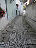 |
Old pavement | Kirchgasse - (map) |
19th century | of importance for the townscape |
09222859
|
 |
Residential house (with restaurant) in a corner | Kirchgasse 1 (map) |
re. 1635, reshaped | In terms of building history, shaping the streetscape and the local history. Right part of the building marked inside, left part of the building renewed in 1845, left: two basement floors (with ice cellar). |
09222830
|
 |
Residential building in closed development | Kirchgasse 2 (map) |
around 1800 | gable, important in terms of the history of the building and the appearance of the street, with a mansard roof. |
09222831
|
| Residential building | Kleiner Weg 19 (map) |
Early 19th century | Upper floor half-timbered, boarded up, of architectural and socio-historical importance. |
09222994
|
|
 More pictures |
Memorial stone for those who died in the First World War, plus stairs | Kleiner Weg 19 (forward) (map) |
after 1918 | of local importance. Sandstone block on base, with bronze plaque, inscription: "In memory of our loved ones", name on bronze plaque. |
09222995
|
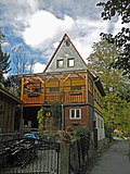 |
Residential building | Kleiner Weg 29 (map) |
around 1800 | Upper floor half-timbered, boarded gable, of architectural significance |
09222993
|
| Residential building | Mittelweg 14 (map) |
re. 1845 | Upper floor half-timbered, gable sides boarded up, labeled, of architectural significance |
09222962
|
|
 |
School and gym | Mühlgasse 1 (map) |
3rd third of the 19th century | Significant local history, beautiful staircase |
09222845
|
 |
Old school | Mühlgasse 1 (map) |
re. 1778 | of importance in terms of building history and local history. Elongated, two-storey plastered building with the inscription: "Ministerio templi et scholae dicatum et exstructum 1778". |
09222846
|
 |
Bee mill | Mühlgasse 4; 6 (card) |
18th century | U-shaped mill complex, consisting of an older building with a half-hip roof, a newer factory building with a pilaster structure , a connecting building and a separate residential building (No. 6) as well as a chimney, ancillary building (No. 4) and two archways - of architectural and local significance. Residential building (number 4, small floor plan, two-story with hipped roof, Renaissance building) and mill building (number 6). |
09222843
|
 |
Old city brewery | Pfaffenberg 6 (map) |
around 1850, Kern possibly. older | Residential house in semi-open development - historically and urbanistically important, two-storey massive building with a very steep pitched roof that characterizes the square, simple construction from the pre-historic period, core older (without newer extensions). |
08951443
|
 |
Residential house in almost closed development and hillside location | Pfaffenberg 12 (map) |
around 1800 | Of importance in terms of building history and urban planning |
09222886
|
 |
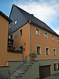
Residential building | Pfaffenberg 13 (map) |
around 1800 | Upper floor half-timbered, clay compartments, historically important. House on a high sandstone base. |
09222875
|
 |
Residential building on a hillside | Pfaffenberg 14 (map) |
around 1800 | Gable boarded up, half-timbered plastered ?, of importance in terms of building history and urban planning |
09222885
|
 More pictures |
Residential house in open development | Pfaffenberg 15 (map) |
1586 Dendro | with structural peculiarities, architectural significance, age value behind the changed facade, ground floor half-timbered building with two-layer block wreath on the beam position, half-timbered double-bar with foot struts, gable facing away on the "Umschrot" also with head struts, board ceiling, former half-timbered house , two-layer Umschrot in Saxon Switzerland so far singular. |
09304190
|
| Residential house in semi-open development | Pfaffenberg 17 (map) |
1st half of the 19th century | Workplace of Carl Friedrich Poppe and Amalie Dietrich (1821–1891), of architectural and local significance. Inscription: "Workplace of the senior of the floristic exploration of Saxon Switzerland master weaver Carl Friedrich Poppe 1804-1877. The famous naturalist Amalie Dietrich stayed here before 1860". |
09222876
|
|
 |
Two-part house | Pfaffenberg 19 (map) |
around 1700 | Upper floor half-timbered with St. Andrew's crosses, of importance in terms of building history and house history. Half-timbered. |
09222877
|
 |
Residential building on a hillside | Pfaffenberg 23 (map) |
around 1800; later changed | Upper floor half-timbered, partly boarded-up, of building historical importance, attached to the gable |
09222878
|
 |
Residential building on a hillside | Pfaffenberg 25 (map) |
around 1800 | over an angled floor plan, of architectural significance |
09222879
|
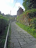 |
Sandstone arch bridges and old pavement | Pfaffenberg 30 (from) (map) |
around 1900 | Sandstone arch bridges - of importance in terms of building history and traffic history |
09222880
|
 More pictures |
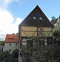
Residential building | Pfaffenberg 31 (map) |
1600 dendro | Over an angled floor plan, of importance in terms of building history and the street scene, age value, middle section independent of the gable. |
09222881
|
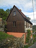 |
Residential building on a hillside | Pfaffenberg 36 (map) |
around 1800 | Upper floor half-timbered, historically important, large gate on the gable side on the mountain side. |
09222883
|
 |
Residential building on a hillside | Pfaffenberg 39 (map) |
End of 18th century | Upper floor timber-framed boarded, historically important |
09222882
|
 More pictures |
Residential building on a hillside | Pfaffenberg 43 (map) |
around 1600 | Upper floor half-timbered plastered, gable boarded up, of architectural and socio-historical importance, age value. |
09222884
|
 |
Residential house in open development with extension | Pirnaer Strasse 2 (map) |
18th century | With a shop zone, of importance in terms of the history of the building and the townscape, cripple hip. |
09222836
|
 |
Residential house in open development | Pirnaer Strasse 3 (map) |
re. 1790 | Significant in terms of building history and urban development, with basket arch portal, marked in the keystone. |
09222837
|
 |
House in a corner | Pirnaer Strasse 4 (map) |
18th century | see also Hainstraße, of architectural and urban significance, uniform shop area made of basket arched windows at the end of the 19th century. |
09222827
|
 |
Old rectory | Pirnaer Strasse 5 (map) |
1st third of the 19th century | Former rectory in open development with high water mark - of architectural and local significance, with mansard roof, home of the composer and Bach researcher Wilhelm Werker (1873–1948). |
09222835
|
 |
House in a corner | Pirnaer Strasse 7 (map) |
1st half of the 19th century | Significant in terms of building history and the appearance of the street, with a basket arched door and shop fittings from the end of the 19th century. |
09223075
|
 |
Julius Otto monument and house with pharmacy | Pirnaer Strasse 8; 8 (forward) (map) |
around 1800 | Birthplace of Ernst Julius Otto (1804–1877) - important in terms of building history, local history and the appearance of the streets. Head building, stele with inscription: "Born in Königstein on September 1st, 1804, died as music director in Dresden on March 5th, 1877." |
09222928
|
 |
Residential house in semi-open development | Pirnaer Strasse 9 (map) |
Mid 19th century | with the original shop front, important in terms of building history and urban planning |
09222930
|
 |
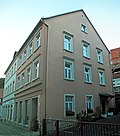
Residential building in closed development | Pirnaer Strasse 10 (map) |
2nd half of the 19th century | Significant in terms of building history and urban development, mansard roof. |
09222927
|
 |
Residential house in semi-open development | Pirnaer Strasse 11 (map) |
3rd third of the 19th century | with the original shop front, important in terms of building history and urban planning |
09222929
|
 |
Residential house in semi-open development, plus rear building with arcade | Pirnaer Strasse 13 (map) |
18th century | with shop fitting, of importance in terms of building history and the appearance of the street |
09222832
|
 |
Former Hotel "Zum Blauen Stern" | Pirnaer Strasse 15 (map) |
re. 1811, changed | Former hotel with a newer hall extension - of architectural and local significance. Front building, arched door marked, house subsequently added, with wooden veranda and former prince's room. |
09222926
|
 |
Residential house in a corner and closed development | Pirnaer Strasse 20 (map) |
Core probably 18th century | Significant in terms of building history and the appearance of the street. Mansard roof with a crooked hip, with a basket arch door. |
09222917
|
 |
Residential building in closed development | Pirnaer Strasse 22 (map) |
1st half of the 19th century, core older | Of importance in terms of building history and urban planning |
09222916
|
 |
Residential building in closed development | Pirnaer Strasse 24 (map) |
around 1800; later changed | Significant in terms of building history and urban development, with a basket arch door |
09222915
|
 |
Residential house in a corner and closed development | Pirnaer Strasse 26 (map) |
1st half of the 19th century, core older | with modern shop fittings, of importance in terms of building history and urban planning |
09222914
|
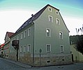 |
House in a corner | Pirnaer Strasse 28 (map) |
Mid 19th century | Historically important, wrought-iron balcony console, hipped roof. |
09222913
|
 |
Schumann House; former city pipe | Pirnaer Strasse 29 (map) |
around 1860 | Simple house (with inscription plaque) on a hillside - the house of the important musicians Georg Schumann, Alfred Schumann, Camillo Schumann (1872–1946) and Clemens Schumann (1876–1938) - of local significance. Inscription: "Schumann-Haus / former town pipe / 1868-1909 / home of important / musical personalities / Georg, Alfred, Camillo / and Clemens Schumann." |
09222828
|
 |
Amtshof | Pirnaer Strasse 30 (map) |
1st half of the 19th century, core possibly older | Residential house (with restaurant) in semi-open development - important in terms of building history and urban development. Two-storey plastered building with gable roof, more recent loft extension, with basket arch door, without extension. |
09223083
|
 |
Apartment building in half-open development | Pirnaer Strasse 31 (map) |
around 1930 | historically important. Plastered building with gable roof, ground floor clad in sandstone. |
09223084
|
| Old pavement | Pladerberg - (map) |
19th century | Characteristic of the townscape and of importance for the history of traffic, large sandstone slabs between No. 24 and No. 30. |
09222949
|
|
 |
Villa on a hillside, with retaining wall | Pladerberg 2 (map) |
around 1905 | built in the reform style of the time around 1905, of structural and architectural significance. Residential castle, mostly ashlar facade, with bay window. |
09222943
|
 |
Villa, with banister and fence (retaining wall) | Pladerberg 4 (map) |
1900/1905 | on a hillside, historically important. Raised ashlar basement, bay window with tower hood, ornamental framework. |
09222944
|
 |
Residential house in open development and on a hillside | Pladerberg 14 (map) |
around 1910 | historically important |
09222946
|
 |
Residential house in open development and on a hillside | Pladerberg 16 (map) |
around 1900 | historically important. Façade with wooden balcony on massive bossed square consoles, with decorative framework. |
09222945
|
 More pictures |
Post mileage | Platz am Frog - (card) |
re. 1727 | Copy of a sandstone distance pillar from 1976, significant in terms of traffic history. Monument text: Copy of an electoral Saxon distance column marked 1727 made of sandstone, almost four meters high, on the small Biela Bridge, in the typical form of an obelisk on a high plinth, inscribed with distance information, with two Polish and two Lithuanian spa coats of arms as well as "AR" monogram and post horn mark . The column changed its location several times, in 1921, restored in 1955/56, set up in its current location in 1956. Copy from 1976 by the Dresden sculptor Werner Hempel (1904–1980). |
09222863
|
 |
Oval fountain basin with a frog | Platz am Frog - (card) |
20th century | Sandstone, of cultural and historical importance |
09222864
|
 |
Wall hook for overhead wire suspension of the Bielatal Motorbahn (trolley bus) | Schandauer Strasse - (map) |
1901 | of importance in terms of traffic history, cf. also Bahnhofstrasse and Bielatalstrasse |
09223063
|
 |
Sandstone arch bridge over the Große Hirschke | Schandauer Strasse - (map) |
re. 1933, older | of importance in terms of building history and technology history |
09222963
|
 |
Residential house in open development | Schandauer Strasse 7 (map) |
around 1880 | historically important |
09224368
|
 |
Residential house in open development | Schandauer Strasse 8 (map) |
2nd half of the 19th century | with a richly structured facade, of importance in terms of building history and the street scene. Gable roof, central projectile, 2 balconies (one with Tuscan columns ), plaster strips, stucco mirrors. |
09222941
|
 |
Residential house in open development and on a hillside | Schandauer Strasse 10 (map) |
1910s | Historically important, with corner bay windows and multi-part roof zone. |
09222942
|
 |
Residential house in open development with retaining wall and enclosure | Schandauer Strasse 16 (map) |
after 1894 | Historically important, with sandstone plinth and wooden winter garden. |
09222955
|
 |
Semi-detached house in open development | Schandauer Strasse 18; 20 (card) |
1905/1910 | Elevated, with decorative framework, of architectural significance |
09222956
|
 |
Residential house in open development, with enclosure and archway | Schandauer Strasse 26 (map) |
1890s | Significant in terms of building history and the street scene , with a beautiful neo-renaissance portal, door and lead-glazed windows in the stairwell. |
09222957
|
 |
Residential house in open development | Schandauer Strasse 27 (map) |
1890s | Significant in terms of building history and the appearance of the street, with corner bay windows, elaborate facade structure and window arcades. |
09222961
|
 |
Residential house in open development | Schandauer Strasse 28 (map) |
around 1910 | Elevated, important in terms of the history of the building and the appearance of the street, with half-timbering, corner turrets and multi-part roof zone. |
09222958
|
 |
Residential house in open development | Schandauer Strasse 38 (map) |
4th quarter of the 19th century | historically important. Plaster structure, disfiguring roof extension, with corner turrets. |
09222960
|
 |
Residential house in open development | Schandauer Strasse 56 (map) |
around 1905 | Elevated, villa-like building, historically important, with corner turrets and ornamental framework. |
09222964
|
 |
Murder and Atonement Cross | Schreiberberg - (map) |
Late Middle Ages | Of local significance, sandstone cross 68 × 73 × 22 cm |
09222840
|
 |
Old pavement | Schreiberberg - (map) |
19th century | of importance for the townscape |
09222839
|
 |
Residential house, plus stairs and terrace made of sandstone | Schreiberberg 2 (map) |
re. 1765 | Upper floor half-timbered structure, of importance in terms of building history and character of the townscape. Half-hip roof with baroque portal, inscribed in the keystone. |
09222841
|
 |
Residential building | Schreiberberg 2a (map) |
around 1800, core possibly older | Upper floor half-timbered, partly boarded up, of importance in terms of building history and character of the townscape. |
09222842 |
Leupoldishain
| image | designation | location | Dating | description | ID |
|---|---|---|---|---|---|
 |
Residential stable house | At the hill 1 (map) |
1st half of the 19th century | Upper floor timber-framed boarded up, gable boarded up, of structural and economic importance. |
09223480
|
 |
Stable house of a farm | Dorfstrasse 4 (map) |
re. 1804 | Upper floor half-timbered, clad gable side, with basket arched door, marked in the keystone, of architectural significance. |
09223483
|
 |
Residential stable house | Dorfstrasse 5 (map) |
1st half of the 19th century | Upper floor half-timbered, boarded gable, of importance in terms of building history and the street scene. |
09223482
|
 |
South stable house (No. 8), side building and barn (No. 9) of a three-sided courtyard and gate pillars | Dorfstrasse 8; 9 (card) |
18th century, probably older, barn and stable more recent | Stable house upper floor timber-framed boarded up, side building upper floor boarded up, massive barn, of structural and economic importance, structure-defining courtyard. |
09223481
|
 |
Residential stable house and two side buildings of a three-sided courtyard | Dorfstrasse 15 (map) |
after 1900 | Residential stable house, plastered construction with the influence of the Swiss style, structure-defining courtyard, of architectural and economic importance. Two-storey solid plastered building with an intact wall-opening ratio, flat saddle roof with overhang, the two side buildings also solid. |
08951450
|
 |
Residential stable house and barn of a two-sided courtyard | Dorfstrasse 19 (map) |
1st half of the 19th century, younger barn | Stable house upper floor timber-framed boarded up, of architectural and economic importance. |
09223484
|
 |
Residential stable house and barn of a two-sided courtyard | Dorfstrasse 21 (map) |
re. 1841 | Upper floor residential barn, partly timber-framed, marked in the lintel, boarded-up barn, changed, of architectural and economic importance. |
09223485
|
 |
Residential stable house (No. 26), house for migrants (No. 25) and barn of a three-sided courtyard | Dorfstrasse 25; 26 (card) |
re. 1846 | Stable house upper floor half-timbered, marked 1846 in the lintel, upper floor half-timbered house for escapes, marked 1838 in the arched door, significant in terms of building history, economic history and the street scene, structure-defining courtyard. |
09223487
|
 |
Eastern barn with attached side building, two gate pillars and courtyard wall of a farm | Dorfstrasse 27 (map) |
19th century | Barn - natural stone building with a mansard gable roof, side building stone plinth, wooden construction boarded over it, two large gate openings on the courtyard side, gable roof with small roof turrets, of architectural and economic importance. |
09223488
|
 |
Stable house and barn of a Hakenhof | Dorfstrasse 32 (map) |
Mid 19th century | Stable house upper floor timber-framed boarded up, street-side massive gable with twin windows, of architectural and economic importance. |
09223489
|
 |
Former stable house | Koenigsteiner Strasse 14 (map) |
Mid 19th century | Upper floor half-timbered, partly boarded up, of architectural significance |
09223477
|
 |
Old school | Koenigsteiner Strasse 21 (map) |
4th quarter of the 19th century | School building with retaining wall - plastered building with over-gabled corner projections and wooden bell tower, clock in the gable field, of architectural and local significance. Two-storey, today residential building. |
09223476
|
 |
Residential mill house | Koenigsteiner Strasse 24 (map) |
re. 1831 | Upper floor half-timbered, of architectural and local significance |
09299665
|
 |
North-west residential stable, north-east side building and two barns of a four-sided courtyard, plus a gate pillar | Lantzschweg 4 (map) |
re. 1816 | Stable house, upper floor, timber-framed boarded up, marked in the arched door, of architectural and economic importance, structure-defining courtyard. |
09223478 |
Pfaffendorf
| image | designation | location | Dating | description | ID |
|---|---|---|---|---|---|
 |
Multi-part restaurant construction Pfaffenstein | (Map) | 1890-1904 | Berggasthof Pfaffenstein - partly half-timbered, partly boarded up, of architectural and local importance. |
09224315
|
| Pfaffenstein shooting range | (Map) | 1900/1905 | castle-like complex made of sandstone, of architectural and local significance |
09221698
|
|
 More pictures |
Pfaffenstein observation tower | (Map) | 1904 | stone tower with two platforms, of architectural and local significance |
09224316
|
 |
Residential building | Am Stallhübel 1 (map) |
re. 1825 | Upper floor half-timbered house, arched door marked in the keystone, elevated, important from an architectural point of view. |
09224294
|
 |
Residential building | Am Stallhübel 3 (map) |
1st half of the 19th century | Upper floor timber-framed boarded, historically important |
09224291
|
 |
Sandstone path | Am Stallhübel 3 (behind) (map) |
19th century | Sandstone path - approx. 2.50 m wide and 150 m long, sandstone blocks, hardly worked, laid in a natural way, partly hewn cubes, of importance in terms of cultural history and the appearance of the street. |
09228386
|
 |
Residential building | Am Wiesenrain 1 (map) |
1st half of the 19th century | Upper floor timber-framed boarded, historically important |
09224305
|
 |
Residential building | Am Wiesenrain 2 (map) |
Early 19th century | Upper floor half-timbered, e.g. Partly boarded up, changed, historically important. |
09224304
|
| Arch bridge over the Potatschke | Pfaffenberg - (map) |
Arch bridge over the Potatschke; Sandstone, historically important. |
09224297
|
||
 |
U-shaped channel made of sandstone cubes with incorporated steps | Pfaffenberg - (map) |
19th century | Significant in terms of building history and character of the townscape, only parcel 61a up to the municipal boundary. |
09229745
|
| Paved path and landmark | Pfaffenberg - (map) |
19th century | Sandstone path, at the lower end boundary stone with the inscription "Gemeinde Pfaffendorf", characterizing the townscape and of importance in terms of local history. Sandstone path 2–3 m wide, path length 150–200 m, boundary stone with the inscription “Gemeinde Pfaffendorf”, height approx. 40–50 cm. |
09228387
|
|
 |
Residential building | Pfaffenberg 42 (map) |
around 1800 | single-storey half-timbered building, wooden door frame, high degree of originality, of architectural significance. |
08951451
|
 |
Residential building | Pfaffenberg 49 (map) |
According to information from 1828 | Upper floor half-timbered, boarded gable, of architectural significance |
09224298
|
 More pictures |
Memorial to the fallen of the First World War | Pfaffendorfer Strasse - (map) |
after 1918 (war memorial) | large sandstone block with inscription plaque within a green area, of local significance. |
09224310
|
 |
House and side building | Pfaffendorfer Strasse 8 (map) |
Early 19th century | Residential building upper floor half-timbered, boarded gable, historically important. |
09224288
|
 |
Residential building | Pfaffendorfer Strasse 10 (map) |
Early 19th century | Upper floor timber-framed boarded, gable slated, of architectural significance, basket arched door. |
09224289
|
| Stone cross | Pfaffendorfer Straße 11 (in front) (map) |
Late Middle Ages | Late medieval way, memorial or atonement cross made of sandstone, of local significance, one arm is missing. |
09221699
|
|
 |
Residential house with retaining wall | Pfaffendorfer Strasse 14 (map) |
Early 19th century | Upper floor timber-framed boarded up, elevated, important from an architectural point of view |
09224290
|
 |
Residential building | Pfaffendorfer Strasse 18 (map) |
Early 19th century | Upper floor timber-framed boarded, historically important |
09224293
|
 |
Residential building | Pfaffendorfer Strasse 23 (map) |
re. 1782 | Upper floor half-timbered, gable slated, basket arched door marked in the keystone, of architectural significance |
09224313
|
 |
Residential building | Pfaffendorfer Strasse 25 (map) |
According to information from 1840 | Upper floor half-timbered, partly boarded up, of architectural significance |
09224312
|
 |
Former Gasthaus Erbgericht | Pfaffendorfer Strasse 28 (map) |
18th century, outbuildings more recent | Side building and courtyard wall with archway and gate of a former farm - side building partly half-timbered, keystone in the archway formerly marked 1776, of architectural and local significance. |
09224300
|
 |
Residential stable house | Pfaffendorfer Strasse 31 (map) |
re. 1834 | Upper floor timber-framed, inscribed above the basket arch door, of architectural significance |
09224311
|
 |
Residential stable house | Pfaffendorfer Strasse 40 (map) |
re. 1846 | Plastered building with a crooked hip roof, inscribed brackets above the door, historically significant |
09224314
|
 |
Residential building | Pfaffendorfer Strasse 50 (map) |
Early 19th century | Upper floor timber-framed boarded, historically important |
09224301
|
 |
Residential stable house | Pfaffendorfer Strasse 55 (map) |
re. 1808 | with porches, upper floor timber-framed boarded, door lintel marked, historically important |
09224307
|
 |
Lindenhof Pfaffendorf | Pfaffendorfer Strasse 58; 60 (card) |
re. 1836 | Residential stable house and pull-out house in a four-sided courtyard, with access road and paving in the courtyard - residential stable upper floor half-timbered plastered, five basket arch doors, some of them clogged, one marked, of importance from a building and social point of view. |
09224302
|
 |
House and side building | Pfaffendorfer Strasse 59 (map) |
Early 19th century | House upper floor timber-framed boarded up, gable side slated, side building boarded up, of architectural significance. |
09224306
|
 |
Barbarinenhof, now a residential building | Pfaffensteinweg 5 (map) |
re. 1824 | Residential house (Umgebung) - upper floor half-timbered, basket arched door marked in the keystone, of architectural significance. Surrounded by sandstone pillars. |
09224303
|
 |
Residential house and retaining wall | Quellweg 2 (map) |
1st half of the 19th century | Upper floor timber-framed boarded up, elevated, important from an architectural point of view |
09224296
|
 |
Sandstone path | Quirlweg - (map) |
19th century | Sandstone slabs, hewn, approx. 2.50–3.00 m wide, approx. 50 m from the road, then from Quirlweg 7 (behind) approx. 130 m to the sports field, of importance for local history and for the appearance of the street, possibly of military history. |
09228383
|
 |
Residential building | Quirlweg 1 (map) |
Early 19th century | Upper floor half-timbered, boarded gable, of architectural significance |
09224292 |
Remarks
- This list is not suitable for deriving binding statements on the monument status of an object. As far as a legally binding determination of the listed property of an object is desired, the owner can apply to the responsible lower monument protection authority for a notice.
- The official list of cultural monuments is never closed. It is permanently changed through clarifications, new additions or deletions. A transfer of such changes to this list is not guaranteed at the moment.
- The monument quality of an object does not depend on its entry in this or the official list. Objects that are not listed can also be monuments.
- Basically, the property of a monument extends to the substance and appearance as a whole, including the interior. Deviating applies if only parts are expressly protected (e.g. the facade).
Detailed memorial texts
-
↑
Monument text
The road bridge between Königstein Fortress and Struppen, which now runs parallel and only a short distance away, originally led over the road bridge, dated 1828 according to the keystone , which spans a narrow inlet of the Waldbach am Vogelstein, which has now fallen dry . The single-arched bridge made of sandstone blocks has several structural features. For example, the bridge arch on the upstream and downstream sides (or west and east side) is shaped differently and increases upstream from a segmented arch to a semicircular cross-section with a correspondingly higher clearance. On both sides of the bridge, massive, slightly inclined wing walls flank the course of the stream, the bottom of which is lined with sandstone blocks in this area. The channel drops abruptly on the downstream side and forms an overflow. The road bridge marks the historical routing of the connecting road between Königstein Fortress and Struppen, and later Thürmsdorf, which was built at the beginning of the 19th century and has only recently been straightened . It is therefore of importance for the region in terms of the history of transport, but also has a technical and historical significance due to its special construction. There is an interplay of different construction elements that act on the flow, which slow down the water flowing through by changing the opening width and thus prevent damage to or undercutting of the structure itself and the subsequent stream bed by means of brick lining and overflow. Arch bridges that are structurally comparable are not yet known. Last but not least, the comparatively high construction costs for the structure spanning a rather insignificant stream allow conclusions to be drawn about the importance of the road that once crossed it.
-
↑
Fortress as a strongly fortified building ensemble on the rock plateau of the table mountain of the same name , the rayon (here: fortress front area) can be clearly demarcated as a designed open landscape from the adjoining wooded surroundings, of historical, artistic, scientific and landscape design importance. The preservation of the whole is in the public interest because of its historical, artistic, scientific and landscape design significance. Description of the garden monument:
- Vegetation: mixed old trees of deciduous and coniferous trees, consisting of a. from horse chestnut (Aesculus hippocastanum), common beech (Fagus sylvatica), linden (Tilia spec.), black pine (Pinus nigra), sycamore maple (Acer pseudoplatanus), norway maple (Acer platanoides).
- Hedges and shrubs: Ornamental shrub population, consisting primarily of lilacs (Syringa vulgaris), snowberries (Symphoricarpos orbiculatus), wild roses (Rosa spec.), Hazel (Corylus avellana), alpine currant (Ribes alpinum).
- Other protected assets: view of the entire surrounding region.
- Monument value: landscaping, regional history.
- Description of individual parts of the garden:
- Commander's garden: Reconstruction with a wooden gazebo, paths and plantings, integrated with originally preserved fence posts, sandstone stairs and sandstone edges as well as old trees (red beech, linden, Norway maple).
- Round linden tree with cut linden trees, so-called Augustusplatz: reconstructed in 1992, 79 linden trees were planted.
- Earth walls with sandstone walls and sandstone stairs that fasten the slope.
- Scenic part in the east of the site: curved paths with edges of sandstone fragments, water-bound cover, mixed deciduous trees (linden, maple, hornbeam, red beech, sycamore elm), as well as a species-rich herb layer (wood anemone, Solomon seal, woodruff), isolated ornamental shrubs (v. A. Rhododendron)
- New armory: east side, two horse chestnuts at the entrance.
- Old treasure house: farm garden with new fencing.
- Barracks B: private garden, laid out as a cottage garden, original fencing made of sandstone posts with wooden beams, to the west of this probably former orchard with the same fencing.
- Old barracks: five hawthorns (Crataegus laevigata) to the north.
- Monument to King Johann: base of polished granite with a marble bust, framed by rhododendron plants.
-
↑
The preservation of the whole is in the public interest because of its historical, artistic, scientific and landscape design importance, first mentioned in a document in 1241. The numbering of the individual monuments is based on the information on the isometric plan attached to the 1992 list of monuments, near Friedrichsburg König-Johann-Denkmal (marked 1881, back, design: Panzner, Otto): Monument for King Johann of Saxony (marble bust on granite pedestal, with Inscription), on flst. 619b fortress cemetery (end of the 17th century, part of the whole): The complex was devastated after 1945, its outlines can only be guessed at.
- Number 1: Rothe Bridge (1890, TD): seesaw bridge (wood / iron construction) as a replacement for drawbridge (around 1800).
- Number 2/3: Lower (outer) works (between 1755 and 1802): Fortification for shallow bombardment of the foreground including the area.
- Number 4: Hornravelin (between 1729 and 1736): casemated outer work to defend the fortress entrance, location of the gate guard (sandstone block construction with crenellated crown and barrel-vaulted gate passage, built according to plans by Johann Georg Maximilian von Fürstenhoff (1686-1753), since 1790 additionally with " Spanish rider "secured).
- Number 5: Trench shears (with Medusa gate) (1729-1736): with a pulling (from 1890) rocker bridge, casemated outer structure with barrel-vaulted gate passage ( Medusa head in the apex , above royal Polish and electoral Saxon coat of arms), gate passage with corner cuboid, cranked Cornice, parapet and coat of arms, Medusa head in the apex and keystone. Built according to plans by Johann GM von Fürstenhoff.
- Number 6: Torhaus (1589 ff., 1729-1736 portal, 1910 relief): multi-storey plastered building (with a representative portal, above a relief of Augustus the Strong, loopholes in the basement, upper floor used for residential purposes), defensive systems in the dark staircase: stone throwing , machicolation , Beam chalk, fall palisade, iron gates, gate: ashlar wall pillars with entablature and blind gable, in the keystone of the archway AR and Polish crown. In the cover above the gable image of August the Strong and coat of arms, on the right and left knight armor in relief (1910!), Gatehouse built according to plans by Paul Buchner (1531–1607).
- Number 7: Commandant's house (1589 ff.): Part of the gatehouse, apartment of the commandant and his family (large, multi-storey plastered building with a gable roof), number 6-8 is a coherent assembly.
- Number 8: Streichwehr (1589 ff.): Multi-storey plastered building, adjoining the gatehouse to the north (built to bombard the entrance area, basement accommodated guns, upper floor for residential purposes).
- Number 9: Georgenburg (1619, core building 14th century): Former Imperial castle, after 1619 Johann-Georgenburg (plastered building with two-storey, three-axis arbor, round arch portal and curtain arched windows, after 1619 used as a hunting lodge, then as a state prison).
- Number 10: Fortification to defend the entrance, inscription: "JOHA GEOR II SAX IUL CLI E MO DUX ELECT M DC LXXIX" ( Johann Georg II. (Saxony) ), above a piece of cornice with a free-standing coat of arms, architect: Wolf Caspar von Klengel ( 1630-1691).
- Number 11: New armory and caponier's corridor (marked 1816): large plastered building (marked in the keystone of the gate, inside three-aisled hall with groined vaults), further caponier's corridor with portcullis, built in 1661 as a ballroom (St. Wooden floor with trap doors to defend the stairway, after a fire it was rebuilt as an armory.
- Number 12: Well house (1735/1736), design: Jean de Bodt (1670–1745): three-storey plastered building with gable projections and hipped roof , plus well (depth: 152.5 m) and conveyor technology, coat of arms and crown in the gable area, well sunk by Freiberger and Marienberg miners under the direction of Martin Planer (1510–1582), water pumping initially by Göpelwerk, later pedal bike, from 1871 steam engine, from 1912 electric motor, since 1967 shut down.
- Number 13: Magdalenenburg (1621/1622, reconstruction 1818/1819): Longitudinal building (with staircase and clock tower, built as a Renaissance castle, conversion to a food store), 1725–1818 location of the 250,000 l giant wine barrel.
- Number 14: St. George's Chapel (core building Romanesque, reconstructions after 1515, 1676, 1681 tower, furthermore 18th-20th century): small hall church (with later added tower), originally castle chapel, after 1515 conversion to a monastery church, 1676 consecrated as a garrison church of St. George.
- Number 15: Old barracks (1589/1590, one side raised 1715/1716, design: Paul Buchner): two-storey, elongated building with a gable roof.
- Number 16: Treasury (1854/1855): small sandstone block building for the storage of the Saxon state treasure, built in the form of a powder magazine from the 18th century, bulletproof.
- Number 17: Hauptwache (end of the 19th century): one-story small plastered building with a gable roof.
- Number 18: Commander's horse stable (end of the 19th century): one-story small plastered building with a gable roof.
- Number 19: Crew barracks (1899): two-part, boarded brick building to accommodate infantrymen.
- Number 20: Ammunition loading system for battery VIII (1889-1891): underground system for preparing ammunition.
- Number 21: Horn and Seigerturm (after 1601): rocky promontory with observation tower, with sundial and Seiger bell.
- Number 22: Kriegskaserne IV (between 1767 and 1832): western part of the casemate complex , was used to accommodate soldiers, prisoners of war and military prisoners and for defense (marked in the keystones of the gates, cf. 24, 26 and 27).
- Number 24: Kriegskaserne III (1884-1885): part of the casemate complex (cf. 22, 26, 27 and 34).
- Number 26: Bäckereikasematte (after 1589, upper parts 1870s, remodeling in 1892): part of the casemate complex (cf. 22, 24, 27 and 34), as a bakery demonstrably since the beginning. Used in the 19th century,
- Number 27: Kriegskaserne II (1880): part of the casemate complex (cf. 22, 24, 26 and 34).
- Number 28: Officers 'mess (1895, renovation 1920s, older core building): former butcher's shop and butcher's apartment, since 1895 officers' mess (plastered building with half-timbered structure), single-storey plastered building with gable roof, central pavilion, new annex on the left (no monument), former butcher's shop on the right.
- Number 29: Altes Zeughaus (1594, reconstruction in 1871): massive plastered building with a gable roof, inside hall with Tuscan columns and groin vault, on the upper floor after 1871 cells for civil prisoners were installed.
- Number 32: Peace hospital (1878): simple two-story plastered building.
- Number 33: Artillery shed: simple elongated plastered building with a gable roof.
- Number 34: Kriegskaserne I (1888/1889): Part of the casemate complex (see numbers 22, 24, 26 and 27).
- Number 35: Ammunition loading system Battery VII: underground system for preparing the ammunition, with elevator.
- Number 37: Pest casemate: natural crevice, converted into a casemate after 1680, reconstruction at the end of the 19th century.
- Number 38: round observation and flanking towers made of sandstone blocks, after 1600.
- Number 39: War powder magazine (1889-1891): bulletproof underground casemate.
- Number 42: Treasure Casemate (1853): underground system made up of three barrel vaults (last used as an ammunition store), with an underlay for artillery.
- Number 44: Friedrichsburg (1589, remodeling 1731): pavilion-like, hexagonal central building with double flight of stairs (probably by MD Pöppelmann), originally an observation and flanking tower with a ballroom on the upper floor.
- Number 45: Bullet magazine & war powder magazine II (1735-1736, marked 1876): barrel-vaulted building covered with earth with sandstone facade, baroque tombstones from the fortress cemetery inside, plans by J. de Bodt, after 1883 only bullet magazine.
- Number 46: Park cistern (for collecting rainwater), probably medieval.
- Number 47: War hospital (1891-1893, marked 1893): one-story, underground casemate building.
- Number 49: Barracks B / Married Building (1897): large, free-standing plastered building (to accommodate married NCOs).
- Number 50: Hungerturm / Rößchen (before 1589): polygonal observation tower with a connecting bridge.
- Numbers 51–58: Battery positions I-VIII (from 1870): with artillery sub-areas and charging systems, VII and VIII also individual objects.
- Rayon: As a horizontal counterpart to the verticality of the fortress, it is also part of its defensive function, the associated landscape-shaping importance represents an important cultural point of identification in Saxony today.
- ↑ Main production building: plastered building with strongly protruding central projecting (elevator) and distinctive mansard roof, corner cuboid, core before 1900, but mostly 1930s, paper room to the north: facade corresponding to 1930s, administration building: three-storey plastered building with corner bay and stucco ornamentation, relief: "Auxilio Dei" , marked AD1920, rich interior (original stairs, doors, handrails), entrance complex originally u. a. Carpentry, redesigned to a portal situation before 1933. Paper mill at this point since the 16th century, fire in 1876, in the factory yard there was also the former terminus of the Bielatal motor train, which was important for the transport of workers as well as the spa guests of the Kaltwasseranstalt.
-
^
Factory owner's villa, Bielatalstrasse 92
- Villa: One-storey plastered building with a multi-part mansard roof, on a high sandstone base, inscription: "God give to all those who know us what they grant us inheritance. 1922 WZ", with a beautiful hall, original furnishings, hillside location, representative staircase.
- Remise: longitudinal building with raised corner buildings, ground floor sandstone cuboids, upper floor plastered, saddle roofs.
- Villa garden: structural assets
- Enclosure: plastered wall in the south of the property, sandstone ashlar at the corners, irregular closure, probably formerly with wooden picket fence panels,
- Development - entrances: main entrance from the south, large driveway and secondary gate (gate leaves are missing), secondary entrance from the west without gate.
- Path system: existing, partially water-bound ceiling, paths in the northwestern part of the building are framed by quarry stones, sandstone stairs at the northeast corner of the villa, formative concrete stairs with railing from the entrance to the villa (very dilapidated), horticultural buildings: in the northwestern part of the garden on the northern garden boundary made of sandstone (possibly bastion or site pavilion).
- Water elements: sandstone scoop in the east of the villa, small pond that has fallen dry (concrete basin with quarry stone border, typical of the time).
- Vegetation: Individual trees: dendrologically rich old trees from Judas tree (Cercis siliquastrum), common beech (Fagus sylvatica), copper beech (Fagus sylvatica 'Atropurpurea'), red-leaved norway maple (Acer platanoides 'Schwedleri'), English oak (Acerus robur) campestre), sycamore maple (Acer pseudoplatanus), ginkgo (Ginkgo biloba), hemlock (Tsuga canadensis), Europ. Larch (Larix decidua), yew (Taxus baccata), spruce (Picea abies), hedges and shrubs: large ornamental shrub stock of rhododendron in species and varieties, peasant jasmine (Philadelphus spec.), Holly (Ilex aquifolium), magnolia (Magnolia soulangiana), Perennials: high-quality shade perennials, in some cases possibly based on the original planting.
- Other protected assets: Ground relief - sloping in several levels from north to south, terraced area northeast of the scoop, retaining wall along the northern garden border, view: to the former factory, partially disturbed.
-
↑
Garden - landscaped hillside garden
- Ground relief: terrain sloping sharply to the north, essentially terraced in three levels: top terrace south and south-east of the building with a retaining wall made of sandstone, retaining wall between the two buildings with three round arches, second level north of the villa, lowest level in the north of the property , the two lower levels are intercepted by embankments.
- Access: driveway and access path with clinker slabs southeast of the villa, zig-zag paths with small sandstone steps leading down the slope.
- Water element: small, dry-fallen sandstone pond below a sandstone rock east of the villa.
- Equipment: two sandstone vases on the pillars of the terrace railing east of the villa (a third one is missing), another sandstone vase without a foot near the pond in the garden (original location unknown).
- Vegetation: various conifers a. a. Hemlock fir (Tsuga canadensis), yew (Taxus baccata), columnar yew (Taxus baccata 'Fastigiata') and boxwood (Buxus sempervirens), below the villa there are mighty rhododendrons, as well as mountain ash (Sorbus aucuparia) and magnolia (Magnolia spec.) And various Fruit trees, ornamental shrubs and ferns.
- Visual relationships: simple viewing platform on the sandstone rock with a view over the Elbe valley, different views to the north of the river landscape from the upper two levels.
- Enclosure: retaining wall made of sandstone ashlar masonry with sandstone posts of a former wooden picket fence along the northern property line.
-
↑
Königstein Cemetery - Structural Protected Goods
- Buildings: chapel, Schumann family crypt house, cemetery. Enclosure: retaining walls on the east and west side, wall on the south side with pillars, all walls sandstone.
- Access: Entrances: 2 entrances, from the north via a ramp with double-leaf ornamental grille, in the east at the height of the chapel via stairs.
- Path system: available, paths parallel to the slope, partly covered with sandstone slabs, otherwise a water-bound ceiling, accessed via four long sandstone stairs running perpendicular to the slope from east to west, the northernmost staircase leads directly to the Schumann family crypt.
- Vegetation: avenues and rows of trees: cut row of linden trees (Tilia spec.) Along the eastern retaining wall, a second row of linden trees (Tilia spec.) Parallel to it in the middle of the cemetery behind the funeral hall, two of which are still preserved, the rest of the row as stumps present, single trees: copper beech (Fagus sylvatica 'Atropurpurea') at the southern end of the cemetery.
- Other protected assets: Ground relief: cemetery laid out like terraces, terrain falls sharply from west to east, view: to the east on the opposite side of the valley, to the north to the Lilienstein.
- ^ Stadtkirche Königstein: Replacement of the old church 1720–24 by the current church, which was built under the advice of George Bähr (1666–1738). Destroyed in the town fire in 1810, but the outer walls and the tower were restored in 1810-28. Restoration in progress since 1995. Classicist hall church with polygonal choir ( 5/8 end ) and integrated west tower. The exterior is characterized by buttresses and the tall and narrow framed basket-arch windows with roofing, which are divided at 2/3 height by horizontal stone beams. The west tower with rectangular windows, the upper free storey approximated to an octagon by bevelled edges, the hood with small portholes and a pointed helmet, after 1810. Above the plain west entrance city arms and coat of arms from Electoral Saxony, around 1600 (?). The interior with galleries on both long sides. Mighty classical pulpit altar, a gabled column front, sandstone (Dehio Sachsen I, 1996).
-
↑
Farm, Halbestadt 25
Cellar: Vaulted. Ground floor: three-part division into living area, corridor and stable, for farmhouses unusual clear room height of over three meters, core of the house around the corridor is very old, u. a. with oven, entrance eater with horizontal flap and floor made of sandstone slabs. Two-flight wooden stairs above the basement entrance, cap vaults and two belt arches in the stable part, on the slope side stands for cows, on the Elbe side a spacious pig pen, slurry drainage through an open gutter across the yard to the lower-lying sandstone-lined manure place (photo p. 32). Upper floor: corridor and outgoing chambers, interior walls made of half-timbered. Roof truss and roof: rafter roof with single standing chair, plain plain tile roofing with wooden planks. Other: Exterior plaster of the house old, several layers of paint - tints in white, gray, green, blue and ocher. Formerly well in front of the house, spilled. M. Hammer. -
↑
Residential building, Halbestadt 28
- Basement: Outside the house under the hay barn built on the slope, vaulted from sandstone blocks, L: 3.60, W: 2.80 and H: 1.95 (m), floor made of sandstone slabs, partly used as a fruit cellar, as there is a large amount of fruit growing was operated.
- Ground floor: steeply sloping hallway with floor made of sandstone slabs, living room, behind it a small kitchen separated from 1960, beamed ceilings that were painted in the room after 1960. Hay shed: attached to the rear of the house and completely renewed after 1960, access to the roof space on the slope side via a wheelbarrow catwalk.
- Upper floor: corridor and two chambers facing the Elbe, the back half-timbered wall in the connecting area of the hay barn partially originally preserved - clay scratch pattern and thin lime plaster on it.
- Roof truss and roof: Previously used as a hayloft, simple standing chair, full shuttering and bitumen shingles, some of which were converted into sleeping quarters. Remains of the massive part of the house: cellar still within the house area, vaulted, ventilation opening above the door walls, used until 1956 as a beet and potato cellar. Walls of the first floor largely preserved, lintel (east side) made of sandstone with the year 1575, door jambs to the half-timbered part (west side) strongly framed. Ceiling beams partially preserved, as well as the push-in staircase to the no longer existing upper floor. M. Hammer.
- ↑ In 1722, the Electorate of Saxony began to erect the Saxon post-mile pillars . Elector Friedrich August I wanted to build a modern traffic and transport control system in the electorate in order to promote trade and economy. He entrusted Magister Adam Friedrich Zürner (1679 - 1742) with the implementation. The system of post mile pillars comprised distance pillars, quarter milestones, half and full mile pillars. The distance columns should be set up in the cities in front of the city gates, later only on the marketplaces. Quarter milestones, half and full mile pillars were set up along the Poststrasse. They received a consecutive numbering (row number), starting from the beginning of the measurement. The all-mile columns were set up outside the cities on the post roads at a distance of 1 mile (= 9.062 km). The distance pillars were marked with the monogram "AR" for "Augustus Rex", the Electoral Saxon and Polish-Lithuanian double coat of arms and the Polish royal crown. The full mile, half mile columns and quarter milestones were all similarly labeled, none of them had a coat of arms, but the monogram "AR". The distances were given in hours (1 hour = ½ post mile = 4.531 km). This mile system was the first European traffic management system. The pillar considered here is of great importance in the history of traffic as part of the nationally significant postal system.
swell
Web links
Commons : Kulturdenkmale in Königstein (Saxon Switzerland) - Collection of images, videos and audio files
