List of cultural monuments in Bad Schandau
The list of cultural monuments in Bad Schandau contains the cultural monuments in Bad Schandau . The notes are to be observed.
This list is a partial list of the list of cultural monuments in the district of Saxon Switzerland-Eastern Ore Mountains .
This list is a partial list of the list of cultural monuments in Saxony .
Legend
- Image: shows a picture of the cultural monument and, if applicable, a link to further photos of the cultural monument in the Wikimedia Commons media archive
- Designation: Name, designation or the type of cultural monument
-
Location: If available, street name and house number of the cultural monument; The list is basically sorted according to this address. The map link leads to various map displays and gives the coordinates of the cultural monument.
- Map view to set coordinates. In this map view, cultural monuments are shown without coordinates with a red marker and can be placed on the map. Cultural monuments without a picture are marked with a blue marker, cultural monuments with a picture are marked with a green marker.
- Dating: indicates the year of completion or the date of the first mention or the period of construction
- Description: structural and historical details of the cultural monument, preferably the monument properties
-
ID: is awarded by the State Office for the Preservation of Monuments in Saxony. It clearly identifies the cultural monument. The link leads to a PDF document from the State Office for the Preservation of Monuments in Saxony, which summarizes the information on the monument, contains a map sketch and often a detailed description. For former cultural monuments sometimes no ID is given, if one is given, this is the former ID. The corresponding link leads to an empty document at the state office. The following icon can also be found in the ID column
 ; this leads to information on this cultural monument at Wikidata .
Bad Schandau
| image | designation | location | Dating | description | ID |
|---|---|---|---|---|---|
 |
Bad Schandau monument protection area | (Map) | Proposal for a conservation area |
09300006
|
|
 |
Former hotel | On the Elbe 4 (map) |
around 1880 | Former hotel (now a tenement house) in closed development (without an extension on the Elbe side) - historically and historically important, location on the banks of the Elbe that characterizes the townscape |
09222070
|
 |
Residential house in semi-open development | On the Elbe 6 (map) |
1870s | Of importance in terms of building history and urban planning |
09222071
|
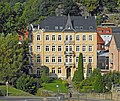 |
Apartment building in open development | On the Elbe 10 (map) |
re. 1894 | With a Wilhelminian style facade, historically important, location on the banks of the Elbe that defines the townscape. |
09222072
|
 |
Residential house in open development | At the Elbe 12 (map) |
re. 1898 | based on the Swiss style , historically important, location on the banks of the Elbe that defines the townscape. |
09225449
|
| Residential house in open development | Badallee 3 (map) |
2nd half of the 19th century | Residential house in open development, gazebo and enclosure - important in terms of urban planning and the street scene. |
09222120
|
|
| Garden shed | Badallee 5 (map) |
1900/1905 | Garden shed, two enclosures and a water pump - part of a residential building, and an important part of the street |
09222119
|
|
 |
Residential house in open development | Badallee 6 (map) |
1900/1905 | Without an intermediate building to the neighboring house no. 5, of importance in terms of building history and the appearance of the street. |
09222118
|
 |
Residential house in open development, with enclosure | Badallee 7 (map) |
1905/1910 | Emphasized entrance area based on the reform style, of importance in terms of building history and the appearance of the street. |
09222117
|
 |
Elementary school Bad Schandau | Badallee 8 (map) |
1900/1910 | School building in open development - of architectural and local significance |
09222116
|
| Residential house with connecting structure | Badallee 9 (map) |
around 1910 | Residential building with a connection to the school in semi-open development and staircase - important in terms of urban planning and shaping the street scene |
09222115
|
|
 |
Residential house in open development with fencing | Badallee 13 (map) |
1860s | Neo-renaissance facade, of importance in terms of building history and shaping the street scene. |
09222114
|
 |
Poliwania house | Badallee 15 (map) |
3rd quarter of the 19th century | Residential house in semi-open development, in front of it a house garden (garden monument) - of importance in terms of urban planning and the street scene. House garden with two copper beeches and rhododendrons designed symmetrically (garden monument). |
09222253
|
 More pictures |
Unity of the railway line Bad Schandau - Sebnitz - Neustadt i. Sat with several individual monuments | Bad Schandau station 4a; 5; 6 (card) |
1870s | Unity of the railway line Bad Schandau – Sebnitz – Neustadt i. Sa. with the following individual monuments: reception building (No. 5, 6) and residential building (No. 4a), (starting point of the railway line, individual monuments ID No. 09224147), as well as the individual features of the route summarized in the aggregate documents under the following ID No. : 09302084 to 09302086 ( Hohnstein ), 09302087 ( Sebnitz, OT Altendorf ), 09302088 ( Sebnitz, OT Lichtenhain ), 09302089 ( Neustadt i. Sa., OT Krumhermsdorf ), 09302090 and 09302091 ( Neustadt i. Sa. ), 09302092 (OT Porschdorf), 09302093 to 09302095 ( Rathmannsdorf ), 09302096 ( Sebnitz, OT Hainersdorf ), 09302098 ( Sebnitz ), 09305214 (OT Prossen), 09279061 ( Sebnitz, OT Schönbach ) - important in terms of building history, railway history and technology history. |
09302083
|
 More pictures |
Bad Schandau train station (individual monuments to ID no.09302083) | Bad Schandau station 4a; 5; 6 (card) |
1870s | Individual features of the entity railway line Bad Schandau – Sebnitz – Neustadt i. Sa .: Reception building (No. 5, 6) and residential building (No. 4a) - important in terms of building history, railway history and technology history. Entrance building: elongated solid plastered building, two-storey, with a gabled central projection and two side projections, typical Swiss-style roof overhang, wall-opening ratio intact, mostly built between 1874 and 1877. |
09224147
|
 |
Residential house in semi-open development | Basteiplatz 3 (map) |
1880s | with shop fitting, of importance in terms of building history and urban planning |
09222094
|
 |
Residential building in closed development | Basteiplatz 5 (map) |
1880s | with risky emphasis on the center and the original shop front, of importance in terms of building history and urban planning. |
09222095
|
| House in a corner | Basteiplatz 6 (map) |
2nd half of the 19th century | Part of the older development on Basteiplatz, of importance in terms of building history and urban development |
09222066
|
|
 |
Residential house in open development with fencing | Basteistraße 20 (map) |
around 1900 | Significant in terms of building history and the appearance of the street. Original condition: iron terrace roofing, Herme etc. |
09222178
|
 |
Residential house in open development | Basteistraße 22 (map) |
around 1800 | Angular construction, important in terms of building history |
09222177
|
 |
Apartment building in open development | Basteistraße 32 (map) |
4th quarter of the 19th century | Significant urban development, location on the banks of the Elbe that defines the townscape |
09222175
|
 |
Residential house in open development | Basteistraße 34 (map) |
2nd half of the 19th century | Historically important, location on the banks of the Elbe that defines the townscape. Original condition (windows and doors). |
09222174
|
 |
Apartment building in open development | Basteistraße 36 (map) |
1880s | Significant urban development, location on the banks of the Elbe that defines the townscape |
09222173
|
 |
House in a corner | Bergmannstrasse 1 (map) |
around 1910 | with a shopping area, of architectural significance |
09222069
|
 |
Residential building in closed development | Bergmannstrasse 4 (map) |
1905/1910 | with a shop zone, of importance in terms of building history and urban planning |
09222130
|
 |
Two school buildings | Bergmannstrasse 4b (map) |
re. 1888 | of local importance |
09222144
|
| Tenement house | Bergmannstrasse 5 (map) |
around 1900 | with shop fitting, of importance in terms of building history and urban planning |
09222068
|
|
 |
House in a corner, with staircase and fence | Bergmannstrasse 7 (map) |
1895/1900 | with a shop area, representative plastered facade with an elaborate structure, of importance in terms of building history and urban planning. |
09222067
|
 |
Rectory | Dampfschiffstrasse 1 (map) |
18th century | Rectory, with gate pillars and wrought iron enclosure - of architectural and local significance |
09222042
|
 |
Residential building with pharmacy | Dresdner Strasse 2 (map) |
2nd half of the 19th century, core building older | Residential house (with pharmacy) in a corner location - important in terms of urban planning and the street scene |
09222258
|
 |
Movie theater of peace; National Park House | Dresdner Strasse 2b (map) |
1953 | Free-standing hall building with open staircase and gable risalit, of architectural and local significance, original lights preserved. |
09222162
|
 |
town hall | Dresdner Strasse 3 (map) |
1920s | of importance in terms of building history and local history |
09222163
|
 |
Apartment building in open development | Dresdner Strasse 6 (map) |
1910s | historically important |
09222161
|
| Residential house in open development | Dresdner Strasse 7 (map) |
1922 according to information | Built in the local style, historically important, location on the banks of the Elbe that defines the townscape. |
09222159
|
|
 |
Apartment building in open development | Dresdner Strasse 8 (map) |
around 1920 | historically important |
09222160
|
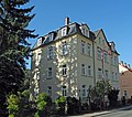 |
Apartment building in open development | Dresdner Strasse 11 (map) |
1890s | historically important |
09222157
|
| Apartment building in half-open development | Kirchstrasse 1 (map) |
re. 1901 | Facing brick facade, of importance in terms of urban development |
09222062
|
|
| Residential house in open development | Kirchstrasse 3 (map) |
around 1880 | Wilhelminian style facade , important in terms of urban development |
09222061
|
|
| Residential building in closed development | Kirchstrasse 4 (map) |
Early 19th century | Of importance in terms of building history and urban planning |
09222063
|
|
| Residential building | Kirchstrasse 5 (map) |
around 1800, changed | with a shop zone, of importance in terms of building history and urban planning |
09222060
|
|
| Residential building in closed development | Kirchstrasse 6 (map) |
re. 1822 | with shop fitting, of importance in terms of building history and urban planning |
09222064
|
|
 |
Residential house with rear extension (both half-timbered) | Kirchstrasse 10 (map) |
End of 18th century | with shop fitting, of importance in terms of building history and urban planning |
09222065
|
 More pictures |
Kirnitzschtalbahn | Kirnitzschtalstrasse (map) |
Tram through the Kirnitzschtal (from Bad Schandau to Lichtenhainer waterfall ) - important in terms of traffic and local history. |
09222256
|
|
 More pictures |
Unity of the Bad Schandau spa gardens with several individual monuments and spa gardens (garden monument) | Kirnitzschtalstrasse (map) |
1873 | The whole of the Bad Schandau spa park with the following individual monuments: open-air stage with two flanking pavilions and a memorial stone for those persecuted by the Nazi regime, this one opposite No. 27 (individual monument ID No. 09222257) and the spa park (garden monument) - of importance in terms of urban planning and local history. |
09302030
|
 |
Open-air stage with two flanking pavilions and a memorial stone for those persecuted by the Nazi regime (individual monuments to ID no. 09302030) | Kirnitzschtalstrasse (map) |
1950s | Individual features of the totality of the Bad Schandau Kurpark: Open-air stage with two flanking pavilions and a memorial stone for those persecuted by the Nazi regime, this one opposite No. 27 - of architectural and local significance. |
09222257
|
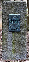 |
monument | Kirnitzschtalstrasse (map) |
1975-1976 | Roughly hewn cuboid made of Lusatian granodiorite , on the front a bronze plaque with outlines of the former GDR and the southern ice border as well as the inscription "Southern border of the Scandinavian inland ice in the Quaternary", historically and scientifically significant. |
09221680
|
| Sandstone arch bridge over the Kirnitzsch | Kirnitzschtalstrasse (map) |
re. 1847 | of importance in terms of building history and technology history |
09222241
|
|
| Bad Schandau waterworks | Kirnitzschtalstrasse (map) |
1896 | Free-standing building made of sandstone, of architectural and technological significance. |
09222184
|
|
 |
Kirnitzschtal Clinic; Spa building | Kirnitzschtalstrasse 6 (map) |
1882 | Spa building, drinking hall with monumental mosaic, in front of the building a free sculpture of the forest nymph and spa garden with a memorial to the fallen soldiers of the First World War - of architectural, artistic and local significance. Spa building: in contemporary historicist forms, with a comparatively lavishly designed hall, two-storey solid plastered building with intact wall-opening ratio, window bars in the original sense, inside hall with stage and pilasters , beautiful glass ceiling, in the drinking hall or fountain hall mosaic by Sascha Schneider , Dresden (allegory of the iron source). Marble nymph by Rudolph Hölbe , Dresden, 1895. War memorial on the grounds of the spa clinic: memorial stone under a canopy on a stepped platform. |
09222185
|
 |
Tram depot of the Kirnitzschtalbahn with workshop and residential building | Kirnitzschtalstrasse 8 (map) |
re. 1898 | Significant in terms of local history and traffic history, brick construction. |
09222244
|
 |
House of Albrechtsburg | Kirnitzschtalstrasse 13 (map) |
1870s | Apartment building in closed development - Wilhelminian style, important in terms of building history and urban development |
09222097
|
 |
Residential building (with restaurant) | Kirnitzschtalstrasse 17 (map) |
1860s | historic facade, of importance in terms of building history and urban development |
09222262
|
 |
Apartment building in half-open development | Kirnitzschtalstrasse 21 (map) |
1880s | Of importance in terms of building history and urban planning |
09222099
|
| Residential building on a hillside | Kirnitzschtalstrasse 31 (map) |
in facade 1680 | Upper floor half-timbered , of architectural significance |
09222102
|
|
 |
Villa Cagiatti | Kirnitzschtalstrasse 43 (map) |
around 1900 | Villa with ancillary building - the small round tower on the corner, on a hillside, built in the neo-Gothic style, is of importance in terms of building history and the street scene. |
09222103
|
 |
Residential house in open development | Kirnitzschtalstrasse 53 (map) |
1890s | historically important |
09222106
|
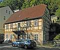 |
Residential house in open development | Kirnitzschtalstrasse 55 (map) |
1st half of the 19th century | Upper floor half-timbered, of architectural significance |
09222107
|
 |
Villa Hohenzollern | Kirnitzschtalstrasse 69 (map) |
1890s | Villa with enclosure - of importance in terms of building history and the appearance of the street |
09222111
|
 |
Residential house in open development and fencing | Kirnitzschtalstrasse 73 (map) |
around 1905 | Wilhelminian style facade with Art Nouveau elements, of importance in terms of building history and the street scene. |
09222109
|
 |
Residential house in open development with remains of the enclosure | Kirnitzschtalstrasse 75 (map) |
around 1880 | u. a. architectural significance. Two-storey solid plastered building with a flat saddle roof , window plastering , two dominant gables (vase-crowned, decoration 1920s), original front door leaves, two balconies, smoothed gable side facing the street. |
09302735
|
| Residential house in open development and fencing | Kirnitzschtalstrasse 81 (map) |
around 1880 | late classicist facade, of importance in terms of architectural history and the appearance of the street. Stained glass in the stairwell, historic door leaf. |
09222179
|
|
 |
Villa Emma | Kirnitzschtalstrasse 83 (map) |
4th quarter of the 19th century | Villa with enclosure - neo-renaissance facade with stucco ornamentation and figural decoration, of importance in terms of architectural history, artistry and the street scene.
with beautiful stucco ornamentation, figural jewelry and columns. |
09222180
|
| Villa Anna | Kirnitzschtalstrasse 85 (map) |
4th quarter of the 19th century | Villa with enclosure and garden pavilion - Wilhelminian style facade with stucco ornamentation and figural ornamentation, of importance in terms of architectural history and the street scene, with stucco ornamentation and figural ornamentation, columns. |
09222181
|
|
| Former rifle house (without rear attachments) | Kirnitzschtalstrasse 87 (map) |
2nd third of the 19th century | Free-standing building, later a decoration school, of local significance. |
09222182
|
|
| Waldhäusl restaurant | Kirnitzschtalstrasse 89 (map) |
re. 1885 | Ornamental framework (Swiss style), of architectural and local significance. |
09222243
|
|
 |
Former Customs House | Koenigsteiner Strasse 4 (map) |
2nd half of the 19th century | Residential building in open development - former customs station, of local historical importance, on a high sandstone plinth, with a vaulted entrance area. |
09222048
|
| Old salt bar | Koenigsteiner Strasse 6 (map) |
18th century | Residential house (formerly a restaurant) - of architectural and local importance |
09222049
|
|
 |
Residential house in open development, outbuildings, fencing and gate pillars | Lindenallee 3 (map) |
End of the 19th century | Architecturally and economically important, some with original furnishings (staircase). |
09222147
|
 |
Residential house in open development | Lindenallee 5 (map) |
1880s | Significant in terms of building history and the appearance of the street |
09222148
|
 |
Residential building | Lindenallee 6 (map) |
around 1930 | Hillside location, built in the local style, of architectural and urban significance, with a high base made of bosses ashlars . |
09222150
|
 |
Residential building | Lindenallee 8 (map) |
around 1930 | Hillside location, built in the local style, of architectural and urban significance, with a high base made of bosses ashlars. |
09222151
|
 |
Residential building | Lindenallee 10 (map) |
around 1930 | Hillside location, built in the local style, of architectural and urban significance, with a high base made of bosses ashlars. |
09222152
|
 |
Villa Helena | Lindenallee 12 (map) |
4th quarter of the 19th century | Residential house in open development (without rear building) - important in terms of building history and the appearance of the street |
09222153
|
 |
Residential house in open development | Lindenallee 15 (map) |
around 1910 | historically important |
09225469
|
 |
Villa and enclosure | Lindenallee 21 (map) |
4th quarter of the 19th century | Neo-Renaissance facade, of architectural and artistic importance. With figure niches, especially beautiful! - partly renovated, partly plastic windows. |
09222154
|
 |
Residential building | Lindenallee 27 (map) |
1910s | built in the reform style of the time around 1910, historically important, with beautiful lead-glazed windows. |
09222155
|
 More pictures |
Bowl fountain | Marketplace (map) |
19th century | of importance for the appearance of the square |
09222255
|
 More pictures |
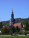
St. John's Church | Marketplace (map) |
1668-1671 | Church with church furnishings - flat-roofed hall church with west tower and polygonal choir, of importance in terms of architectural history, the history of the place and the appearance of the square. Evang. City Church of John the Baptist, originally St. Marien. Hall church , the eastern end as a 3/8-polygon. 1876/77 renovation of the interior, altar by Johann Walther (1572) - until 1760 in the Dresden Kreuzkirche , then until 1906 in the Annenkirche Dresden , 1927 reconstruction and current installation in the nave. War memorial for the First World War created by Georg Türke in 1927 (numbers for the Second World War added later). |
09222030
|
 |
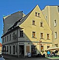
Corner restaurant and hotel with two courtyard entrances | Marketplace 1 (map) |
1883 (market side) | In terms of building history, shaping the landscape and the local history of importance. Inscribed in the door keystone, a ship depiction in the lintel above and an extension to the main building on the market side, with Tuscan columns on the ground floor. |
09222129
|
 |
House in a corner | Marketplace 2 (map) |
18th century | with shop, of importance in terms of building history and the appearance of the street |
09222031
|
 |
Hotel building (Elbe side) | Marktplatz 3 (map) |
around 1880 | representative building, of importance in terms of building history and character of the townscape.
Representative building and residential building (with newer shop fittings and wooden loggia), residential building and rear building on the market side, 18th century, demolished in 2006, hotel on the Elbe side renovated after the flood, around 1880. |
09222044
|
 |
Apartment building in closed development | Marktplatz 4 (map) |
1890s | Significant in terms of urban planning and the appearance of the square, with original door, stucco ceiling in the entrance area. |
09222032
|
| Hotel facade on the Elbe side and portal from the building on the Mark side presented as a spoil inside | Marktplatz 7 (map) |
after 1850 | Neo-Renaissance facade in the Venetian style with a significant impact on the townscape. The facade was restored after flood damage and integrated into the Hotel Elbresidenz as the last relic of the building. |
09222045
|
|
| Hotel facade on the Elbe side | Marktplatz 7b (map) |
1860 to 1870 | Neo-Renaissance facade in the Venetian style with a significant impact on the townscape. The facade was restored after flood damage and integrated into the Hotel Elbresidenz as the last relic of the building. |
09220770
|
|
 |
Residential building in closed development | Marktplatz 8 (map) |
18th century | Baroque building with a historically reshaped facade, of importance in terms of the history of the building and the appearance of the square. |
09222033
|
| Hotel in closed development | Marktplatz 9 (map) |
1890s | Architecturally and historically important, with original door. |
09222037
|
|
 |
Former Goldener Anker inn | Marketplace 10 (map) |
3rd quarter of the 19th century | Apartment building in closed development - with a gate passage, formerly with a restaurant, of architectural and local significance. |
09222035
|
 |
Hotel construction in a corner | Marktplatz 11 (map) |
1890s | Hotel construction in a corner location consisting of three parts of the building: after the market, after Königsteiner Straße (formerly Königsteiner Straße 1) and after the Elbe - an important part of the townscape. |
09222046
|
 |
Former brewery | Marktplatz 12 (map) |
re. 1680 | Former brewery yard in a space-defining location, with rear buildings (grouped around an inner courtyard), a stair tower and an elongated barn wing on the south side as well as an archway with an old gate to the market, on Dresdner Straße Torpfeiler - important in terms of building history, the history of the place and the appearance of the square. Inscribed in the keystone of the gateway to the market. |
09222034
|
| House and gate entrance | Marktstrasse 1 (map) |
in facade 1704 | with a shop zone, upper floor half-timbered, of importance in terms of building history and the appearance of the street. Nice shopping area, gate entrance marked in the keystone 1945. |
09222074
|
|
| Residential building in closed development | Marktstrasse 4 (map) |
18th century | with two shop fittings, one from the 19th century, of architectural significance. |
09222052
|
|
| Residential building in closed development | Marktstrasse 6 (map) |
1890s | of urban significance |
09222053
|
|
| To the Red House | Marktstrasse 10 (map) |
1st half of the 19th century | Residential house with restaurant in half-open development - upper floor half-timbered, of architectural and local significance. |
09222055
|
|
 |
Residential house in a corner and closed development | Poststrasse 1 (map) |
1880s, core building older | Significant in terms of building history and urban development, with arched portal and putti . |
09222059
|
 |
Residential house in half-open development with inscription plaque | Poststrasse 3 (map) |
Mid-18th century | Upper floor half-timbered, of architectural and local significance. Inscription: “Birthplace of Magister CG Hering founder of German music didactics born. 25 Oct 1766 died Jan. 4, 1853. “, original front door. |
09222058
|
 |
Post office | Poststrasse 5 (map) |
3rd third of the 19th century | Post office building in open development with rear building - historically important |
09222057
|
 |
Residential building in semi-open development | Poststrasse 6 (map) |
Early 19th century, core older | historically important |
09222093
|
 |
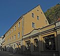
Residential house in semi-open development | Poststrasse 7 (map) |
1880s | with shop fittings, of importance in terms of building history and urban planning. Beautiful windows, original front door. |
09222056
|
 |
Residential house in closed development, with rear building and garden pavilion | Poststrasse 8 (map) |
Door rel. 1787 | Late baroque plastered building, back building half-timbered, of importance in terms of building history and the street scene. |
09222091
|
 |
Residential building | Poststrasse 10 (map) |
18th century | Upper floor half-timbered, with modern shop fittings, historically important |
09222090
|
 |
Old town house | Poststrasse 12 (map) |
Core building 2nd half of the 16th century | Former district court with a staircase in front of it - arbor , seat niche portal, representation of sailing ships and coat of arms in the facade, of importance in terms of building history, house history and local history. |
09222089
|
 |
Apartment building in closed development | Poststrasse 14 (map) |
1880s | with original shop front, Wilhelminian style facade, of architectural and urban importance. |
09222088
|
 |
Residential and commercial building in a formerly closed development | Poststrasse 16 (map) |
around 1905 | Late founding facade with echoes of Art Nouveau, of importance in terms of architectural history, artistry and the street scene. |
09222087
|
| gym | Rosengasse (map) |
1890s | of importance in terms of building history and social history. Flat rectangular building with blind arcade structure. |
09222073
|
|
 |
House in a corner | Rosengasse 1; 3 (card) |
1930s | in the Heimatstil, of architectural significance |
09222145
|
| Residential house in semi-open development | Rosengasse 7 (map) |
around 1800 | Upper floor half-timbered, of architectural significance |
09222146
|
|
| So-called. Raftsman Monument | Rudolf-Sendig-Strasse (map) |
19th century | Crowned sandstone pillar in the Kirnitzsch - historically important |
09304584
|
|
 More pictures |
Passenger elevator to Ostrau | Rudolf-Sendig-Strasse (map) |
1904-1905 | Bad Schandau passenger elevator - free-standing iron tower with bridge and wrought-iron railing, electric elevator, of importance in terms of technology and transport history. |
09222137
|
 |
So-called. Million building | Rudolf-Sendig-Strasse 1; 3; 5; 7 (card) |
No. 1 re. 1887 | Row of houses as the southern boundary of the spa park - with a shop area, of importance in terms of building history and urban planning |
09222122
|
 |
Haus zur Steinburg | Rudolf-Sendig-Strasse 2 (map) |
4th quarter of the 19th century | Residential house in open development - with the original shop front, of architectural significance |
09222131
|
 |
Residential house in open development | Rudolf-Sendig-Strasse 6 (map) |
4th quarter of the 19th century | historically important |
09222132
|
 |
Residential house in open development | Rudolf-Sendig-Strasse 8 (map) |
4th quarter of the 19th century | historically important |
09222133
|
 |
Residential house in open development | Rudolf-Sendig-Strasse 10 (map) |
after 1888 | House of the Sendig-Bauvereinigung, with arched style and late classicist influences, of architectural and local significance.
three-story solid plastered building, ground floor and first floor each with three central axes, round arches, overhang of the flat hip roof, eaves frieze with non-original painting, inside no decor (anymore), e.g. T. interior walls made of hewn sandstone, garden once went as far as the Elbe. |
09300430
|
 |
Hotel Lindenhof | Rudolf-Sendig-Strasse 11 (map) |
1890s | Hotel building (without front annex) and hotel garden (garden monument) - of importance in terms of building history, local history and the appearance of the street. Hotel garden: west of the hotel. |
09222121
|
 |
Sendig Hotel | Rudolf-Sendig-Strasse 12 (map) |
1880s | Hotel with main building and hall building of the hotelier Rudolf Sendig , within a former park area - of importance in terms of building history, local history and the appearance of the street. Main building with open pillared loggias, ballroom building with large open terrace and colonnades . |
09222139
|
 |
Villa Bohemia | Rudolf-Sendig-Strasse 15 (map) |
1870s | Villa (without rear extension) and enclosure - historically important |
09222134
|
 |
Residential house in open development and fencing | Rudolf-Sendig-Strasse 17 (map) |
1880s | built in the arched style, historically important |
09222135
|
 |
Catholic parish of St. Marien | Rudolf-Sendig-Strasse 19 (map) |
End of the 19th century | Church (former villa) with an integrated parsonage and enclosure - of architectural and local significance |
09222136
|
 |
Residential house and outbuildings in open development | Rudolf-Sendig-Strasse 21; 23 (card) |
4th quarter of the 19th century | Residential house (no. 23) and ancillary building (no. 21) in open development with a flight of stairs and cast-iron railing - of importance in terms of building history and shaping the street scene |
09222138
|
 |
Residential house in open development | Rudolf-Sendig-Strasse 27 (map) |
1890s, changed | Late founding facade, of architectural significance |
09222140
|
 |
Inscription in the rock behind the building | Rudolf-Sendig-Strasse 29 (behind) (map) |
re. 1791 | relevance to tourism history. “Honor to GOD alone. Ephraim Lebrecht Saupe built this garden for pleasure from 1780 to 1791 ”. |
09305268
|
 |
Residential house in open development and fencing | Rudolf-Sendig-Strasse 31 (map) |
around 1900 | Façade with echoes of the Swiss style, of importance in terms of building history and the appearance of the street. Particularly beautiful (old ridge tiles, beautiful canopy, wooden balcony) without a rear building. |
09222141
|
 |
Residential house in open development | Rudolf-Sendig-Strasse 33 (map) |
around 1900 | Residential house in open development (without rear building) and fencing - of importance in terms of architectural history and the appearance of the street. |
09222142
|
 |
Residential house in open development | Rudolf-Sendig-Strasse 35 (map) |
around 1900 | Residential house in open development (without rear building) and fencing - of importance in terms of architectural history and the appearance of the street. |
09222143
|
| Schiller monument and grotto | Schillerpromenade (map) |
1859 (monument) | historical and local historical relevance. Stele on pedestal approx. 350 cm high, with the inscription: “To the 10th Nov. 1859” (= Schiller's 100th birthday), “renewed in 1900”, grotto below the memorial: sandstone vault with keystone, stone bench. |
09304533
|
|
 More pictures |
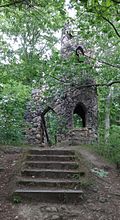
Remains of a medieval castle complex and artificial ruins | Schloßberg (map) |
14th century | Burgstall Schomberg - important in terms of local history. The Schlossberg or Schomberg probably served as an electricity and water control room to secure the movement of goods on the Elbe and the Hohen Strasse to the Lausitz. The traces of fire on the sparse remains (rampart, ditch, cistern ) indicate destruction in the Hussite Wars of 1419/1436. The artificial ruin (Staffagebau) was built as a lookout point by the builder Dachsel and inaugurated in 1883. |
09222324
|
 |
Residential building | Schloßberg 12 (map) |
17th century | Upper floor half-timbered, partly boarded up, of architectural and house-historical importance, renovated. |
09222098
|
 |
Residential building | Sebnitzer Strasse 6 (map) |
Early 19th century | Upper floor half-timbered, of architectural significance |
09222164
|
 |
Residential building | Sebnitzer Strasse 7 (map) |
re. 1835 | Upper floor half-timbered, of architectural significance |
09222259
|
 |
Residential building | Sebnitzer Strasse 10 (map) |
1st half of the 19th century | Upper floor half-timbered, of architectural significance |
09222165
|
 |
Residential building | Sebnitzer Strasse 11 (map) |
1848 according to information | Upper floor half-timbered, of architectural significance |
09222166
|
 |
Residential building | Sebnitzer Strasse 12 (map) |
1st half of the 19th century | Upper floor half-timbered, of architectural significance |
09222260
|
 |
Residential building | Sebnitzer Strasse 16 (map) |
Early 19th century | Upper floor half-timbered, of architectural significance |
09222167
|
 |
Residential building | Sebnitzer Strasse 21 (map) |
around 1800 | Upper floor half-timbered, of architectural significance |
09222169
|
 |
Residential building | Sebnitzer Strasse 27; 29 (card) |
1st half of the 19th century | Upper floor half-timbered, of architectural significance |
09222170
|
 |
Residential building | Zaukenstrasse 5 (map) |
1st half of the 19th century | Upper floor half-timbered, of architectural significance. Shop fitting. |
09222077
|
 |
Residential building | Zaukenstrasse 6 (map) |
1701/1800 | Upper floor half-timbered, independent from the gable, of importance in terms of building history and the street scene |
09222086
|
 |
Residential house in semi-open development | Zaukenstrasse 7 (map) |
Door rel. 1835 | Significant in terms of building history and urban planning, marked in the door frame “No. 90 JGER 1835 ". |
09222100
|
 |
Residential house in semi-open development | Zaukenstrasse 8 (map) |
2nd half of the 19th century, core building older | with half-timbered gable, of importance in terms of building history, house history and the street picture. Basket arched door with keystone and wrought iron gate, inscription "Craft, you count what you make of yourself". |
09222085
|
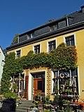 |
Gasthof Zum Bären | Zaukenstrasse 10 (map) |
2nd half of the 19th century | Inn (with seat niche portal, labeled) in half-open development - of architectural and local significance |
09222084
|
| Residential building in closed development | Zaukenstrasse 12 (map) |
2nd half of the 19th century | of urban significance. Three bat dormers. |
09222083
|
|
 |
Residential house in semi-open development | Zaukenstrasse 15 (map) |
According to information around 1850 | with shop fitting, important in terms of building history |
09222078
|
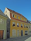 |
Residential house in almost closed development | Zaukenstrasse 17 (map) |
1st half of the 19th century | with more recent shop fittings, of importance in terms of building history |
09222079
|
 |
Residential house in semi-open development | Zaukenstrasse 19 (map) |
re. 1835 | with modern shop fittings, historically significant, inscribed in the door frame “No. 77 JGH 1835 ". |
09222080
|
 |
Apartment building in half-open development | Zaukenstrasse 20 (map) |
1890s | with shop fitting, important in terms of building history |
09222081
|
 |
Residential house in open development | Zaukenstrasse 21 (map) |
Mid 19th century | of urban significance.
with hipped roof, original front door with roof |
09225476
|
 More pictures |
Material entirety of Bad Schandau cemetery with several individual monuments and cemetery as a whole | Zaukenweg (map) |
around 1880 | Material entirety of Bad Schandau cemetery with the following individual monuments: chapel as a gatehouse to the cemetery, cemetery enclosure in the east and tomb (individual monuments ID No. 09222171), cemetery design with terracing, alleys and rows of trees (garden monument) and cemetery as a whole - of importance in terms of building history and local history. |
09302108
|
 More pictures |
Chapel as a gatehouse to the cemetery (individual monuments for ID No. 09302108) | Zaukenweg (map) |
re. 1887 | Individual features of the whole cemetery Bad Schandau: chapel as a gatehouse to the cemetery, cemetery enclosure in the east and tomb - of architectural and local significance. |
09222171
|
 |
Residential building | Zaukenweg 1 (map) |
1st half of the 19th century | Upper floor half-timbered, of importance in terms of building history and the appearance of the street. |
09222261
|
 |
Pilgrim's House | Zaukenweg 2 (map) |
re. 1787 | Residential house on a hillside, upper floor half-timbered, of importance in terms of building history and the street scene. Slated gable, inscribed wooden basket arch inside. |
09222172 |
Cribs
| image | designation | location | Dating | description | ID |
|---|---|---|---|---|---|
 More pictures |
Residential building | At station 2 (map) |
1895/1900 | Residential house in open development; Plastered building with corner tower and flattened hipped roof, belt cornice - historically important. |
09224145
|
 |
Front mill | Bächelweg 2 (map) |
re. 1801 | Mill building - upper floor half-timbered, boarded gable, of importance in terms of building history and the street scene. Basket arch door marked in the keystone, crooked hip . |
09224112
|
 |
Residential building | Bächelweg 3 (map) |
re. 1831 | Upper floor timber-framed boarded, historically important. Arched door marked inside |
09224113
|
 More pictures |
Gasthof Erbgericht | Bächelweg 4 (map) |
re. 1715 | Raised on a terrace, plastered building with a mansard gable roof , of architectural and local significance. Basket arch portal inscribed in the fighter, facade bend to the former Mühlgraben , inscribed: ANNO 1715 Leonhard. |
09224122
|
 |
Residential building | Bächelweg 5 (map) |
Mid 19th century | Upper floor half-timbered, of architectural significance |
09224117
|
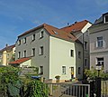 |
Former store | Bächelweg 7 (map) |
Mid 19th century | Upper floor timber-framed boarded, historically important |
09224115
|
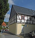 |
Residential building | Bächelweg 8 (map) |
Mid 19th century | Upper floor half-timbered, of architectural significance |
09224116
|
 |
Gasthof "Zur Eiche" | Bächelweg 10 (map) |
End of the 19th century | Inn with terrace and ancillary building - plastered building with gabled central projectile, belt cornice, wooden ancillary building, of architectural and local significance. |
09224114
|
 |
school-building | Bächelweg 11 (map) |
According to explanatory board 1781 (school) | Today a residential building with a modern shop fitting, simple plastered building with a saddle roof, the oldest school in the nativity scene, of local significance, two-storey plastered building. |
09224127
|
 |
Residential building | Bächelweg 16 (map) |
1st half of the 19th century | Upper floor half-timbered, of architectural significance |
09224131
|
 |
Residential building | Bächelweg 18 (map) |
According to information from 1830 | Upper floor half-timbered, of architectural significance |
09224132
|
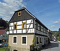 |
Residential building | Bächelweg 21 (map) |
Door lintel re. 1846 | Upper floor half-timbered, historically important, with a basement. |
09224134
|
 |
Residential house in open development | Bächelweg 25 (map) |
End of the 19th century | Plastered building with gabled central projection, of importance in terms of building history. Plaster ornamentation, metal decorative elements. |
09224135
|
 |
Residential building | Bächelweg 27 (map) |
1st half of the 19th century | Upper floor half-timbered, of architectural significance |
09224141
|
 |
Residential house in open development | Bächelweg 29 (map) |
End of the 19th century | Simple plastered construction, pitched roof, of importance in terms of urban development, old windows, plaster strips. |
09224136
|
 |
Residential building | Bächelweg 33 (map) |
re. 1830 | Without garage extension, upper floor half-timbered structure, basket arched door marked, historically important. Basement. |
09224111
|
 More pictures |
Carolahöhe viewing point | Berghangweg (map) |
19th century | semicircular vantage point with sandstone walls, sandstone benches and inscription plaque, of local historical importance. |
09224120
|
 |
Residential building | Berghangweg 12 (map) |
Mid 19th century | Upper floor half-timbered, elevated location, of architectural significance. |
09224124
|
 |
Residential building | Berghangweg 13 (map) |
re. 1690 | Upper floor half-timbered, elevated, of architectural significance, with basket arch door |
09224125
|
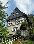 |
Residential building | Berghangweg 15 (map) |
1st half of the 19th century | Upper floor half-timbered, elevated position, historically important, changed, not renovated, windows on the ground floor enlarged. |
09224128
|
 |
Residential building | Berghangweg 16 (map) |
1st half of the 19th century | Upper floor half-timbered, elevated location, of architectural significance. |
09224129
|
 |
Residential building | Berghangweg 17 (map) |
around 1800 | Upper floor half-timbered, partly boarded up, of architectural significance. |
09224126
|
 |
Residential building | Berghangweg 18 (map) |
around 1800 | Upper floor half-timbered, of architectural significance. |
09224130
|
 |
Residential building | Elbweg 9 (map) |
1st half of the 19th century | Upper floor half-timbered, partly boarded up, of architectural significance. |
09224123
|
 |
Residential house in open development | Elbweg 10 (map) |
around 1920 | Plastered building with a gabled central projection, fine plaster structure, of importance in terms of building history. Volute gable. |
09224118
|
 |
Residential building (without extension) | Elbweg 22 (map) |
1st half of the 19th century | Upper floor half-timbered, partly plastered, originally a brickworks, later an inn and customs station as a test station for the shipping going down to the valley, of architectural and local significance. |
09224144
|
 More pictures |
Entity Ev. Parish church and churchyard Nativity scenes with several individual monuments and churchyard as a whole | Friedrich-Gottlob-Keller-Strasse (map) |
2nd half of the 19th century | Entity Ev. Parish church and churchyard Nativity scenes with the following individual monuments: neo-Romanesque hall church with south-west tower, war memorial for those who fell in the First World War, gravesite FG cellar and crypt house (individual monuments ID No. 09224099) as well as the cemetery as a whole - of architectural and local significance. |
09302544
|
 More pictures |
Parish church cribs, war memorial for the fallen soldiers of the First World War, gravesite FG cellar and crypt house (individual monuments to ID no. 09302544) | Friedrich-Gottlob-Keller-Strasse (map) |
1882 | Individual features of the entity Ev. Parish church and churchyard cribs: neo-Romanesque hall church with south-west tower, war memorial for the fallen of the First World War, grave of Friedrich Gottlob Keller and crypt house - of architectural and local significance. |
09224099
|
| Two villas at an angle with stairs | Friedrich-Gottlob-Keller-Strasse 1 (map) |
around 1880 | House 1 with late Classicist influence, House 2 characterized by the Swiss style, exposed location, of importance in terms of building history and urban development. House 1: three-storey and basement storey, massive plastered building with roof overhang, painted bands, mostly window crowns, gabled central projectile, here remarkable stucco frieze band (geranke, head, animals), some windows still with gallows. House 2: three-storey massive building with a gabled central projection, there two balconies, 2nd floor with ornamental half-timbering, roof overhang. |
09223775
|
|
 |
Railway house | Friedrich-Gottlob-Keller-Strasse 4; 5 (card) |
around 1900 | typical clinker brick building with towed gable roof, important in terms of railway history. |
09224089
|
 More pictures |
Station cribs | Friedrich-Gottlob-Keller-Strasse 7 (map) |
around 1900 | Reception building with platform roofing and covered exit with bus shelters, plus a fountain and two outbuildings connected to the reception building by walls - a half-timbered bus shelter, an octagonal sandstone trough fountain and a hand-operated pump , of architectural, railway and local significance. |
09224087
|
 |
Residential house in open development, with enclosure | Friedrich-Gottlob-Keller-Strasse 8 (map) |
End of the 19th century | Plastered building with a gabled central projection, there high arched windows, of architectural significance. |
09224090
|
 |
Residential house in open development with staircase | Friedrich-Gottlob-Keller-Strasse 9 (map) |
around 1900 | simple plastered building with boarded jamb, high plinth made of sandstone blocks with basement area, side stairs, historically important. |
09224091
|
 |
Residential house in open development | Friedrich-Gottlob-Keller-Strasse 10 (map) |
around 1900 | representative plastered building with flat saddle roof, of architectural significance.
Window parapets with sawn decorations |
09224092
|
 |
Residential house in open development, coach house and retaining wall with enclosure | Friedrich-Gottlob-Keller-Strasse 11 (map) |
3rd third of the 19th century | Representative plastered building with elevated central projections, emphasis on the facade by the balcony on the upper floor, which rests on four Doric columns, of architectural significance. |
09224093
|
 |
Residential house in open development | Friedrich-Gottlob-Keller-Strasse 16 (map) |
4th quarter of the 19th century | Plastered building with jamb floor, there round ventilation windows, emphasis of the center by the balcony, which rests on four brackets, of architectural significance.
with outside staircase and balcony |
09224095
|
 |
Residential house with an angled floor plan | Friedrich-Gottlob-Keller-Strasse 21 (map) |
re. 1690 | Upper floor half-timbered, historically important, age value. Slate roof. |
09224096
|
 |
Residential building | Friedrich-Gottlob-Keller-Strasse 27 (map) |
18th century | Upper floor half-timbered, partly boarded up, of architectural significance, age value. Half-timbered with St. Andrew's crosses . |
09224097
|
 |
Residential building | Friedrich-Gottlob-Keller-Strasse 31 (map) |
1st half of the 19th century | Upper floor half-timbered, of architectural significance. Slate roof. |
09224098
|
 |
Krippener school | Friedrich-Gottlob-Keller-Strasse 39 (map) |
re. 1906 | with elaborate plaster structure, of architectural and local importance. |
09224139
|
 |
Residential building | Friedrich-Gottlob-Keller-Strasse 48 (map) |
Door lintel re. 1844 | Upper floor half-timbered, of architectural significance. |
09224140
|
 More pictures |
Old school | Friedrich-Gottlob-Keller-Strasse 50 (map) |
1852 | Plastered construction on a high sandstone base, of local significance. |
09224101
|
 |
Post office building | Friedrich-Gottlob-Keller-Strasse 56 (map) |
around 1900 | Plaster construction with plaster blocks on the ground floor, belt cornice, saddle roof with free rafters , of importance in terms of building history. |
09224137
|
 |
Arch bridge over the Krippenbach | Friedrich-Gottlob-Keller-Strasse 63 (near) (map) |
19th century | Sandstone, historically important. |
09224142
|
 |
Residential building | Friedrich-Gottlob-Keller-Strasse 64 (map) |
1st half of the 19th century | Upper floor half-timbered, of architectural significance.
Beaver tail coverage |
09224150
|
 |
Former Poor house | Friedrich-Gottlob-Keller-Strasse 66 (map) |
Mid 19th century | Simple plastered building on a high base, of local significance.
three storeys |
09224102
|
 |
Residential building | Friedrich-Gottlob-Keller-Strasse 68 (map) |
re. 1792 | Upper floor half-timbered, of architectural significance. Basket arch door marked in the keystone, beautiful roof tiles. |
09224100
|
 |
Residential building | Friedrich-Gottlob-Keller-Strasse 71 (map) |
Mid 19th century | Upper floor half-timbered, of architectural significance. |
09224109
|
 |
Arch bridge over the Krippenbach | Friedrich-Gottlob-Keller-Strasse 71 (near) (map) |
19th century | Sandstone, historically important |
09224148
|
 |
Residential house in open development | Friedrich-Gottlob-Keller-Strasse 73 (map) |
around 1900 | representative plastered building with wooden balcony and ornamental framework in the gable, base in polygonal masonry, of architectural significance. |
09224108
|
 |
Friedrich Gottlob Keller memorial | Friedrich-Gottlob-Keller-Strasse 76 (map) |
According to the explanation board 1867 | Former Home of Friedrich Gottlob Keller - plain stucco building with übergiebeltem central projection, now a museum, local historical significance. With the inscription: “... Friedrich Gottlob Keller born. June 27, 1816 died September 8, 1895 ”. |
09224107
|
 |
Residential building | Friedrich-Gottlob-Keller-Strasse 78 (map) |
According to information from 1767 | Upper floor half-timbered, of architectural significance. House with sandstone plinth, upper floor partially boarded up, gable slated. |
09224106
|
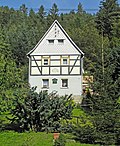 |
Residential building | Friedrich-Gottlob-Keller-Strasse 79 (map) |
1st half of the 19th century | Upper floor half-timbered, of architectural significance |
09224149
|
 |
Ham mill | Friedrich-Gottlob-Keller-Strasse 84 (map) |
re. 1832, older core | Residential mill house with mill wheel and mill ditch, plus rock cellar - residential mill house upper floor, partly solid, partly timber-framed, of importance in terms of building history and local history. |
09224105
|
| Former Hirschmühle subsidiary customs office | Hirschmühle 3 (map) |
1898 | Former Customs office - used today as a residential building, well-balanced, historicizing building, of architectural and local significance. Axially structured facade, base made of Cyclops masonry, accentuated by decorative gables, and the old windows are also striking. |
09223727
|
|
 |
Residential building | Kleinhennersdorfer Strasse 2 (map) |
re. 1784 | Upper floor half-timbered, of architectural significance. |
09224104
|
 |
Residential house in open development | Kleinhennersdorfer Strasse 7 (map) |
around 1900 | Typical plastered construction with plastered structure and free space in the gable, of architectural significance. Large roof overhangs, decorative wooden gables. |
09224103
|
 |
Residential house in open development | To Mittelhangweg 2 (map) |
1860/1880 | Plastered building with hipped roof, square floor plan, the street side emphasized by the central axis with an ädikula- like entrance area and balcony, of architectural significance. Central window axis particularly decorated, balcony, window canopies. |
09224121
|
 |
Residential house in open development, with enclosure | To Mittelhangweg 3 (map) |
around 1900 | simple plastered building with open rafters on the gable ends, of architectural significance. Window walls with a gable-shaped end, roof overhangs. |
09224119 |
Ostrau
| image | designation | location | Dating | description | ID |
|---|---|---|---|---|---|
| Ostrava monument protection area | (Map) | Proposal for a conservation area |
09300023
|
||
| Local mountain hut | (Map) | 1905 | Former Social building and field smithy of a basalt quarry - of local and socio-historical importance, single-storey, stone house, saddle roof. |
09300341
|
|
 More pictures |
Mountaineer monument Hohe Liebe | (Map) | 1920 | artistically and historically of importance. A table-like structure made of embossed sandstone elements on a stone base, two metal panels. Inaugurated in 1920 as a special kind of war memorial: about half of all members of the Saxon Mountaineering Association were affected . |
09300342
|
 More pictures |
Residential building | Old way to school 1 (map) |
End of 18th century | Upper floor timber-framed boarded up, of structural and social significance. |
09222215
|
| Residential stable house | Old way to school 3 (map) |
Early 19th century | Upper floor timber-framed boarded, historically important. |
09222216
|
|
 More pictures |
Residential house (formerly surrounding area) and side building | Old way to school 4 (map) |
End of 18th century | Upper floor half-timbered house, of architectural significance. |
09222217
|
 More pictures |
Farm with stable house (surrounding area) and barn with passage | Old way to school 6 (map) |
re. 1810 | Stable house upper floor half-timbered, barn half-timbered, historically and socially important. Stable house inscribed in the keystone of the basket arch door. |
09222219
|
| Residential building | Old way to school 8 (map) |
around 1800 | Upper floor half-timbered, partly boarded up, of architectural significance. |
09222218
|
|
| Hotel Ostrauer Scheibe, former FDGB holiday home | Old way to school 12 (map) |
re. 1904 | Inn with annex and side building - inn with echoes of the Swiss style, of architectural and local importance. |
09222212
|
|
 More pictures |
Mountain hotel Großer Winterberg | On the Winterberg 1 (map) |
1840-1841 | Excursion bar and hotel with the Großer Winterberg observation tower , two outbuildings and a kiosk - of importance in terms of both building history and local history. |
09222222
|
 More pictures |
Stable house of a farm | Dorfstrasse 1 (map) |
Early 19th century | Upper floor half-timbered, of architectural significance |
09222201
|
| Former school building | Dorfstrasse 3 (map) |
around 1910 | of local importance |
09222220
|
|
| Residential building | Dorfstrasse 7 (map) |
around 1800 | Upper floor half-timbered, of architectural significance |
09222213
|
|
| Residential building | Dorfstrasse 8 (map) |
around 1800, changed | Upper floor half-timbered, of architectural significance |
09222203
|
|
 More pictures |
Residential house (surrounding area) and side building | Dorfstrasse 12 (map) |
around 1800 | Upper floor half-timbered house, of architectural significance. |
09222205
|
| Residential stable house and residential building in the corner | Falkensteinstrasse 3; 4 (card) |
3rd third of the 19th century | both buildings upper floor half-timbered, historically important. |
09222202
|
|
| Residential building | Heidehorn 1 (map) |
1st half of the 19th century | Upper floor half-timbered, of architectural significance. Half-timbered plastered, gable boarded up. |
09222210
|
|
| Residential building | Heidehorn 2 (map) |
around 1800 | Upper floor half-timbered, of architectural significance. Half-timbered, boarded gable. |
09222206
|
|
 More pictures |
Residential building | Heidehorn 4 (map) |
End of the 18th century, modified | Upper floor half-timbered, of architectural significance. |
09222207
|
| Arch bridge over the Kirnitzsch | Kirnitzschtalstrasse (map) |
re. 1850 | Quarry stone, historically important. |
08951458
|
|
| Wooden house with extension and outbuildings of the same construction | Klüftelweg 7 (map) |
Wooden house with an extension and ancillary building of the same construction - significance in terms of building history. |
09305941
|
||
 More pictures |
Mountain inn Kuhstall | Cowshed 1 (map) |
1837 | of great importance in terms of building history and tourism history. Main building: mainly two-storey, on the left three-storey, on the top storey each clad with wood, segmental arches at the ground floor openings, shutters, home style, former "open hall": one-storey, with triangular gable, windows over the entire front facade, largely unchanged, part of the original Investment. Stable building: regular sandstone cuboids, wooden walls as a top end, wooden front gable. |
09222211
|
 |
Luther monument with Luther oak | Luther Trail (map) |
1859 (monument) | Bust with writing in rock niche, meaning of local history. Scripture: "A strong castle is our God", "God's word and Luther's honor / will pass now and never again", to the left of it an oak (of formerly two), square supported by a wall made of sandstone blocks. |
09304532
|
| Residential house in open development | Niederweg 5 (map) |
1908 according to information | Plastered building with ornamental framework in the gable, historically important |
09222251
|
|
| Residential house in open development | Niederweg 6 (map) |
around 1906 according to information | Plastered construction with ornamental framework in the gable, wooden verandas, of architectural significance. |
09222250
|
|
| villa | Niederweg 7 (map) |
around 1910 | built in the reform style of the time around 1910, historically important. Refurbished in the original sense, beautiful wooden stairs inside. |
09222247
|
|
| Residential house in open development | Niederweg 9 (map) |
around 1910 | Plastered building with ornamental framework, of architectural significance. |
09222248
|
|
| Residential house in open development | Niederweg 18 (map) |
1900/1905 | Plastered building with gabled central projectile and wooden porch porch, of architectural significance. |
09222245
|
|
| Wartburg House | Niederweg 22 (map) |
around 1900 | Residential house in open development - typical building with ornamental framework, of architectural importance. |
09222246
|
|
| Residential house in open development | Ostrauer Berg 4 (map) |
1900/1905 | historically important. |
09222249
|
|
| Residential building | Ostrauer Berg 9 (map) |
End of 18th century | Upper floor half-timbered, of architectural significance.
Boarded up timber frame |
09222208
|
|
| Residential house in open development | Ostrauer Ring 1 (card) |
1904 according to information | Country house style, historically important, steep pitched roof, boarded gable |
09222221
|
|
| Residential house in open development | Ostrauer Ring 3 (card) |
1903-1904 | Wooden house in country house style, prefabricated house by the Witt company, Osterwieck / Harz, of architectural significance, colored lead-glazed windows. |
09222223
|
|
| House high love | Ostrauer Ring 4 (card) |
1903-1904 | Residential house in open development - wooden house in country house style, prefabricated house by the Witt company, Osterwieck / Harz, of architectural significance, lead-glazed windows, marked 1904 in the gable. |
09222224
|
|
| Schrammsteinblick House | Ostrauer Ring 5 (card) |
1903-1904 | Residential house in open development - wooden house in country house style, prefabricated house by the Witt company, Osterwieck / Harz, of architectural significance, with colored lead-glazed windows. |
09222225
|
|
| Residential house in open development | Ostrauer Ring 6 (card) |
1903-1904 | Wooden house in country house style, prefabricated house from Witt, Osterwieck / Harz, of architectural significance. |
09222226
|
|
| Villa Falkenstein | Ostrauer Ring 7 (card) |
1903-1904 | Residential house in open development - wooden house in country house style, prefabricated house by the Witt company, Osterwieck / Harz, of historical importance. |
09222227
|
|
| Residential house in open development | Ostrauer Ring 8 (card) |
1903-1904 | Wooden house in country house style, prefabricated house from Witt, Osterwieck / Harz, of architectural significance. |
09222228
|
|
| Residential house in open development | Ostrauer Ring 9 (card) |
1903-1904 | Wooden house in country house style, prefabricated house from Witt, Osterwieck / Harz, of architectural significance. |
09222229
|
|
| Residential house in open development | Ostrauer Ring 10 (card) |
1903-1904 | Wooden house in country house style, prefabricated house from Witt, Osterwieck / Harz, of architectural significance.
with turret |
09222230
|
|
 More pictures |
Residential house in open development | Ostrauer Ring 11 (card) |
1903-1904 | Wooden house in country house style, with roof turret, prefabricated house by the Witt company, Osterwieck / Harz, of architectural significance. |
09222231
|
| Residential house in open development | Ostrauer Ring 12 (card) |
1903-1904 | Wooden house in country house style, prefabricated house from Witt, Osterwieck / Harz, of architectural significance. |
09222232
|
|
| Wooden house | Ostrauer Ring 14 (card) |
1903-1904 | Country house style, prefabricated house from Witt, Osterwieck / Harz, significant in terms of building history. |
09222233
|
|
 |
Wooden house | Ostrauer Ring 15 (card) |
1903-1904 | Country house style, prefabricated house from Witt, Osterwieck / Harz, significant in terms of building history. |
09222234
|
| Wooden house | Ostrauer Ring 16 (card) |
1903-1904 | Country house style, prefabricated house from Witt, Osterwieck / Harz, significant in terms of building history. |
09222235
|
|
| Wooden house | Ostrauer Ring 17 (card) |
1903-1904 | Country house style, prefabricated house from Witt, Osterwieck / Harz, significant in terms of building history. |
09222236
|
|
| Café Berghaus | Ostrauer Ring 20 (card) |
around 1905 | Restaurant in a corner location - with a corner tower, elaborate, country house-like wooden architecture, of importance in terms of building history and local history. |
09222237
|
|
 More pictures |
Hotel building | Ostrauer Ring 21 (card) |
around 1905 | Timber and solid construction, historically important. |
09222238
|
| Settler house | Ostrauer Ring 22 (card) |
circa 1930 | built in the Heimat style, of architectural significance. Originally preserved to a high degree, new box windows, single storey, deep saddle roof with attic, gable cladding, in the vicinity of the "Sendig houses". |
09293954
|
|
| Residential building | Ostrauer Ring 35a (card) |
1900/1910 | single-storey half-timbered house, historically important. Beaver tail coverage. |
09222239
|
|
 More pictures |
Schrammsteinbaude | Zahnsgrund 5 (map) |
1900/1905 | Pension, formerly a rest home - of significance in terms of building history and local history. |
09222240 |
Porschdorf
| image | designation | location | Dating | description | ID |
|---|---|---|---|---|---|
| Four way stones | 19th century (Wegestein) | sandstone signposts, significant in terms of traffic history. |
09224715
|
||
 |
Material entity component of the material entity railway line Bad Schandau - Sebnitz - Neustadt i. Sat with individual monuments and the route as a whole | At station 58 (map) |
around 1900 | Material entity component of the material entity railway line Bad Schandau - Sebnitz - Neustadt i. Sat. with the following individual monuments: Entrance building with attached wooden waiting hall (individual monument ID no. 09224734) and the route as an entity part - important in terms of railway history. |
09302092
|
 |
Porschdorf stop (single monument for ID no.09302092) | At station 58 (map) |
around 1900 | Individual monument belonging to the railway line Bad Schandau - Sebnitz - Neustadt i. Sa .: Entrance building with attached wooden waiting hall - of architectural and railway history of importance. Boarded up upper floor, waiting hall in the manner of an ambient. |
09224734
|
| Residential building | Am Plan 23 (map) |
1st half of the 19th century | Upper floor half-timbered, gable slated, historically important. |
09224753
|
|
| Residential building | Am Plan 24 (map) |
According to information from 1827 | Upper floor timber-framed boarded, historically important |
09224752
|
|
| Residential building | Am Plan 26 (map) |
1st half of the 19th century, modified | Upper floor half-timbered, of architectural significance |
09224751
|
|
| Residential building | Am Plan 28 (map) |
1st half of the 19th century | Upper floor half-timbered, of architectural significance |
09224749
|
|
 More pictures |
Porschdorf village church | Main street (map) |
1903-1904 | Porschdorf village church - small hall church with square choir and south tower, of architectural and local importance. |
09224718
|
| Residential stable house, barn and side building of a three-sided courtyard | Hauptstrasse 2 (map) |
re. 1838 | Stable house upper floor timber-framed boarded, barn timber-framed, side building boarded-up, of architectural and economic importance. Residential stable house inscribed in basket arch door. |
09224716
|
|
| Residential building | Hauptstrasse 16 (map) |
1st half of the 19th century, modified | Upper floor half-timbered, of architectural significance |
09224746
|
|
| Residential building | Hauptstrasse 17 (map) |
Mid 19th century | Upper floor half-timbered, of architectural significance |
09224745
|
|
 |
school | Hauptstrasse 17c (map) |
End of the 19th century | Plastered building with a gabled central projection and an inscription above the door, of importance in terms of building history and local history. Inscription: "Use the time and learn for life!" |
09224747
|
| Residential building | Hauptstrasse 29 (map) |
1st half of the 19th century | Upper floor half-timbered, gable slated, historically important. |
09224728
|
|
| Rectory | Hauptstrasse 59 (map) |
1900/1910 | Plastered building with decorative trusses in the gables, of architectural and local significance. |
09224717
|
|
| Arch bridge over the Polenz | Hohnsteiner Strasse (map) |
re. 1843 | Sandstone, relief slab with crown, of architectural significance |
09224733
|
|
| Former sawmill | Hohnsteiner Strasse 19 (map) |
around 1900 | Residential mill house - upper floor half-timbered, of architectural and local significance. |
09224756
|
|
| Residential building | Hohnsteiner Strasse 20 (map) |
re. 1804, changed | Half-timbered house - upper floor half-timbered, basket arch door in the keystone marked 1804, of architectural significance. |
09224755
|
|
| milestone | Hohnsteiner Strasse 20b (near) (map) |
19th century | Half milestone, of significance in terms of traffic history |
09224743
|
|
| Residential building (former restaurant) | Hohnsteiner Strasse 20c (map) |
1880s | Plastered building with stick cornices and figure niche, of architectural and local significance. |
09224748
|
|
 |
Frinztalmühle | Hohnsteiner Strasse 54b (map) |
around 1900 | Residential building - originally a mill building, later an inn, plastered building with decorative wooden gables and glazed wooden balconies, of architectural significance. |
09224732
|
| Residential building | Lindenallee 21 (map) |
1st half of the 19th century | Upper floor half-timbered, gable slated, historically important |
09224754
|
|
| Residential house in open development | Neuporschdorfer Strasse 61 (map) |
around 1900 | Typical plastered building with decorative framework in the gable, of architectural significance. |
09224710
|
|
| Residential house in open development | Neuporschdorfer Strasse 62 (map) |
around 1900 | Typical plastered building with decorative wooden gable and stucco, historically important |
09224704
|
|
| Residential house in open development | Neuporschdorfer Strasse 63 (map) |
around 1900 | Plastered building with wooden extensions, of importance in terms of building history. |
09224711
|
|
| Residential house in open development, with enclosure | Neuporschdorfer Strasse 64 (map) |
around 1900 | plastered construction typical of the time, of architectural significance |
09224713
|
|
| Residential building | Neuporschdorfer Strasse 64g (map) |
1920s | Single-storey wooden house of very good documentation value, slated gable, pointed gable roof with slate covering , of historical importance. |
08975864
|
|
| Residential house in open development, with enclosure | Neuporschdorfer Strasse 65 (map) |
around 1900 | Plastered building with gabled central projection, hipped roof, of architectural significance. Remains of the pilasters, wrought-iron banisters, a colored glass window. |
09224712
|
|
| Stable house, moving house and wooden side building of a three-sided courtyard | Niederdorf 7 (map) |
re. 1815 | Stable house upper floor half-timbered boarded up, pull-out house upper floor half-timbered, wooden side building, of architectural and economic importance. Residential stable house inscribed in basket arch door. |
09224731
|
|
| Residential stable house and barn of a farm | Niederdorf 8; 9 (card) |
around 1800 | Residential stable house (No. 8) and barn (No. 9) of a farm, with remains of the paving - residential stable house upper floor half-timbered, barn boarded up, of architectural and economic importance. |
09224730
|
|
| Residential building | Niederdorf 12 (map) |
around 1800 | Upper floor half-timbered, boarded gable, of architectural significance. |
09224729
|
|
| Stone cross | Ringweg 32 (near) (map) |
before 1700 | Locally significant, late medieval wayside or atonement cross (sandstone) in the shape of a Maltese cross . |
09224759
|
|
| Stable house of a farm | Ringweg 33 (map) |
around 1800 | Upper floor timber-framed boarded, historically important |
09224719
|
|
| Residential stable house | Ringweg 34 (map) |
around 1800 | Upper floor half-timbered partly plastered, partly boarded up, of architectural significance. |
09224723
|
|
| Residential stable house and barn of a Hakenhof | Ringweg 35 (map) |
re. 1849 | Stable house upper floor half-timbered, boarded barn, of architectural and economic significance. Residential stable house marked in the lintel. |
09224724
|
|
| Residential stable house | Ringweg 37 (map) |
1st half of the 19th century | Upper floor half-timbered structure, significance in terms of building history |
09224725
|
|
| Residential stable house | Ringweg 38 (map) |
End of 18th century | Upper floor timber-framed boarded up, two basket arch doors with keystones, of architectural significance. |
09224726
|
|
| Residential stable house | Ringweg 39 (map) |
1st half of the 19th century | Upper floor partly timbered with timber framing, of architectural significance. |
09224727
|
|
| Residential building | Ringweg 42 (map) |
Early 19th century | Upper floor half-timbered, partly boarded up, gable slated, important from an architectural point of view. |
09224721
|
|
| Residential building | Ringweg 44 (map) |
re. 1815 | Upper floor timber-frame boarded up, gable slated, marked on the facade, of architectural significance. |
09224720
|
|
| Residential stable house | Ringweg 48 (map) |
re. 1831 | Upper floor half-timbered, partly boarded up, gable slated, basket arched door marked, important from an architectural point of view. |
09224722
|
|
| Residential building | Ringweg 49 (map) |
2nd half of the 19th century | Plastered building with jamb and gable roof, wooden entrance house, historically important. |
08975863 |
Postelwitz
| image | designation | location | Dating | description | ID |
|---|---|---|---|---|---|
 |
Postelwitz monument protection area | (Map) | Proposal for a conservation area |
09300007
|
|
 |
Residential building | Buchentilke 4 (map) |
Mid 19th century | Upper floor half-timbered, of architectural significance |
09222264
|
 |
Residential building | Buchentilke 6 (map) |
1848 according to information | Upper floor half-timbered, of architectural significance |
09222263
|
 More pictures |
Gierseilfähre Postelwitz – Krippen | Elbe bank (map) |
1929 | Gierseilfähre - the oldest surviving ferry of this type in Saxony, thus of singular and special significance in terms of technical history, and also with a high level of experience and memorable value. Passenger ferry, built in 1929, in service until 1998, then anchored in Prossen harbor for a long time, repair work by Schifferverein Postelwitz e. V. at the shipyard in Bad Schandau, since June 25, 2005 at the current location (across from Elbufer 75 in Bad Schandau, OT Postelwitz), older ferry boats are not known. |
09223287
|
 |
Residential house in open development | Elbufer 1 (map) |
3rd quarter of the 19th century | Plastered building with wooden loggia, of architectural significance |
09222305
|
 |
Residential house in open development | Elbufer 3 (map) |
4th quarter of the 19th century | Wilhelminian style facade, of architectural importance |
09222306
|
 |
Residential house (formerly surrounding area) | Elbufer 9 (map) |
18th century | Upper floor half-timbered, of architectural significance |
09222300
|
 More pictures |
Residential house (surrounding area) with arcade | Elbufer 11 (map) |
around 1745 according to the new plate | Upper floor half-timbered, of architectural significance |
09222299
|
 |
Residential building | Elbufer 13 (map) |
Early 19th century | Upper floor half-timbered, of architectural significance |
09222298
|
 |
Residential building | Elbufer 14 (map) |
Early 18th century | Without extension or conversion on the Elbe side, upper floor half-timbered, independent from the gable, historically important, partly very old half-timbered. |
09222308
|
 |
Residential building | Elbufer 15 (map) |
around 1800 | Upper floor half-timbered, independent from the gable, of architectural significance |
09222297
|
 |
Residential house in open development | Elbufer 18 (map) |
4th quarter of the 19th century | Plastered construction, historically important, location on the Elbe that characterizes the townscape. |
09222309
|
 |
Residential building | Elbufer 19 (map) |
Core building 17th century, modified | Upper floor half-timbered (St. Andrew's cross), of architectural significance |
09222295
|
 |
Residential building | Elbufer 22 (map) |
around 1800 | Upper floor half-timbered, historically important, location on the Elbe that characterizes the townscape. |
09222296
|
 |
Inn | Elbufer 25 (map) |
Front building around 1900, main building older | with wooden dining room porch, of architectural and local significance |
09222294
|
 |
Residential house in open development | Elbufer 27 (map) |
2nd half of the 19th century | Plastered construction, historically important, location on the Elbe that characterizes the townscape. |
09222293
|
 |
Residential building | Elbufer 37 (map) |
around 1800 | Upper floor half-timbered, historically important, location on the Elbe that characterizes the townscape |
09222290
|
 |
Residential building | Elbufer 41 (map) |
around 1800 | Upper floor half-timbered, historically important, location on the Elbe that characterizes the townscape. |
09222289
|
 |
Residential building | Elbufer 43 (map) |
17th century | Upper floor half-timbered, historically important, location on the Elbe that characterizes the townscape. |
09222288
|
 |
Residential building | Elbufer 45 (map) |
around 1700, changed | Upper floor half-timbered (St. Andrew's cross), of architectural significance, location on the Elbe that characterizes the townscape. |
09222287
|
 More pictures |
Residential building | Elbufer 47 (map) |
17th century | Upper floor half-timbered, independent from the gable, of architectural and socio-historical importance, location on the Elbe that characterizes the townscape. |
09222286
|
 More pictures |
Residential building | Elbufer 49 (map) |
1610 according to the new table | Upper floor half-timbered (St. Andrew's cross), of architectural and socio-historical importance, location on the Elbe that characterizes the townscape. |
09222285
|
 More pictures |
Residential building | Elbufer 51 (map) |
End of 17th century | Upper floor half-timbered, historically and socially important, location on the Elbe that characterizes the townscape. |
09222284
|
 More pictures |
Seven Brothers House | Elbufer 57 (map) |
17th century, remodeled | Upper floor half-timbered plastered, gable-independent, of architectural and local significance. |
09222283
|
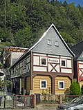 More pictures |
Seven Brothers House | Elbufer 59 (map) |
17th century | Upper floor half-timbered (St. Andrew's cross), independent from the gable, of architectural and local significance, location on the Elbe that characterizes the townscape |
09222282
|
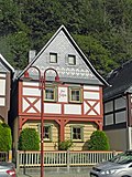 More pictures |
Seven Brothers House | Elbufer 61 (map) |
re. 1635 | Upper floor half-timbered (St. Andrew's cross), independent from the gable, of architectural and local significance, location on the Elbe that characterizes the townscape. |
09222281
|
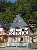 More pictures |
Seven Brothers House | Elbufer 63 (map) |
17th century | Upper floor half-timbered, independent from the gable, of architectural and local significance, location on the Elbe that characterizes the townscape. |
09222280
|
 More pictures |
Seven Brothers House | Elbufer 65 (map) |
17th century | Upper floor half-timbered (St. Andrew's cross), independent from the gable, of architectural and local significance, location on the Elbe that characterizes the townscape. |
09222279
|
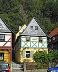 More pictures |
Seven Brothers House | Elbufer 67 (map) |
17th century | Upper floor half-timbered, independent from the gable, of architectural and local significance, location on the Elbe that characterizes the townscape |
09222278
|
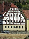 More pictures |
So-called. parents house | Elbufer 69 (map) |
re. 1791 | Residential house - upper floor half-timbered, of architectural and historical importance, location on the Elbe, marked in the keystone of the basket arch door. |
09222276
|
 |
Residential house in open development | Elbufer 81 (map) |
around 1905, changed | with ornamental framework and wooden extensions, historically important |
09222267
|
 |
House and back house | Elbufer 85 (map) |
1st half of the 19th century | Upper floor half-timbered house, of architectural significance |
09222274
|
 |
Residential building | Elbufer 87 (map) |
around 1800, changed | Upper floor half-timbered, of architectural significance |
09222273
|
 |
Residential building | Elbufer 89 (map) |
Early 19th century, modified | Upper floor half-timbered, of architectural significance |
09222269
|
 |
Residential house in open development | Elbufer 91 (map) |
2nd half of the 19th century | Residential house in open development and retaining wall - important in terms of building history |
09222268
|
 |
Residential house in open development | Elbufer 97 (map) |
around 1920 | Residential house with open development and fencing - built in the local style with wooden extensions and half-timbering, historically important, location on the Elbe that characterizes the townscape. |
09222254
|
 |
Residential building | Cherry Rite 3 (Map) |
1860s according to information | Upper floor half-timbered, of architectural significance |
09222270
|
 |
Residential building | Kirschleite 5 (card) |
1st half of the 19th century | Upper floor half-timbered, of architectural significance |
09222272
|
 |
Residential building | Kirschleite 6 (card) |
re. 1838 | Upper floor half-timbered, of architectural significance
Arched door marked |
09222271
|
 |
Landmark | Wolfsgraben (map) |
19th century | of local importance |
09222303
|
| Residential building | Wolfsgraben 3 (map) |
around 1800 | Upper floor half-timbered, of architectural significance |
09222302
|
|
 More pictures |
Residential building | Wolfsgraben 5 (map) |
End of 18th century | Upper floor half-timbered, of architectural significance |
09222301
|
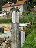 |
Waystone | Zahnsberg (map) |
19th century | of importance in terms of traffic history. Sandstone, narrow column, approx. 2 m high, text area with a stocky color, tapering cross-vault-shaped end, inscriptions: "To Schmilka 1 St., to Postelwitz and Schandau 1/2 St." and "Weg in den Königlichen Wald", probably first half 19th century |
09222304 |
Prossen
| image | designation | location | Dating | description | ID |
|---|---|---|---|---|---|
| Material entity component of the material entity railway line Bad Schandau - Sebnitz - Neustadt i. Sa: railway line section Prossen | (Map) | around 1900 | Material entity component of the material entity railway line Bad Schandau - Sebnitz - Neustadt i. Sa: Prossen route section (without individual monuments), railway line as an aggregate part (see aggregate ID no. 09302083) - important in terms of railway history and technology history. |
09305214
|
|
| Residential house with retaining wall | Bergstrasse 24 (map) |
1st half of the 19th century | Upper floor half-timbered, of architectural significance |
09224318
|
|
| Residential building | Gründelweg 1 (map) |
According to information from 1835 | Upper floor half-timbered, partly boarded up, of architectural significance |
09224319
|
|
| Residential building | Gründelweg 6 (map) |
around 1800 | Upper floor half-timbered, partly boarded up, of architectural significance |
09224321
|
|
| House and outbuildings | Gründelweg 8 (map) |
1st half of the 19th century | Residential building upper floor half-timbered, younger outbuilding, historically important |
09224322
|
|
| Gardeners good | Gründelweg 14b (map) |
re. 1778 | Moving out house from a former homestead - upper floor half-timbered, high documentation value, of architectural and socio-historical importance. |
09224323
|
|
 More pictures |
Material entirety of the Prossen estate with several individual monuments and objects as a whole as well as paved area | Gründelweg 15; 16; 17 (map) |
18./19. Century | Composition of the Prossen Manor with the following individual monuments: mansion (No. 15), servants' house (No. 17), garden pavilion, enclosure wall and stone bench in the park (individual monument ID No. 09224320) as well as manor park and orchard (garden monument) and the following elements: farmyard with eastern (without no.) and western (no. 16) farm buildings as well as paved area made of river pebbles on parcel 98/1 - mansion plastered quarry stone building with hipped roof, on the west side strong supporting pillars, structure of the facade by cornices and pilasters, stucco ceilings inside, historical and local as well as landscaping of importance. |
09304447
|
 More pictures |
Manor house and servants' house as well as garden pavilion (individual monuments to ID No. 09304447) | Gründelweg 15; 17 (map) |
1st half of the 18th century | Individual features of the Prossen estate as a whole: mansion (No. 15) and servants' house (No. 17) as well as garden pavilion, terracing with retaining and fencing walls and stone bench in the park - manor house plastered quarry stone building with hipped roof, on the west side strong pillars, structure of the facade by cornices and pilaster strips, stucco ceilings inside, of architectural and local importance. |
09224320
|
 |
Former Rösler paper factory | Hohnsteiner Strasse 23 (map) |
around 1870 (main building) | Mill complex with half-timbered building, connecting structure and mill building with annex (turbine room) including water-technical system (weir with sandstone surround, mill ditch, underground ditch set in sandstone blocks and partly vaulted) and former transformer house and chimney of the boiler house - of importance in terms of building history, the history of the place and the character of the town. |
09224231
|
 |
Military clothing office VII | Talstrasse 28; 28a (card) |
around 1940 | Two barracks buildings: one plastered building with an irregular floor plan with a raised central section, a gable roof with three long peaks, the other plastered building with a gable roof and two long peaks - of importance in terms of building history and local history. |
09224324 |
Schmilka
| image | designation | location | Dating | description | ID |
|---|---|---|---|---|---|
| Hotel building in open development | Schmilka 10 (map) |
1905/1910 | Without a dining room extension, of local history. |
09222323
|
|
| Former rafting company | Schmilka 18 (map) |
19th century | elongated farm building, today a residential building, of local significance. |
09222322
|
|
| Residential building | Schmilka 19 (map) |
re. 1859 | Cube-shaped building with a beautiful facade structure, of architectural significance. Cube-shaped building with beautiful facade structure, remains of the original furnishings. |
09222321
|
|
| Residential building | Schmilka 21 (map) |
re. 1924 | Multi-part plastered building with a mansard hipped roof , facade with different window shapes, of importance in terms of building history and shaping the street scene. |
09222319
|
|
| Residential house (with restaurant) in a corner | Schmilka 23 (map) |
1900/1910 | Without a rear annex, important in terms of building history and the appearance of the street. |
09222311
|
|
| Schmilka border checkpoint | Schmilka 24 (map) |
1890s | Service building of the border protection post - of architectural and local significance. |
09222310
|
|
| Residential house in open development | Schmilka 26b (map) |
Core building 18th century | historically important |
09222312
|
|
 More pictures |
Residential building | Schmilka 29 (map) |
Core building 17th century | Upper floor half-timbered, partly overbuilding the street, of importance in terms of building history and the appearance of the street. Half-timbered partially plastered, with St. Andrew's cross, boarded gable, surrounding framework partially renewed. |
09222313
|
| Residential building | Schmilka 32 (map) |
Core building 18./19. Century | Upper floor timber-framed boarded, historically important. |
09222314
|
|
| Residential building | Schmilka 33 (map) |
around 1800 | Upper floor timber-framed boarded, historically important |
09222315
|
|
 More pictures |
Schmilk Mill | Schmilka 36 (map) |
re. 1665 | Mill complex with several building parts (the house formerly with a restaurant), z. Partly overbuilding the street - important in terms of building history, local history and the appearance of the street. Modified in the 2nd half of the 19th century, inscribed on the facade. |
09222316
|
 More pictures |
Residential building | Schmilka 38 (map) |
around 1800 | Upper floor half-timbered, of architectural significance |
09222320
|
| Former Forest house on a hillside | Schmilka 54 (map) |
1913 according to information | Influences of reform and Heimat style, of importance in terms of building history, local history and urban planning. |
09222318
|
|
| Residential building on a hillside | Schmilka 57 (map) |
around 1800 | Upper floor half-timbered, of architectural significance |
09222317 |
Waltersdorf
| image | designation | location | Dating | description | ID |
|---|---|---|---|---|---|
 |
Remainder of a triangulation column | (Map) | 1865 (triangulation column) | Station of the Royal Saxon Triangulation, 2nd order network, scientifically and technologically significant. |
09305060
|
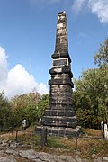 |
Wettin Obelisk on the Lilienstein | (Map) | 1889 | Monument with enclosure - sandstone obelisk on pedestal, with inscription, in memory of the 800th anniversary celebration of the House of Wettin, of historical importance. Inscription: "Memorial column 16m high, erected by the Mountain Association for Saxon-Bohemian Switzerland in 1889 / PROVIDENTIAE MEMOR / In memory of the jubilee of the 800-year reign of the House of Wettin June 19, 1889 / 1089/1889", with royal crown. |
09224706
|
| Arch bridge over the Polenz | (Map) | re. 1898 | Sandstone, of importance in terms of building history and landscape design. |
09224709
|
|
| Freight elevator of the Royal Saxon Shipping Company Übigau | (Map) | 1923-1924 | Freight elevator of a shipping company - important in terms of technology history. |
09224705
|
|
 |
Material entirety Waldfriedhof am Lilienstein | (Map) | presumably 1950s | Material forest cemetery at Lilienstein with a memorial plaque for the victims of fascism and a wooden enclosure (material parts) - historical significance. |
09305808
|
| Residential building | Gründelweg 30 (map) |
18th century | Upper floor half-timbered partly boarded up, St. Andrew's crosses, of architectural significance. |
09224758
|
|
| Residential building | Gründelweg 31 (map) |
re. 1787 | Upper floor half-timbered, of architectural significance. House marked in a basket arch door. |
09224757
|
|
| Residential stable house, side building and barn of a farm | Liliensteinstrasse 3 (map) |
re. 1798 | Residential stable house, side building and barn of a farm as well as a pond in front of the courtyard - residential stable building upper floor half-timbered, barn and side building boarded up, of architectural and economic importance. Stable house: three basket arch doors, one marked in the keystone. |
09224739
|
|
| Residential stable house, side building and barn of a farm | Liliensteinstrasse 4 (map) |
around 1800 | Stable house upper floor half-timbered, partly plastered, barn and side buildings boarded up, of architectural and economic significance. |
09224741
|
|
| House and barn of a farm | Liliensteinstrasse 5 (map) |
18th century | Residential building upper floor timber-framed boarded, historically significant. |
09224742
|
|
| Residential stable house and side building | Liliensteinstrasse 10 (map) |
around 1800 | Residential stable house upper floor half-timbered, of architectural significance |
09224740
|
|
| Residential stable house and moving house of a three-sided courtyard | Liliensteinstrasse 14 (map) |
re. 1828 | Both buildings on the upper floor are timber-framed, of importance in terms of architectural and social history. Wohnstallhaus marked 1828 in basket arch door. |
09224699
|
|
| Waltersdorf inn | Liliensteinstrasse 22 (map) |
1st half of the 19th century | Upper floor half-timbered, of architectural and local significance. |
09224702
|
|
| Residential building | Liliensteinstrasse 24 (map) |
Mid 19th century | Upper floor half-timbered, of architectural significance |
09224701
|
|
| Stable house of a former farm | Liliensteinstrasse 26 (map) |
1st half of the 19th century | Upper floor half-timbered, of architectural significance |
09224744
|
|
| Stable house of a former farm | Neuer Weg 15 (map) |
re. 1841, probably older, Kern around 1700 | Upper floor half-timbered, partly plastered, marked in a basket arch door, of architectural significance. Headband recognizable on the gable side. |
09224700
|
|
| Residential building | Neuer Weg 19 (map) |
1st half of the 19th century | Upper floor half-timbered, partly boarded up, of architectural significance |
09224738
|
|
| Residential building | New way 20 (map) |
around 1800 | Upper floor half-timbered, of architectural significance |
09224703
|
|
 |
New Waltersdorfer Mühle | Waltersdorfer Mühle 36b (map) |
around 1900 | Guest house and covered free-standing guest terrace in the corner - guest house typical of the time plastered building with a gabled risalit, open space in the gable, wooden balconies, covered wooden guest terrace with arcade-like openings, decorated wooden panels in the upper area, wide roof overhang, of architectural and local significance. |
09224708 |
Remarks
- This list is not suitable for deriving binding statements on the monument status of an object. As far as a legally binding determination of the listed property of an object is desired, the owner can apply to the responsible lower monument protection authority for a notice.
- The official list of cultural monuments is never closed. It is permanently changed through clarifications, new additions or deletions. A transfer of such changes to this list is not guaranteed at the moment.
- The monument quality of an object does not depend on its entry in this or the official list. Objects that are not listed can also be monuments.
- Basically, the property of a monument extends to the substance and appearance as a whole, including the interior. Deviating applies if only parts are expressly protected (e.g. the facade).
Detailed memorial texts
-
^
Kurpark Bad Schandau - Structural Protected Goods
Development: Path system: existing, partly changed. Garden equipment: basalt columns, VVN memorial (sandstone monolith, individual monument), memorial stone (not an individual monument) for Paul Hartig (composer), some new sculptures were introduced. Horticultural structures: wooden pavilion (probably formerly a private garden), open-air stage with flanking pavilions. Water elements: fountain with spheres (probably 1980s), Kirnitzsch with retaining walls integrated in the design.
Vegetation: avenues and rows of trees: Crataegus spec. as a row in the southern part of the park along the Badallee, single trees: English oak (Quercus robur), copper beech (Fagus sylvatica 'Atropurpurea'), linden (Tilia spec.), Japanese maple (Acer palmatum), horse chestnut (Aesculus hippocastanum), column oak (Quercus robur ' Fastigiata '), yellow chestnut (Aesculus flava) on the open-air stage. Hedges and bushes: throughgrown hornbeam hedge (Carpinus betulus) on the open-air stage, old witch hazel bushes (Hamamelis spec.), Numerous newly planted ornamental bushes.
Other protected assets: Ground relief: level, except for the regularly designed area with retaining walls (terraces) and linden trees. Visual relationship: within the system. Disruptive elements: parking spaces. - ↑ Dimensions of the cuboid: 1.8 m high and 0.7 m × 0.5 m. In Saxony, a total of four stones mark the southern limit of the northern inland ice (the points of greatest spread of glaciation during the Ice Age). Established in 1975/76 by the then councils of the Dresden and Chemnitz districts at the suggestion of the Society for Geological Sciences . Belongs to the few monuments that are dedicated to special natural sciences.
-
↑
Bad Schandau Town Church
A late Gothic church was given the west tower in front of it in 1645, and the nave was rebuilt in its current size from 1668–71. After the town fire in 1694, the ship was rebuilt by 1709, new upper floor of the tower by 1711. The interior was redesigned by Gotthilf Ludwig Möckel in 1876/77. Simplifying restoration of the interior in 1962, restoration of the tower 1978–80.
The massive west tower, at the same time bell tower and refuge in the event of war, is characteristic of the cityscape, the basement floor has a square floor plan, the octagonal upper floor is closed with a hood, lantern and onion. The buttresses of the ship from the reconstruction after 1704. Sandstone block construction.
Inside: flat coffered ceiling , single-storey galleries . The two-storey altar made of sandstone, with pairs of columns and a rich collection of figures, is a major work by Hans Walther II , 1575–79, originally in the Dresden Kreuzkirche, he was in the St. Anne's Church there until 1902, since 1927 there. On the main floor, a relief of the Last Supper, as a cladding of the Passover meal altar table, between the pillars an allegory of the suffering and the conquering church. In the center of the excerpt the crucified one above the tablets of the law, to the side angels with instruments of passion and two evangelists. The other two to the side of the gable with God the Father above the dove of the Holy Spirit, crowned by the figure of the risen Christ. - High baroque sandstone pulpit, the basket with the figures of Salvator and the Evangelists is carried by a figure of Moses. - Font A. 18th century, sandstone. - Wooden sculpture Christ resting, around 1500. On the north wall of the choir, painting of the crucifixion of Christ, 18th century (Dehio Sachsen I, 1996). -
↑
Hotel Lindenhof - structural protection goods:
Enclosure: retaining wall made of sandstone slabs, on which fence pillars made of sandstone (fence fields no longer exist). Access: Access: from the west, ramp-like path with sandstone gate posts. Path system: regularly laid out, e.g. Z. concrete pavement, earlier probably with a water-bound ceiling.
Vegetation: Individual trees: a pair of cut linden trees (Tilia spec.) To the left and right of the main entrance to the hotel, a pair of cut silver linden trees (Tilia tomentosa) to the left and right of the ramp-like access path, also three cut horse chestnuts (Aesculus hipposastanum) in a row parallel to the Retaining wall. Other protected assets: Ground relief: terracing. -
Jump up ↑ Ambient house , Schloßberg 12
Younger part of the house: Erected in the last third of the 19th century, in the basement there is the entrance door to the younger and older part of the house (with surrounding area). The floor heights of the basement, the 1st and 2nd floors were adapted to the structural situation, so in the younger part of the house 2.8 m clear room height in the corridor of the 1st floor. Solid wall to the surrounding area of the house throughout.
Access to the few and large rooms of the old house from the stairwell (spiral sandstone staircase). Boundary part of the house: Basement: Partly in the rock, walls made of large sandstone blocks, flat, newer ceiling made of steel girders and hollow floorboards. Ground floor: Remnants of a block room (used as a cafe until 1994), interior walls and ceiling clad, clear room height 2.25 m.
1st floor: front and (smaller) back room, back room around 10 cm higher, interior walls and ceilings clad, clear room height front room 2.28 m, door with four panels from the construction period of the younger part of the house. Attic: Two developed rooms with water connection, only original door (wooden knob, door height 1.76 m, probably moved here from the ground floor) in the wall to the younger part of the house. (M. Hammer).
-
↑
Bad Schandau Cemetery - Structural Protected Goods
Buildings: Cemetery chapel (individual monument). Enclosure: retaining wall with sandstone posts and metal grating in the east (individual monument). Access: Entrances: Main entrance from the east below the chapel, secondary entrance in SE corner, small gate in the north, path system: available, parallel to the slope. Equipment: bench niche, water point, both with sandstone blocks, carved in the manner of Cyclops masonry , individual graves along the southeastern border with elaborate ornamental grids.
Vegetation: avenues and rows of trees: cut rows of chestnut and linden trees (Aesculus hippocastanum, Tilia spec.), Planted alternately along the western and southern borders, cut rows of linden trees (Tilia spec.) Along the southeast border to the chapel, row of thuja along the northeast border to the Chapel, another row of thuja (probably an extension), Thujaallee west of the chapel. Other protected assets: Ground relief: the terrain falls from west to east, terraces are partially intercepted by retaining walls. - ^ Evangelical parish church cribs. Neo-Romanesque hall church with a small east choir and this almost overwhelming choir tower in the north, built in a neo-Romanesque-neo-Gothic mixed style according to a design by Gotthilf Ludwig Möckel in 1881/82. Sandstone block construction. The exterior with buttresses. Still flat on the inside. Galleries on the south and west sides of the ship. Equipment from the construction period (Dehio Sachsen I, 1996).
- ↑ The Berggasthaus Kuhstall , which has existed since 1837, consists of a two-storey section with a flat, overhanging saddle roof, the structure of the pilaster strips located between the arched openings continues above the planking of the upper storey, despite frequent changes in this type of building, this part already existed in the 19th century, as illustrated by contemporary postcards. The design language points to the so-called “Swiss style”, which was popular in Saxon Switzerland from around 1870 and can also be found in villas and train stations. The relevance to the building history is thus indicated. The three-storey tower-like extension with a pyramid roof is likely to be a testimony to the home style of the 1930s. Because this region has been perceived as beautiful or sublime for over 200 years, i.e. aesthetically interesting (and not just as before, e.g. as a hunting ground), it was one of the germ cells of tourism, a phenomenon of the beginning modernity. In this context, the “cowshed” as a particularly striking rock formation resulted in a gastronomic establishment being established here around 180 years ago. In addition to the architectural history, there is the tourism history and landscape-defining importance. The age value and the high degree of originality are evident (Finkler, LfD / 2014).
-
↑
The 1929 from the shipyard Gustav Schinke in Bad Schandau in composite construction, d. H. with wooden floor, rudder and mast as well as steel shelves, built yaw ferry was in service at the Postelwitz – Krippen ferry station until 1998. During an overhaul at the same shipyard in 1977, the ferry was also equipped with a steel floor and received a new rudder and a new steel mast. After almost 70 years of operation, the yaw ferry was taken out of service and then lay in the Prossen harbor for a few years. After repair work at the Bad Schandau shipyard, the Schifferverein Fortuna Postelwitz e. V. finally took the ferry to its current location on the Postelwitz bank of the Elbe on June 25, 2005.
A ferry connection seems to have existed in Postelwitz at the beginning of the 15th century, probably in the form of a simple boat. From around 1890 steam ferries came into use at the Postelwitz – Krippen ferry station, and from 1929 the present yaw ferry on the longitudinal rope. This type of ferry moves back and forth on a Giertau anchored in the river in an arc between the river banks. The yaw ferry uses the current of the river to be crossed as a driving force by setting it at an angle against the direction of the current with the help of the rudder and then being driven away laterally by the current.
The principle on which this ferry is based was first applied in 1657 by the Dutchman Hendrick Heuck from Nijmegen, but only found widespread use in connection with the development of chain shipping towards the end of the 19th and beginning of the 20th century. The ropes of conventional rope ferries stretched between the banks could no longer be used due to the chains that were now crossing along the river and over the decks of the chain tug boats, so that the introduction of chain shipping was accompanied by a switch to yaw rope ferries. The ferry boat presented here represents a type of construction by the Schinke shipyard, which was used in this form at several Elbe ferry stations in Saxony. B. in Rathen, Schmilka, Strehla or Wehlen.
Today only a few yaw ferries are still in use on German rivers or, like the Postelwitzer yaw ferry, have been preserved as exhibits on land, so that they are of great testimony to the development and functioning of this special type of ferry. In addition to its technical and historical significance, the Postelwitzer Gierseilfähre also has a rarity as the oldest surviving ferry in Saxony. Despite their loss of function, their technical details, such as the rope overflow bracket on the bow, the mast with rope pulley or the very long rudder, are still there today. The resulting very good readability of the functionality of the yaw ferry and its installation near the original location at the Postelwitz – Krippen ferry station also make this technical monument very memorable (LfD / 2012). -
↑
Residential house, Elbufer 49
Cellar: rock cellar with separate access, vaulted, approx. 8 m². Ground floor: tripartite parlor with wooden ceiling and bevelled beams, hall (formerly probably with a stove) and kitchen-cum-living room (formerly narrow storage and equipment rooms and boat shed open on the Elbe side), 1912 enlargement of the house towards the rear.
Upper floor: corridor and three chambers leading from it, continuous central beam. Roof construction and roof: rafter roof , covered with slate until 1976 , then with bitumen shingles . Miscellaneous: From 1978, the exterior view of the house increased in value by maintaining the block room with surrounding framework on the ground floor and the St. Andrew's cross on the upper floor. (M. Hammer). - ↑ Garden monument: to the south and east of the manor house terraced garden area with massive retaining walls made of sandstone to the south and east and a small stone pavilion in the southwest corner of the terrace, view from the pavilion to the south over the Elbe landscape, the small landscaped manor park with water-bound paths and old trees made of plane trees (Platanus x hispanica), beech (Fagus sylvatica), sycamore maple (Acer pseudoplatanus), linden (Tilia spec.), Larch (Larix decidua) and yew (Taxus baccata) adjoins the terraced area to the southwest, here is also below the pavilion the stone bench, west of the manor house there is an orchard.
-
↑
Horseshoe-shaped mill complex of the former Rösler paper factory, as the successor to an earlier plant between Lachsbach (1 km before it flows into the Elbe) and the railway that was probably built around the time (1875-77), with a dominant four-story industrial mill building, this massive plastered building with profiled sandstone walls, Ventilation rosettes and arched twin windows on the 3rd and 4th floors. Already in 1897 in this zone converted for residential purposes, on the ground floor inside walled-in door jambs as a spoil from a previous building, designated 1820s, followed by a three-storey plastered building, also with arched twin windows, attached turbine shaft with 5-ton Voith turbine from 1939 (finally installed probably only after 1945), water-technical system with sandstone-enclosed weir, approx. 700 m long mill ditch partly vaulted and set in sandstone blocks. The complex also includes a coach house or craftsman's building with a half-timbered upper floor, a chimney with a profiled head left over from a boiler house after 1910 (building application), and finally a younger transformer house (1930s?) With an interesting rustic surface made of sandstone blocks. Hellerau kitchen furniture production here during the GDR era . Architectural and technical historical relevance, as well as an industrial mill in a narrow valley that shapes the landscape in a situation that is especially typical for Saxony.
- Four-storey mill building with ventilation rosettes and twin windows with round arches on the 3rd and 4th floors, converted early for residential purposes, profiled sandstone window frames, three-storey connecting building (central building) with several sandstone arches, twin windows with round arches
- Transformer house: sandstone cuboid with beaver tail covering
- Chimney of the boiler house: lower part octagonal, upper part round with a profiled head.
- ↑ The point Lilienstein was built on the western part of the Lilienstein, near the bridge. The Royal Saxon State Fiscus owned the property. Hint from Nagel 1890: Nefarious hands have removed the upper part of the pillar and thrown it into the depths. To be added again for later observations. This seems to have happened. Measurements were taken several times on the pillar. Later the column crashed again and could only be partially recovered in 2000. In the period from 1862 to 1890, a land survey was carried out in the Kingdom of Saxony , in which two triangular networks were formed. On the one hand, there is the network for grade measurement in the Kingdom of Saxony (network I. class / order) with 36 points and the royal Saxon triangulation (network II. Class / order) with 122 points. This national survey was led by Prof. Christian August Nagel , according to which the triangulation columns are also referred to as "Nagelsche columns". This surveying system was one of the most modern layer networks in Germany. The surveying columns set for this purpose remained almost entirely in their original locations. They are an impressive testimony to the history of land surveying in Germany and in Saxony. The system of surveying columns of both orders is in its entirety a cultural monument of supraregional importance.
