Palfau
|
Palfau (cadastral community) locality Cadastral municipality of Palfau |
||
|---|---|---|
|
|
||
| Basic data | ||
| Pole. District , state | Liezen (LI), Styria | |
| Judicial district | Liezen | |
| Pole. local community | Rural | |
| Coordinates | 47 ° 42 '35 " N , 14 ° 48' 15" E | |
| height | 512 m above sea level A. | |
| Residents of the village | 367 (January 1, 2020) | |
| Building status | 156 (2001 ) | |
| Area d. KG | 57.97 km² | |
| Post Code | 8923 | |
| prefix | + 43/3638 | |
| Statistical identification | ||
| Locality code | 15831 | |
| Cadastral parish number | 67108 | |
| Counting district / district | Palfau (61258 004) | |
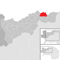
 Location of the former municipality in the Liezen district |
||
| Independent municipality until the end of 2014 Source: STAT : Local directory ; BEV : GEONAM ; GIS-Stmk |
||
Palfau is a village , cadastral municipality and former municipality in the municipality of Landl in the Liezen district with 394 inhabitants (as of January 1, 2014). As part of the municipal structural reform in Styria , it has been merged with the municipalities of Gams bei Hieflau , Landl and the municipality of Hieflau (previously in the Leoben district ) since 2015 , the new municipality continues to use the name Landl. The basis for this is the Styrian Municipal Structural Reform Act - StGsrG.
The boundaries of the districts of Liezen and Leoben have been changed so that the new municipality lies entirely in the district of Liezen.
geography
Geographical location
Palfau is located in the lower Salzatal, on an extensive river terrace on both sides of the Salza , which has cut into a deep gorge here up to the confluence with the Enns near Großreifling .
The northern part of the municipality up to the Lower Austrian border on the ridge of the Gamsstein ( 1774 m above sea level ) belongs to the Ybbstal Pre-Alps , the eastern part up to the Hochkar ( 1808 m above sea level ) to the Lassingalpen , the area south of the Salza to the Hochschwab Group ( Cold Wall Group ).
structure
The elongated place Palfau together form the Rotte Obere Palfau ( ⊙ ) and the scattered houses Untere Palfau ( ⊙ ) and Palfau Links , ( ⊙ ) the former on the northern, right bank of the Salza on the L714 Salzastraße , the latter on the left on the B25 Erlauftal Straße , Reachable via a footbridge, otherwise via An der Wacht , ( ⊙ ) where the two streets on the valley sides meet.
The Kirchberg of Palfau lies between Untere Palfau and Obere Palfau . In its surroundings there are numerous other individual layers , in the valley Karlbauer, Hämmerl, Grubbauer, Birkner, Schneßl, Lackner, Bergbauer in front of the church, Moar, An der Wacht after the church, Ghf. Eschau, Hebenstreit, Weber, Faschingbauer, Püllgraben left of the Salza.
The cadastral community also includes three places:
The Rotten Raffelgraben and Mendling - with ore heaps and Hirtenlehner - are up the Mendlingbach (Lassingbach) .
The Rotte Schönau with Pieringer, Nachbagauer extends on the Salza towards the Wildalpen.
The Bergbauern-Lackneralmhütte (Naturfreundehütte) and Moaralmhütte am Gamsstein, the Mooswirtalm am Kerzenmandl ( 1246 m above sea level ) in the west, the Voralpen farmstead and the Lärchkogelalm am Stangl ( 1592 m above sea level ) in the area of the cadastral community are still located South, and the Akoglbauer is located in the far southwest above Gams.
history
The place is mentioned in a document in 1280 as Palfawe . Palfau's more recent historical importance goes back in particular to its location on Eisenstrasse : its main branch was the old commercial post road Eisenerz - Steyr , today's Eisenstrasse B 115 in Ennstal. In Großreifling an important secondary route branched off along the Salza, via which the three important small iron towns of Gresten , Scheibbs and Purgstall an der Erlauf (or Scheibbs, Purgstall, Göstling ) were supplied with pig iron, and which was therefore called Dreimärktestrasse (today's B 25 ). The customs and toll station was originally located in Mendling, on the Styrian - Austrian border (the iron toll house in Mendling is now a listed building). The road over the Mendling Pass - and the Promau to Hollenstein an der Ybbs - was preserved by the local trades of these valleys, the Hammerherren . In 1811, the maintenance of the Innerberger Main Union was transferred, which - also to prevent smuggling (blackening) from Erzhalden via Scheibenberg (Ybbstaler Voralpen) and Sandgraben to Hollenstein while avoiding the toll - relocated the toll to Palfau. This was raised until the 1880s.
Population development of the former municipality
The number of inhabitants has been declining for several years despite the emerging tourism in the region (2001: 449 inhabitants).

Coat of arms of the former municipality
The municipal coat of arms of Palfau emblazoned :
- "A silver raftsman's hook and a silver hoe crossed diagonally over a black grooved silver wall in the shield base in red ."
The coat of arms was awarded on September 19, 1988. The wall, the built on the Salza fixing is with gate. Hoe and pike pole relate to the clearing of the area Palfauer and centuries-long forestry work and timber floating on the Salza. The colors silver / red are those of the Admont Abbey .
Economy and Infrastructure
In addition to agricultural businesses and some commercial enterprises, tourism is also an important source of income for the localities in Palfau.
Culture and sights
Buildings
- Remains of a fortified castle (ruin) that was built below Palfau. It was built in 1529 because of the Turkish threat (compare the Türkenschanze near Gaflenz ). It was re-fortified in the 17th century because of rebellious Upper Austrian farmers and during the French era . Due to its remote location, it was never attacked or destroyed, but was partly demolished (for house building etc.), partly left to nature. The current place name An der Wacht at the gorge entrance up the Salza is a reminder of this.
- The local church was probably originally a fortified church . Remains of a Wehrbemauerung are of the current appearance Tomahügels , on which it stands, recognizable. Today's church is more recent.
Natural monuments
A giant karst spring located on the southern slope of the Hochkar is known under the name Wasserloch . The spring and the gorge below are visited by several thousand guests every year.
Web links
- Entry on Palfau in the Austria Forum (in the AEIOU Austria Lexicon )
Individual evidence
- ^ Styrian municipal structural reform .
- ↑ § 4 paragraph 2 of the law of December 17, 2013 on the reorganization of the municipalities of the State of Styria ( Styrian Municipal Reform Act - StGsrG). Provincial Law Gazette for Styria of April 2, 2014. No. 31, year 2014. ZDB -ID 705127-x . P. 4.
- ↑ Ordinance of the Styrian Provincial Government of 10 July 2014, with which the Styrian District Authority Ordinance is changed. Provincial Law Gazette for Styria dated September 10, 2014. No. 99 Volume 2014. ZDB -ID 705127-x .
- ↑ not in ÖK / GEONAM , but in the index of places and maps
- ↑ Mountain farmers - Lackneralmhütte 1020 m , naturfreunde-haeuser.net
- ↑ History palfau.at,
- ↑ Palfau: Sights ( Memento of the original from September 23, 2015 in the Internet Archive ) Info: The archive link was inserted automatically and has not yet been checked. Please check the original and archive link according to the instructions and then remove this notice. : Themed trail , eisenstrasse.co.at
- ↑ Georg Goeth: The Duchy of Styria: geographically-statistically-topographically represented and provided with historical explanations . tape 1 . Heubner, 1840, p. 167 ff . ( Google eBook, full view - especially note **, p. 168 f).
- ↑ Population development 1869 - 2011. (PDF file; 35 kB) at: statistik.at
- ↑ with effect from September 1, 1988, LGB1. 1988, issue 18, No. 82.
- ^ A b Heinrich Purkarthofer : The Styrian municipal coat of arms awarded in 1988. Appendix in: Mitteilungen 39 ( pdf ( page no longer available , search in web archives ) Info: The link was automatically marked as defective. Please check the link according to the instructions and then remove this notice. , Verwaltung.steiermark.at, Palfau p. 8 )


