Oneida County, New York
 Oneida County Courthouse |
|
| administration | |
|---|---|
| US state : | new York |
| Administrative headquarters : | Utica |
| Foundation : | March 15, 1798 |
| Made up from: | Herkimer County |
| Area code : | 315 |
| Demographics | |
| Residents : | 234,878 (2010) |
| Population density : | 74.8 inhabitants / km 2 |
| geography | |
| Total area : | 3,255.922 km² |
| Water surface : | 117.087 km² |
| map | |
| Website : www.ocgov.net | |
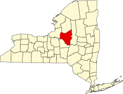
Oneida County is a county in the state of New York in the United States . At the 2010 census , Oneida County had 234,878 residents and a population density of 109.8 people per square kilometer. The county seat is Utica .
geography
Oneida County is located in the hill country east of Lake Ontario in an area mainly shaped by the last Ice Age. The largest body of water is Oneida Lake in the west of the county, on the south and east banks of which are some of the county's settlements. The Pools Brook , a canalised river in the lower reaches, connects the industrial centers of Utica and Rome with Lake Ontario via Oneida Lake and its outflow. The Mohawk River also rises north of Rome . There are no noteworthy surveys; the highest hills rise up to about 300 meters in the south and up to 400 meters in the north.
The county covers an area of 3,255.9 square kilometers, of which 117.1 square kilometers are water.
Surrounding areas
| Oswego County | Lewis County | Herkimer County |
| Oswego County |

|
Herkimer County |
| Madison County | Madison County | Otsego County |
history


The county was founded on March 15, 1798 as an independent county by separation from Herkimer County and named after the Oneida Indians, after the population of the area had increased sharply during the pioneering phase of the area and an independent administration made sense. The original area was changed and made smaller several times, again in order to create separate administrative areas. In 1801, a section of the then neighboring Clinton County was taken over, in 1805 the areas of the newly established areas of Lewis County and Jefferson County were separated, in 1816 a part was given to Oswego County and, in 1836, when Madison County was founded , parts of the area of the new county of Oneida County surrendered. This ended the biggest changes in area.
The opening of the Erie Canal (completed in 1825) and some complementary canals such as the Chenango Canal and the Black River Canal encouraged the emergence of industrial and commercial centers such as Utica , Rome and New Hartford ; the construction of railway lines from 1838, which supplemented the Erie Canal and also ensured the transport of goods in winter, allowed these centers to grow further.
The county's fertile lands were primarily used for dairy farming, which in turn supplied dairies and, above all, cheese factories. This cheese was then shipped by rail and ship to the major cities on the canal or the rail lines, in particular to Buffalo and New York City , but also to Chicago and Baltimore . For 1865, 80 cheese dairies are documented, of which 79 obtained the milk from 27,176 cows in the county and made around 4,000 tons of cheese from it, with a clear upward trend. Other important branches of industry included logging companies and a number of quarries.
The economic crisis of the 1930s deeply affected the county's economic centers; agriculture, however, was only slightly affected. After the Second World War, the railway system was largely replaced by the construction of expressways, which led to a further economic boom that continued into the 1970s. Since then, workers have been migrating, particularly to the metropolises on the great lakes and the east coast.
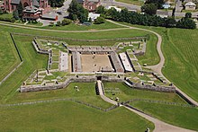
There is a national monument in the county , Fort Stanwix . Six locations have National Historic Landmark status . 76 buildings and sites in the county are registered in the National Register of Historic Places (as of February 17, 2018), including the Deansboro Railroad Station .
Population development
| year | 1800 | 1810 | 1820 | 1830 | 1840 | 1850 | 1860 | 1870 | 1880 | 1890 |
|---|---|---|---|---|---|---|---|---|---|---|
| Residents | 22,047 | 33,792 | 50,997 | 71,326 | 85.310 | 99,566 | 105.202 | 110.008 | 115,475 | 122,922 |
| year | 1900 | 1910 | 1920 | 1930 | 1940 | 1950 | 1960 | 1970 | 1980 | 1990 |
| Residents | 132,800 | 154.157 | 182.833 | 198,763 | 203,636 | 222,855 | 264,401 | 273.037 | 253.466 | 250,836 |
| year | 2000 | 2010 | 2020 | 2030 | 2040 | 2050 | 2060 | 2070 | 2080 | 2090 |
| Residents | 235,469 | 234,878 |
Cities and towns
In addition to the independent municipalities listed below, there are several villages in Oneida County .
| Locality | status | Population (2010) |
Total area [km²] |
Land area [km²] |
Population density [inhabitants / km²] |
founding | Specialty |
|---|---|---|---|---|---|---|---|
| Annsville | town | 3,012 | 156.6 | 155.8 | 19.3 | Apr 12, 1823 | |
| Augusta | town | 2,020 | 71.8 | 71.8 | 28.1 | 15th Mar 1798 | |
| Ava | town | 676 | 97.6 | 97.5 | 6.9 | May 12, 1846 | |
| Boonville | town | 4,555 | 187.9 | 186.1 | 24.5 | 28 Mar 1805 | |
| Bridgewater | town | 1,522 | 61.8 | 61.7 | 24.7 | 24 Mar 1797 | |
| Camden | town | 4,934 | 140.2 | 139.8 | 35.3 | 15th Mar 1799 | |
| Deerfield | town | 4,273 | 85.6 | 85.3 | 50.1 | 15th Mar 1798 | |
| Florence | town | 1,025 | 142.4 | 142.2 | 7.2 | Feb 16, 1805 | |
| Floyd | town | 3,819 | 90.1 | 89.6 | 42.6 | 4th Mar 1796 | |
| Forestport | town | 1,535 | 204.3 | 199.1 | 7.7 | Nov 24, 1869 | |
| Kirkland | town | 10,315 | 87.6 | 87.5 | 117.9 | Apr 13, 1827 | |
| lee | town | 6,486 | 117.9 | 116.8 | 55.5 | Apr 3, 1811 | |
| Marcy | town | 8,982 | 86.3 | 85.1 | 105.5 | 30th Mar 1832 | |
| Marshall | town | 2.131 | 84.9 | 84.9 | 25.1 | Feb 21, 1829 | |
| New Hartford | town | 22,166 | 66.0 | 65.6 | 337.9 | Apr 12, 1827 | |
| Paris | town | 4,411 | 81.6 | 81.5 | 54.1 | Apr 10, 1792 | |
| Remsen | town | 1.929 | 95.5 | 94.4 | 20.4 | 15th Mar 1798 | |
| Rome | City | 33,725 | 195.8 | 193.7 | 174.1 | 4th Mar 1796 | Founded as a town ; the city appointed on February 23, 1870 |
| Sangerfield | town | 2,561 | 80.2 | 79.8 | 32.1 | 5th Mar 1795 | |
| Sherrill | City | 3,071 | 6.0 | 6.0 | 511.8 | 1916 | |
| Steuben | town | 1,100 | 110.6 | 110.5 | 10.0 | Apr 10, 1792 | |
| Trenton | town | 4,498 | 113.2 | 112.3 | 40.1 | 24 Mar 1797 | |
| Utica | town | 62,235 | 44.1 | 43.4 | 1434.0 | Apr 3, 1798 | County seat; Founded as a village , made a town in 1827, declared a city on February 13, 1832 |
| Vernon | town | 5,408 | 98.0 | 98.0 | 55.2 | Feb. 17, 1802 | |
| Verona | town | 6,293 | 180.3 | 179.3 | 35.1 | Feb. 17, 1802 | |
| Vienna | town | 5,440 | 246.2 | 159.2 | 34.2 | Apr 3, 1807 | |
| Western film | town | 1,951 | 141.6 | 132.6 | 14.7 | Feb 10, 1797 | |
| Westmoreland | town | 6.138 | 111.8 | 111.7 | 55.0 | Apr 10, 1792 | |
| Whitestown | town | 18,667 | 70.8 | 70.7 | 264.0 | 7th Mar 1788 |
literature
- John Homer French: Gazetteer of the State of New York . RP Smith, Syracuse, NY 1860, pp. 458 ff . (English, archive.org [PDF; 63.8 MB ; accessed on January 1, 2017]).
- Franklin Benjamin Hough: Gazetteer of the State of New York . tape 2 . A. Boyd, Albany, NY 1873, pp. 456 ff . (English, archive.org [PDF; 58.3 MB ; accessed on January 1, 2017]).
Individual evidence
- ↑ Oneida County in the United States Geological Survey's Geographic Names Information System
- ↑ Listing of National Historic Landmarks by State: New York . National Park Service , accessed February 17, 2018.
- ↑ Search mask database in the National Register Information System. National Park Service , accessed February 17, 2018.
- ↑ Population 1800–2010 according to census results
- ↑ Population data from the 2010 US Census in the American Factfinder
- ↑ a b Official data of the United States Board on Geographic Names
- ^ Franklin Benjamin Hough: Gazetteer of the State of New York . tape 2 . A. Boyd, Albany, NY 1873, pp. 460 ff .
Web links
Coordinates: 43 ° 15 ′ N , 75 ° 26 ′ W
