Pečeňady
| Pečeňady | ||
|---|---|---|
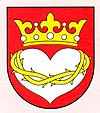
| coat of arms | map | |

|
|
|
| Basic data | ||
| State : | Slovakia | |
| Kraj : | Trnavský kraj | |
| Okres : | Piešťany | |
| Region : | Dolné Považie | |
| Area : | 8.573 km² | |
| Residents : | 558 (Dec. 31, 2019) | |
| Population density : | 65 inhabitants per km² | |
| Height : | 166 m nm | |
| Postal code : | 922 07 ( Veľké Kostoľany post office ) | |
| Telephone code : | 0 33 | |
| Geographic location : | 48 ° 29 ' N , 17 ° 43' E | |
| License plate : | PN | |
| Kód obce : | 507431 | |
| structure | ||
| Community type : | local community | |
| Administration (as of November 2018) | ||
| Mayor : | Ladislav Boháčik | |
| Address: | Obecný úrad Pečeňady č. 93 922 07 Pečeňady |
|
| Website: | www.pecenady.sk | |
| Statistics information on statistics.sk | ||
Pečeňady (until 1927 Slovak and "Pečeňany"; Hungarian Besnyőpetőfalva - until 1907 Pecsenyéd ) is a municipality in the west of Slovakia with 558 inhabitants (December 31, 2019) that the Piešťany District , part of the kraj Trnavský belongs.
geography
The community is located in the Trnavská pahorkatina (part of the Slovakian Danube lowlands ) on a corridor terrace of the Dudváh . The almost 8.6 km² large municipal area has a share in the Bohunice nuclear power plant west of the village. The town center is located at an altitude of 166 m nm and is 15 kilometers from Hlohovec , 16 kilometers from Trnava and 21 kilometers from Piešťany .
The village Peťová (Hungarian Petőfalva ), incorporated in 1907, belongs to the municipality and is no longer part of the municipality today.
history
Pečeňady was first mentioned in writing in 1208 as a Bissenorum . An indirect mention is already in the Zobor documents in 1113 in a description of the boundaries of the neighboring village Bohunice . To the east of it was a camp of the Pechenegs and Szeklers , who monitored an inner border line as part of the Hungarian Gyepű system. The name of the place means "village of the Petschenegen".
After the borders were stabilized in the 14th century, the camp was abandoned and re-established as a village in the late 14th century due to the immigration of South Slavic settlers. Since then, the village has belonged to the domain of Guttenstein Castle (Slovak hrad Dobrá Voda ) in the Little Carpathians . Significant families in the place up to the 20th century were Bánffy up to the half of the 17th century and then Užovič , of Croatian descent , who received the neighboring town of Peťová as a donation around 1450.
The place Peťová was first mentioned in writing in 1452 as Petewfalwa .
population
Results after the 2001 census (475 inhabitants):
|
By ethnicity:
|
By denomination:
|
Buildings
- Roman Catholic Church of the Sacred Heart of Jesus, consecrated October 31, 1899
- Classicist country castle of the Užovič family from 1825, built on the site of a country estate
Personalities
Sons and Daughters of the Church:
- Anton Kolarovič (1894–1977), SDB , Catholic priest , youth minister , religious prisoner (sentenced to 5 years in prison).
literature
- Marián Klčo: Okres Piešťany - stručná história a erby miest a obcí . 2nd Edition. Balneologické múzeum v Piešťanoch, Piešťany 2005, ISBN 80-968258-0-1 , p. 63-65 .
Individual evidence
- ↑ KUBANOVIČ, Zlatko: Historický náhľad do dejín slovenských saleziánov (Od dona Bosca do roku 1924) . Bratislava: Don Bosco, 2019. ISBN 978-80-8074-436-6 . P. 250.
