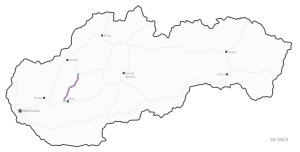
Rýchlostná cesta R8
| Rýchlostná cesta R8 in Slovakia | |

|
|
| map | |
| Basic data | |
| Operator: | Národná diaľničná spoločnosť, as |
| Overall length: | 55 km |
| of which in planning: | 55 km |
|
Kraj : |
|
The R8 expressway is a highway located entirely in the planning stage in western Slovakia . It will run through the northern Danube lowlands along the Nitra River near the cities of Nitra , Topoľčany and Bánovce nad Bebravou . The planned route runs away from the European road network and is of more regional importance.
The R8 was added to the expressway network in 2008.
