
Diaľnica D2
| Diaľnica D2 in Slovakia | |||||||||||||||||||||||||||||||||||||||||||||||||||||||||||||||||||||||||||||||||||||||||||||||||||||||

|
|||||||||||||||||||||||||||||||||||||||||||||||||||||||||||||||||||||||||||||||||||||||||||||||||||||||
| |
|||||||||||||||||||||||||||||||||||||||||||||||||||||||||||||||||||||||||||||||||||||||||||||||||||||||
| map | |||||||||||||||||||||||||||||||||||||||||||||||||||||||||||||||||||||||||||||||||||||||||||||||||||||||
 |
|||||||||||||||||||||||||||||||||||||||||||||||||||||||||||||||||||||||||||||||||||||||||||||||||||||||
| Basic data | |||||||||||||||||||||||||||||||||||||||||||||||||||||||||||||||||||||||||||||||||||||||||||||||||||||||
| Operator: | Národná diaľničná spoločnosť, as | ||||||||||||||||||||||||||||||||||||||||||||||||||||||||||||||||||||||||||||||||||||||||||||||||||||||
| Overall length: | 80.5 km | ||||||||||||||||||||||||||||||||||||||||||||||||||||||||||||||||||||||||||||||||||||||||||||||||||||||
| of which in operation: | 80.5 km | ||||||||||||||||||||||||||||||||||||||||||||||||||||||||||||||||||||||||||||||||||||||||||||||||||||||
|
Kraj : |
|||||||||||||||||||||||||||||||||||||||||||||||||||||||||||||||||||||||||||||||||||||||||||||||||||||||
| Development condition: | 2 lanes per direction | ||||||||||||||||||||||||||||||||||||||||||||||||||||||||||||||||||||||||||||||||||||||||||||||||||||||
 |
|||||||||||||||||||||||||||||||||||||||||||||||||||||||||||||||||||||||||||||||||||||||||||||||||||||||
| Lafranconi Bridge in Bratislava | |||||||||||||||||||||||||||||||||||||||||||||||||||||||||||||||||||||||||||||||||||||||||||||||||||||||
|
Course of the road
|
|||||||||||||||||||||||||||||||||||||||||||||||||||||||||||||||||||||||||||||||||||||||||||||||||||||||
The Diaľnica D2 is the second longest motorway in Slovakia and is located in the far west of the country. It is part of the European roads E 65 , E 75 and the full length part of the IV. Pan-European Transport Corridor ( Berlin / Nuremberg - Prague - Bratislava - Budapest - Constanța / Thessaloniki / Istanbul ). Its length is 80 km.
history

The first plans to build the D2 motorway appeared in the 1960s. In 1963, the government of Czechoslovakia decided to build a 117 km long section of motorway between Brno and Bratislava, 58.4 km of which are in today's Slovakia. Construction work began in April 1969, the first 29.3 km long section between Bratislava and Malacky was opened on November 7, 1973, which also became the first section of the motorway in today's Slovakia. In 1974 work began on the Czech side in Brno; In 1978 it was extended to Kúty (24.2 km). The motorway on Slovak territory was completed by 1979, after completion of the work on the Czech side, the entire route was open to traffic from November 8, 1980 and made the connection to the Czech D1 to Prague. Thus, the two capitals of the ČSSR were connected to each other by motorway. The construction costs on the Slovak side amounted to approximately 1.4 billion Kčs .
The Lafranconi Bridge was built over the Danube between 1985 and 1991 . In 1987 the section to the Hungarian border was added to the plan. In the now independent Slovakia, further construction began in 1996 and in February 1998 the section to the Hungarian border was opened, sometimes with only two lanes. This section has been completely four-lane since 2002. With the commissioning of the last section of 3 km length with the 1,440 m long Sitina tunnel in Bratislava on June 24, 2007 the D2 motorway was completed.
On June 1, 2011, the toll exemption on the D2 was extended to Jarovce , where it intersects with the D4. In the extension to the Hungarian border, the toll remains as well as that on the short section of the D4 to the Austrian border.
At Moravský Svätý Ján (km 13.7) a green bridge (length 80 m) was built between April 2015 and February 2016 , which is necessary for the Alps-Carpathian corridor . After the green bridges at Lučivná and north of Hôrka (both on the D1) it became the third green bridge in Slovakia.
future
The operator NDS as is planning to fully extend the section from the Czech border to the Bratislava-Polianky junction on a six-lane motorway, some with collector lanes, a total of 58.2 km. Execution is expected in the 2020s.
Sections
| section | length | start of building | Installation |
|---|---|---|---|
| Czech border (near Brodské ) - Kúty | 4.489 km | May 1976 | August 1978 (1st lane) July 1979 (2nd lane) |
| Kúty - Malacky | 24.175 km | May 1973 | August 1, 1978 |
| Malacky - Bratislava - Lamač | 29.336 km | April 22, 1969 | 7th November 1973 |
| Bratislava (Lamač - Staré grunty) | 3,661 km | October 27, 2003 | June 24, 2007 |
| Bratislava (Staré grunty - Viedenská cesta) | 3,500 km | April 1985 | October 1990 (1st lane) December 1991 (2nd lane) |
| Bratislava (Viedenská cesta - Hungarian border near Čunovo ) | 14.890 km | April 1996 | February 1998 (partly 1st lane) 13 December 2002 (completely 2nd lane) |
Most of the motorway requires a vignette; The exception is the Bratislava city route (exits 55–71).

The Pečňa motorway junction near Petržalka . The D1 motorway branches off here (towards Hungary)
Motorway to the Austrian and Hungarian border, Petržalka on the left

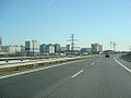
Shortly after Bratislava, towards the Czech Republic

The motorway behind the Malacky junction, towards the Czech Republic


Individual evidence
- ↑ Zmena v spoplatnení diaľnice D2 ( Memento of the original from August 20, 2016 in the Internet Archive ) Info: The archive link was inserted automatically and has not yet been checked. Please check the original and archive link according to the instructions and then remove this notice. dated May 31, 2011, accessed January 4, 2012
- ↑ Introducing the Alpine-Carpathian Corridor , accessed on December 30, 2012.