
Rýchlostná cesta R1
| Rýchlostná cesta R1 in Slovakia | ||||||||||||||||||||||||||||||||||||||||||||||||||||||||||||||||||||||||||||||||||||||||||||||||||||||||||||||||||||||||||||||||||||||||||||||||||||||||||||||||||||||||||||||||||||||||||||||||||||||||||||||||||||||||||||||||||||||||||||||||||||||||||||||||||||||||||||||||||||||||||||||||||||||||||||||||||||||||||||||||||||||||||||||||||||||||||||||||||||||||||||||||||||||||||||||||||||||||||||||||||||||||||||||||||||||||||||||||||||

|
||||||||||||||||||||||||||||||||||||||||||||||||||||||||||||||||||||||||||||||||||||||||||||||||||||||||||||||||||||||||||||||||||||||||||||||||||||||||||||||||||||||||||||||||||||||||||||||||||||||||||||||||||||||||||||||||||||||||||||||||||||||||||||||||||||||||||||||||||||||||||||||||||||||||||||||||||||||||||||||||||||||||||||||||||||||||||||||||||||||||||||||||||||||||||||||||||||||||||||||||||||||||||||||||||||||||||||||||||||
| |
||||||||||||||||||||||||||||||||||||||||||||||||||||||||||||||||||||||||||||||||||||||||||||||||||||||||||||||||||||||||||||||||||||||||||||||||||||||||||||||||||||||||||||||||||||||||||||||||||||||||||||||||||||||||||||||||||||||||||||||||||||||||||||||||||||||||||||||||||||||||||||||||||||||||||||||||||||||||||||||||||||||||||||||||||||||||||||||||||||||||||||||||||||||||||||||||||||||||||||||||||||||||||||||||||||||||||||||||||||
| map | ||||||||||||||||||||||||||||||||||||||||||||||||||||||||||||||||||||||||||||||||||||||||||||||||||||||||||||||||||||||||||||||||||||||||||||||||||||||||||||||||||||||||||||||||||||||||||||||||||||||||||||||||||||||||||||||||||||||||||||||||||||||||||||||||||||||||||||||||||||||||||||||||||||||||||||||||||||||||||||||||||||||||||||||||||||||||||||||||||||||||||||||||||||||||||||||||||||||||||||||||||||||||||||||||||||||||||||||||||||
 |
||||||||||||||||||||||||||||||||||||||||||||||||||||||||||||||||||||||||||||||||||||||||||||||||||||||||||||||||||||||||||||||||||||||||||||||||||||||||||||||||||||||||||||||||||||||||||||||||||||||||||||||||||||||||||||||||||||||||||||||||||||||||||||||||||||||||||||||||||||||||||||||||||||||||||||||||||||||||||||||||||||||||||||||||||||||||||||||||||||||||||||||||||||||||||||||||||||||||||||||||||||||||||||||||||||||||||||||||||||
| Basic data | ||||||||||||||||||||||||||||||||||||||||||||||||||||||||||||||||||||||||||||||||||||||||||||||||||||||||||||||||||||||||||||||||||||||||||||||||||||||||||||||||||||||||||||||||||||||||||||||||||||||||||||||||||||||||||||||||||||||||||||||||||||||||||||||||||||||||||||||||||||||||||||||||||||||||||||||||||||||||||||||||||||||||||||||||||||||||||||||||||||||||||||||||||||||||||||||||||||||||||||||||||||||||||||||||||||||||||||||||||||
| Operator: | Národná diaľničná spoločnosť, as | |||||||||||||||||||||||||||||||||||||||||||||||||||||||||||||||||||||||||||||||||||||||||||||||||||||||||||||||||||||||||||||||||||||||||||||||||||||||||||||||||||||||||||||||||||||||||||||||||||||||||||||||||||||||||||||||||||||||||||||||||||||||||||||||||||||||||||||||||||||||||||||||||||||||||||||||||||||||||||||||||||||||||||||||||||||||||||||||||||||||||||||||||||||||||||||||||||||||||||||||||||||||||||||||||||||||||||||||||||
| further operator: | Granvia Operation as (PPP) | |||||||||||||||||||||||||||||||||||||||||||||||||||||||||||||||||||||||||||||||||||||||||||||||||||||||||||||||||||||||||||||||||||||||||||||||||||||||||||||||||||||||||||||||||||||||||||||||||||||||||||||||||||||||||||||||||||||||||||||||||||||||||||||||||||||||||||||||||||||||||||||||||||||||||||||||||||||||||||||||||||||||||||||||||||||||||||||||||||||||||||||||||||||||||||||||||||||||||||||||||||||||||||||||||||||||||||||||||||
| Overall length: | approx. 265 km including feeder | |||||||||||||||||||||||||||||||||||||||||||||||||||||||||||||||||||||||||||||||||||||||||||||||||||||||||||||||||||||||||||||||||||||||||||||||||||||||||||||||||||||||||||||||||||||||||||||||||||||||||||||||||||||||||||||||||||||||||||||||||||||||||||||||||||||||||||||||||||||||||||||||||||||||||||||||||||||||||||||||||||||||||||||||||||||||||||||||||||||||||||||||||||||||||||||||||||||||||||||||||||||||||||||||||||||||||||||||||||
| of which in operation: | 177.2 km | |||||||||||||||||||||||||||||||||||||||||||||||||||||||||||||||||||||||||||||||||||||||||||||||||||||||||||||||||||||||||||||||||||||||||||||||||||||||||||||||||||||||||||||||||||||||||||||||||||||||||||||||||||||||||||||||||||||||||||||||||||||||||||||||||||||||||||||||||||||||||||||||||||||||||||||||||||||||||||||||||||||||||||||||||||||||||||||||||||||||||||||||||||||||||||||||||||||||||||||||||||||||||||||||||||||||||||||||||||
| of which in planning: | approx. 90 km | |||||||||||||||||||||||||||||||||||||||||||||||||||||||||||||||||||||||||||||||||||||||||||||||||||||||||||||||||||||||||||||||||||||||||||||||||||||||||||||||||||||||||||||||||||||||||||||||||||||||||||||||||||||||||||||||||||||||||||||||||||||||||||||||||||||||||||||||||||||||||||||||||||||||||||||||||||||||||||||||||||||||||||||||||||||||||||||||||||||||||||||||||||||||||||||||||||||||||||||||||||||||||||||||||||||||||||||||||||
|
Kraj : |
||||||||||||||||||||||||||||||||||||||||||||||||||||||||||||||||||||||||||||||||||||||||||||||||||||||||||||||||||||||||||||||||||||||||||||||||||||||||||||||||||||||||||||||||||||||||||||||||||||||||||||||||||||||||||||||||||||||||||||||||||||||||||||||||||||||||||||||||||||||||||||||||||||||||||||||||||||||||||||||||||||||||||||||||||||||||||||||||||||||||||||||||||||||||||||||||||||||||||||||||||||||||||||||||||||||||||||||||||||
| Development condition: | four lanes 1 km six lanes |
|||||||||||||||||||||||||||||||||||||||||||||||||||||||||||||||||||||||||||||||||||||||||||||||||||||||||||||||||||||||||||||||||||||||||||||||||||||||||||||||||||||||||||||||||||||||||||||||||||||||||||||||||||||||||||||||||||||||||||||||||||||||||||||||||||||||||||||||||||||||||||||||||||||||||||||||||||||||||||||||||||||||||||||||||||||||||||||||||||||||||||||||||||||||||||||||||||||||||||||||||||||||||||||||||||||||||||||||||||
 |
||||||||||||||||||||||||||||||||||||||||||||||||||||||||||||||||||||||||||||||||||||||||||||||||||||||||||||||||||||||||||||||||||||||||||||||||||||||||||||||||||||||||||||||||||||||||||||||||||||||||||||||||||||||||||||||||||||||||||||||||||||||||||||||||||||||||||||||||||||||||||||||||||||||||||||||||||||||||||||||||||||||||||||||||||||||||||||||||||||||||||||||||||||||||||||||||||||||||||||||||||||||||||||||||||||||||||||||||||||
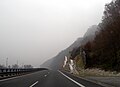
| The R1 at Zlaté Moravce | ||||||||||||||||||||||||||||||||||||||||||||||||||||||||||||||||||||||||||||||||||||||||||||||||||||||||||||||||||||||||||||||||||||||||||||||||||||||||||||||||||||||||||||||||||||||||||||||||||||||||||||||||||||||||||||||||||||||||||||||||||||||||||||||||||||||||||||||||||||||||||||||||||||||||||||||||||||||||||||||||||||||||||||||||||||||||||||||||||||||||||||||||||||||||||||||||||||||||||||||||||||||||||||||||||||||||||||||||||||
|
Course of the road
|
||||||||||||||||||||||||||||||||||||||||||||||||||||||||||||||||||||||||||||||||||||||||||||||||||||||||||||||||||||||||||||||||||||||||||||||||||||||||||||||||||||||||||||||||||||||||||||||||||||||||||||||||||||||||||||||||||||||||||||||||||||||||||||||||||||||||||||||||||||||||||||||||||||||||||||||||||||||||||||||||||||||||||||||||||||||||||||||||||||||||||||||||||||||||||||||||||||||||||||||||||||||||||||||||||||||||||||||||||||
The Rýchlostná cesta R1 (until 1999 Diaľnica D65 ) is a expressway in Slovakia . The expressway is part of the European roads E 58 , E 77 and E 571 .
It starts in the west in Trnava before it crosses the D1 motorway . On its course to the east, the R1 reaches the regional capitals Nitra and Banská Bystrica . Near Žiar nad Hronom (kilometer 123) there is the connection of the R2 to the northwest towards Prievidza and Trenčín .
The expressway is almost completely subject to a vignette for vehicles under 3.5 t. Exceptions are the short entry into the town at Nitra-Zobor and the city route Banská Bystrica. Large parts of the expressway were created by upgrading existing four-lane roads of the first order or expanding them, so that in some places there are no suitable parallel roads.
history


The first parts were already built in the 1970s (as state roads I / 51 Báb –Nitra, 17.4 km and I / 66 Kováčová – Banská Bystrica, 18.2 km, both completed in 1980). In the 1980s, the line between Šášovské Podhradie and Budča was added (state road I / 50 , 15.3 km, completion 1986). However, all of these projects were built independently of one another and did not constitute part of a targeted undertaking.
From 1987 to 1999 the route was planned as the D65 motorway, but was downgraded to an expressway due to the rejected D22.5 motorway category (in Slovakia motorways with a cross-section of 26.5 m or 24.5 m are planned).
The next step was the expansion of the 28.6 km long Trnava – Báb line, beginning with the Sereď-Šoporňa section (construction began in 1983, completion in 1995). However, the complete four-lane expansion did not end until July 2000 and was then still dedicated as part of I / 51. In the 1990s, construction began again in the Grantal , the first being the two-lane bypass from Žarnovica was completed in 1998. The route from Hronský Beňadik to Žarnovica, including the second lane of the bypass from Žarnovica, was gradually expanded from 2003 to 2006, together with the 2.8 km long Tekovské Nemce – Hronský Beňadik line (completion 2005). The 3 km long connection between the two ends at Zvolen (Budča – Kováčová) was built in 2004. The gap in the Grantal valley was closed in two sections: the first section from Žarnovica to Lehôtka pod Brehmi was opened in November 2009. The gap from Lehôtka pod Brehmi to Šášovské Podhradie was closed in January 2011 after a delay of several months due to a landslide; an approximately 1 km long stretch near Žiar nad Hronom was only two-lane until August 2011.
Construction of the 46 km long Nitra – Tekovské Nemce line, divided into the Nitra – Selenec, Selenec – Beladice and Beladice – Tekovské Nemce sections, began in September 2009 and was opened to traffic on October 28, 2011 after a construction period of 25 months. This project was built as a PPP project, with Granvia taking over operation for 30 years after completion. The Banská Bystrica bypass with a length of 5.1 km is also operated by Granvia (commissioning July 28, 2012).
The project for the route from Nitra to Tekovské Nemce and the Banská Bystrica bypass was given the official name PR1BINA on July 14, 2011, reminding of the early medieval prince Pribina .
expansion
The entire expressway has a cross-section of R22.5, i.e. two lanes plus narrow hard shoulder in each direction. A kilometer-long stretch between the Banská Bystrica-Radvaň (161) and Banská Bystrica-Hušták (162) junctions has six lanes without hard shoulders; in the further course to Kováčová (146) there is a wide median with space for an additional lane in each direction. There is only one slow lane, between the Hronský Beňadik junction (86) and just before the Tekovské Nemce petrol station in the direction of Nitra over a length of about 2.8 km.
Construction and planning
An extension to the D1 motorway in the northern Slovak city of Ružomberok is largely being planned. This project is conceivable as an alternative to the Žilina – Ružomberok section of the D1 motorway, but it is not expected to be carried out in the near future.
There are long-term plans to build the expressway further west. The new building would leave the current route between Vlčkovce and Sereď and continue around Sládkovičovo and mostly along the northern side of the Little Danube to the junction with the D4 at Most pri Bratislave . The length of this plan is 42,140 m.
gallery
On the slope of Pohronský Inovec between Žarnovica and Nová Baňa

Crossing the Hron at Žiar nad Hronom

The R1 in central Slovakia, junction Hronská Dúbrava
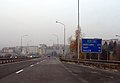
In Banská Bystrica (note the state road sign, now replaced)


Individual evidence
- ↑ Cestu smrti medzi Nitrou a Zlatými Moravcami nahradila R1 , webnoviny.sk, October 28, 2011 (Slovak)
- ^ R1 Most pri Bratislave - Vlčkovce ( Memento from May 19, 2011 in the Internet Archive )
- ↑ Rýchlostná cesta R1 Most pri Bratislave - Vlčkovce , Enviroportál, accessed on October 26, 2013 (maps available via the link "grafické prílohy")