Cesta I. triedy 68
| Cesta I. triedy 68 in Slovakia | ||||||||||||||||||||||||||||||||||||||||||||||||||||||||||||||||||||||||||||||||||||||||||||||||||||||||||||||||

|
||||||||||||||||||||||||||||||||||||||||||||||||||||||||||||||||||||||||||||||||||||||||||||||||||||||||||||||||
| |
||||||||||||||||||||||||||||||||||||||||||||||||||||||||||||||||||||||||||||||||||||||||||||||||||||||||||||||||
| map | ||||||||||||||||||||||||||||||||||||||||||||||||||||||||||||||||||||||||||||||||||||||||||||||||||||||||||||||||

|
||||||||||||||||||||||||||||||||||||||||||||||||||||||||||||||||||||||||||||||||||||||||||||||||||||||||||||||||
| Basic data | ||||||||||||||||||||||||||||||||||||||||||||||||||||||||||||||||||||||||||||||||||||||||||||||||||||||||||||||||
| Operator: | Slovenská správa ciest | |||||||||||||||||||||||||||||||||||||||||||||||||||||||||||||||||||||||||||||||||||||||||||||||||||||||||||||||
| Overall length: | 80.4 km | |||||||||||||||||||||||||||||||||||||||||||||||||||||||||||||||||||||||||||||||||||||||||||||||||||||||||||||||
|
Kraj : |
||||||||||||||||||||||||||||||||||||||||||||||||||||||||||||||||||||||||||||||||||||||||||||||||||||||||||||||||
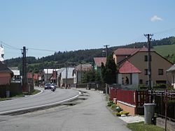
| The I / 68 as the main street of Plavnica | ||||||||||||||||||||||||||||||||||||||||||||||||||||||||||||||||||||||||||||||||||||||||||||||||||||||||||||||||
|
Course of the road
|
||||||||||||||||||||||||||||||||||||||||||||||||||||||||||||||||||||||||||||||||||||||||||||||||||||||||||||||||
The Cesta I. triedy 68 ( Slovak for '1st order street 68'), I / 68 for short , is a 1st order street in Slovakia . Larger cities that the road passes through or affects are Stará Ľubovňa , Sabinov and Prešov . In Prešov it is part of the European route 50 .
On August 1, 2015, sections south of Prešov were separated from the I / 68 and two new streets were created, each with its own number: from Prešov (Rusínska intersection) to Budimír the street bears the number I / 20 and from Košice to Hungarian border at Milhosť it is numbered I / 17 .
course
The road begins as a continuation from Poland ( national road 87 ) out of Mníšek nad Popradom and after a few kilometers it crosses the Vabec pass ( Ľubovnianska vrchovina , 766 m nm ) to avoid the detour through the Poprad valley . It copies this river between Stará Ľubovňa and sieubotín before it leaves its valley behind Pusté Pole . It then runs on the left bank of the Torysa , between the mountains Čergov (east), Leutschauer Berge and Bachureň (west), first through Lipany , then on to Sabinov , before reaching the regional capital Prešov . There it ends south of the city center at I / 20.
Individual evidence
- ↑ Rozhodnutie MDVRR SR o usporiadaní cestnej siete (Decision of the Ministry of Transport, Building and Regional Development of the Slovak Republic on the organization of the road network) of July 23, 2015 , accessed on November 1, 2015
swell
- Description of the course of the road as of January 1, 2015 (Slovak) PDF file; 3.2 MB
- VKÚ as (ed.): Autoatlas 1: 100 000 - Slovenská republika . 9th edition. Harmanec 2012, ISBN 978-80-8042-636-1 .
