
Schilda (Brandenburg)
| coat of arms | Germany map | |
|---|---|---|

|
Coordinates: 51 ° 36 ' N , 13 ° 23' E |
|
| Basic data | ||
| State : | Brandenburg | |
| County : | Elbe Elster | |
| Office : | Elsterland | |
| Height : | 137 m above sea level NHN | |
| Area : | 8.69 km 2 | |
| Residents: | 442 (Dec. 31, 2019) | |
| Population density : | 51 inhabitants per km 2 | |
| Postal code : | 03253 | |
| Area code : | 035326 | |
| License plate : | EE, FI, LIB | |
| Community key : | 12 0 62 440 | |
| Office administration address: | Kindergartenstrasse 2a 03253 Schönborn |
|
| Website : | ||
| Mayor : | Lothar Benning | |
| Location of the community of Schilda in the Elbe-Elster district | ||
  |
||

Schilda ( Lower Sorbian Šydłow ) is a municipality in the south of Brandenburg in the Elbe-Elster district . The community belongs to the Elsterland office . The administrative seat of the office is the municipality of Schönborn .
geography
The community is located in an agricultural part in the far west of the historic Niederlausitz . It is surrounded by the communities Doberlug-Kirchhain , Tröbitz and Uebigau-Wahrenbrück .
history

Schilda was first mentioned in a document in 1300. The place was from December 1300 to 1335 in the possession of the de Ileburg . In 1335 they sold the village to the Dobrilugk Monastery and Schilda was occupied by German settlers. It remained in the possession of the monastery until 1541. In 1335 a productive wine-growing and wine-press operation started from the monastery . The cellar house on the road from Schilda to Langennaundorf is a reminder of the existence of a vineyard at that time . In the following years, the vineyards fell away and disappeared completely in the 19th century.
Even if the place is unlikely to be the historical Schilda , old traditions reveal the special way of life of the people. So it is said that they did without the useless display of windows on the north side of the church. Around 1800 the lawn iron stone brought a little additional income. It was delivered to the Lauchhammer ironworks . In April 1856 the part of the village south of the church burned down completely.
In earlier times there were a total of three brickworks on the territory of the municipality . Brick production was very labor-intensive in the past centuries. The population development from 1900 to 1910 shows that the lignite industry became the main source of income for many residents. The coal industry experienced a heyday again after 1945. The lignite plant later became an agricultural machinery company . The political turning point in 1989 brought about a major upheaval in the working life of the residents. Employers in the vicinity, such as agricultural machinery and briquette factories , were not profitable enough and were closed.
Schilda had belonged to the Luckau district in the province of Brandenburg since 1816 , and to the Finsterwalde district in the GDR district of Cottbus from 1952 to 1990 . The community has been in the Elbe-Elster district in Brandenburg since 1993
Population development
|
|
|
|
|
Territory of the respective year, number of inhabitants: as of December 31 (from 1991), from 2011 based on the 2011 census
politics
Community representation
The community council of Schilda consists of seven community representatives and the honorary mayor. The local election on May 26, 2019 resulted in the following distribution of seats:
| Voter group | Seats |
|---|---|
| Schilda voters group | 6th |
| Single applicant Kathleen Fröschke | 1 |
Kathleen Fröschke's share of the vote corresponds to two seats. Therefore, according to § 48 (6) of the Brandenburg Local Election Act, a seat in the municipal council remains vacant.
mayor
- 2001-2014: Diana Schmidt
- since 2014: Lothar Benning (Schilda voter group)
Benning was elected in the mayoral election on May 26, 2019 with 72.4% of the valid votes for a term of five years without a candidate.
coat of arms
The coat of arms was approved on June 1, 1994.
Blazon : "A walking silver horse in green."
Sights and culture
In the list of architectural monuments in Schilda (Brandenburg) and in the list of ground monuments in Schilda (Brandenburg) are the cultural monuments entered in the list of monuments of the state of Brandenburg.
Several places, including Schilda, claim that the conditions in their city were the model for the stories about the Schild citizens . However, there is no historical proof of this link. Even the unusual lack of windows in the north side of the Schilda church should not be sufficient evidence of the shield bourgeoisie in Schilda.
The Schildaer Dorfkirche (built in 1450) is a medieval building with a rectangular floor plan. The walls are made of granite boulders and lawn iron stone. The almost square tower was added later.
Active clubs in Schilda are the youth club and the volunteer fire brigade with their numerous events.
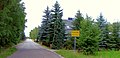
Entrance from the direction of Wildgrube
Fairground

Graves of Jewish citizens who did not survive the Lost Train

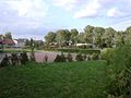
Village green

graveyard


traffic
Schilda is on the L 603 state road between Drasdo and Tröbitz .
Personalities
Sons and daughters of the church
- Hans Waldmann (* 1928), GDR Combine Director
- Gitta Rost (* 1943), two-time GDR badminton champion
Personalities associated with Schilda
- Gerolf Seemann (* 1940), multiple GDR badminton champion, lived in Schilda
- Gottfried Seemann (* 1940), multiple GDR badminton champion , lives in Schilda
- Annemarie Seemann (* 1942), multiple GDR badminton champion, lives in Schilda
Individual evidence
- ↑ Population in the State of Brandenburg according to municipalities, offices and municipalities not subject to official registration on December 31, 2019 (XLSX file; 223 KB) (updated official population figures) ( help on this ).
-
↑ Sorbischer Name: Šydłow (formerly district Luckau )
→ Arnost Muka : Lower Sorbian names of the towns and villages ; 1911–1928, Sorbian Institute.
→ Arnošt Muka: building blocks for local history of the Luckauer Kreis. District Committee, Luckau 1918. - ↑ Historical municipality register of the state of Brandenburg 1875 to 2005. Elbe-Elster district . Pp. 22-25
- ↑ Population in the state of Brandenburg from 1991 to 2015 according to independent cities, districts and municipalities , Table 7
- ^ Office for Statistics Berlin-Brandenburg (Ed.): Statistical report AI 7, A II 3, A III 3. Population development and population status in the state of Brandenburg (respective editions of the month of December)
- ^ Result of the local election on May 26, 2019
- ↑ Brandenburg Local Election Act, Section 48
- ↑ I want to give something back to Schilda. In: Lausitzer Rundschau , March 29, 2006.
- ^ Result of the mayoral election on May 25, 2014
- ↑ Section 73 of the Brandenburg Local Election Act
- ^ Result of the mayoral election on May 26, 2019
- ↑ Coat of arms information on the service portal of the state administration of Brandenburg
Web links
- Link catalog on Schilda at curlie.org (formerly DMOZ )
Bad Liebenwerda | Crinitz | Doberlug-Kirchhain | Elsterwerda | Falkenberg / Elster | Spruce forest | Finsterwalde | Gorden-Staupitz | Val Gardena | Great | Heathland | Herzberg (Elster) | Hirschfeld | Hohenbucko | Hohenleipisch | Kremitzaue | Lebusa | Lichterfeld-Schacksdorf | Massen-Niederlausitz | Merzdorf | Mühlberg / Elbe | Plessa | Röderland | Rückersdorf | Sallgast | Schilda | Close | Schönborn | Schönewalde | Schraden | Sonnewalde | Trobitz | Uebigau-Wahrenbrück