
Mud village
| coat of arms | Germany map | |
|---|---|---|

|
Coordinates: 49 ° 48 ' N , 11 ° 44' E |
|
| Basic data | ||
| State : | Bavaria | |
| Administrative region : | Upper Palatinate | |
| County : | Neustadt an der Waldnaab | |
| Management Community : | Kirchenthumbach | |
| Height : | 449 m above sea level NHN | |
| Area : | 20.34 km 2 | |
| Residents: | 862 (Dec. 31, 2019) | |
| Population density : | 42 inhabitants per km 2 | |
| Postal code : | 95519 | |
| Area code : | 09205 | |
| License plate : | NEW, ESB , VOH | |
| Community key : | 09 3 74 155 | |
| Community structure: | 9 districts | |
| Address of the municipal administration: |
Schulstr. 3 95519 Schlammersdorf |
|
| Website : | ||
| Mayor : | Gerhard Löckler | |
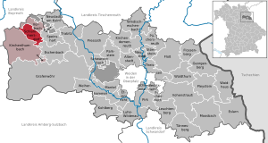
| Location of the community Schlammersdorf in the district of Neustadt an der Waldnaab | ||
  |
||


Schlammersdorf is a municipality in the Upper Palatinate district of Neustadt an der Waldnaab and a member of the Kirchenthumbach administrative community .
geography
Schlammersdorf is located in the Upper Palatinate North planning region .
Community structure
The municipality of Schlammersdorf has nine districts:
|
There are the districts of Moos and Schlammersdorf.

history
Until the church is planted
The place was part of the Electorate of Bavaria and formed a closed Hofmark of the barons of Gravenreuth (Schlammersdorfer line), previously the von Schlammersdorf family , whose seat was Schlammersdorf. There were three noble residences in Schlammersdorf. One of them was the castle next to the Püttner brewery, which has been restored and is used as a residential building; previously it housed the school.
The noble family von Schlammersdorf was first mentioned in 1309 with a "Chvnrad Slamerstorf" in an Ensdorfer monastery document. The place itself is documented much earlier in historical writings. Other country estates were Menzlas and Naslitz, which now belong to the municipality. From 1491 to 1517 Erasmus von Streitberg owned the noble seat Schlammersdorf and goods in Ernstfeld as a Palatine fief.
In the course of the administrative reforms in Bavaria , today's municipality was created with the municipal edict of 1818 .
Incorporations
In January 1946 part of the municipality of Moos was incorporated.
Population development
- 1939: 694 inhabitants
- 1950: 784 inhabitants
- 1961: 699 inhabitants
- 1970: 781 inhabitants
- 1987: 775 inhabitants
- 1991: 824 inhabitants
- 1995: 837 inhabitants
- 2000: 858 inhabitants
- 2005: 905 inhabitants
- 2010: 888 inhabitants
- 2015: 876 inhabitants
Between 1988 and 2018 the municipality grew from 795 to 857 by 62 inhabitants or 7.8% of the population.
politics
mayor
Mayor is Johannes Schmid (impartial voter group). In 2020 he succeeded Gerhard Löckler (UWG).
Municipal council
The election in March 2014 resulted in this distribution of seats:
- CSU: 5 seats
- UWG: 3 seats
coat of arms
Blazon: "Divided by black and gold, above a striding golden lion, below three or two blue heraldic lilies arranged in a row."
Architectural monuments
Economy and Infrastructure
Economy including agriculture and forestry
According to official statistics, there were 442 employees at the place of work in the manufacturing sector and 110 in the trade and transport sector. There were a total of 548 employees at the place of residence subject to social security contributions. There were two companies in the manufacturing sector and no companies in the main construction sector. In addition, in 1999 there were 21 farms with an agricultural area of 499 hectares, of which 319 were arable land and 179 were permanent green areas.
education
The following institutions exist (as of: 1999):
- Kindergartens: 50 kindergarten places with 66 children
- Elementary schools: one with seven teachers and 154 students
Individual evidence
- ↑ "Data 2" sheet, Statistical Report A1200C 202041 Population of the municipalities, districts and administrative districts 1st quarter 2020 (population based on the 2011 census) ( help ).
- ↑ http://www.bayerische-landesbibliothek-online.de/orte/ortssuche_action.html ? Anzeige=voll&modus=automat&tempus=+20111107/172547&attr=OBJ&val= 989
- ^ Dieter Zöberlein: The von Streitberg, story of a Franconian noble family . Self-published, Burggrub 2018, part 2, p. 360.
- ^ Wilhelm Volkert (ed.): Handbook of Bavarian offices, communities and courts 1799–1980 . CH Beck, Munich 1983, ISBN 3-406-09669-7 , p. 460 .
- ↑ http://www.verwaltungsgemeinschaft-kirchenthumbach.de/seite/gs/oberpfalz/01096:255/-/Gemeinderat_und_Ausschuesse.html
Web links
- Schlammersdorfer website
- Aerial photos of the place
- Entry on the coat of arms of Schlammersdorf in the database of the House of Bavarian History

Altenstadt an der Waldnaab |
Bechtsrieth |
Eschenbach in the Upper Palatinate |
Eslarn |
Etzenricht |
Raft |
Flossenbürg |
Georgenberg |
Grafenwohr |
Irchenrieth |
Kirchendemenreuth |
Kirchenthumbach |
Kohlberg |
Leuchtenberg |
Luhe-Wildenau |
Coat |
Moosbach |
Neustadt am Kulm |
Neustadt an der Waldnaab |
Park stone |
Pirk |
Pleystein |
Pressath |
Püchersreuth |
Umbrella seat |
Schlammersdorf |
Schwarzenbach |
Super tough |
Störnstein |
Tännesberg |
Theisseil |
Trabitz |
Vohenstrauss |
Vorbach |
Waidhaus |
Waldthurn |
Weiherhammer |
Windischeschenbach
Unregulated areas: Heinersreuther Forst | Manteler Forest | Speiny forest