Slaný
| Slaný | ||||
|---|---|---|---|---|
|
||||
| Basic data | ||||
| State : |
|
|||
| Region : | Středočeský kraj | |||
| District : | Kladno | |||
| Area : | 3513 ha | |||
| Geographic location : | 50 ° 14 ' N , 14 ° 5' E | |||
| Height: | 234 m nm | |||
| Residents : | 15,834 (Jan 1, 2019) | |||
| Postal code : | 250 11-274 01 | |||
| License plate : | S. | |||
| traffic | ||||
| Railway connection: | Prague – Most | |||
| structure | ||||
| Status: | city | |||
| Districts: | 10 | |||
| administration | ||||
| Mayor : | Martin Hrabánek (as of 2014) | |||
| Address: | Velvarská 136/1 274 01 Slaný 1 |
|||
| Municipality number: | 532819 | |||
| Website : | www.meuslany.cz | |||
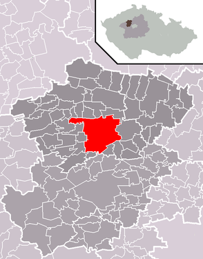
| Location of Slaný in the Kladno district | ||||

|
||||
Slaný , formerly also Slané , German Schlan , is a city and former royal city in Bohemia . It is located in the Schlaner Plateau, the northwestern part of the Prague Plateau, about 25 km northwest of Prague .
history
The area around Prague has been populated since the Neolithic Age. The emergence of the town of Slaný goes back to a salt spring , at which a settlement can be proven around the year 750 AD. At the beginning of the 13th century a prosperous town developed near this salt spring and was named royal town by Wenceslas II in 1305 . The rulers from the House of the Přemyslids gave the city numerous privileges, as did Emperor Charles IV later . During the Hussite Wars , Slaný was a center of the political-religious movement of the Hussites in Bohemia. The city remained economically prosperous for the next two centuries. After the Battle of White Mountain with the victory of the Catholic League over the Protestant landlords in Bohemia, the assets and property were confiscated by the Austrian emperor's property management. She sold the town in 1620 to Jaroslav Borsita Count von Martinic on Smečno . Schlan had been the seat of the district office of the Rakonitz district since 1788. In 1848 Schlan received its own city administration and developed into an industrial city in the second half of the 19th century. In 2003 Slaný had 15,754 inhabitants.
coat of arms
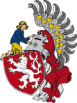
Originally, the city arms Slanýs corresponded to the Royal Bohemian coat of arms, including crest . To distinguish it, an unclothed boy kneeling on the left of the helmet cover from the perspective of the beholder , who - looking to the right - holds the helmet with both hands. In the newer form he is dressed in blue and the left side of the crest has been removed.
Attractions
- town hall
- Holy Trinity Church - originally Protestant, built in 1581–1602. Today the seat of the Carmelite Order.
- St. Gotthard Church
- Piarist residence, founded in 1658, today the seat of the city library and the regional history museum.
- Gates of the city fortifications - Pražská, Lounská, Velvarská and Fortna - only Velvarská remains today.
- Schlaner Berg: dominant volcanic mountain, with salt mines.
- Jewish Cemetery
- synagogue
- District house Slaný
- Wiehl house
Districts
Dolín, Želevčice, Lotouš (German: Sanddörfel ), Blahotice, Netovice, Kvíc, Trpoměchy, Otruby
Twin cities
- Pegnitz , Germany
Personalities
- Václav Beneš Třebízský (1849–1884), Catholic clergyman, writer
- Karl Joseph Biener von Bienenberg (1731–1798), district captain, prehistoric
- Matthäus Crocinus (1580–1654), painter
- Ladislav Čepelák (1924–2000), painter and graphic artist
- Jaroslav Fencl (* 1913), graphic artist
- Josef Holub (1870–1957), landscape painter
- Eduard Hradec , urologist, professor at the University of Prague
- Jindřich Hulinský , historian and archivist
- Dominik Kynský , writer and translator
- Josef Lacina ( pseudonym Kolda Malínský ; 1850–1908), historian, writer
- Paul Ludwik (1878–1934), technician
- Jan Malypetr (1873–1947), Prime Minister of Czechoslovakia
- František Karel Miltner , archaeologist and numismatist
- Václav Moucha , archaeologist
- Josef Matěj Navrátil , painter
- Václav Nejtek , academic sculptor
- Josef Pacák , professor of organic chemistry at the University of Prague, specialist journalist
- Martin Přibyl , priest, royal archivist in Berlin
- Karel Scheinpflug (1869–1948), entrepreneur, writer and journalist, father of Olga Scheinpflugova and father-in-law of Karel Čapek
- Olga Scheinpflugová , actress and writer. Wife of Karel Čapek
- Václav Smetáček (1906–1986), composer and conductor
- Miloslav Stiebr , professor at the University of Prague, lawyer and legal historian
- Jaroslav Suchý , anthropologist
- Václav Štech (1859–1947), writer, author, theater director and co-founder of the Schlaner Museum
- Václav Vilém Štech , art historian, publicist
- Johann Schulz von Felsdorf (Czech Jan Šultys z Felsdorfu ), (1560–1621), Primator von Kuttenberg
- Radek Tóth (* 1968), ice hockey goalkeeper
- Rudolf Urbánek , historian, professor at the University of Brno in Moravia, specialist journalist
- Ferdinand Velc , painter, art historian, publicist
- Daniel Vepřek , author of the “historical calendar” town chronicler
- Karel Alois Vinařický , translator of classical literature
- Jakub Voráček (* 1989), ice hockey player
- Karl Wildbrunn , singer
Web links
Individual evidence
- ↑ Český statistický úřad - The population of the Czech municipalities as of January 1, 2019 (PDF; 7.4 MiB)
- ^ Milan boys : Heraldry. Albatros, Prague 1987.
- ↑ http://mapy.mzk.cz/mzk03/001/037/049/2619267395/


