
Neudrossenfeld
| coat of arms | Germany map | |
|---|---|---|

|
Coordinates: 50 ° 1 ′ N , 11 ° 30 ′ E |
|
| Basic data | ||
| State : | Bavaria | |
| Administrative region : | Upper Franconia | |
| County : | Kulmbach | |
| Height : | 334 m above sea level NHN | |
| Area : | 50.23 km 2 | |
| Residents: | 3739 (Dec. 31, 2019) | |
| Population density : | 74 inhabitants per km 2 | |
| Postal code : | 95512 | |
| Area code : | 09203 | |
| License plate : | KU, EBS , SAN | |
| Community key : | 09 4 77 142 | |
| LOCODE : | DE ND6 | |
| Community structure: | 48 districts | |
| Address of the municipal administration: |
Adam-Seiler-Str. 1 95512 Neudrossenfeld |
|
| Website : | ||
| Mayor : | Harald Huebner ( CSU ) | |
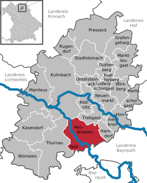
| Location of the community of Neudrossenfeld in the district of Kulmbach | ||
  |
||

Neudrossenfeld is a municipality in the district of Kulmbach ( administrative district of Upper Franconia ).
geography
Geographical location
Neudrossenfeld is located on federal highway 85 halfway between Bayreuth and Kulmbach . The Autobahn 70 runs north with junction 24 (Kulmbach-Neudrossenfeld). The relief of the municipality is characterized by a rock spur made of sandstone , which overlooks the valley of the Red Main .
Community structure
The municipality of Neudrossenfeld is divided into 48 districts:
history

Until the 19th century
Neudrossenfeld was first mentioned in a document in 1260 in the Langenstadt Treaty. In 1285 Drossenfeld was a parish with its own parish church (consecrated to St. James). The Burgraves of Nuremberg ( Hohenzollern ) bought the Kulmbacher Land in 1340 and ruled the Drossenfeld manor (until 1806). Until 1429 the parish of Drossenfeld was under the patronage of the Langheim monastery . In 1430 it was pillaged by the Hussites . 1494-1584 the "Burckgut Drosenfelt" belonged to the dynasty of Wirsberg , which the Marquis I. Georg Friedrich sold. The margraves then had it managed by tenants. In 1525, during the Peasants' War , the Drossenfeld peasantry remained rather passive. In 1528 the Reformation was introduced in Neudrossenfeld.
In the years 1553 and 1554 it was destroyed during the Albertine War. Looting from 1632 in the Thirty Years' War and the plague depopulated the whole area. Margrave Christian Ernst von Bayreuth sold Neudrossenfeld in 1689 to the bourgeois judiciary Johann Wolfgang Franke. In 1732 almost all of Neudrossenfeld burned down. In 1752 the estate came partly as an inheritance and partly through purchase to the imperial count Philipp Andreas von Ellrodt . The new owner and his son Friedrich expanded the castle (architect: Carl von Gontard ) and built the new large Margrave Church (Dreifaltigkeitskirche) from 1753 to 1760. The terraced gardens, which were famous at the time, were laid out.
In 1775, after the death of Philip von Ellrodt and his two sons in 1763, his widow Drossenfeld could not hold on, the manor was sold to Georg Christoph von Reitzenstein . The property deteriorated and was sold to the bourgeoisie in 1809. Eight bourgeois owners followed over the next 200 years.
After the last Margrave Karl Alexander renounced the Principality of Kulmbach-Bayreuth in 1791 , it became Prussian in January 1792 . After the defeat of the Prussian army in the battle of Jena and Auerstedt , it was occupied by French troops in October 1806 and remained under French administration for four years. On June 30, 1810, the French army handed over Neudrossenfeld and the whole of the Bayreuth region to Bavaria, which had now become a kingdom and which the former principality had bought from Napoleon for 15 million francs .
20th century

On June 26, 1909, the Bayreuth – Thurnau railway with the Drossenfeld (in Altdrossenfeld) and Neuenreuth stations was opened. Passenger traffic was discontinued on June 3, 1973, freight trains still came from Kulmbach via Thurnau until the end of 1982.
From mid-June 1944 to April 1945, one of the numerous branch offices of the Flossenbürg concentration camp existed on the area of the New Cotton Spinning Mill in Bayreuth . There they worked on optical control systems for guided weapons. After a bomb attack on April 11, 1945, its civil scientists, engineers and craftsmen were relocated to Neudrossenfeld Castle with their tools, machines and documents. After it was captured by the US Army , the research there continued until October 1945 under Werner Rambauske as head of the "Institute Teleoptics".
Incorporations

As part of the territorial reform on January 1, 1972, the previously independent community of Neuenreuth am Main and parts of the dissolved community of Lindau were incorporated. On July 1, 1972, Muckenreuth was added. Pechgraben followed on January 1, 1975. Parts of the dissolved community of Leuchau were incorporated on January 1, 1976. Brücklein joined on January 1, 1978. The main part of the dissolved Altdrossenfeld community finally followed on May 1, 1978.
Population development
In the period from 1988 to 2018, the municipality grew from 3,018 to 3,753 by 735 inhabitants or 24.4%. On December 31, 2005, Neudrossenfeld had 3983 inhabitants.
politics
mayor
The professional first mayor has been Harald Hübner (CSU) since May 1, 2014. In the mayoral election in 2020, he was confirmed in the second ballot with a share of 64% of the votes. His predecessor was Dieter Schaar (free electorate).
Municipal council
The municipal council consists of the first mayor and 16 members. The municipal council elections from 2002 to 2020 led to the following allocation of seats:
| 2002 | 2008 | 2014 | 2020 | |
|---|---|---|---|---|
| Free electorate | 6th | 7th | 3 | 4th |
| CSU | 4th | 4th | 3 | 4th |
| SPD | 3 | 3 | 4th | 3 |
| Waldau voter group | 2 | 2 | 2 | 1 |
| Free community citizens | 1 | - | - | - |
| For our community | - | - | 4th | 4th |
| total | 16 | 16 | 16 | 16 |
Culture and sights


Buildings
- Trinity Church : The Protestant Margrave Church , built between 1753 and 1760, is one of the most beautiful baroque churches in Bayreuth and Kulmbacher Land. The architect and builder was Johann Georg Hoffmann from Kulmbach.
- Neudrossenfeld Castle with terrace garden: its oldest parts date from the 16th century. It was expanded and renewed from 1752 by the architect Carl von Gontard .
- The brewery site, which has existed since 1649 and is under monument protection, with an inn, beer garden and the actual brewery building with ice house in the center of Neudrossenfeld.
- The 50 meter long sandstone bridge over the Red Main with five arches was probably built between 1557 and 1603.
Architectural monuments
Attractions
- The dance linden tree in Langenstadt, historically confirmed as a court linden tree, was replanted after the old tree had to be removed due to old age and has been the center of local customs again since 2010.
- Since 2014, the Lindenbaum Museum in Neudrossenfeld has been using models to show over 40 examples of guided linden trees in Europe, many of them dance linden trees.
Sports
The TSV Neudrossenfeld is the largest sports club in the community. The club's soccer team will play in the Bayernliga from the 2014/15 season.
Regular events
- Every two years at the beginning of May, the Europe Days , organized by the Promotion Agency for European Communication, take place, during which the Charles IV European Medal is awarded. There is also a wide range of cultural and culinary options from many European countries.
sons and daughters of the town
- Johann Wilhelm Friedrich Höfling (1802-1853), Lutheran theologian and co-founder of the " Erlanger School "
literature
- Johann Kaspar Bundschuh : Drosenfeld . In: Geographical Statistical-Topographical Lexicon of Franconia . tape 3 : I-Ne . Verlag der Stettinische Buchhandlung, Ulm 1801, DNB 790364301 , OCLC 833753092 , Sp. 646-647 ( digitized version ).
- Johann Kaspar Bundschuh : New Droßenfeld . In: Geographical Statistical-Topographical Lexicon of Franconia . tape 3 : I-Ne . Verlag der Stettinische Buchhandlung, Ulm 1801, DNB 790364301 , OCLC 833753092 , Sp. 736 ( digitized version ).
- Georg Paul Hönn : Neu-Drossenfeld . In: Lexicon Topographicum of the Franconian Craises . Johann Georg Lochner, Frankfurt and Leipzig 1747, p. 275-276 ( digitized version ).
- Pleikard Joseph Stumpf : Neudrossenfeld . In: Bavaria: a geographical-statistical-historical handbook of the kingdom; for the Bavarian people . Second part. Munich 1853, p. 576 ( digitized version ).
Web links
- Homepage of the community of Neudrossenfeld
- Entry on Neudrossenfeld's coat of arms in the database of the House of Bavarian History
- Neudrossenfeld: Official statistics of the LfStat
- Map of Alt- and Neudrossenfeld around 1850 at bayerische-landesbibliothek-online.de
Individual evidence
- ↑ "Data 2" sheet, Statistical Report A1200C 202041 Population of the municipalities, districts and administrative districts 1st quarter 2020 (population based on the 2011 census) ( help ).
- ↑ bayerische-landesbibliothek-online.de
- ↑ Nature and art in harmony. In: Nordbayerischer Kurier. August 31, 2016, p. 24.
- ↑ Karl Müssel: Bayreuth in eight centuries. P. 124.
- ↑ Karl Müssel: Bayreuth in eight centuries. P. 132.
- ↑ Karl Müssel: Bayreuth in eight centuries. P. 139.
- ^ Robert Zintl: The Thurnauer Bockela. P. 103.
- ↑ Peter Engelbrecht: Secret research in the castle. In: Nordbayerischer Kurier. September 13, 2016, p. 17.
- ^ Wilhelm Volkert (ed.): Handbook of Bavarian offices, communities and courts 1799–1980 . CH Beck, Munich 1983, ISBN 3-406-09669-7 , p. 503 .
- ^ Federal Statistical Office (ed.): Historical municipality directory for the Federal Republic of Germany. Name, border and key number changes in municipalities, counties and administrative districts from May 27, 1970 to December 31, 1982 . W. Kohlhammer GmbH, Stuttgart / Mainz 1983, ISBN 3-17-003263-1 , p. 692 and 693 .
- ↑ Results of the local elections of March 15, 2020 on okvote.osrz-akdb.de
- ↑ Graefe, Rainer, 1941-: Buildings made from living trees: guided dance and court linden trees . Geymüller, Publishing House for Architecture, Aachen [u. a.] 2014, ISBN 978-3-943164-08-4 , pp. 84 f .

Earl wage | Guttenberg | Harsdorf | Sky crown | Kasendorf | Ködnitz | Kulmbach | Kupferberg | Ludwigschorgast | Mainleus | Marktleugast | Marktschorgast | Neudrossenfeld | Neuenmarkt | Presseck | Rugendorf | Stadtsteinach | Thurnau | Trebgast | Untereinach | Wirsberg | Wonsees