Spišský Hrušov
| Spišský Hrušov | ||
|---|---|---|
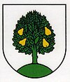
| coat of arms | map | |

|
|
|
| Basic data | ||
| State : | Slovakia | |
| Kraj : | Košický kraj | |
| Okres : | Spišská Nová Ves | |
| Region : | Spiš | |
| Area : | 13.070 km² | |
| Residents : | 1,294 (Dec. 31, 2019) | |
| Population density : | 99 inhabitants per km² | |
| Height : | 424 m nm | |
| Postal code : | 053 63 | |
| Telephone code : | 0 53 | |
| Geographic location : | 48 ° 57 ' N , 20 ° 42' E | |
| License plate : | SN | |
| Kód obce : | 543616 | |
| structure | ||
| Community type : | local community | |
| Administration (as of November 2018) | ||
| Mayor : | Adriana Tkáčová | |
| Address: | Obecný úrad Spišský Hrušov č. 216 053 63 Spišský Hrušov |
|
| Website: | www.spisskyhrusov.sk | |
| Statistics information on statistics.sk | ||
Spišský Hrušov (until 1927 Slovak "Hrušov"; German Birndorf or Grausch , Hungarian Szepeskörtvélyes - until 1907 Körtvélyes ) is a village and municipality in the east of Slovakia , with a population of 1,294 (December 31, 2019) and is part of the Spišská Nová Ves District ( Košický kraj ).
geography
The municipality is located in the Hornádska kotlina basin at the confluence of the Lodina and Hrušov rivers in the traditional Spiš region , eight kilometers west of Spišské Vlachy and 12 kilometers east of Spišská Nová Ves .
history
The place was first mentioned in writing in 1253 as Kurtues . In 1826 there are 86 houses and 637 inhabitants. In 1831 58 people died during a cholera epidemic , shortly before the peasant uprising there .
Attractions
- Roman Catholic Church of St. Catherine of Alexandria from the end of the 13th century, originally Gothic, rebuilt in the 18th century
- Originally a renaissance, today partly baroque and partly classicist country castle from 1596, today the seat of the municipal administration
- Ruins of a church that belonged to the submerged Miloj settlement, west of the village
