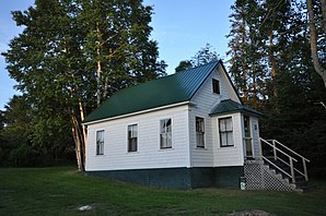
Upton (Maine)
| Upton | ||
|---|---|---|
 Town Hall and Library |
||
| Location in Maine | ||
|
|
||
| Basic data | ||
| Foundation : | February 9, 1860 | |
| State : | United States | |
| State : | Maine | |
| County : | Oxford County | |
| Coordinates : | 44 ° 44 ′ N , 70 ° 59 ′ W | |
| Time zone : | Eastern ( UTC − 5 / −4 ) | |
| Residents : | 113 (as of 2010) | |
| Population density : | 1.1 inhabitants per km 2 | |
| Area : | 108.34 km 2 (approx. 42 mi 2 ) of which 102.33 km 2 (approx. 40 mi 2 ) is land |
|
| Height : | 427 m | |
| Postal code : | 04261 | |
| Area code : | +1 207 | |
| FIPS : | 23-78465 | |
| GNIS ID : | 0582775 | |
 Upton Library |
||
Upton is a town in Oxford County in the state of Maine in the United States . In 2010, 113 people lived there in 199 households on an area of 108.34 km².
geography
According to the United States Census Bureau , Upton has a total area of 108.34 km², of which 102.33 km² is land and 6.01 km² is made up of water .
Geographical location
Upton is in northwest Oxford County. To the west it borders Coös County , New Hampshire . In the northwest is the Umbagog Lake , in the east is the B Pond . The surface of the area is rather flat, the highest point is the 619 m high Rabbit Knoll .
Neighboring communities
All distances are given as straight lines between the official coordinates of the places from the 2010 census.
- North: Magalloway , 6.6 mi
- East and South: North Oxford , Unorganized Territory, 14 mi
- Southwest: Cambridge , Coös County, New Hampshire, 7.4 mi
- Northwest: Errol , Coös County, New Hampshire, 6.5 mi
City structure
There are two settlement areas in Upton: Lower Dam and Upton (Upton Hill) .
climate
The mean mean temperature in Upton is between -11.1 ° C (12 ° F ) in January and 18.3 ° C (65 ° F) in July. This means that the place is around 2 degrees cooler compared to the long-standing mean of Maine. The snowfall between October and May is well over two meters (with a peak in January of almost 50 cm) about twice as high as the mean snow depth in the USA. The daily sunshine duration is at the lower end of the range in the USA.
history
Upton was organized as a town on February 9, 1860. Previously it was organized as Letter B. Plantation .
Population development
| Census Results - Town of Upton, Maine | ||||||||||
|---|---|---|---|---|---|---|---|---|---|---|
| year | 1800 | 1810 | 1820 | 1830 | 1840 | 1850 | 1860 | 1870 | 1880 | 1890 |
| Residents | 219 | 187 | 245 | 232 | ||||||
| year | 1900 | 1910 | 1920 | 1930 | 1940 | 1950 | 1960 | 1970 | 1980 | 1990 |
| Residents | 242 | 306 | 123 | 166 | 174 | 105 | 35 | 54 | 65 | 70 |
| year | 2000 | 2010 | 2020 | 2030 | 2040 | 2050 | 2060 | 2070 | 2080 | 2090 |
| Residents | 62 | 113 | ||||||||
Culture and sights
Buildings
In Upton, several structures have been listed and placed on the National Register of Historic Places .
- Forest Lodge , 2008 under the register no. 08001257.
- Upton Grange No. 404 , 2008 under the register no. 00001206.
Economy and Infrastructure
traffic
The Maine State Route 26 runs of the Town by the south-west corner. It connects Upton with Errol in New Hamsphire and Newry.
Public facilities
Upton does not have its own hospital. The closest hospital is Rumford Hospital in Rumford.
The closest libraries are in Bethel and Andover.
education
The Upton School Department is responsible for school education in Upton.
Web links
- Website of Upton ( English )
- Upton on City-Data.com
- Upton on maine.gov
Individual evidence
- ↑ Upton in the United States Geological Survey's Geographic Names Information System , accessed March 9, 2019
- ↑ Maine 2010 Census Results ; official publication of the Census Authority, (English; PDF; 32.5 MB)
- ↑ Rabbit Knoll. In: peakery.com. Retrieved March 9, 2019 .
- ↑ Coordinates of the locations of the Census Authority 2010
- ↑ a b Upton, Maine. In: mainegenealogy.net. Retrieved March 9, 2019 .
- ↑ a b Upton, Maine (ME 04216) profile: population, maps, real estate, averages, homes, statistics, relocation, travel, jobs, hospitals, schools, crime, moving, houses, news, sex offenders. In: city-data.com. www.city-data.com, accessed on March 9, 2019 .
- ↑ Population 1860–2010 according to census results
- ↑ Forest Lodge 08001257
- ↑ Upton Grange No. 404 00001206
- ↑ Local: Maine.gov. In: maine.gov. Retrieved March 9, 2019 .

