
Usak (province)
| Usak | |
|---|---|
| Province number: | 64 |
  |
|
| Counties | |
 |
|
| Basic data | |
| Coordinates: | 38 ° 31 ' N , 29 ° 21' E |
| Provincial capital: | Usak |
| Region: | Aegean region |
| Surface: | 5,556 km² |
| Population: | 367,514 (2018) |
| Population density: | 77.2 inhabitants / km² |
| Political | |
| Governor: | Funda Kocabıyık |
| Seats in Parliament: | 3 |
| Structural | |
| Telephone code: | 0276 |
| Features : | 64 |
| Website | |
| www.usak.gov.tr (Turkish) | |
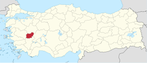
Uşak is a province of Turkey with the capital of the same name, Uşak .
geography
The province has an area of 5,5565 km² and a population of over 360,000 people, of which over 200,000 live in the provincial capital. Uşak is located on the border between the Aegean region and Central Anatolia . The province is bounded in the north by the province of Kütahya , in the east by the province of Afyonkarahisar , in the south by the province of Denizli and in the west by the province of Manisa . The province's population share in the Aegean region is around 3.5 percent.
mountains
- Elma Dağı - 1,805 m
- Ahir Dağı - 1,940 m
- Tahtalı Tepe - 1,644 m
- Kocatepe - 1,298 m
- Murat Dağı - 2,309 m
- Bulkaz Dağı - 1,990 m
Administrative division
Counties
The province is divided into six districts ( İlçe )
| district | Area 1 (km²) |
Population (2018) 2 | Number of Units | Density (Ew / km²) |
urban share (in%) |
Sex ratio 3 |
Founding date 4.5 |
|||
|---|---|---|---|---|---|---|---|---|---|---|
| District ( İlçe ) | Administrative headquarters (Merkez) |
Municipalities (Belediye) |
City quarter (Mahalle) |
Villages (Köy) |
||||||
| Banaz | 1,114 | 36,373 | 16,376 | 2 | 9 | 46 | 50.2 | 32.65 | 1011 | 1953 |
| Eşme | 1,156 | 34,932 | 14,644 | 2 | 9 | 59 | 48.2 | 30.22 | 1019 | |
| Karahallı | 330 | 10,457 | 5,884 | 1 | 6th | 13 | 56.3 | 31.69 | 999 | 1953 |
| Merkez Usak | 1,655 | 252.044 | 223.246 | 1 | 30th | 83 | 88.6 | 152.29 | 1009 | |
| Sivaslı | 473 | 20,753 | 7.091 | 4th | 12 | 18th | 62.4 | 43.88 | 988 | 1953 |
| Ulubey | 828 | 12,955 | 6,596 | 1 | 7th | 26th | 50.9 | 15.65 | 1029 | 1953 |
| PROVINCE OF Uşak | 5,556 | 367,514 | 11 | 73 | 245 | 77.2 | 66.15 | 1009 | 1953 | |
swell
1 Area 2014
2 Population update on December 31, 2018
3 Gender ratio : number of women per 1000 men (calculated)
4 PDF file of the Ministry of the Interior
5 districts that were only formed after Turkey was founded (1923).
Cities
In the province there are five municipalities ( Belediye ) that are not the seat of a district. The following table shows the population at the end of 2018 and the corresponding counties and the number of districts ( Mahalle ). The Turkish statistics rarely list the population of the cities (Belediye), but rather that of the city quarters (Mahalle).
| Belediye | district | Number of meals |
Residents |
|---|---|---|---|
| Yeleğen | Eşme | 3 | 2,189 |
| Tartare | Sivaslı | 3 | 1,975 |
| Pınarbaşı | Sivaslı | 2 | 1,964 |
| Selçikler | Sivaslı | 2 | 1,922 |
| Kızılcasöğüt | Banaz | 3 | 1,896 |
Villages
The 245 villages ( Köy ) have a total population of 83,731 inhabitants, which corresponds to about a quarter (20188: 22.78%) of the total population. Eleven villages in the province have more than a thousand inhabitants, four of which are in the capital district (İlçe Merkez). A village has an average of 342 inhabitants. Kaşbelen (3,931), İlyaslı (1,783) and Yayalar (1,695) are the largest villages in the province, three villages with 27 inhabitants are the smallest. 80 of the 245 villages have more than average, i. H. 342 pop.
population
In 1924 the city of Uşak still had 15,000 inhabitants. In Ulubey, Karahallı, and Banaz counties, the figure was 70,000. In 1926 the population rose from 85,000 to 91,298. From 1950 to 1955 the population increased by 68.1%, as the Eşme district was added to the Manisa Uşak province .
Results of the population extrapolation
The following table shows the annual population development after updating by the addressable population register (ADNKS) introduced in 2007. In addition, the population growth rate and sex ratio are ( Sex Ratio listed ie number of women per 1,000 men). The 2011 census found 340,636 inhabitants, over 18,000 more than in the 2000 census.
| year | Population at the end of the year | Population growth rate (in%) |
Gender ratio (women per 1000 men) |
Rank (among 81 provinces) |
||
|---|---|---|---|---|---|---|
| total | male | Female | ||||
| 2018 | 367,514 | 182.931 | 184,583 | 0.70 | 1009 | 52 |
| 2017 | 364.971 | 181,898 | 183,073 | 1.74 | 1006 | 52 |
| 2016 | 358.736 | 179.259 | 179,477 | 1.61 | 1001 | 52 |
| 2015 | 353.048 | 176.281 | 176,767 | 1.03 | 1003 | 52 |
| 2014 | 349,459 | 174,231 | 175.228 | 0.85 | 1006 | 52 |
| 2013 | 346.508 | 172,573 | 173.935 | 1.24 | 1008 | 52 |
| 2012 | 342,269 | 169.997 | 172.272 | 0.75 | 1013 | 52 |
| 2011 | 339.731 | 169.343 | 170.388 | 0.51 | 1006 | 53 |
| 2010 | 338.019 | 168.064 | 169.955 | 0.64 | 1011 | 52 |
| 2009 | 335.860 | 166,944 | 168.916 | 0.52 | 1012 | 52 |
| 2008 | 334.111 | 165.506 | 168.605 | 0.00 | 1019 | 53 |
| 2007 | 334.115 | 165.235 | 168,880 | - | 1022 | 51 |
| 2000 | 322.313 | 159,804 | 162.509 | 1017 | 58 | |
Census results
The following tables show the population of Uşak Province documented in the 9 censuses .
The values up to 1960 are taken from e-books (from the original documents), the values from 1965 onwards come from the data query of the Turkish Statistics Institute TÜIK - available on this website:
| year | population | rank | |
|---|---|---|---|
| province | Turkey | ||
| 1955 | 165.614 | 24,064,763 | 59 |
| 1960 | 184,733 | 27,754,820 | 59 |
| 1965 | 190,536 | 31,391,421 | 62 |
| 1970 | 207,512 | 35.605.176 | 62 |
| 1975 | 229,679 | 40,347,719 | 60 |
| year | population | rank | |
|---|---|---|---|
| province | Turkey | ||
| 1980 | 247.224 | 44,736,957 | 60 |
| 1985 | 271.261 | 50,664,458 | 59 |
| 1990 | 290.283 | 56.473.035 | 58 |
| 2000 | 322.313 | 67,803,927 | 58 |
Number of provinces in relation to the census years:
- 1935: 57 provinces
- 1955: 67 provinces
- 1960 to 1985: 73 provinces
- 1990: 73 provinces
- 2000: 81 provinces
economy
45.34% of the people in the region work in agriculture. But the production is not enough for self-consumption. The province produces 147,150 tons of wheat, 231,990 tons of barley, 2,478 tons of oats and 2,105 tons of maize annually. 49 567 tons of peas are harvested in the Banaz district. In addition, 6,931 tons of tobacco are processed. Fruit and vegetables are grown exclusively in the Sivaslı district, where a strawberry festival is held every year . Uşak has the oldest sugar factory in Turkey, and the leather and ceramics industries are also important.
kitchen
- Tarhana çorbası
Tarhana soup is very popular in the region . Ingredients are wheat flour , yogurt , onions, tomatoes, pepper. It is usually prepared for lunch.
- Ground poppy seeds (Haşhaş)
Dried poppy seeds are ground into a paste with the help of oil, which is then prepared as a spread or something similar.
- cucumber salad
Preparation: peel the ripe cucumber, cut into small pieces, cook with butter and onions. Sprinkle hot spices over it.
Web links
Individual evidence
- ↑ Nufusu.com , accessed July 31, 2019
- ↑ Portrait of the governor on the province's website , accessed July 31, 2019
- ↑ Directorate General of Mapping İl ve İlçe Yüzölçümleri (PDF file 0.25 MB)
- ↑ Türkiye Nüfusu İl İlçe Mahalle Köy Nüfusu , accessed on July 31, 2019
- ↑ [1] TARİH (1) .pdf 1.4 MB
- ↑ Central Dissemination System from TÜIK Population of municipalities, villages and quarters , accessed on July 31, 2019
- ↑ Tokat Nüfusu , accessed July 31, 2019
- ↑ Genel Nüfus Sayımları (census results 1965 to 2000)
Adana | Adıyaman | Afyonkarahisar | Ağrı | Aksaray | Amasya | Ankara | Antalya | Ardahan | Artvin | Aydın | Balıkesir | Bartın | Batman | Bayburt | Bilecik | Bing oil | Bitlis | Bolu | Burdur | Bursa | Çanakkale | Çankırı | Çorum | Denizli | Diyarbakır | Düzce | Edirne | Elazığ | Erzincan | Erzurum | Eskişehir | Gaziantep | Giresun | Gümüşhane | Hakkâri | Hatay | Iğdır | Isparta | İstanbul | İzmir | Kahramanmaraş | Karabük | Karaman | Kars | Kastamonu | Kayseri | Kırıkkale | Kırklareli | Kırşehir | Kilis | Kocaeli | Konya | Kutahya | Malatya | Manisa | Mardin | Mersin | Muğla | Muş | Nevşehir | Niğde | Ordu | Osmaniye | Rize | Sakarya | Samsun | Siirt | Sinop | Sivas | Şanlıurfa | Şırnak | Tekirdağ | Tokat | Trabzon | Tunceli | Usak | Van | Yalova | Yozgat | Zonguldak