
Winkelhaid (unincorporated area)

The municipality-free area Winkelhaid is located in the central Franconian district of Nürnberger Land .
The 18.44 km² state forest is the part of the Lorenzer Reichswald north of Winkelhaid , east of the Nuremberg district of Brunn and around the Winkelhaid district of Ungelstetten . The A3 and A6 motorways run through the area and form the Altdorf motorway junction between Ungelstetten and Winkelhaid . The Altdorf / Leinburg junction is on the eastern edge of the area . There are eight exclaves belonging to the Winkelhaid community in the area. A nameless mountain north of Moosbach ( 49 ° 24 ′ 16.16 ″ N , 11 ° 15 ′ 54.5 ″ E ) is 434 m above sea level. NHN the highest elevation.
Waters
One of the most beautiful river landscapes in the Nuremberg region runs through the forest, the Röthenbach valley with its numerous tributaries, such as the Ludergraben or the Haidelbach . Between Ungelstetten and Moosbach is the small layer spring Kalter Brunnen ( 49 ° 24 ′ 23.98 ″ N , 11 ° 17 ′ 7.91 ″ E ).
Protected areas

A large part is part of the EU bird sanctuary area Nuremberg Reichswald . In the north there is a large part of the lichen-pine forest nature reserve south of Leinburg .
Natural monuments
- The Rumpelbach Gorge (Röthenbach Gorge), a sandstone gorge that is also designated as a geotope. ( 49 ° 24 ′ 19.12 ″ N , 11 ° 20 ′ 0.53 ″ E )
- The Napoleon oak , an oak with a chest height of 6.80 m (2014). ( 49 ° 24 ′ 20.84 ″ N , 11 ° 17 ′ 23.82 ″ E )
- The Obere Egelsee, a forest pond near the A6 motorway ( 49 ° 24 ′ 39.7 ″ N , 11 ° 20 ′ 42.2 ″ E )
- The oak group at the Lower Egelsee ( 49 ° 24 ′ 59.69 ″ N , 11 ° 20 ′ 46.03 ″ E )
Worth seeing
The area is criss-crossed by a number of cycling and hiking trails. The Franconian Dune Trail also crosses the area.
Atonement crosses
- The carpenter's cross is an atonement cross between Ungelstetten and Moosbach. According to tradition, is to here near 1605 a carpenter have been killed ( 49 ° 24 '22.43 " N , 11 ° 16' 53.04" O )
- An atonement cross near Röthenbach . According to legend, officers of the Thirty Years' War are buried here . ( 49 ° 24 '4.93 " N , 11 ° 19' 25.61" O )
Others
- The Rote Marter , a wooden pillar between Ungelstetten and Moosbach ( 49 ° 24 ′ 22.18 ″ N , 11 ° 17 ′ 6.22 ″ E )
- The dead martyr in Weißenbrunn , a shrine of the dead path of Weissenbrunn to the cemetery to Altdorf
- A portion of the lined trench in Erten Ungelstetten , a remnant of a undertaken in the middle ages, and then set channel project ( 49 ° 25 '29.17 " N , 11 ° 16' 11.24" O )
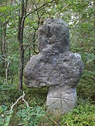
- Forest district boundary stone near Birnthon, on the western edge of the community-free area at a forest road intersection ( 49 ° 24 ′ 24.12 ″ N , 11 ° 15 ′ 31.5 ″ E ). Here are Fischbach , wet deferred and Ungelstetten.
Picture gallery

Layer source Kalter Brunnen

Red torture between Ungelstetten and Moosbach
Atonement cross near Röthenbach near Altdorf

Röthenbach near Ungelstetten

Napoleon oak

Upper Egelsee

The Lined Trench

Totenmaterl near Weissenbrunn


See also
- List of unincorporated areas in Bavaria
- List of ground monuments in Winkelhaid (unincorporated area)
- List of natural monuments in the district of Nürnberger Land
Individual evidence
- ↑ Area information at www.destatis.de, as of December 31, 2018 , accessed on August 1, 2020.
- ↑ www.protectedplanet.net, Nürnberger Reichswald (accessed on August 4, 2017)
- ↑ 6533-471 Nuremberg Reichswald. (EU bird sanctuary) Profiles of the Natura 2000 areas. Published by the Federal Agency for Nature Conservation . Retrieved November 18, 2017.
- ^ Entry in the directory of monumental oaks . Retrieved January 10, 2017
- ↑ www.suehnekreuz.de, Zimmermannskreuz (accessed on August 8, 2017)
- ↑ www.suehnekreuz.de, Sühnekreuz bei Röthenbach / Ludersheim (accessed on August 8, 2017)
- ^ Bavarian State Forests, Monuments in the Nuremberg Reich Forest
Web links
- Winkelhaid, community-free area in OpenStreetMap (accessed on March 18, 2013)

Alfeld | Altdorf near Nuremberg | Burgthann | Engelthal | Damp | Happurg | Hartenstein | Henfenfeld | Hersbruck | Kirchensittenbach | Lauf an der Pegnitz | Leinburg | Neuhaus an der Pegnitz | Neunkirchen am Sand | Offenhausen | Ottensoos | Pommelsbrunn | Reichenschwand | Röthenbach an der Pegnitz | Rückersdorf | Schnaittach | Schwaig near Nuremberg | Schwarzenbruck | Simmelsdorf | Velden | Provision | Winkelhaid
Unregulated areas:
Behringersdorfer Forst |
Brunn |
Engelthaler Forest |
Moist forest |
Fischbach |
Forsthof |
Günthersbühler Forest |
Haimendorfer Forest |
Laufamholzer Forest |
Leinburg |
Rückersdorfer Forst |
Schoenberg |
Winkelhaid |
Zerzabelshofer Forest
Coordinates: 49 ° 24 ′ 15 ″ N , 11 ° 17 ′ 56 ″ E