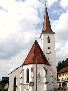
Zeilarn
| coat of arms | Germany map | |
|---|---|---|

|
Coordinates: 48 ° 18 ' N , 12 ° 50' E |
|
| Basic data | ||
| State : | Bavaria | |
| Administrative region : | Lower Bavaria | |
| County : | Rottal Inn | |
| Height : | 450 m above sea level NHN | |
| Area : | 28.91 km 2 | |
| Residents: | 2173 (Dec. 31, 2019) | |
| Population density : | 75 inhabitants per km 2 | |
| Postal code : | 84367 | |
| Area code : | 08572 | |
| License plate : | PAN, EG, GRI, VIB | |
| Community key : | 09 2 77 154 | |
| LOCODE : | DE ZIL | |
| Community structure: | 87 districts | |
| Address of the municipal administration: |
Rupertistraße 22 84367 Zeilarn |
|
| Website : | ||
| Mayor : | Werner Lechl ( United Voting Community ) | |
| Location of the municipality of Zeilarn in the Rottal-Inn district | ||
Zeilarn is a municipality in the Rottal-Inn district in Lower Bavaria .
geography
Geographical location
Zeilarn is located in the Landshut region in the typically Lower Bavarian hilly landscape, directly on the B 20, about 14 km southeast of Eggenfelden , 18 km northeast of Altötting , 20 km north of Burghausen , 17 km northwest of Simbach and 20 km southwest of the district town of Pfarrkirchen . The closest train station on the Mühldorf - Braunau route is in Marktl, nine kilometers away .
Community structure
Zeilarn has 87 districts:
There are the districts of Gumpersdorf, Obertürken and Schildthurn.
history
Until the founding of the forerunner churches
Zeilarn was first mentioned in a document as Cidlar in 788 in the property register of the Archdiocese of Salzburg . Later the place belonged to the Grafschaft Leonberg , in 1319 after its extinction the Counts von Hals inherited the property.
Until the administrative reform in Bavaria in 1818 it belonged to the Landshut Rent Office and the Eggenfelden district court . After that, according to the 2nd municipal edict, the municipalities of Obertürken, Gumpersdorf and Schildthurn emerged.
Incorporations
Today's municipality of Zeilarn is the result of the regional reform in Bavaria with the amalgamation of the municipalities of Obertürken, Gumpersdorf and Schildthurn on April 1, 1971.
Assignments
On January 1, 1980, an area with a little less than 100 inhabitants was assigned to the Tann market .
Population development
Between 1988 and 2018 the municipality grew from 2,081 to 2,163 by 82 inhabitants or 3.9%.
- 1961: 1897 inhabitants
- 1970: 2071 inhabitants
- 1987: 2053 inhabitants
- 1991: 2156 inhabitants
- 1994: 2218 inhabitants
- 1995: 2222 inhabitants
- 2000: 2221 inhabitants
- 2005: 2251 inhabitants
- 2010: 2190 inhabitants
- 2011: 2131 inhabitants
- 2012: 2131 inhabitants
- 2013: 2117 inhabitants
- 2014: 2138 inhabitants
- 2015: 2141 inhabitants
- 2016: 2149 inhabitants
politics
The municipal council has 14 seats. In the local elections in Bavaria in 2020 , the United Voting Community received 8 seats, the voter group WE-together-for each other 6 seats. Werner Lechl (United Voting Association) has been mayor since May 2014.
coat of arms
Blazon : In blue, a vertical silver sword, each with a golden lily stem.
Economy and Infrastructure
Economy including agriculture and forestry
According to official statistics, there were a total of 548 employees subject to social security contributions at the place of work in 2017. Of the resident population, 905 people had an employment relationship subject to social security contributions. The number of out-commuters thus outnumbered 357 people. 30 residents were registered as unemployed. 24 employees worked in the four construction companies.
The number of farms has decreased from 115 in 1999 to 59 in 2016. Of the agriculturally used area of 1157 ha (2016), 608 ha was arable land and 549 ha was permanent green space. 697 hectares of the municipality are forest.
traffic
The federal road 20 runs through the community , immediately southwest of Obertürken and Zeilarn and through Gumpersdorf
education
There are the following institutions (as of 2018):
- a day-care center with 75 places and 58 children, nine of them children under three years of age
- a primary school with 63 students
Attractions
- Schildthurn pilgrimage church
- Church of St. John the Baptist (Gehersdorf)
- The late Gothic parish church of St. Martin was enlarged in 1888. It has a neo-Gothic interior with some Gothic and Baroque figures and gravestones.
Web links
- Entry on the coat of arms of Zeilarn in the database of the House of Bavarian History
- Zeilarn: Official statistics of the LfStat (PDF; 1.24 MB)
Individual evidence
- ↑ "Data 2" sheet, Statistical Report A1200C 202041 Population of the municipalities, districts and administrative districts 1st quarter 2020 (population based on the 2011 census) ( help ).
- ^ Community Zeilarn in the local database of the Bayerische Landesbibliothek Online . Bayerische Staatsbibliothek, accessed on January 5, 2018.
- ^ Wilhelm Volkert (ed.): Handbook of Bavarian offices, communities and courts 1799–1980 . CH Beck, Munich 1983, ISBN 3-406-09669-7 , p. 552 .
- ^ Federal Statistical Office (ed.): Historical municipality directory for the Federal Republic of Germany. Name, border and key number changes in municipalities, counties and administrative districts from May 27, 1970 to December 31, 1982 . W. Kohlhammer GmbH, Stuttgart / Mainz 1983, ISBN 3-17-003263-1 , p. 630 .
- ↑ Municipality of Zeilarn: Municipal election 2020. Accessed on March 26, 2020 .
- ^ House of Bavarian History - Bavaria's municipalities. Retrieved February 14, 2019 .


