Amfreville (Calvados)
| Amfreville | ||
|---|---|---|

|
|
|
| region | Normandy | |
| Department | Calvados | |
| Arrondissement | Lisieux | |
| Canton | Cabourg | |
| Community association | Normandy-Cabourg-Pays d'Auge | |
| Coordinates | 49 ° 15 ′ N , 0 ° 14 ′ W | |
| height | 0-57 m | |
| surface | 6.06 km 2 | |
| Residents | 1,399 (January 1, 2017) | |
| Population density | 231 inhabitants / km 2 | |
| Post Code | 14860 | |
| INSEE code | 14009 | |
| Website | www.amfreville.net | |
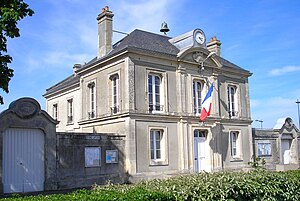
 Amfreville Town Hall ( Mairie ) |
||
Amfreville is a French commune with 1,399 inhabitants (as of January 1 2017) in the department of Calvados in the region of Normandy . It belongs to the Arrondissement Lisieux and the Canton of Cabourg . The inhabitants are known as Amfrevillais or Amfrevillaises .
geography
Amfreville is located on the Orne and is around 25 kilometers from Caen . Amfreville is surrounded by Sallenelles in the north, Gonneville-en-Auge in the northeast, Petiville in the east, Bréville-les-Monts in the southeast, Ranville in the south, Bénouville in the southwest, Saint-Aubin-d'Arquenay in the west and Ouistreham in the northwest .
Population development
| year | 1793 | 1831 | 1876 | 1926 | 1946 | 1968 | 1990 | 2008 | 2016 |
| Residents | 700 | 564 | 460 | 350 | 386 | 444 | 905 | 1188 | 1420 |
| Source: Cassini, EHESS and INSEE | |||||||||
Attractions
- Place Le Plain , a planted green area with the parish church of Saint-Martin in the center, registered as Zone naturelle d'intérêt écologique, faunistique et floristique ("Natural area of ecological interest, flora and fauna")
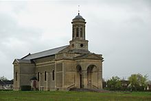
- Saint Martin Church
literature
- Le Patrimoine des Communes du Calvados. Volume 1, Flohic Editions, Paris 2001, ISBN 2-84234-111-2 , pp. 357-359.
Web links
Commons : Amfreville - collection of images, videos and audio files

