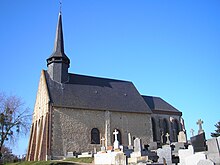
Glos
| Glos | ||
|---|---|---|
|
|
||
| region | Normandy | |
| Department | Calvados | |
| Arrondissement | Lisieux | |
| Canton | Lisieux | |
| Community association | Lisieux Normandy | |
| Coordinates | 49 ° 7 ' N , 0 ° 17' E | |
| height | 49-165 m | |
| surface | 12.93 km 2 | |
| Residents | 924 (January 1, 2017) | |
| Population density | 71 inhabitants / km 2 | |
| Post Code | 14100 | |
| INSEE code | 14303 | |
| Website | http://www.glos.fr/ | |
Glos is a French municipality with 924 inhabitants (as of January 1 2017) of the department of Calvados in the region of Normandy . Administratively, it is assigned to the canton of Lisieux (until 2015: canton of Lisieux-1 ) and the arrondissement of Lisieux . The inhabitants are called Glosiens .
geography
Glos is located about 47 kilometers east-southeast of Caen and about four kilometers southeast of the city center of Lisieux in the Pays d'Auge landscape on the Orbiquet . Glos is surrounded by the neighboring municipalities of Hermival-les-Vaux in the north, Firfol in the northeast, Courtonne-la-Meurdrac in the east, Le Mesnil-Guillaume in the south and southeast, Saint-Jean-de-Livet in the southwest, and Saint-Martin-de -la-Lieue in the west and south-west, Beuvillers in the west and Lisieux in the north-west.
Population development
| year | 1962 | 1968 | 1975 | 1982 | 1990 | 1999 | 2006 | 2013 |
|---|---|---|---|---|---|---|---|---|
| Residents | 848 | 780 | 767 | 783 | 857 | 909 | 899 | 919 |
| Source: Cassini and INSEE | ||||||||
Attractions
- Saint-Sylvain church
- Old Notre-Dame church in Villers-sur-Glos
- Villers Castle (also: Grosmesnil Castle)
- La Brairie mansion from the 15th century, a historical monument since 2005
- La Quesse mansion from the 16th century, a historic monument since 1927
- Bray mansion from the 16th century, monument historique since 1928
- Colandon mansion from the 18th century, a historic monument since 1971
- La Motte mansion
- La Vallée mansion

