Birchiș
|
Birchiș Birkisch, Pirkisch Marosberkes |
||||
|
||||
| Basic data | ||||
|---|---|---|---|---|
| State : |
|
|||
| Historical region : | Banat | |||
| Circle : | Arad | |||
| Coordinates : | 45 ° 58 ' N , 22 ° 10' E | |||
| Time zone : | EET ( UTC +2) | |||
| Area : | 102.28 km² | |||
| Residents : | 1,854 (2011) | |||
| Population density : | 18 inhabitants per km² | |||
| Postal code : | 317050 | |||
| Telephone code : | (+40) 02 57 | |||
| License plate : | AR | |||
| Structure and administration (as of 2016) | ||||
| Community type : | local community | |||
| Structure : | Birchiș, Căpâlnaș , Ostrov and Virișmort | |||
| Mayor : | Guțu Ioan ( PNL ) | |||
| Postal address : | Str. Principală No. 162 loc. Birchiș, jud. Arad, RO-317050 |
|||
| Website : | ||||
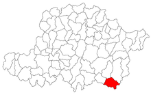
Birchiș (German: Birkisch , Pirkisch , Hungarian: Marosberkes ) is a municipality in the Arad district , in the Banat , in western Romania . The villages of Căpâlnaș , Ostrov and Virișmort also belong to the municipality of Birchiș .
Geographical location
Birchiș is located on the left bank of the Marosch , in the historical Banat region , 81 km from the district capital Arad .
Neighboring places
| Bulci | Vărădia de Mureș | Săvârșin |
| Virișmort |

|
Căpâlnaș |
| Groși | Făget | Bunea Mare |
history
The first written mention of the village of Pierter comes from 1596.
In the course of the centuries different place names appeared: 1596 Pierter , 1717 Birtesch , 1734 Pirkess , 1787 Birkis , 1808 Birkis , 1828 Birkis , Pirkisch , 1839 Birkis , 1858, 1863 Birkis , 1877 Birkis , 1882 Birkis , Birchisiu , 1891, 1893 Birkis , 1900 Birkis , 1909 Birchiş , Birkis , 1910, 1913 Marosberkes , 1921 Birchiş , Marosberkes , 1925 Birchiş .
Until the First Austrian Turkish War (1526), the settlement belonged to the Kingdom of Hungary and then to the Ottoman Empire (1526–1699). After the Peace of Karlowitz (1699), Arad and the Maroscher Land came under Austrian rule , while the Banat south of the Marosch remained under Turkish rule until the Peace of Passarowitz (1718) . On the Josephine land survey is Burkisch entered. As a result of the Austro-Hungarian Compromise (1867), the Arad region, like the whole of Banat and Transylvania, was annexed to the Kingdom of Hungary within the Austro-Hungarian dual monarchy . The official place name was Marosberkes . The Treaty of Trianon on June 4, 1920 resulted in border regulation, whereby Birchiș fell to the Kingdom of Romania .
In the Banat Village Museum , a branch of the Banat National Museum in Timișoara , a pottery house from Birchiș is exhibited together with a pottery wheel and kiln .
Population development
| census | Ethnicity | |||||||
|---|---|---|---|---|---|---|---|---|
| year | Residents | Romanians | Hungary | German | Other | |||
| 1880 | 3763 | 3705 | 21st | 32 | 5 | |||
| 1910 | 3984 | 3770 | 133 | 27 | 54 | |||
| 1930 | 3714 | 3506 | 64 | 23 | 121 | |||
| 1977 | 2705 | 2592 | 12 | 1 | 100 | |||
| 1992 | 2106 | 1948 | 14th | - | 144 | |||
| 2002 | 2044 | 1793 | 10 | 2 | 239 | |||
Web links
- ghidulprimariilor.ro , Birchiş City Office
- virtualarad.net , Birchiş on VirtualArad
Individual evidence
- ↑ citypopulation.de , census October 20, 2011
- ↑ Mayoral elections 2016 in Romania ( MS Excel ; 256 kB)
- ↑ arcanum.hu/hu , Birchiș
- ↑ muzeulsatuluibanatean.ro , pottery house from Birchiș
- ↑ kia.hu , E. Varga: Statistics of the population by ethnic group in the Arad district according to censuses from 1880 - 2002


